Ihľany
| Ihľany | ||
|---|---|---|
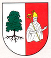
| coat of arms | map | |

|
|
|
| Basic data | ||
| State : | Slovakia | |
| Kraj : | Prešovský kraj | |
| Okres : | Kežmarok | |
| Region : | Tatry | |
| Area : | 28.457 km² | |
| Residents : | 1,561 (Dec. 31, 2019) | |
| Population density : | 55 inhabitants per km² | |
| Height : | 706 m nm | |
| Postal code : | 059 94 | |
| Telephone code : | 0 52 | |
| Geographic location : | 49 ° 11 ′ N , 20 ° 32 ′ E | |
| License plate : | KK | |
| Kód obce : | 523534 | |
| structure | ||
| Community type : | local community | |
| Structure of the municipality: | 2 parts of the community | |
| Administration (as of November 2018) | ||
| Mayor : | Ján Turek | |
| Address: | Obecný úrad Ihľany čislo 94 05994 Ihľany |
|
| Website: | www.ihlany.sk | |
| Statistics information on statistics.sk | ||
Ihľany is a municipality in eastern Slovakia northeast of Kežmarok with 1561 inhabitants (as of December 31, 2019).
It was formed in 1960 through the amalgamation of the following municipalities:
- Stotince (German Hodermark , before 1920 Hundertmarkt , Hundertmorgen ; Hungarian since 1907 Száztelek ; first mentioned in 1307)
- Majerka (German since 1927 Meierhöfen ; first mentioned in 1307; was spun off from the Ľubica municipality before 1895 and was called Ihlanovce until 1961 ).
It lies on the western foothills of Levoca Mountains ( Levočské vrchy ) and mostly in the lowlands of Hollomnitz Brook ( Holumnický Potok ) east of the city Spisska Bela . The name of the place refers to the mountain Ihla (German "Nadel", 1284 m), which is located east of the place.
population
Results after the 2001 census (593 inhabitants):
|
By ethnicity:
|
By denomination:
|
Buildings
See also: List of listed objects in Ihľany
Web links
Commons : Ihľany - collection of pictures, videos and audio files

