Ilme
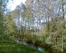
The Ilme is a 32.6 km long left and western tributary of the Leine in Lower Saxony , Germany .
geography

Upper course
The flowing water arises at the new pond in the center of the Solling at 340 m above sea level. NN . The water that first feeds the Ilme collects in the high moor Teichwiesen and the associated hillside spring moor located immediately to the west of the pond. As a torrent, its upper course flows through an almost completely wooded part of the Solling to Relliehausen in a natural environment . On the way, the runoff of the lake pond flows into it. Sediments in the Bachtal are sand-like, as the alluvial oss overburden has eroded away, forming a valley.
Lower course

From Relliehausen it flows with a significantly lower gradient than in the upper reaches. Due to the slight incline, the lower course had a wild character until about the Younger Tundra Period and only then formed a meander. The Ilme basin was covered with alluvial forest. Clearance at the time of the Billunger and the Counts of Dassel created a meadow landscape, the vegetation of which stabilized the surfaces that are still almost entirely used for agriculture today. Auelehm sedimented on the edge of the Ilme.
It first flows north to Dassel to the Bierberg , where it leaves the Dassel Basin to enter the Einbeck-Markoldendorfer Basin and then flows along the northern edge of the Ellenser Forest in an easterly direction between the villages of Eilensen and Krimmensen to Markoldendorf . This is where she accepts the applicants . The Dieße also flows in before the Ilme reaches Hullersen . From there it flows, partially straightened, to the southern edge of the city of Einbeck , where the Krumme Wasser joins. At Einbeck the federal highway 3 also leads over the Ilme. At only 105 m above sea level, it flows into the Leine near Volksen .
Mill Canal
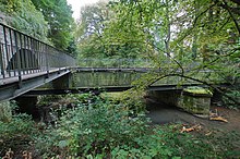
Before 1470, a canal was dug to operate watermills in Einbeck, which has since then led the water of the Ilme into the city. The mill channel branches off from the river about 1 km east of Hullersen . There the water was led into the canal at a weir ; the process was called the Huller Raid . In 2011 it was dismantled to the invert to allow fish migration. The canal then flows in a north-easterly direction to the edge of the old town of Einbeck. Since the Krumme Wasser passes the old town in a south-easterly direction, the canal and the stream intersect, so that the canal is passed over the Krumme Wasser by means of a trough bridge . It is a metal aqueduct instead of the wooden structure of the early modern era . In addition, the canal meets the wall of the Einbeck city fortification , so that it is crossed under by means of a tunnel. It then continues in an easterly direction, partly piped, flows south near the Bartholomäus Chapel and flows into the Ilme after a total of around 4 km.
Flora and fauna
In the Ilme, common fish species have been identified with the brown trout and bullhead . In the swamp forest area of the source zone, peat moss forms extensive vegetation. Frizzy pondweed and water moss grow in the water itself . The bank area in the Solling is mainly made up of spruce trees , while black alders or willows stand out in the further course . In the herb layer there are stinging nettles and sourgrass plants close to the shore , which are then used for agricultural purposes as meadows . The Ilmetal also offers the red kite , the red-backed shrike and the Kingfisher habitat.
natural reserve
As part of the EU's Sixth Environment Action Program, the Ilme, including several side streams, was designated as an FFH protected area. 97% of the total protected area of 706 ha are fringing biotopes .
The implementation of Directive 2000/60 / EC (Water Framework Directive) also supports a near-natural ecology on the Ilme. Various organizations are involved in the conservation and development measures. The aim is also to reintroduce displaced species such as grayling .
use
Since the completion of the Lakenteich, rafting has been carried out on the Ilme. The tree trunks were connected to a raft near Holtensen until 1737 , then in Relliehausen. There was also a water-powered paper mill there, which always stood still during a raft process.
The Paul Gerhardt School Dassel uses the water power of the Ilme with the help of a Francis turbine to generate electricity . There is a fish ladder at the weir there. In pre-industrial times, the nearby Von Alten mill was one of the local mills. Downstream the Bruchmühle was operated in Markoldendorf, 2 km east of it the Juliusmühle . From the 15th century, three town mills and the fulling mill with the water of the Ilme were operated in Einbeck.
Others
Named after the Ilme is the Ilmebahn railway line leading from Salzderhelden via Einbeck to Dassel and a regional transport company, the Ilmebahn GmbH (rail and bus company).
Touristic tours in the Ilmetal are organized by the regional tourism information in the Eickesches Haus .
In Markoldendorf the NLWKN operates an official measuring station for the level.
Web links
Individual evidence
- ^ Deutsches Gewässerkundliches Jahrbuch Weser-Ems 2014. Lower Saxony State Agency for Water Management, Coastal Protection and Nature Conservation, p. 198, accessed on October 4, 2017 (PDF, German, 8805 kB).
- ^ Norbert Rother: Holocene fluvial morphodynamics in the Ilmetal and on the northeastern roof of the Solling , 1989
- ^ Gerhard M. Veh, Hans-Jürgen Rapsch: Von Brunnen und Zucken, Pipen und Wasserkünsten, 1998, p. 113
- ↑ More permeability after dismantling the attack ( memento from September 25, 2015 in the Internet Archive )
- ↑ Catalog of measures Ilme waters (PDF; 3.1 MB)
- ^ Society for Nature Conservation Einbeck und Umgebung eV
- ↑ Grayling (Tymallus thymallus) (PDF; 506 kB)
- ↑ Helmut Jäger, Erhard Kühlhorn: Historisch-Landeskundliche Excursionskarte von Niedersachsen, sheet Osterode am Harz, 1976, p. 217
- ↑ Jürgen Delfs: The rafting in the river basin of the Weser, 1952, p. 31
- ↑ Fish ladder
- ↑ Erich Plümer: History of the City of Dassel - An Overview, 1965, p. 80
- ^ HL Harland: History of the City of Einbeck, Volume 1, 1854, pp. 198ff
- ↑ We want to show how beautiful nature is here
- ↑ Flood reporting level: Oldendorf ( Memento of the original from February 19, 2014 in the Internet Archive ) Info: The archive link was inserted automatically and has not yet been checked. Please check the original and archive link according to the instructions and then remove this notice.


