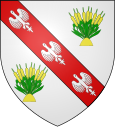
Joncreuil
| Joncreuil | ||
|---|---|---|

|
|
|
| region | Grand Est | |
| Department | Aube | |
| Arrondissement | Bar-sur-Aube | |
| Canton | Brienne-le-Château | |
| Community association | Lacs de Champagne | |
| Coordinates | 48 ° 31 ' N , 4 ° 37' E | |
| height | 123-139 m | |
| surface | 10.55 km 2 | |
| Residents | 92 (January 1, 2017) | |
| Population density | 9 inhabitants / km 2 | |
| Post Code | 10330 | |
| INSEE code | 10180 | |
Joncreuil is a French commune with 92 inhabitants (as of January 1, 2017) in the Aube department in the Grand Est region (until 2015 Champagne-Ardenne ). The municipality is part of the Bar-sur-Aube arrondissement and the Lacs de Champagne municipal association founded in 2014 . The inhabitants are called Joncreuillois .
geography
Joncreuil is 30 kilometers southwest of Saint-Dizier and about 45 kilometers northeast of Troyes in the southeast of the Champagne sèche , the "dry Champagne". The municipal area of 10.55 km² has hardly any height differences and is characterized by arable land in the western part and forests in the eastern part ( Bois des Gauterots, Bois Lamiarde, Le Chanet ). In the northeast, the municipality borders on the Marne department . About eight kilometers northeast of Joncreuil is the largest reservoir in France, the Lac du Der-Chantecoq . The hamlet of Le Sicherheitson belongs to the community of Joncreuil . Joncreuil is surrounded by the neighboring communities Arrembécourt in the north-west and north, Outines in the north-east, Bailly-le-Franc in the east, Lentilles in the south-east and Chavanges in the south and west.
Population development
| year | 1962 | 1968 | 1975 | 1982 | 1990 | 1999 | 2009 | 2016 | |
| Residents | 113 | 92 | 102 | 85 | 96 | 87 | 85 | 98 | |
| Sources: Cassini and INSEE | |||||||||
Attractions
- Saint-Pierre-ès-Liens Church, Monument historique
- Monumental cross in the cemetery, Monument historique
- La Croix Dorée, Croix Blanche and other floor crosses
Economy and Infrastructure
Seven farms are located in Joncreuil (grain cultivation, cattle breeding).
Joncreuil is away from the major transport axes. Seven kilometers west of Joncreuil, the D396 (formerly RN 396 ) runs from Vitry-le-François to Brienne-le-Château . In the city of Vitry-le-François, 25 kilometers to the north, there is a connection to the motorway-like RN 4 from Paris to Strasbourg . The Vallentigny – Vitry-le-François railway runs immediately to the west of the community of Joncreuil , but with no stopping point nearby.
supporting documents
- ↑ Joncreuil on cassini.ehess.fr
- ↑ Joncreuil on insee.fr
- ^ Entry in the Base Mérimée of the Ministry of Culture. Retrieved February 17, 2019 (French).
- ^ Entry in the Base Mérimée of the Ministry of Culture. Retrieved February 17, 2019 (French).
- ↑ Farms on annuaire-mairie.fr (French)


