
Julbach (Upper Austria)
|
Julbach
|
||
|---|---|---|
| coat of arms | Austria map | |
 |
|
|
| Basic data | ||
| Country: | Austria | |
| State : | Upper Austria | |
| Political District : | Rohrbach | |
| License plate : | RO | |
| Surface: | 21.77 km² | |
| Coordinates : | 48 ° 40 ' N , 13 ° 52' E | |
| Height : | 589 m above sea level A. | |
| Residents : | 1,540 (January 1, 2020) | |
| Population density : | 71 inhabitants per km² | |
| Postal code : | 4162 | |
| Area code : | 07288 | |
| Community code : | 4 13 13 | |
| NUTS region | AT313 | |
| Address of the municipal administration: |
Schulstrasse 4 4162 Julbach |
|
| Website: | ||
| politics | ||
| Mayor : | Johannes Plattner ( SPÖ ) | |
|
Municipal Council : (2015) (19 members) |
||
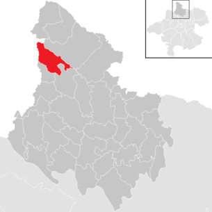
| Location of Julbach in the Rohrbach district | ||
  |
||
 Municipal Office |
||
| Source: Municipal data from Statistics Austria | ||

Julbach is a municipality in Upper Austria in the Rohrbach district in the upper Mühlviertel with 1540 inhabitants (as of January 1, 2020). The community is located in the judicial district of Rohrbach .
geography
Julbach lies at an altitude of 588 m above sea level. A. in the north-western part of the Rohrbach district in the upper Mühlviertel . In terms of the nature conservation area structure, the entire municipality belongs to the southern Bohemian Forest foothills . The extension is 7.2 km from north to south, 7.7 km from west to east, the total area is 21.77 km². In terms of area, Julbach is in the upper middle field of the municipalities in the Rohrbach district. With 72 inhabitants per km² in 2013 the municipality was in the upper third of the municipalities in the district. While the main town of the municipality is at around 600 meters, the other localities of the municipality are spread up to 700 meters above sea level. The highest elevation, the Schläger Berg, is 843 meters in the south of the municipality. In 2001, 31 percent of the municipal area was forested, 64 percent of the area was used for agriculture. Compared with the federal state of Upper Austria, Julbach is slightly less forested than the regional average (Upper Austria: 38.3 percent) or there is significantly more agricultural land (Upper Austria: 49.3 percent). The proportion of other uses (construction areas, gardens, bodies of water and others) is around 5 percent, well below the Upper Austrian average of 13.8 percent. Neighboring communities are Ulrichsberg in the north, Peilstein in the Mühlviertel in the east and Nebelberg in the south. The state border with Germany runs in the west , with Julbach bordering the district of Passau .
- Geology and soils: The landscape of the municipality is part of the Bohemian Massif, which goes back to a very old mountain range that was created by the Variscan mountain formation in the Paleozoic ( Carboniferous ). After the strong erosion of the former high mountains, during the Alpidic mountain formation in the Tertiary, the crystalline basement was abolished by several 100 meters, causing fractures and faults. Subsequently, sediments were deposited in the Tertiary and Quaternary periods . Older granites are the dominant rocks in the municipality. It is one of the first masses of magma to solidify during the folding of the mountains, has a typical coarseness and causes a restless landscape character with rapid alternation of peaks and valleys. In the municipal area, silicate brown earth, which forms on granites and gneiss, prevails as a soil type. The light to very light soils are generally poor in nutrients and their use depends on the depth and the water supply. The soil type is generally loamy sand or sandy loam, with the dominant form of humus in dry locations being mild , otherwise mull . In addition, in the valley area of the Kleine Mühl Gley soils occur, which also occur in the area of waterlogged springs, ditches, hollows and at the foot of slopes. Podsol exists in the valley area of the Finsterbach and in the valley of the Kleine Mühl south of the village of Julbach.
- Landscape and vegetation: Julbach is located at the transition from the Bohemian Forest to the open cultural landscape and is characterized by flat low mountain ranges that are only more pronounced towards the main ridge of the Bohemian Forest. The valley of the Kleine Mühl cuts through the community in a north-west-south-east direction, which means that the landscape is divided into two parts. In the west and east, for example, there is a stepped landscape with numerous hedge fragments, which is broken through by the valley floor landscape of the Kleine Mühl with extensively used wet meadows. The stepped landscape is predominantly agricultural, but forms a structured agricultural landscape with a large number of landscape elements. There are larger contiguous forest areas here, especially in hilltop locations, with the forests partly having mixed stands, while in higher areas there are pure coniferous forest stands. In agriculture, intensive grassland management dominates, and some arable land also exists. The area of the valley area of the Kleine Mühl includes the densely built-up valley area and the accompanying elevations. As in the rest of the municipality, there is largely intensively used grassland or little arable land, although extensive grassland of significant nature conservation has been preserved in the area of the valley landscape of the Kleine Mühl. The forest areas in this area are closed in the north, in the north-east the edge zones of large forest areas penetrate, with predominantly coniferous forest. In addition, there is a large number of small forest areas with predominantly deciduous trees in this area.
Community structure
The municipality includes the following localities (population in brackets as of January 1, 2020):
- Bräuerau (84)
- Aft ship (36)
- Hochkraml (59)
- Julbach (875)
- War Forest (144)
- Leithen (37)
- Niederkraml (106)
- Oberthiergrub (30)
- Preuer (20)
- Sagberg (79)
- Unterthiergrub (12)
- Fore ship (48)
- Front impact (10)
Origin of the name: The name Jugelbach (Jubelbach from Jubilo or Jubo?) Appears in a document in 1160 in the Upper Austrian Urbar. The popular name has always been "in Julwa". (The place certainly existed in the 11th century.)
history
Originally located in the eastern part of the Duchy of Bavaria , the place belonged to the Duchy of Austria since the 12th century . Since 1490 it has been assigned to the Principality of Austria ob der Enns .
Since 1918 the place belongs to the federal state of Upper Austria. After the annexation of Austria to the German Reich on March 13, 1938, the place belonged to the Gau Oberdonau . After 1945 the restoration of Upper Austria took place.
From 1850 Julbach was part of the judicial district of Aigen . In 2003 the judicial district of Aigen was dissolved and the municipality was assigned to the Rohrbach judicial district.
During the refugee crisis in Europe in 2015 , thousands of refugees were smuggled through Julbach to Germany.
Population development
In 2013, 1,571 people lived in the municipality of Julbach, placing Julbach in the upper third of the 42 municipalities in the district. At the end of 2001, 98.0 percent of the population were Austrian citizens (Upper Austria 92.8 percent, Rohrbach district 96.9 percent), by the beginning of 2013 the value rose to 97.7 percent (Upper Austria 91.1 percent, Rohrbach district 96.9 percent) Percent). In 2013, only 36 foreigners were counted in the municipality, more than 90 percent of whom came from EU countries. A total of 102 community residents were born abroad. In 2001, 96.9 percent of the population committed to the Roman Catholic Church (Upper Austria: 79.4 percent), 1.6 percent were without confession, 0.6 percent were Protestants.
The average age of the community population in 2001 was roughly the national average. 19.0 percent of the inhabitants of Julbach were younger than 15 years (Upper Austria: 18.8 percent), 60.3 percent between 15 and 59 years old (Upper Austria: 61.6 percent). The proportion of residents over 59 years of age was 20.7 percent, just above the national average of 20.2 percent. As a result, the average age of the population of Julbach changed, especially in the first two segments. The proportion of people under the age of 15 fell to 13.3 percent as of January 1, 2013, while the proportion of people between the ages of 15 and 59 increased significantly to 70.1 percent. By contrast, the proportion of people over 59 years of age fell to 16.7 percent. According to their marital status, in 2001 48.1 percent of the residents of Julbach were single, 43.3 percent married, 7.0 percent widowed and 1.6 percent divorced.

The population of Julbach has decreased slightly since 1981, because the birth balance is positive, but this was canceled out by the negative migration balance - with the exception between 1991 and 2001.
politics
The municipal council, as the highest body of the municipality, has 19 seats and is elected every six years in the course of Upper Austria-wide municipal council elections. The municipality board consists of five members, whereby the Social Democratic Party of Austria (SPÖ) is represented after the municipal council elections in 2009 with the mayor, the deputy mayor and one other member on the municipality board and thus has an absolute majority in this body. The Austrian People's Party (ÖVP) sends two members.
For a long time the strongest faction in Julbach's municipal council was the ÖVP, which between 1945 and 1991 achieved an absolute majority of votes and seats in municipal elections. The ÖVP had its best election result in 1945 with 76.3 percent, subsequently it came up to 1979 with results between 56.7 and 71.8 percent. After the ÖVP was able to achieve 71.4 percent in 1979, it gradually lost its share of the vote. In 1997 the ÖVP slipped below 50 percent for the first time, but was still able to hold first place. In 2003, however, she was overtaken by the SPÖ with only 43.7 percent and her worst result to date. The SPÖ achieved results between 15.9 and 37.6 percent between 1945 and 1973, and with one exception it was always the second largest party in the local council. After the SPÖ had achieved 28.6 percent in 1979, it was able to increase successively from election to election. In 1985 it passed the 30 percent mark, and in 1997 it exceeded 40 percent for the first time. In 2003 the SPÖ was able to replace the ÖVP as the party with the strongest vote with 52.2 votes and achieve an absolute majority. The Freedom Party of Austria (FPÖ) entered in 1949 as VdU and was able to overtake the SPÖ with 23.6 percent. After that, however, she did not run for office in the community until the 1980s. In 1985, it narrowly failed when it entered the local council, which succeeded in 1991. In 2003 the FPÖ flew out of the municipal council again at short notice. Overall, the FPÖ came to 4.1 to 7.7 percent between 1985 and 2009. In the 2009 municipal council elections, the SPÖ took first place with 46.3 percent, or nine seats, just ahead of the ÖVP, which had 46.1 percent, or nine seats. The FPÖ achieved 7.7 percent and one mandate. The 2015 municipal council election brought the following results:
- SPÖ: 9 seats
- ÖVP: 8 mandates
- FPÖ: 2 mandates
- mayor
The mayor has been determined by direct election since 1997 , with no absolute majority for a candidate in a runoff election . The first direct election was won by Adolf f Salzinger (SPÖ), whereby he was able to prevail against the ÖVP candidate with 53.6 percent in the first ballot. Salzinger became the first SPÖ mayor of the community. Salzinger was able to prevail in the first ballot in 2003 with 64.8 percent and in 2009 with 51.9 percent. In the 2015 election, the SPÖ candidate Johannes Plattner was elected mayor with 54.2 percent of the vote.
Mayor since 1850:
| Term of office | Surname | Term of office | Surname |
|---|---|---|---|
| 1850-1861 | Michael Gabriel | 1945-1947 | Josef Geier |
| 1861-1864 | Augustin Prügl | 1945-1947 | Josef Geier |
| 1864-1870 | Mathias Prigl | 1947-1955 | Josef Reif |
| 1894-1900 | Anton Müschgl | 1955-1961 | Heinrich Woess |
| 1900-1919 | Heinrich Wöss | 1961-1969 | Johann Kraml |
| 1919-1922 | Josef Grims | 1969-1992 | Alfred Fischer |
| 1922-1933 | Peter Krenn | 1992-1997 | Erwin Gabriel |
| 1933-1942 | Heinrich Woess | 1997-2015 | Adolf Salzinger |
| 1942-1945 | August Leitner | since 2015 | Johannes Plattner |
- Other options
As in municipal council elections, the ÖVP also dominated state elections in the municipality. With the exception of 2003, the ÖVP was always able to achieve an absolute majority of votes. The ÖVP had its best result so far in 1945 with 76.3 percent, its worst so far in 2003 with 46.7 percent. The SPÖ had results between 15.8 percent and 43.6 percent since 1945, with its worst result in the community in 1949. The SPÖ has achieved at least 28 percent in state elections since 1973, and in 2003 it achieved its best result to date with 43.6 percent. The FPÖ's predecessor party, the VdU, achieved 18 and 14 percent respectively in the community from 1949 to 1995, after which the FPÖ did not exceed three percent for a long time. In 1991 it was able to post a notable result for the first time with 7.3 percent, in 1997 it achieved 12.0 percent. After a setback to 4.8 percent in 2003, the FPÖ subsequently recovered. In the last state election in 2009, the ÖVP came in first place with 50.4 percent and its second-lowest result to date. The SPÖ only got 30.1 percent and thus had to give up around 14 percent of its share of the vote. The FPÖ achieved their best result to date with 12.4 percent, the Greens only got 3.7 percent.
coat of arms
On September 25, 1971, the municipality of Julbach determined the design of the municipality's coat of arms and the municipality's colors (blue and white) by resolution of the municipal council. The coat of arms was subsequently awarded by resolution of the Upper Austrian provincial government of November 15, 1971 and the municipal colors were approved. The blazon of the coat of arms reads: “ Divided; two black, eight-spoke wheels side by side in silver above; below in blue a golden, laden Kelheimer. “The coat of arms refers to the history of the community. The eight-spoke wheels symbolize the trade route, which was already known in early history, and which transported salt in particular to Bohemia from the berths of the ships on the Danube via today's municipal area. In addition to this transport route, the ship also stands for the place names “Vorder- und Hinterschiffl” or “Schifflberg”. The design comes from Johann Kraml from Julbach.
Culture and sights

Sons and daughters of the church
- Erwin Reiter (1933–2015) Austrian sculptor, professor at the University of Design, Linz (Upper Austria)
Web links
- 41313 - Julbach (Upper Austria). Community data, Statistics Austria .
- Further information about the municipality of Julbach (Upper Austria) on the geographic information system of the federal state of Upper Austria .
- Julbach municipality
Individual evidence
- ↑ a b c Province of Upper Austria: Mapping of natural areas in Upper Austria. Landscape survey Julbach. Final report, Kirchdorf an der Krems 2006
- ↑ Statistics Austria: Population on January 1st, 2020 by locality (area status on January 1st, 2020) , ( CSV )
- ↑ Andreas Glas: "The biggest smugglers are the Austrians" Süddeutsche Zeitung, October 5, 2015, viewed on October 5, 2015
- ↑ nachrichten.at: "On the run: breathing space in Julbach" nachrichten.at from October 5, 2015, viewed on October 5, 2015
- ↑ a b Province of Upper Austria ( Memento of the original from November 29, 2014 in the Internet Archive ) Info: The archive link was inserted automatically and has not yet been checked. Please check the original and archive link according to the instructions and then remove this notice. Population levels in Upper Austria in comparison by citizenship
- ↑ Statistics Austria: Population by religion and federal states 1951 to 2001 (accessed on October 2, 2013)
- ^ Statistics Austria community data from Julbach
- ↑ a b Province of Upper Austria ( Memento of the original from October 29, 2013 in the Internet Archive ) Info: The archive link was automatically inserted and not yet checked. Please check the original and archive link according to the instructions and then remove this notice. Resident population in Upper Austria compared by age group
- ↑ Statistics Austria, A look at the community Julbach, population development. Retrieved April 27, 2019 .
- ↑ State of Upper Austria ( Memento of the original from December 20, 2013 in the Internet Archive ) Info: The archive link was automatically inserted and not yet checked. Please check the original and archive link according to the instructions and then remove this notice. Local council elections in Julbach from 1945
- ↑ a b Province of Upper Austria, results of the 2015 elections. Accessed April 27, 2019 .
- ^ Province of Upper Austria election results in mayoral elections
- ^ State of Upper Austria Mayor of the Julbach community since 1850
- ↑ State of Upper Austria ( Memento of the original from December 20, 2013 in the Internet Archive ) Info: The archive link was automatically inserted and not yet checked. Please check the original and archive link according to the instructions and then remove this notice. State election results in Julbach from 1945
- ^ State of Upper Austria coat of arms of the Julbach community

Aigen-Schlägl | Altenfelden | Arnreit | Atzesberg | Eggplant | Haslach an der Mühl | Helfenberg | Hofkirchen im Mühlkreis | Hörbich | Julbach | Kirchberg ob der Donau | Klaffer am Hochficht | Kleinzell im Mühlkreis | Kollerschlag | Lembach im Mühlkreis | Lichtenau im Mühlkreis | Nebelberg | Neufelden | Neustift im Mühlkreis | Niederkappel | Niederwaldkirchen | Oberkappel | Oepping | Peilstein in the Mühlviertel | Parish churches in the Mühlkreis | Putzleinsdorf | Rohrbach Mountain | St. Johann am Wimberg | St. Martin im Mühlkreis | St. Oswald near Haslach | St. Peter am Wimberg | St. Stefan-Afiesl | Ortisei in the Mühlkreis | St. Veit im Mühlkreis | Sarleinsbach | Schwarzenberg am Böhmerwald | Ulrichsberg