
Hofkirchen in the Mühlkreis
|
market community Hofkirchen in the Mühlkreis
|
||
|---|---|---|
| coat of arms | Austria map | |
 |
|
|
| Basic data | ||
| Country: | Austria | |
| State : | Upper Austria | |
| Political District : | Rohrbach | |
| License plate : | RO | |
| Surface: | 22.59 km² | |
| Coordinates : | 48 ° 29 ' N , 13 ° 49' E | |
| Height : | 601 m above sea level A. | |
| Residents : | 1,507 (January 1, 2020) | |
| Population density : | 67 inhabitants per km² | |
| Postal code : | 4142 | |
| Area code : | 0 72 85 | |
| Community code : | 4 13 12 | |
| NUTS region | AT313 | |
| Address of the municipal administration: |
Markt 8 4142 Hofkirchen im Mühlkreis |
|
| Website: | ||
| politics | ||
| Mayor : | Martin Raab ( ÖVP ) | |
|
Municipal Council : (2015) (19 members) |
||
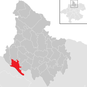
| Location of Hofkirchen im Mühlkreis in the Rohrbach district | ||
  |
||
 View of the town with a protected wayside shrine |
||
| Source: Municipal data from Statistics Austria | ||

Hofkirchen im Mühlkreis is an Upper Austrian market town in the Rohrbach district with 1507 inhabitants (as of January 1, 2020). The community is located in the judicial district of Rohrbach . Until the end of 2002 the community belonged to the judicial district of Lembach .
geography
Hofkirchen is at an altitude of 601 m above sea level. A. in the southwestern edge of the Rohrbach district in the upper Mühlviertel . In terms of the nature conservation spatial structure, the municipality has a share in the spatial units of the Central Mühlviertel highlands , the southern Bohemian Forest foothills and Danube gorges and side valleys . The area slopes slowly from north to south and is structured by numerous knolls and hollows, which also results in a main drainage direction. The extension is 8.9 km from north to south, 7.4 km from west to east, the total area is 22.59 km². Hofkirchen is thus in the upper middle range of the municipalities in the district. With 66 inhabitants per km² in 2013 Hofkirchen was also in the middle of the range of municipalities. The municipality extends over an average height of between 550 and 650 meters, with the lowest point in the municipality in the Danube Valley at around 280 meters and the highest point in the municipalities at around 810 meters. In 2001, 35.5 percent of the municipal area was forested, 49.6 percent of the area was used for agriculture. In comparison with the federal state of Upper Austria, Hofkirchen is in the Upper Austrian average (Upper Austria: 38.3 percent and 49.3 percent). The proportion of other uses (construction areas, gardens, bodies of water and others) is 14.9 percent, also within the Upper Austrian average of 13.8 percent. Neighboring communities are Neustift in the Mühlkreis in the southwest, Pfarrkirchen in the Mühlkreis in the west and north, Putzleinsdorf in the northeast and Niederkappel in the east. In the southeast, south and southwest, Hofkirchen borders the Eferding district , where Haibach ob der Donau and St. Agatha in the southeast, Waldkirchen in the south and Engelhartszell in the southwest are the neighboring communities.
Geology and soils
The landscape of the municipality is part of the Bohemian Massif, which goes back to a very old mountain range that was created by the Variscan mountain formation in the Paleozoic ( Carboniferous ). After the strong erosion of the former high mountains, during the Alpidic mountain formation in the Tertiary, the crystalline basement was abolished by several 100 meters, causing fractures and faults. Subsequently, sediments were deposited in the Tertiary and Quaternary periods . The dominant soil type in the municipality is silicate brown earth. Depending on the slope, there are medium to deep, mature soils that are poor in nutrients but are considered to be profitable due to their balanced water balance. In the case of waterlogging, wet meadows or along rivers, there is also gley that is suitable for grassland management, in higher forest plateau areas (parish forest) there are also podsolation phenomena.
Landscape and vegetation
The landscape of the municipality can be divided into three parts. In the north is the wooded Hofkirchner highlands, which represent the southernmost foothills of the Bohemian Forest. The forest area is a completely coherent large-scale stand that has a partially natural composition and structure (spruce-fir-beech forest). In some cases, however, there are also pure spruce stands that are heavily influenced by forestry. The main part of the municipality is a raised hill country with changing equipment of landscape elements. The area is more or less intensely agriculturally characterized with medium altitudes and scattered small forest areas. The area is also loosely populated throughout. Most of the forest areas consist of pure spruce stands that are strongly characterized by forestry, and to a lesser extent there are also hardwood-rich sub-areas, especially with beech trees. Agriculture is a mixture of arable and grassland farming, with a slight focus on grassland. In the south of the municipality are the wooded slopes of the Danube and the Danube lowlands. Most of the steep hillside forests are near-natural and protected by Natura 2000. The species composition of the hillside forests is largely natural and planted with oak-hornbeam forest. There are also spruce-dominated stands on the slopes of the confluent side valleys.
Districts of the municipality
The municipality includes the following localities (population in brackets as of January 1, 2020):
- Au (18)
- Village (40)
- Emmerstorf (131)
- Falkenstein (132)
- Free Cell (18)
- Gerastorf (37)
- Hofkirchen im Mühlkreis (748)
- Hoetzendorf (51)
- Dog filling (66)
- Bell (7)
- Marsbach (35)
- Niederranna (150)
- Oberbumberg (11)
- Meadows (63) with the Katzbrenning noble seat
history
Early history and Roman times
The Danube region was settled at an early stage, and finds from the Neolithic and Bronze Age have been found in the municipal area of Hofkirchen. From the birth of Christ to around 400 AD, the Danube formed the border between the Romans in the south and the Germanic Marcomanni in the north, which enabled Roman coins to be discovered in Niederranna and Untermühl. After the invasion of the Heruli in 480, the Romans withdrew from the Danube region.
middle Ages
Bavarian settlers began to settle the Mühlviertel starting from the Danube in the 9th century. Settlement was sparse at the beginning, only around 1100 began the reclamation and settlement of the so-called northern forest, a then almost impenetrable woodland between the Mühl and the Ranna. The main burden of colonization was carried by the highly free families of the Griesbachers and those on Falkenstein. It was only from the 1160s that the Passau residents' possessions on the Donauleiten and on the Kleine Mühl (Marsbach, Haichenbach, Tannberg) can be identified. The first settlements in today's municipal area are likely to have been Hofkirchen and Niederranna an der Donau in the immediate vicinity of the Falkensteiner Hof, with the latter serving as a loading and toll station for the Falkensteiners. Hötzendorf and Gerastorf are also likely to be Falkensteinian foundations. Later, the Passau residents founded Marsbach with the Kling and Freizell stores and the villages of Emmerstorf, Wiesen and Hundsfülling. On September 1, 1333 Hofkirchen was granted market rights by a letter of freedom from Albrecht II, which allowed the town to hold a weekly market and sell “five pounds” of salt. According to an unproven account, the market award by Otto the Fröhlichen is said to have been confirmed in 1335, which led to the widespread opinion that 1335 was the year of the market survey. In 1459, Archduke Albrecht VI granted Hofkirchen the right to hold a fair on St. Ulrich's Day and the salt trading privilege was extended to an unlimited extent. At the same time, the people of Hofkirchen were allowed to seduce the salt into Bohemia.
Modern times
The residents of Hofkirchen had different privileges, a distinction being made in particular between the citizens and the mercenaries. The citizens were owners of a castle right, by which one understood a house endowed with civil rights. Mercenaries, on the other hand, only owned one Sölde (small house), mostly for no reason, whereby the Sölde was based on civil land and the mercenary had to pay interest to the owner of the castle. While the citizens were allowed to exercise civil trades and trade and enjoyed a share in the community's property, the mercenaries were denied these civil rights. Nevertheless, they all had to bear civil burdens. The castle rights were recorded for the first time in the land register of 1527, with 37 castle rights, a "small Hofmarch" and five Sölden being listed. Most recently there were 39 castle rights and seven civil Sölden. The citizens usually elected the market judge on St. Stephen's Day every six years , who subsequently had to be confirmed by the Falkenstein-Altenhof rulers. The judge was only to a small extent concerned with the case law, but rather had to take care of the issuing of legal documents, the implementation of ordinances and the annual accounting of the municipality. In addition, there was an "inner council" which took part in the discussion of the market judge's most important business and which consisted of five councilors or council members. In addition, there was the so-called “external council”, which monitored trade as well as weights and measures and ensured the maintenance of law and order.
In the second half of the 16th century Protestantism spread in the area of Hofkirchen and as a result many farmers and the entire market population converted to Protestant teaching. Lutheran preachers were supported by the keeper of Falkenstein and Lutherans also preached in the castle chapels of Marsbach and Rannariedl. At the beginning of the 17th century, the Counter-Reformation pushed Protestantism back, with a Catholic priest in Hofkirchen again in 1603.
politics
Municipal council
The municipal council, as the highest body of the municipality, has 19 seats and is elected every six years in the course of Upper Austria-wide municipal council elections. The municipality board consists of five members, whereby the Austrian People's Party (ÖVP) is represented on the municipal board after the municipal council election in 2009 with the mayor, the vice mayor and two other members and thus has the absolute majority in this body. The Social Democratic Party of Austria (SPÖ) sends another member.
The strongest faction in the Hofkirchen im Mühlkreis municipal council has always been the ÖVP, which since 1945 has always achieved an absolute majority of votes and mandates or, with one exception, always had a two-thirds majority. In 1955, the ÖVP achieved its best result to date with 87.8 percent; in 2003 it recorded its worst result with 64.7 percent. The second strongest party in the municipal council of Hofkirchen im Mühlkreis was always the SPÖ, which has achieved results between 12.2 and 24.9 percent since 1945. The SPÖ had its best result in 1985, its worst in 1955. The Freedom Party of Austria (FPÖ) entered the community for the first time in 1973 and was able to achieve 9.1 percent, in 1979 the FPÖ left the local council. It was not until 1991 that the FPÖ ran again in Hofkirchen, reaching 5.1 percent and in 1997 10.8 percent. In 2003 she left the municipal council again with 2.9 percent. The Greens, however, made it into the municipal council for the first time in 2003 with 10.1 percent. In the last municipal council election in 2009, the ÖVP won 68.6 percent or 13 seats, the SPÖ won 20.1 percent or four seats, the Greens won 11.3 percent and two seats.
mayor
The mayor has been determined by direct election since 1997 , with no absolute majority for a candidate in a runoff election . The mayor Erich Moser (ÖVP), who has been in office since 1988, won the first direct election with 82.2 percent in the first ballot against the SPÖ candidate. In 2003 Moser was replaced by Martin Raab (ÖVP), who came to 78.7 percent of the direct mayor election in the first ballot. In 2003 candidates from the SPÖ and Greens ran against Raab. Raab was again confirmed in office in 2009 with 80.4 percent, although in this election only one candidate from the Greens ran against him.
Mayor since 1850:
| Term of office | Surname | Term of office | Surname |
|---|---|---|---|
| 1850-1858 | Johann Stuböck | 1944-1945 | Anton Höglinger |
| 1858-1861 | Michael Preininger | 1945 | Johann Mayrhofer |
| 1861-1879 | Johann Rauscher | 1945-1946 | Roman Gahleitner |
| 1879-1900 | Alois Wimmer | 1946-1949 | Leopold Zinöcker |
| 1900-1902 | Anton Arnezeder | 1949-1973 | Adalbert Thaler |
| 1902-1903 | Josef Eggetsberger | 1973-1988 | Norbert Heinzl |
| 1903-1933 | Karl Bogg | 1988-2003 | Erich Moser |
| 1933-1935 | Anton Hackl | since 2003 | Martin Raab |
| 1935-1942 | Leopold Zinöcker | ||
| 1942-1944 | Josef Wurzer |
Other options
As in municipal council elections, the ÖVP also dominates regional elections in the municipality. By 2003, the ÖVP was able to achieve a two-thirds majority with the exception of one election by 1997, and in 1979 it achieved its best result to date with 81.9 percent. Since then, however, the ÖVP has gradually lost its share of the vote. The second strongest party in state elections until 1991 was always the SPÖ, which won between 14.4 and 23.8 percent. The SPÖ had its best result in 2003, its worst in 2009. As VdU, the FPÖ still achieved 11.2 percent in the municipality in 1949, after which it remained below around 3 percent until 1985, with one exception. It was not until the 1991 election that the FPÖ was able to achieve a significant result again with 9.4 percent. In 1997 the FPÖ was able to achieve its best result to date with 11.7 percent, but after that it fell to 3.8 percent. In the last state election in 2009, the ÖVP came in first place with 61.6 percent and its lowest result to date. The SPÖ only got 14.4 percent and had to give up around 9 percent of its share of the vote. The FPÖ achieved their second-best result so far with 10.9 percent, the Greens got their best election result with 10.1 percent.
coat of arms
The coat of arms of the municipality of Hofkirchen im Mühlkreis is comparatively old, but the award of the coat of arms to Hofkirchen is not documented by a certificate. The first evidence of the use of the market coat of arms comes from July 25, 1571, when a seal with the inscription "S." was printed on the "letter of violence for purchase" from the markets of the upper Mühlviertel. HOFKHIRICHEN. PEI. VALKHENSTAIN ”and the year 1541 was printed. In later descriptions of the coat of arms, the extension of the parish church was incorrectly referred to as the "town hall", which was why the coat of arms was represented accordingly in the following period. The blazon of the coat of arms reads: In blue on a green three-mountain a silver wall with a black open arched gate and two windows; towering behind it is a silver church with black roofs, two windows on the gable end of the nave and three on the flank tower and two on the annex, the tent roof of the tower is equipped with a golden knob and cross. The coat of arms symbolizes the name of the settlement after the church built next to a manorial court, whereby the name "Hofkirgen" was mentioned in a Bavarian document as early as 1160. The municipality colors blue-white-green are used according to old traditions, but without official approval.
population
Population structure
In 2013, 1,481 people lived in the municipality, which means that Hofkirchen im Mühlkreis was on average for the municipalities in the district. At the end of 2001, 98.7 percent of the population were Austrian citizens (Upper Austria 92.8 percent, Rohrbach district 96.9 percent), by the beginning of 2013 the value had fallen to 96.6 percent (Upper Austria 91.1 percent, Rohrbach district 96.9 percent) Percent). A total of 50 foreigners were counted in the municipality in 2013, 86 percent of whom came from Europe (mostly from EU countries). A total of 105 people with a foreign country of birth lived in Hofkirchen in 2013. In 2001, 97.6 percent of the population committed to the Roman Catholic Church (Upper Austria: 88.6 percent), 1.0 percent were without confession, 0.3 percent were Islamic and 0.8 percent were Protestant.
The average age of the community population in 2001 was roughly the national average. 19.4 percent of the inhabitants of Niederwaldkirchen were younger than 15 years (Upper Austria: 18.8 percent), 62.6 percent between 15 and 59 years old (Upper Austria: 61.6 percent). The proportion of residents over 59 years of age was 18.0 percent, below the national average of 20.2 percent. The average age of the population of Hofkirchen changed as a result, especially in the first two segments. The proportion of people under the age of 15 fell to 14.4 percent as of January 1, 2013, while the proportion of people between 15 and 59 years of age increased significantly to 69.6 percent. The proportion of people over 59 years of age fell slightly to 16.0 percent. According to marital status, in 2001 47.8 percent of the residents of Hofkirchen were single, 43.7 percent married, 6.1 percent widowed and 2.3 percent divorced.
Population development
Today's municipal area of Hofkirchen im Mühlkreis has experienced an almost analogous population development compared to the Rohrbach district since the late 19th century. While the number of inhabitants in the Rohrbach district remained practically the same from 1869 to 2013, the number of inhabitants in Hofkirchen fell by around three percent during this period. The population of the federal state of Upper Austria, however, almost doubled. The population development of Hofkirchen has fluctuated in a relatively narrow corridor over the past 150 years. Between 1869 and 1900, the population initially fell from 1,515 to 1,305, or 14 percent, and then stagnated. As a result, the population moved between around 1,300 and 1,400 until the beginning of the 1970s, and only since then has a continuous, albeit slow, population increase developed. Decisive for the population development in the community is a noticeable emigration and a clear birth surplus. In the 1900s to 2000s, the community recorded an outward migration of around 40 to 100 people per decade, but this was offset by a slightly higher birth surplus. This trend continued even after the turn of the millennium.

Economy and Infrastructure
Workplaces and employees
At the end of October 2011, Hofkirchen im Mühlkreis housed 136 workplaces with 618 employees, with 238 people or around 39 percent of employees working in eleven workplaces in the field of material goods production alone. In the field of material goods production, Global Hydro Energy GmbH is also the largest employer in the municipality, which in Niederranna produces small hydropower plants and turbines with more than 150 employees. In 2011, the production of goods was followed by trade with 93 employees (15 percent of employees) and 17 workplaces, followed by agriculture and forestry with 73 employees (12 percent) at 49 workplaces and education with 45 employees ( seven percent). Other important sectors were the health and social services as well as the hotel and catering sector with six and five percent respectively.
Of the 793 economically active persons living in Hofkirchen in 2010, only 1.0 percent were unemployed. Of the 779 people in employment, 210 were employed in manufacturing (27 percent), 291 in retail (14 percent) and 191 in health and social services (9 percent). Other important sectors were trade, with a share of 11 percent, followed by construction with nine percent and health and social services or agriculture and forestry with eight percent each. Of the 768 employed persons from Hofkirchen (excluding employed residents temporarily absent from work) at the end of October 2011, 272 people were employed in Hofkirchen. 496 or 65 percent had to commute to work. Of the out-commuters, 32 percent had their place of work in the state capital Linz and 41 percent in the Rohrbach district. The most important commuter communities besides Linz were Sarleinsbach , the district capital Rohrbach and Lembach in the Mühlkreis . In return, 294 people commuted to Hofkirchen, 76 percent of whom came from the Rohrbach district. The most important communities of origin were parish churches in the Mühlkreis , Neustift in the Mühlkreis and Putzleinsdorf .
Community finances
In 2013, the Hofkirchen community had an income of around 5.5 million euros. The municipality earned 2.6 million euros from fees for services such as sewage disposal, waste disposal and water supply, with the fees for sewage disposal accounting for the largest share at around 2.3 million euros. Hofkirchen earned around 1.65 million euros from public taxes. The community received around 1.1 million from revenue shares in joint federal taxes and around 0.55 million from community taxes. Around three quarters of the municipal taxes come from the municipal tax , 20 percent from the property tax B , whereby in 2012 the largest taxable company in the municipality paid around 49% of the total municipal tax revenue. The third largest income item was the field of teaching, education, sport and science with around 0.7 million euros, with the municipality generating income in particular for the secondary school and the kindergarten. The municipality received a further 0.2 million euros from income for road construction and the building yard. In 2013, the income was offset by expenses of 5.45 million euros, which meant that the municipality was able to achieve a slight surplus. The main expenditure items were community services at EUR 2.65 million, with wastewater disposal once again having the greatest impact at EUR 2.35 million. The municipality spent another million euros on teaching, education, sport and science, with 59 percent of the expenditure going to the secondary school and 26 percent to the kindergarten. Hofkirchen spent 0.4 million euros on municipal administration and the costs of the elected municipal bodies, 0.35 million euros went to social welfare and housing subsidies (social welfare association levy), and 0.3 million euros each went to health (especially hospital contributions) and roads - and hydraulic engineering.
With its financial strength, the market municipality ranked 124th in comparison with the other 444 municipalities in Upper Austria in 2012 and took fifth place within the municipalities of the Rohrbach district. Based on a per capita debt of 4,584 euros in 2012, the municipality ranked 23rd and took 8th place among the 42 municipalities in the Rohrbach district.
Agriculture and Forestry
The statistics showed a total of 74 agricultural and forestry holdings for the community of Hofkirchen in 2010. These included 31 full-time businesses and 37 part-time businesses as well as four businesses run by legal entities or two communities of persons. The total number of businesses had fallen by 14 businesses or 16 percent compared to 1999, with the number of full-time businesses falling more sharply than the number of part-time businesses, contrary to the district and state trend. The farms jointly cultivated a total of 1640 hectares in 2010, with 59 percent of the area being farmed by full-time farmers and 36 percent by part-time farmers. The average area of full-time farmers was 31.1 hectares, well below the district average (34.7 hectares) or the Upper Austrian average of 33.8 hectares.
traffic
Until the 19th century, the Danube was the main route for the import and export of goods, with the loading stations in Niederranna, Freizell and Kling being important for trade and traffic. It was initially transported by rafts, and from 1830 also by steamships. On land routes, people used the “old salt route” built in the 11th to 12th centuries, which led from the mouth of the Ranna via parish churches to Bohemia. Around 1500 the "new salt path" was built diagonally across the Salzleiten from Niederranna to the old salt path. On the plateau, however, a west-east road served as the main route, which led from Bavaria via Hofkirchen to Lembach. The road connections remained very poor until the 19th century, and the roads were not expanded until the 1880s. The road to Lembach was expanded between 1882 and 1883, the new road between Niederranna and Hofkirchen was built between 1906 and 1908, and the road between Kling and Marsbach was rebuilt from 1910 to 1914 and 1919 to 1923.
The most important road connection today is the Falkenstein Landesstraße (L 584), which leads from Lembach in the Mühlkreis to the east via Putzleinsdorf to Hofkirchen and then to the north via Pfarrkirchen and Oberkappel to the German border. Starting from Markt Hofkirchen, the Niederkappeler Bezirksstraße leads in a south-easterly direction to Niederkappel and in a northerly direction to Lembach. The Ebenhoch Landesstraße (L 587), on the other hand, branches off to the west of the market from the Falkenstein Landesstraße and leads south through Niederranna and over the Danube to Waldkirchen am Wesen . With the Rannariedler Bezirksstraße (L 1541) there is another state road that starts from Niederranna first in a north-easterly direction and then in a northerly direction to Neustift im Mühlkreis and on to Oberkappel.
education
The elementary school in Hofkirchen was attended by 57 students in the 2013/14 school year, with four classes being passed. Since the mid-1960s, Hofkirchen has also been the location of a secondary school and a polytechnic course, whereby the classes between 1966 and 1970 had to be accommodated in the old elementary school, in the Zinöckervilla and in the new elementary school building. The construction of the secondary school began in 1970, after which the first classes could move in in 1972. The official inauguration took place in 1974, and an extension followed between 1988 and 1990. In the 2013/14 school year, there were eight classes in the secondary school that were attended by 157 children.
Culture and sights
In Hofkirchen there are 15 listed , immovable objects, whereby the community is rich in ruins, castles and palaces. The Falkenstein castle ruins are a former, large castle above the Ranna valley , which was mentioned in a document as early as the middle of the 12th century. The Haichenbach castle ruins were first mentioned in documents in the middle of the 12th century. It lies above the Schlögener Schlinge and offers a wide view from the castle tower. In contrast to the two ruins, Marsbach Castle is still preserved. It is located on a steep drop on the left side of the Danube and has been documented since 1075. When lock free cell is an only partly preserved plant, which dates back to the late Middle Ages. In addition to the stately facilities, the parish church of St. Ulrich and the rectory are under monument protection. There are also four residential or town houses in the market, the town hall and the market fountain. Since 2010, the municipality has had modern sights with three labyrinths, whereby the labyrinth theme is also reflected in works of art and private facilities. The three labyrinths are a plant labyrinth, a stone labyrinth and an art labyrinth.
Regular events
- A wine fair takes place every first Saturday in May.
- At the end of April the TSU 1960 Hofkirchen hosted the one-day rock festival "Hofkirchen Rock City".
- The street art festival Mühlviertler Speckdackel takes place every two years on the end of school weekend in July .
- Every year in July, the fire brigade organizes the forest festival in Stockat Raidl.
Individual evidence
- ↑ a b c Province of Upper Austria: Mapping of natural areas in Upper Austria. Landscape survey of the community of Hofkirchen im Mühlkreis. Final report. Kirchdorf an der Krems 2005, PDF on ZOBODAT
- ↑ Statistics Austria: Population on January 1st, 2020 by locality (area status on January 1st, 2020) , ( CSV )
- ↑ State of Upper Austria ( Memento of the original from December 20, 2013 in the Internet Archive ) Info: The archive link was automatically inserted and not yet checked. Please check the original and archive link according to the instructions and then remove this notice. Local council elections in Hofkirchen from 1945
- ^ Province of Upper Austria election results in mayoral elections in the municipality of Hofkirchen im Mühlkreis
- ^ State of Upper Austria Mayor of the community of Niederkappel since 1850
- ↑ State of Upper Austria ( Memento of the original from December 20, 2013 in the Internet Archive ) Info: The archive link was automatically inserted and not yet checked. Please check the original and archive link according to the instructions and then remove this notice. State election results in Hofkirchen im Mühlkreis from 1945
- ^ State of Upper Austria coat of arms of the municipality Hofkirchen iM
- ↑ a b Province of Upper Austria ( Memento of the original from November 29, 2014 in the Internet Archive ) Info: The archive link was inserted automatically and has not yet been checked. Please check the original and archive link according to the instructions and then remove this notice. Population levels in Upper Austria in comparison by citizenship
- ↑ Statistics Austria: Population by religion and federal states 1951 to 2001 (accessed on October 2, 2013)
- ↑ a b c d e Statistics Austria community data from Hofkirchen im Mühlkreis
- ↑ a b Province of Upper Austria ( Memento of the original from October 29, 2013 in the Internet Archive ) Info: The archive link was automatically inserted and not yet checked. Please check the original and archive link according to the instructions and then remove this notice. Resident population in Upper Austria compared by age group
- ↑ offenerhaushalt.at
- ↑ a b c Office of the Upper Austrian Provincial Government (Ed.): Audit report by the Rohrbach district authority on the insight into the management of the market town of Hofkirchen in the Mühlkreis . Linz 2013
- ↑ Hofkirchen primary school in the Mühlkreis
- ^ Hauptschule Hofkirchen im Mühlkreis
- ↑ labyrinthe-hofkirchen.at
- ↑ Hofkirchen Rock City. In: www.facebook.com. Retrieved May 18, 2016 .
literature
- Johann Altendorfer (Hrsg.): 650 years market Hofkirchen im Mühlkreis. Hofkirchen then and now. Hofkirchen market town 1985
Web links
- Community website
- Map in the Digital Upper Austrian Room Information System ( DORIS )
- Further information about the municipality of Hofkirchen im Mühlkreis can be found on the geographic information system of the federal state of Upper Austria .

Aigen-Schlägl | Altenfelden | Arnreit | Atzesberg | Eggplant | Haslach an der Mühl | Helfenberg | Hofkirchen im Mühlkreis | Hörbich | Julbach | Kirchberg ob der Donau | Klaffer am Hochficht | Kleinzell im Mühlkreis | Kollerschlag | Lembach im Mühlkreis | Lichtenau im Mühlkreis | Nebelberg | Neufelden | Neustift im Mühlkreis | Niederkappel | Niederwaldkirchen | Oberkappel | Oepping | Peilstein in the Mühlviertel | Parish churches in the Mühlkreis | Putzleinsdorf | Rohrbach Mountain | St. Johann am Wimberg | St. Martin im Mühlkreis | St. Oswald near Haslach | St. Peter am Wimberg | St. Stefan-Afiesl | Ortisei in the Mühlkreis | St. Veit im Mühlkreis | Sarleinsbach | Schwarzenberg am Böhmerwald | Ulrichsberg