
Lembach in the Mühlkreis
|
market community Lembach in the Mühlkreis
|
||
|---|---|---|
| coat of arms | Austria map | |
 |
|
|
| Basic data | ||
| Country: | Austria | |
| State : | Upper Austria | |
| Political District : | Rohrbach | |
| License plate : | RO | |
| Surface: | 7.98 km² | |
| Coordinates : | 48 ° 30 ' N , 13 ° 54' E | |
| Height : | 552 m above sea level A. | |
| Residents : | 1,523 (January 1, 2020) | |
| Population density : | 191 inhabitants per km² | |
| Postal code : | 4132 | |
| Area code : | 07286 | |
| Community code : | 4 13 18 | |
| NUTS region | AT313 | |
| Address of the municipal administration: |
Schulstrasse 2 4132 Lembach im Mühlkreis |
|
| Website: | ||
| politics | ||
| Mayor : | Nicole Leitenmüller ( ÖVP ) | |
|
Municipal Council : (2015) (19 members) |
||
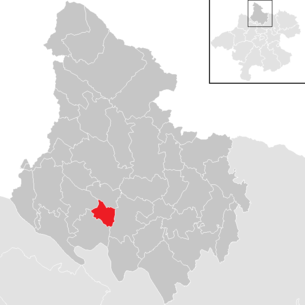
| Location of Lembach im Mühlkreis in the Rohrbach district | ||
  |
||
 Lembach municipal office |
||
| Source: Municipal data from Statistics Austria | ||

Lembach im Mühlkreis is a market town in Upper Austria in the Rohrbach district in the upper Mühlviertel with 1523 inhabitants (as of January 1, 2020). The community is located in the judicial district of Rohrbach .
geography
Lembach im Mühlkreis is located at 552 m above sea level in the upper Mühlviertel or in the nature conservation area of the Central Mühlviertel Highlands . The community area is the smallest in the district at 7.98 km². The extension is 3.6 km from north to south and 4 km from west to east. 27.2% of the area is forested, 61.7% of the area is used for agriculture.
Geology and soils
The landscape of the municipality is part of the Bohemian Massif , which goes back to a very old mountain range, which was formed by the Variscan mountain formation in the Paleozoic ( Carboniferous ). After the strong erosion of the former high mountains, during the Alpidic mountain formation in the Tertiary, the crystalline basement was abolished by several 100 meters, causing fractures and faults. Subsequently, sediments were deposited in the Tertiary and Quaternary periods . The dominant rocks in the municipality are older, coarse-grained granites of the Weinsberg granite type . It is one of the first masses of magma to solidify during the folding of the mountains, has a typical coarseness and causes a restless landscape character with rapid alternation of peaks and valleys. In terms of nature, Lembach is part of the wavy highland with its notch valleys of the "Ranna-Mühl-Rodl-Hochland" of the Bavarian-Upper Austrian solid edge of the crystalline edge region.
The soil type is soils of the brown earth podsol series made of crystalline, with silicate brown earth predominating in the municipality. This formed on the granites and gneisses of the Bohemian Massif. The light to very light soils are qualitatively dependent on the depth and the water supply, whereby the different grain size of the parent rock determines the water content or dryness of the soil. Generally, the bottoms of loamy sand and sandy loam of the municipality are nutrients, the humus is in dry areas Moder , under normal circumstances Mull . In addition, in the valley area of the Kleine Mühl and the Brücklbach Podsol can be found .
Landscape and vegetation
In terms of landscape, the municipality can be roughly divided into two natural areas. The valley area of the Brücklbach with forest slopes and the local area of Lembach extends to the southwest and south. Almost all of the landscape is part of the Central Mühlviertler Hochland spatial unit, while the southernmost section belongs to the Danube gorge and side valleys . In this part of the municipality, in addition to the main town of the municipality, there are large forest areas, which are mainly planted with coniferous forest used for forestry. There are also smaller areas with deciduous and mixed forest. In the agricultural area, the grassland dominates, with a few small forest areas, orchards and individual trees as structural elements. The second landscape area to be distinguished comprises the main part of the municipal area from northwest to southeast. The landscape lies entirely in the Central Mühlviertel highlands and is home to intensively used agricultural areas and wooded stream valleys. The forests in this area are mainly limited to the slopes of the curb valleys covered with coniferous forest, and there are also small forest areas with deciduous trees in the peripheral areas of the area. The majority of the areas are used intensively for green and arable land, extensive usable areas only exist on remaining areas. As structural elements, there are local hedges, as well as small forest areas, orchards on the outskirts, intensively used ponds, rows of fruit trees and individual trees. Overall, hardly any ecologically valuable landscape elements have been preserved in the municipality, with the streams showing the highest potential.
Community structure
| District | 2001 | 2011 |
|---|---|---|
| Atzesberg | 52 | 44 |
| Feichten | 43 | 41 |
| dig | 21st | 19th |
| Lembach in the Mühlkreis | 1,321 | 1,365 |
| Lug | 8th | |
| Oberlembach | 29 | 26th |
| Upper town | 53 | 44 |
| Volkersdorf | 14th | 12 |
The municipality of Lembach in the Mühlkreis is congruent with the cadastral municipality of Lembach. Around 86 percent of the community's residents live in Markt Lembach, which in 2001 had 395 buildings with 1,321 residents. The remaining six or seven districts had a maximum of around 50 inhabitants. The Lembach market is located in the west of the municipality. To the northeast or north of the municipality is the Oberlembach district, which consists of the hamlet of Oberlembach and the hamlet of Grub. In 2001 the district comprised only six buildings. To the east of Lembach or in the center of the municipality is the district of Feichten. In 2001 the Rotte Feichten had a total of 14 buildings. In the northeast of the municipality is the Atzesberg district, with the 2001 Rotte consisting of 14 buildings. The hamlet of Volkersdorf, which in 2001 consisted of five buildings, is located south of Atzesberg and east of Lembach. In the southeast of the municipality there is also the scattered settlement of Obernort, which also includes the single farm estate. In 2001 the district had a total of 14 buildings. In the southernmost part of the municipality there is another hamlet called Graben. The district had six buildings in 2001 and also housed the Bruckwirt inn.
The municipality includes the following localities (population in brackets as of January 1, 2020):
- Atzesberg (38)
- Trees (41)
- Trench (16)
- Lembach im Mühlkreis (1344)
- Lug (9)
- Oberlembach (24)
- Upper Town (33)
- Volkersdorf (18)
Neighboring communities
| Putzleinsdorf | Hörbich | |
.svg)
|
Altenfelden | |
| Niederkappel |
coat of arms
It is not known who awarded the coat of arms and when it was awarded. However, 1612 is assumed to be the year of the award, as Emperor Matthias raised Lembach to a perfect market on December 23 of that year .
In the coat of arms collection of Upper Austria. Landesarchivs, the coat of arms of the market town of Lembach iM is described as follows: In blue a golden, narrow wave bar, top and bottom mirrored accompanied by a golden, large star, which is surrounded by five small stars arranged in a semicircle by the bar.
The community colors are blue-yellow
history
Lembach was founded around 1000 by the Falkensteiners at the transition over the "long stream", from which the name Lembach is derived via "Lengenbach". Later manorial rule by the dominions Falkenstein , Marsbach and Pürnstein .
The place in the east of the Principality of Passau was first mentioned in documents in 1230 as "Lengenbach" and in 1256 it became the seat of the Passau court.
In the course of the Hussite Wars in 1427, the former Lembach Castle was completely destroyed.
Beginning of the Upper Austrian Peasants' War (May 17, 1626)
between farmers and Bavarian soldiers a dispute breaks out in the “Habach” tavern, with 6 soldiers being killed. Thereupon the agreed alarm signal is given from Obernort for the great peasant uprising in the state above the Enns.
During the Napoleonic Wars , the place was occupied several times.
In 1848 the linen dealer Alois Johanniter had a chapel built on the Mühlholzberg including the Way of the Cross as a thank you for being saved from drowning in the Danube.
Around 1850, the resolution is in the course manors created the market town of Lembach.
Since 1918 the place belongs to the federal state of Upper Austria. After the annexation of Austria to the German Reich on March 13, 1938, the place belonged to the Gau Oberdonau . After 1945 the restoration of Upper Austria took place.
Until the end of 2002 the community belonged to the judicial district of Lembach , on January 1, 2003 the community was assigned to the judicial district of Rohrbach.
politics
Municipal council
The municipal council, as the highest body of the municipality, has 19 seats and is elected every six years in the course of Upper Austria-wide municipal council elections. The municipality board consists of five members, with the Austrian People's Party (ÖVP) with the mayor and vice mayor as well as two other members since 2015 three members, the Social Democratic Party of Austria (SPÖ) and the Freedom Party of Austria (FPÖ) each have one member .
The strongest faction in Lembach im Mühlkreis municipal council has always been the ÖVP, which between 1973 and 2009 was always able to achieve an absolute majority of votes and mandates. The ÖVP achieved election results between 57.7 and 67.2 percent during this period. The second strongest party was always the SPÖ, which won between 21.0 and 34.5 percent of the vote. The Freedom Party of Austria (FPÖ) also competed in every election during this period and got between 4.9 and 18.4 percent of the votes, with the FPÖ only reaching the 10 percent mark in 1991, 1997 and 2015. In the last municipal council election in 2015, the ÖVP won 63.4 percent or 13 mandates, the SPÖ won 19.4 percent and 3 mandates, the FPÖ 17.3 percent and also 3 mandates.
mayor
Nicole Leitenmüller is the first woman to take over the mayor's office at the age of 30 in spring 2020 from Herbert Kumpfmüller, who abdicated after 30 years.
Other options
Similar to the good results in municipal elections, the ÖVP was always able to take first place in state elections between 1973 and 2009. With the exception of the 2003 state elections, the ÖVP always achieved an absolute majority of votes. The ÖVP recorded its worst result in 1997 with 48.7 percent, its best result since 1973 was 65.4 percent in 1973. The SPÖ was always the second strongest force in state elections in the Lembach community. In the period since 1973, in 2003, it achieved its best result with 37.5 percent; the SPÖ achieved its worst result in 2009. The FPÖ has always been in third place in state elections in the municipality since 1991, having previously received only a few votes. In 1997 she achieved her best result to date with 13.5 percent. In the state elections in 2009, the ÖVP was again first with 55.5 percent. The SPÖ posted its worst result to date with 23.0 percent. The FPÖ achieved its second best result since 1973 with 11.6 percent, while the Greens achieved their best result so far with 6.8 percent.
population
Population structure
In 2013, 1,540 people lived in the municipality of Lembach in the Mühlkreis, which placed Lembach in the upper third of the 42 municipalities in the district. In terms of population density, like Lembach, it even has the third highest population density in the district area. At the end of 2001 94.7 percent of the population were Austrian citizens (Upper Austria 92.8 percent, Rohrbach district 96.9 percent), by the beginning of 2013 the value had changed to 95.5 percent (Upper Austria 91.1 percent, Rohrbach district 96, 9 percent) hardly. A total of 69 foreigners were counted in the municipality in 2013, 81 percent of whom came from Europe. In 2001, 92.4 percent of the population committed to the Roman Catholic Church (Upper Austria: 79.4 percent), 2.7 percent were without confession, 3.5 percent were Islamic and 1.0 percent were Protestant.
The average age of the community population in 2001 was slightly above the national average. 18.5 percent of the residents of Lembach were younger than 15 years (Upper Austria: 18.8 percent), 55.6 percent between 15 and 59 years old (Upper Austria: 61.6 percent). The proportion of residents over 59 years of age was 25.9 percent, well above the national average of 20.2 percent, which can be explained by around 100 residents in the Lembach district nursing home. As a result, the average age of the population of Lembach changed in all segments. The proportion of people under the age of 15 fell to 13.5 percent as of January 1, 2013, while the proportion of people between the ages of 15 and 59 increased significantly to 63.3 percent. In contrast, the proportion of people over 59 years of age fell slightly to 23.1 percent. According to their marital status, in 2001 45.1 percent of the residents of Lembach were single, 41.0 percent married, 10.4 percent widowed and 3.5 percent divorced.
Population development
The community of Lembach im Mühlkreis recorded a strong population growth of 15 percent between 1869 and 1880, after which there was hardly any population movement until 1939. Rather, the population fluctuated around 1,000 residents. Population growth began in 1939, with particularly strong growth in the 1960s and 1980s. The community's population growth was significantly higher than that of the Rohrbach district, but slightly below that of the federal state of Upper Austria. Since the 1970s, the municipality has had a strongly fluctuating birth and migration balance. Whereas the positive birth balance in the 1970s was just able to offset the negative migration balance, immigration in the 1980s was more than twice as high as the birth surplus. In the 1990s, the birth balance then turned sharply into the red, but was offset by a consistently high balance of migration. Immigration has also been high since 2001, while the birth balance is very negative.

Culture and sights
education
- VS Lembach
- NMS Lembach
- State Music School Lembach
Sons and daughters
- Alfons Dorfner (1911–1982), canoeist
- Manfred Mayrhofer (conductor) (* 1944), conductor
- Michael Zaglmair (* 1987), soccer goalkeeper
health
Since 1990 the Red Cross has been providing emergency medical care for the population of Lembach and the surrounding communities with the Lembach branch. Before that time, the Green Cross had this role. There is also a general practitioner, a dentist and an osteopath in town.
Web links
- 41318 - Lembach in the Mühlkreis. Community data, Statistics Austria .
- Further information about the municipality of Lembach im Mühlkreis on the geographic information system of the federal state of Upper Austria .
- Lembacher Nachrichten News from and around Lembach
Individual evidence
- ↑ a b c natural space mapping Upper Austria. Landscape elevation Lembach in the Mühlkreis. Final report. Kirchdorf an der Krems 2007 (PDF; 2 MB)
- ↑ Statistics Austria: Population on January 1st, 2020 by locality (area status on January 1st, 2020) , ( CSV )
- ^ Province of Upper Austria (PDF; 210 kB) Local council elections in Lembach in the Mühlkreis
- ^ Province of Upper Austria (PDF; 201 kB) State election results
- ↑ a b Province of Upper Austria ( Memento of the original from November 29, 2014 in the Internet Archive ) Info: The archive link was inserted automatically and has not yet been checked. Please check the original and archive link according to the instructions and then remove this notice. Population levels in Upper Austria in comparison by citizenship
- ↑ Statistics Austria: Population by religion and federal states 1951 to 2001 (accessed on October 2, 2013)
- ↑ a b Statistics Austria community data from Lembach im Mühlkreis
- ↑ a b Province of Upper Austria ( Memento of the original from October 29, 2013 in the Internet Archive ) Info: The archive link was automatically inserted and not yet checked. Please check the original and archive link according to the instructions and then remove this notice. Resident population in Upper Austria compared by age group

Aigen-Schlägl | Altenfelden | Arnreit | Atzesberg | Eggplant | Haslach an der Mühl | Helfenberg | Hofkirchen im Mühlkreis | Hörbich | Julbach | Kirchberg ob der Donau | Klaffer am Hochficht | Kleinzell im Mühlkreis | Kollerschlag | Lembach im Mühlkreis | Lichtenau im Mühlkreis | Nebelberg | Neufelden | Neustift im Mühlkreis | Niederkappel | Niederwaldkirchen | Oberkappel | Oepping | Peilstein in the Mühlviertel | Parish churches in the Mühlkreis | Putzleinsdorf | Rohrbach Mountain | St. Johann am Wimberg | St. Martin im Mühlkreis | St. Oswald near Haslach | St. Peter am Wimberg | St. Stefan-Afiesl | Ortisei in the Mühlkreis | St. Veit im Mühlkreis | Sarleinsbach | Schwarzenberg am Böhmerwald | Ulrichsberg