
Pupping
|
Pupping
|
||
|---|---|---|
| coat of arms | Austria map | |
 |
|
|
| Basic data | ||
| Country: | Austria | |
| State : | Upper Austria | |
| Political District : | Eferding | |
| License plate : | EF | |
| Main town : | Pupping | |
| Surface: | 13.33 km² | |
| Coordinates : | 48 ° 20 ' N , 14 ° 0' E | |
| Height : | 270 m above sea level A. | |
| Residents : | 1,783 (January 1, 2020) | |
| Postal code : | 4070 | |
| Area code : | 07272 | |
| Community code : | 4 05 09 | |
| NUTS region | AT312 | |
| Address of the municipal administration: |
Pupping 13 4070 Pupping |
|
| Website: | ||
| politics | ||
| Mayor : | Mario Hermüller ( ÖVP ) | |
|
Municipal Council : (2015) (25 members) |
||
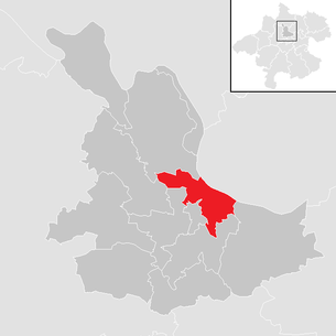
| Location of Pupping in the Eferding district | ||
  |
||
| Source: Municipal data from Statistics Austria | ||

Pupping is a municipality with 1783 inhabitants (as of January 1, 2020) in Upper Austria in the Eferding district in the Hausruckviertel . The community is located in the judicial district of Eferding .
geography
Pupping is located in the Eferdinger basin of the Hausruckviertel , on the right - here to the west - the Danube , at around 270 m above sea level. A. The extension is 6.9 km from north to south and 6 km from west to east. The total area is 13.2 km², 15.9% of the area is forested, 62.9% of the area is used for agriculture.
Community structure
The municipality includes the following 16 localities (population in brackets as of January 1, 2020):
- Altau (23)
- Au near Brandstatt (56)
- Au at high bridge (65)
- Auhof (20)
- Brandstatt (96)
- Friedlau (4)
- Goldenberg (56)
- Gstaltenhof (7)
- Gstöttenau (191)
- Leumühle (294)
- Upper damage (184)
- Pupping (133)
- Taubenbrunn (107)
- Lower damage (113)
- Washing point (257)
- Worth (177)
The community consists of the cadastral communities Oberschaden and Pupping .
The only counting area is pupping .
Neighboring communities
| Hartkirchen | Donau Feldkirchen an der Donau ( District Urfahr-Umg. ) | |
| Stroheim |
.svg)
|
alcove |
| Hinzenbach | Eferding | Fraham |
history
Pupping was first mentioned in a document in 994 as “Puppinga”, in connection with the death of Bishop Wolfgang von Regensburg , who died on October 31, 994 in the chapel of St. Othmar in Pupping. The place name goes back to the Old High German personal name Buppo.
Originally located in the eastern part of the Duchy of Bavaria , the place belonged to the Duchy of Austria since the 12th century . Since 1490 it has been assigned to the Principality of Austria ob der Enns . During the Napoleonic Wars , the place was occupied several times. Since 1918 the place belongs to the federal state of Upper Austria .
After the annexation of Austria to the German Reich on March 13, 1938, the place belonged to the Gau Oberdonau . During the Second World War , the main camp Stalag XVII D was established and was initially a branch camp of Stalag XVII B Krems-Gneixendorf . It was later renamed Stalag 237 , Stalag 97 and Stalag 398 Pupping . The camp consisted of 15 wooden barracks. The headquarters and accommodations of the guards were in the Puppinger Franciscan monastery . Deceased prisoners of war were buried at the Deinham camp cemetery (municipality of Hartkirchen ), which was already used as a camp cemetery during the First World War. Today, 1032 Soviet prisoners of war are commemorated on the war memorial. In 1945 Upper Austria was restored.
politics
The municipal council consists of a total of 25 members and has been composed of mandates from the following parties since the 2015 municipal council elections : 12 ÖVP, 6 SPÖ and 7 FPÖ.
- mayor
- until 2008 Leonhard Wenzelhuemer (ÖVP)
- 2008–2020 Hubert Schlucker (ÖVP)
- since 2020 Mario Hermüller (ÖVP)
Population development
In 1991 the community had 1855 inhabitants according to the census, in 2001 it had 1906 inhabitants.

coat of arms
Official description of the municipal coat of arms :
- “In green above a silver twin wavy bar a gold miter embroidered with a green Latin cross ; between the golden ribbons hanging down on both sides a golden ax placed at an angle to the left . "
The municipality colors are green-white-green.
The green color symbolizes the fertility of the area, the two wavy bars the Danube and the Aschach . Miter and ax are the saints attributes of St. Wolfgang, who died in Pupping in 994 .
The coat of arms was awarded on February 18, 1980.
Culture and sights

- Pupping Monastery Church : The current branch church, consecrated in 1879, was replaced by the former chapel dedicated to St. Othmar built. On October 31, 994 St. Wolfgang in front of the altar of the chapel.
- Shalomkloster Pupping : Was built in place of the old monastery (1477–1801) after 1879 and is now used as a meeting place.
- St. Wolfgang Chapel : The chapel in the village of Brandstatt was built at the point where Bishop Wolfgang von Regensburg is said to have come ashore by ship from Passau before he went to the St. Othmar Chapel Pupping was brought out.
economy
The majority of the municipal area is dominated by agriculture and here mostly by growing vegetables. There is a large organic farm here, which is based in the district of Schaden and markets its products from Eferding.
The leading company (?) In the region, which has its main location in the neighboring municipality of Hinzenbach , is also heavily supplied. A large carpentry shop, a company for furnishing the interior of apartments and a large gravel company are located in the community.
traffic
- Street: Pupping is on the B 130 Nibelungen Straße (Eferding - Passau)

- Train: The center of the village is accessible from the Pupping train station of the Aschacher Bahn . Another train stop is in the village of Leumühle . The rail freight traffic on the Aschacher Bahn is important, the passenger traffic is currently limited to a pair of trains on weekdays and a pair of trains on weekends (status 2008) and special traffic to the Puppinger vegetable fair.
- Public transport: Pupping is on the bus routes:
- Linz - Eferding - Passau / Haibach / St. Agatha / St. Aegidi (line no. 2002/06)
- Aschach - Eferding - Bad Schallerbach - Wels (660)
- Bad Mühllacken - Eferding - Kirchberg - Pasching - Leonding Meixnerkreuzung (8177)
- Eferding Airfield ( ICAO code LOLE ): Eferding Airfield, primarily a glider airfield with a grass runway , is located in the Gstaltenhof municipality of Pupping.
- Shipping: Danube ship landing stage: In the district of Brandstatt there is a ( DDSG ) - boat landing stage of the Danube.
- Cycle traffic: Danube Cycle Path R1: The Danube Cycle Path R1 leads via Pupping ( Brandstatt district ).
Personalities
- Wolfgang von Regensburg (around 924–994), saint, Reich Bishop of St. Emmeran, died here in 994
Web links
- Community website
- 40509 - Pupping. Community data, Statistics Austria .
- Entry on pupping in the Austria Forum (in the AEIOU Austria Lexicon )
- More information about the community of Pupping on the geo-information system of the federal state of Upper Austria .
- Map in the Digital Upper Austrian Room Information System ( DORIS )
Individual evidence
- ↑ Statistics Austria: Population on January 1st, 2020 by locality (area status on January 1st, 2020) , ( CSV )
- ^ Ernst Schwarz: The place names of eastern Upper Austria (= Pr. German studies ). Kraus Verlag, Reichenberg, p. 122 .
- ↑ Hubert Speckner: In the power of the enemy: POW camp in the "Ostmark" 1939 to 1945. R. Oldenbourg, Munich / Vienna 2003, ISBN 3-486-56713-6 , p. 258.
- ↑ a b c Facts and Figures , Pupping Municipality

Cadastral communities: Oberschaden | Pupping
Locations: Altau | Au at high bridge | Au near Brandstatt | Auhof | Brandstatt | Friedlau | Goldenberg | Gstaltenhof | Gstöttenau | Leumühle | Upper damage | Pupping | Taubenbrunn | Under damage | Wash point | Wörth
Villages: Pupping • Waschpoint • Wörth | Hamlet: Auhof | Rotten: Altau • Au near Brandstatt • Au near Hohe Steg • Brandstatt • Goldenberg • Gstaltenhof • Gstöttenau • Leumühle • Upper damage • Taubenbrunn • Lower damage | Other locations: Auhof Castle • Friedlau • Gstaltenhof Airfield
Counting area: pupping
