List of bodies of water in Halle (Saale)
This is a listing of the bodies of water in the area of the city of Halle (Saale) . They are recorded in the groups flowing water , springs and standing water .
Running waters
All rivers and streams in the urban area belong to the catchment area of the Saale .
| Surname | course | length | use | photo |
|---|---|---|---|---|
| Saale | flows through the city essentially in a south-north direction | 27 km (main arm); 47 km (with side arms) |
Passenger shipping, water sports |

|
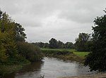
| White magpie | flows south of the city in a north-westerly direction; flows into the Saale at Beesen | 6.3 km | - |
|
| Beesener Bach (also Ellernbach) | flows south of the city in a southerly direction; flows into the White Elster | at the beginning of the 20th century piped and built over; 1993/94 e.g. T. revitalized | ||
| Reide | flows in the east of the city from north to south; flows into the White Elster | 14.7 km | - |

|
| Kabelske | flows from Schkeuditz in a westerly direction to Halle; flows into the Reide; eponymous for the municipality of Kabelsketal | 13.75 km | - | |
| Dölbauer Graben | flows in the east of the city in a southerly direction from Dölbau (municipality of Kabelsketal ); opens into the cable lock | - | Drainage ditch | |
| Steinlache, downhill Gerwische, then still water | flows south of the city in the Saale-Elster-Aue in a north-westerly direction; flows together (at the same place) with the White Elster into the Saale | - |

|
|
| Markgraben, downhill Stille Elster | flows south of the city in the Saale-Elster-Aue in a north-westerly direction; flows into the White Elster near Radewell / Osendorf | - | ||
| Hechtgraben (Saale) | Originates in the Dölauer Heide, crosses the district Heide-Nord / Blumenau and flows from the left into the Saale | 5 km | - |

|
| Hatred pit | flows in the north of the city in an easterly direction; partially piped, opens into the Hechtgraben (Saale) | - | ||
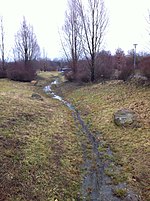
| Saugraben (hall) | begins in Nietleben , runs north of Halle-Neustadt in a westerly direction to the Saale | approx. 5 km | piped in the area where it joins the Saale to cross under a street; removes water that occurs through precipitation and the artificial dewatering of the Bruchsee , sometimes dries out |
|
| Roßgraben (Saale) (also Zscherbener Bach) | flows from Zscherben south of Neustadt in a northeasterly direction; flows through the church pond and the flood dam southeast of Neustadt (over a sluice ); flows into the Saale | partially piped; Discharges water from precipitation and groundwater uplift |

|
|
| Götsche | flows in the north-west of the city in a south-westerly direction coming from Sennewitz ( Saalekreis ), flows into a Saalaltarm, later into the Saale | 15.14 km | forms the border between Halle and Saalekreis in the lower reaches |

|
swell
The springs in the urban area belong to the catchment area of the Saale .
| Surname | location | use | photo |
|---|---|---|---|
| Healthy well | The source of the Gesundbrunnen springs in the southern part of the city | formerly used as a healing spring, today without use |

|
Standing waters
Most of the lakes and ponds in the urban area were created as a result of mining; only a small part is of natural origin. The mining activity here also tells of the former wealth of raw materials in the urban area. This is how bodies of water emerged from the remains of the mining of lignite, shell limestone, clay and gravel.
| Surname | location | Emergence | Hydrographic description | Use / specialty | photo |
|---|---|---|---|---|---|
| Horseshoe Lake | in the east of the city; between Kanena and Büschdorf | Flooded open pit of the lignite mine "Alwiner Verein" (later "Bruckdorf-Nord") | Area: 70 ha; Depth max: 26 m; Volume: 6.6 million m³ |
Water sports and leisure activities |

|
| Osendorfer See | in the southeast of the city; northeast of Osendorf | Flooded open-cast mine hole of the brown coal mine "Hermine Henriette" (later mine vdHeydt) | Area: 22 ha; Depth: 16 m; Volume: 2.6 million m³ |
Water sports (canoe and rowing regatta course) | |
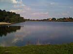
| Heidesee | in the west of the city; northwest of Nietleben | Flooded open-cast mine hole in the "Neuglück" lignite mine | Area: 12.5 ha; Depth: max. 13 m | outdoor pool |
|
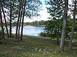
| Big Angersdorfer pond | in the west of the city; south of Neustadt bei Angersdorf | flooded clay pit | Area: 6 ha; Depth: max. 6 m | outdoor pool |
|
| Small Angersdorfer pond | in the west of the city; south of Neustadt bei Angersdorf | flooded clay pit | Area: 3 ha; Depth: max. 6 m | Area natural monument |

|
| Saaleaue gravel pit (north trough) | in the Saale floodplain in the southwest of the city; between Neustadt and Saale | Residual lake of gravel mining, the gravel was extracted for the concrete required for the construction of Halle-Neustadt | Area: 19 ha | Bathing and fishing waters, there are two islands |

|
| Saaleaue gravel pit (south trough) | in the Saale floodplain in the southwest of the city; between Neustadt and Saale | Remaining lake of gravel mining for the construction of Halle-Neustadt | Area: 5.5 ha | Fishing waters |

|
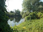
| Old sewer | southern section of the canal in the Saale floodplain in the southwest of the city; between Neustadt and Saale | Unfinished part of the planned Halle bypass canal in the planned south wing of the Mittelland Canal | Fishing waters |
|
|
| Canal (regatta course) | northern section of the canal in the Saale floodplain in the southwest of the city; between Neustadt and Saale | Unfinished part of the planned Halle bypass canal in the planned south wing of the Mittelland Canal | Bathing and fishing waters; formerly water sports (rowing / canoe regatta course ) |

|
|
| Posthorn pond (also Great Mötzlicher pond) | in the north of the city; in the Mötzig district | subsidence of the terrain resulting from the partial collapse of the “Frohe Zukunft” lignite underground mine; flooded with groundwater | Area: 20 ha; Depth: max. 2 m | Fishing waters |

|
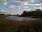
| Kleiner Posthorn Pond (also known as Kleiner Mötzlicher Pond) | in the north of the city; in the Mötzig district | subsidence of the terrain resulting from the partial collapse of the “Frohe Zukunft” lignite underground mine; flooded with groundwater | Area: 5 ha; Depth: max. 2 m | Fishing waters |
|
| Cemetery pond | in the west of the city; west of Neustadt | Flooded open-cast mine hole in the "Alt-Zscherben" lignite mine | Area: 5 ha; Depth: max. 20 m | - |

|
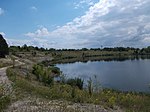
| Quarry (see) | in the west of the city; southwest of Neustadt | flooded limestone quarry | Area: 5 ha | - |
|
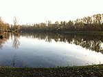
| Kröllwitz gravel pit | in the north of the city, districts Kröllwitz / Lettin ; on the left bank of the Saale opposite the Trotha harbor | two flooded gravel pits | Area approx. 30,000 and 4,800 square meters | Fishing waters |
|
| Bruchsee (also Graebsee) | in the west of the city; between Neustadt and Nietleben | flooded shell limestone quarry | Area: 2.0 ha; Depth: max. 11 m | - |

|
| Church pond | in the west of the city; southeast of Neustadt | Remnants of a former arm of the hall | Area: 5 ha; Depth: max. 2 m | Part of the “Südpark” recreation area, the Roßgraben (Saale) flows through it, which then also flows through the Dreiecksteich |

|
| Herthateich | in the west of the city; in the Dölauer Heide | on lens-like deposits of clays; natural origin; only temporarily water-bearing | Area: approx. 530 square meters | - | |
| Deer pond | in the west of the city; in the Dölauer Heide | on lens-like deposits of clays; natural origin | - | ||
| Small pond | in the west of the city; in the west of Neustadt | Area: 0.3 ha | - |

|
|
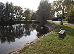
| Hose pond | in the north of the city; in the Mötzig district | Village pond | Area: 0.2 ha | - |
|
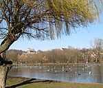
| fountain | in the central urban area; on the Ziegelwiese between Peißnitzinsel and the old town | Artificially created water surface with Europe's third highest fountain | Area: 1 ha | Part of a local recreation area |
|
| Blue eye | in the southeast of the city next to the Osendorfer See ; between Osendorf and Bruckdorf | like Osendorfer See flooded open pit of the lignite mine "Hermine Henriette" (later "vd Heydt") | The shape of the lake resembles a stylized eye |

|
|
| Cruiser ponds | in the northwest of the city; at the former state stud cross | three man-made ponds; originally used as a floodplain for the Kreuz stud | Area: 350, 550 and 3,000 m²; Depth: max. 1.5 m | - |

|
| Bruckdorf opencast mine | in the southeast of the city; west of Bruckdorf | Flooded open-cast mine hole of the open-cast lignite mine "vd Heydt" | - | ||
| Open pit cobra | in the southeast of the city; west of Bruckdorf | Flooded open-cast mine hole of the open-cast lignite mine "vd Heydt" | - | ||
| Powder willow pond | Pond on the Saale Island Pulverweiden , in the south of the island | the pond has an island and is in turn on a hall island | Part of a local recreation area |

|
|
| Tornau village pond | in the north of the city, in the center of Tornau | Village pond |

|
||
| Pond without an official name; also called Panzerteich or Fraunhofer pond | in the west of the city, west of Heideallee, district Heide-Süd | used as a tank washing pond by the Soviet armed forces once stationed in the nearby former barracks, hence also a tank pond; or Fraunhofer pond, as Fraunhofer institutes are in the immediate vicinity | Part of the Weinbergwiesen recreation area |

|
|
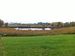
| Seebener pond ; or Seebener Weiher | in the north-west of the city, at the entrance to the Seeben district | the pond was created in a depression of the former coal mine "Karl Ernst" | extensive natural monument |
|
|
| Tavern | in the south of the city, between the Saale and the Böllberg / Wörmlitz district | Area: approx. 1,100 square meters | |||
| Triangular pond | in the west of the city; southeast of Neustadt | together with the church pond remnants of a former arm of the hall | water management system, is flowed through by the Roßgraben (Saale) |