| Surname |
location |
Type |
entry |
image
|
|
Benvie Mill
|
56 ° 28 ′ 14.5 " N , 3 ° 5 ′ 32" W.56.470694444444 -3.0922222222222
|
Mill
|
10864
|
|
|
Gray House
|
56 ° 28 ′ 34.7 " N , 3 ° 4 ′ 36" W.56.476305555556 -3.0766666666667
|
Mansion
|
12858
|

|
|
Powrie Castle
|
56 ° 29 ′ 59.3 " N , 2 ° 56 ′ 30" W.56.499805555556 -2.9416666666667
|
Castle ruins
|
19019
|

|
|
Camperdown Dock
|
56 ° 27 '47.9 " N , 2 ° 57' 13.7" W.56.463305555556 -2.9538055555556
|
dock
|
24923
|

|
|
Habour warehouse
|
56 ° 27 '47.7 " N , 2 ° 57' 25.9" W.56.46325 -2.9571944444444
|
Storage
|
24932
|
|
|
McManus Galleries
|
56 ° 27 '45.2 " N , 2 ° 58' 15.8" W.56.462555555556 -2.9710555555556
|
museum
|
24939
|
|
|
Logie Works
|
56 ° 27 '43.1 " N , 2 ° 59" 19.6 " W.56.461972222222 -2.9887777777778
|
Mill
|
24956
|
|
|
Panmure Shipyards workshops
|
56 ° 27 '36.2 " N , 2 ° 57' 38.3" W.56.460055555556 -2.9606388888889
|
workshops
|
24957
|
|
|
Tay Works machine house
|
56 ° 27 '44.3 " N , 2 ° 58' 47.9" W.56.462305555556 -2.9799722222222
|
Industrial building
|
24960
|

|
|
South Mills
|
56 ° 27 '37.9 " N , 2 ° 58' 47.2" W.56.460527777778 -2.9797777777778
|
Mill
|
24965
|
|
|
Victoria Dock
|
56 ° 27 ′ 41.9 " N , 2 ° 57 ′ 35" W.56.461638888889 -2.9597222222222
|
dock
|
24971
|
|
|
Dundee Royal Infirmary
|
56 ° 27 '56.9 " N , 2 ° 58' 52.2" W.56.465805555556 -2.9811666666667
|
hospital
|
24982
|

|
|
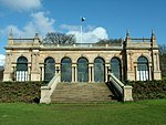
Baxter Park Pavilion
|
56 ° 28 '19.7 " N , 2 ° 57' 2.8" W.56.472138888889 -2.9507777777778
|
pavilion
|
24992
|
|
|
Castlehill House
|
56 ° 27 '40 " N , 2 ° 58' 4.4" W.56.461111111111 -2.9678888888889
|
Residential buildings
|
24993
|
|
|
St Paul's Cathedral
|
56 ° 27 '39.4 " N , 2 ° 58' 4.7" W.56.460944444444 -2.9679722222222
|
church
|
24997
|

|
|
Edward Street Mill
|
56 ° 27 '41.1 " N , 2 ° 59" 25.1 " W.56.461416666667 -2.9903055555556
|
Mill
|
25003
|
|
|
Tay Works
|
56 ° 27 '43.6 " N , 2 ° 58' 44.6" W.56.462111111111 -2.9790555555556
|
Industrial building
|
25030
|
|
|
High mill
|
56 ° 28 ′ 21.4 " N , 3 ° 0 ′ 23.7" W.56.472611111111 -3.0065833333333
|
Mill
|
25041
|
|
|
Cox's stack
|
56 ° 28 ′ 22 " N , 3 ° 0 ′ 12.5" W.56.472777777778 -3.0034722222222
|
stack
|
25044
|

|
|
Fintry Castle
|
56 ° 29 '7.7 " N , 2 ° 57' 29.3" W.56.485472222222 -2.9581388888889
|
Castle
|
25066
|
|
|
51-65 Commercial Street
|
56 ° 27 '42.1 " N , 2 ° 58' 6.1" W.56.461694444444 -2.9683611111111
|
Commercial building
|
25071
|
|
|
73-99 Commercial Street
|
56 ° 27 '44 " N , 2 ° 58' 10.8" W.56.462222222222 -2.9696666666667
|
Commercial building
|
25075
|
|
|
Camperdown House
|
56 ° 29 '4.1 " N , 3 ° 2' 33.8" W.56.484472222222 -3.0427222222222
|
Mansion
|
25078
|

|
|
Lower Dens Works
|
56 ° 27 '55.9 " N , 2 ° 57' 46" W.56.465527777778 -2.9627777777778
|
Mill
|
25093
|

|
|
68-110 Commercial Street
|
56 ° 27 '43.2 " N , 2 ° 58' 11.9" W.56.462 -2.9699722222222
|
Commercial building
|
25099
|
|
|
Upper Dens Mill
|
56 ° 27 '57 .7 " N , 2 ° 57' 45.9" W.56.466027777778 -2.96275
|
Mill
|
25101
|
|
|
Seafield Works
|
56 ° 27 ′ 17 " N , 2 ° 59 ′ 38" W.56.454722222222 -2.9938888888889
|
Industrial building
|
25111
|
|
|
Claverhouse Bleachworks
|
56 ° 29 '30.9 " N , 2 ° 57' 46.1" W.56.491916666667 -2.9628055555556
|
Industrial building
|
25112
|
|
|
Verdant Works
|
56 ° 27 ′ 41.8 " N , 2 ° 58 ′ 59" W.56.461611111111 -2.9830555555556
|
Mill
|
25140
|

|
|
Exchange Coffee House
|
56 ° 27 '36.6 " N , 2 ° 58' 2.3" W.56.460166666667 -2.9673055555556
|
Commercial building
|
25150
|
|
|
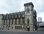
High School of Dundee
|
56 ° 27 '46.6 " N , 2 ° 58' 23" W.56.462944444444 -2.9730555555556
|
school
|
25177
|

|
|
Margaret Harris Building
|
56 ° 27 '45.1 " N , 2 ° 58' 26.2" W.56.462527777778 -2.9739444444444
|
school
|
25189
|
|
|
25-27 Trades Lane
|
56 ° 27 '46 " N , 2 ° 57' 57.9" W.56.462777777778 -2.9660833333333
|
Storage
|
25194
|
|
|
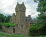
Dudhope Castle
|
56 ° 27 '51.4 " N , 2 ° 59' 1.9" W.56.464277777778 -2.9838611111111
|
Mansion
|
25195
|

|
|
Gardyne's Land
|
56 ° 27 '39.6 " N , 2 ° 58' 10.9" W.56461 -2.9696944444444
|
Residential and commercial buildings
|
25239
|

|
|
74-76 High Street
|
56 ° 27 '39.8 " N , 2 ° 58' 10.4" W.56.461055555556 -2.9695555555556
|
Commercial building
|
25243
|
|
|
77-80 High Street
|
56 ° 27 '41 " N , 2 ° 58' 9.7" W.56.461388888889 -2.9693611111111
|
Commercial building
|
25247
|
|
|
Caird Hall
|
56 ° 27 '35.7 " N , 2 ° 58' 7.1" W.56.459916666667 -2.9686388888889
|
Event building
|
25258
|

|
|
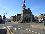
St Andrew's Church
|
56 ° 27 '52.5 " N , 2 ° 58' 5.2" W.56.464583333333 -2.9681111111111
|
church
|
25279
|

|
|
Clepington Primary School
|
56 ° 28 '22.2 " N , 2 ° 57' 32.7" W.56.472833333333 -2.9590833333333
|
school
|
25280
|
|
|
Morgan Academy
|
56 ° 28 '28 .7 " N , 2 ° 57' 14.7" W.56.474638888889 -2.9540833333333
|
school
|
25288
|

|
|
The Howff
|
56 ° 27 '41.3 " N , 2 ° 58' 22.3" W.56.461472222222 -2.9728611111111
|
graveyard
|
25312
|
|
|
St Salvador's Episcopal Church
|
56 ° 28 '12.1 " N , 2 ° 58' 17.8" W.56.470027777778 -2.9716111111111
|
church
|
25314
|
|
|
St Mary's Roman Catholic Church
|
56 ° 28 '15.1 " N , 3 ° 0' 29.2" W.56.470861111111 -3.0081111111111
|
church
|
25338
|
|
|
Invergowrie House
|
56 ° 27 '40.9 " N , 3 ° 2' 13.4" W.56.461361111111 -3.0370555555556
|
Mansion
|
25369
|
|
|
St Mary's Tower
|
56 ° 27 '33.8 " N , 2 ° 58' 23.3" W.56.459388888889 -2.9731388888889
|
tower
|
25370
|

|
|
Steeple Church
|
56 ° 27 '34.1 " N , 2 ° 58' 22" W.56.459472222222 -2.9727777777778
|
church
|
25374
|
|
|
Old St Paul's and St David's Church
|
56 ° 27 '34.5 " N , 2 ° 58' 20.6" W.56.459583333333 -2.9723888888889
|
church
|
25378
|
|
|
Dundee Parish Church
|
56 ° 27 '34.7 " N , 2 ° 58' 19.5" W.56.459638888889 -2.9720833333333
|
church
|
25382
|
|
|
133-139 Nethergate
|
56 ° 27 '26.4 " N , 2 ° 58' 34" W.56.457333333333 -2.9761111111111
|
Residential and commercial buildings
|
25402
|

|
|
136-148 Nethergate
|
56 ° 27 '28.1 " N , 2 ° 58' 27.8" W.56.457805555556 -2.9743888888889
|
Residential buildings
|
25451
|
|
|
Nethergate House
|
56 ° 27 '25.8 " N , 2 ° 58' 31.2" W.56.457166666667 -2.9753333333333
|
villa
|
25458
|
|
|
The Vine
|
56 ° 27 '11.9 " N , 2 ° 59' 13.1" W.56.453305555556 -2.9869722222222
|
villa
|
25469
|
|
|
Coldside Branch Public Library
|
56 ° 28 ′ 29.6 " N , 2 ° 58 ′ 50.4" W.56.474888888889 -2.9806666666667
|
Library
|
25494
|
|
|
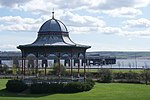
Magdalen Green Bandstand
|
56 ° 27 '11 " N , 2 ° 59' 40.9" W.56.453055555556 -2.9946944444444
|
pavilion
|
25499
|
|
|
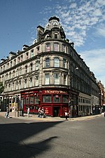
Royal Exchange
|
56 ° 27 '47.6 " N , 2 ° 58' 14.9" W.56.463222222222 -2.9708055555556
|
Commercial building
|
25507
|
|
|
India Buildings
|
56 ° 27 '49.6 " N , 2 ° 58' 18.6" W.56.463777777778 -2.9718333333333
|
Commercial building
|
25515
|
|
|
Seymour Lodge
|
56 ° 27 '24.7 " N , 2 ° 59' 58.9" W.56.456861111111 -2.9996944444444
|
villa
|
25542
|

|
|
1-27 South Tay Street
|
56 ° 27 '29.4 " N , 2 ° 58' 32.3" W.56.458166666667 -2.9756388888889
|
Residential buildings
|
25546
|
|
|
St Mark's Church
|
56 ° 27 '22 " N , 2 ° 59' 7.5" W.56.456111111111 -2.9854166666667
|
church
|
25601
|

|
|
McCheyne Memorial Church
|
56 ° 27 ′ 22.5 " N , 2 ° 59 ′ 44" W.56.45625 -2.9955555555556
|
church
|
25603
|

|
|
Greywalls
|
56 ° 27 '19.9 " N , 3 ° 0' 18.4" W.56.455527777778 -3.0051111111111
|
villa
|
25617
|
|
|
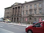
Old customs house
|
56 ° 27 '40.8 " N , 2 ° 57' 50.8" W.56.461333333333 -2.9641111111111
|
public building
|
25673
|
|
|
1-32 Springfield
|
56 ° 27 '24.4 " N , 2 ° 59' 8.8" W.56.456777777778 -2.9857777777778
|
Residential buildings
|
25678
|
|
|
Tay Railway Bridge
|
56 ° 26 '16.5 " N , 2 ° 59' 16.8" W.56.437916666667 -2,988
|
bridge
|
25681
|

|
|
Balmossie Viaduct
|
56 ° 28 '55.3 " N , 2 ° 50' 32.3" W.56.482027777778 -2.8423055555556
|
bridge
|
25739
|
|
|
Broughty Ferry Railway Station
|
56 ° 28 '2.8 " N , 2 ° 52' 24" W.56.467444444444 -2.8733333333333
|
railway station
|
25823
|

|
|
St Luke's and Queen Street Church
|
56 ° 28 '10.1 " N , 2 ° 52' 59.7" W.56.469472222222 -2.88325
|
church
|
25885
|

|
|
Eastern Primary School
|
56 ° 28 '4.4 " N , 2 ° 52' 6.1" W.56.467888888889 -2.8683611111111
|
school
|
25887
|
|
|
East Bridge
|
56 ° 29 '4.9 " N , 2 ° 52' 19.2" W.56.484694444444 -2.872
|
bridge
|
25892
|

|
|
West Bridge
|
56 ° 28 '59.9 " N , 2 ° 52' 39.8" W.56.483305555556 -2.8777222222222
|
bridge
|
25893
|
|
|
Pitkerro Lodge
|
56 ° 29 '23.1 " N , 2 ° 53' 23.1" W.56.48975 -2.88975
|
Residential buildings
|
25894
|

|
|
Pitkerro House
|
56 ° 29 '32.5 " N , 2 ° 53' 22.3" W.56.492361111111 -2.8895277777778
|
Mansion
|
25895
|
|
|
St Stephen's and West Church
|
56 ° 28 '4.5 " N , 2 ° 52' 54.5" W.56.467916666667 -2.8818055555556
|
church
|
25932
|
|
|
Red Court
|
56 ° 28 '18.3 " N , 2 ° 54' 6.6" W.56.47175 -2.9018333333333
|
villa
|
25938
|
|
|
Beach tower
|
56 ° 28 '9.7 " N , 2 ° 54' 23.1" W.56.469361111111 -2.9064166666667
|
villa
|
25947
|
|
|
Aystree
|
56 ° 28 '16.4 " N , 2 ° 53' 11.3" W.56.471222222222 -2.8864722222222
|
villa
|
25950
|
|


.jpg)


.jpg)
.jpg)


.jpg)


.jpg)
.jpg)
.jpg)
.jpg)


-geograph-2679678.jpg)


.jpg)


.jpg)


.jpg)


.jpg)

.jpg)
