| Surname |
location |
Type |
entry |
image
|
|
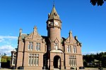
Barry Mill
|
near Carnoustie
56 ° 30 ′ 15.9 " N , 2 ° 45 ′ 30.4" W.56.504416666667 -2.7584444444444
|
Mill
|
4649
|

|
|
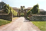
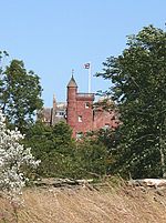
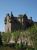
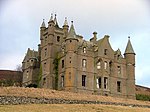
Careston Castle
|
near Brechin
56 ° 43 ′ 41.7 " N , 2 ° 46 ′ 7.3" W.56.72825 -2.7686944444444
|
Tower House
|
4656
|

|
|
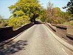
Bridge of Dun
|
near Farnell
56 ° 42 '59.1 " N , 2 ° 33' 9.3" W.56.716416666667 -2.5525833333333
|
bridge
|
4677
|

|
|
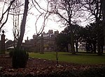
House of Dun
|
near Montrose
56 ° 43 ′ 45.6 " N , 2 ° 32 ′ 25.3" W.56.729333333333 -2.5403611111111
|
Mansion
|
4691
|

|
|
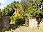
Court of Offices
|
near Montrose
56 ° 43 ′ 45.2 " N , 2 ° 32 ′ 28.3" W.56.729222222222 -2.5411944444444
|
Mansion
|
4692
|
|
|
St Vigeans Parish Church
|
Arbroath
56 ° 34 '36.2 " N , 2 ° 35' 24.7" W.56.576722222222 -2.5901944444444
|
church
|
4770
|

|
|
Melgund Castle
|
near Brechin
56 ° 41 ′ 47.3 " N , 2 ° 44 ′ 33.5" W.56.696472222222 -2.7426388888889
|
Tower House
|
4931
|

|
|
Usan House
|
near Montrose
56 ° 41 ′ 16.6 " N , 2 ° 27 ′ 18.6" W.56.687944444444 -2.4551666666667
|
Mansion
|
4964
|

|
|
Dunninald Castle
|
near Montrose
56 ° 40 ′ 45.3 " N , 2 ° 29 ′ 7.5" W.56.67925 -2.4854166666667
|
Mansion
|
4972
|
|
|
Kirk Tower House
|
near Montrose
56 ° 41 ′ 34.2 " N , 2 ° 29 ′ 7.2" W.56.692833333333 -2.4853333333333
|
church
|
4979
|

|
|
Craig House (Angus)
|
near Montrose
56 ° 41 ′ 49.1 " N , 2 ° 29 ′ 12.4" W.56.696972222222 -2.4867777777778
|
Mansion
|
4984
|
|
|
Gatehouse of Craig House
|
near Montrose
56 ° 41 ′ 48.3 " N , 2 ° 29 ′ 9.6" W.56.69675 -2.486
|
goal
|
4985
|
|
|
Kintrockat House
|
near Brechin
56 ° 43 ′ 18.4 " N , 2 ° 42 ′ 24.5" W.56.721777777778 -2.7068055555556
|
villa
|
5011
|
|
|
Ardovie House
|
near Brechin
56 ° 41 ′ 53.5 " N , 2 ° 39 ′ 57.4" W.56.698194444444 -2.6659444444444
|
villa
|
5016
|
|
|
Brechin Castle
|
Brechin
56 ° 43 ′ 44.2 " N , 2 ° 39 ′ 32.7" W.56.728944444444 -2.6590833333333
|
Mansion
|
5030
|

|
|
Stannochy Bridge
|
near Brechin
56 ° 43 ′ 18.4 " N , 2 ° 40 ′ 54.4" W.56.721777777778 -2.6817777777778
|
bridge
|
5042
|
|
|
Auchterhouse Old Mansion House
|
Auchterhouse
56 ° 31 ′ 22.1 ″ N , 3 ° 5 ′ 19.1 ″ W.56.522805555556 -3.0886388888889
|
Mansion
|
5689
|

|
|
Pigeon House of the Auchterhouse Old Mansion House
|
Auchterhouse
56 ° 31 '24.3 ″ N , 3 ° 5 ′ 14 ″ W.56.523416666667 -3.0872222222222
|
Pigeon house
|
5690
|
|
|
East Gates
|
near Liff
56 ° 28 ′ 25.2 " N , 3 ° 6 ′ 25.3" W.56.473666666667 -3.1070277777778
|
goal
|
10854
|
|
|
Gallery
|
near Marykirk
56 ° 46 ′ 51.4 " N , 2 ° 32 ′ 12" W.56.780944444444 -2.5366666666667
|
Mansion
|
11165
|
|
|
Marykirk Bridge
|
Marykirk
56 ° 46 '32.1 " N , 2 ° 30' 55.4" W.56.775583333333 -2.5153888888889
|
bridge
|
11177
|
|
|
Marykirk Customs House
|
Marykirk
56 ° 46 '31.1 " N , 2 ° 30' 58.5" W.56.775305555556 -2.51625
|
Customs House
|
11178
|
|
|
Inglis Memorial Hall
|
Edzell
56 ° 48 ′ 26.1 ″ N , 2 ° 39 ′ 13 ″ W.56.80725 -2.6536111111111
|
Hall
|
11261
|
|
|
Ethie Castle
|
near Lunan
56 ° 36 ′ 44.4 " N , 2 ° 30 ′ 39.8" W.56.612333333333 -2.5110555555556
|
Mansion
|
11278
|
|
|
Baldovie Farmhouse
|
near Kirriemuir
56 ° 40 ′ 24.7 " N , 3 ° 6 ′ 14.8" W.56.673527777778 -3.1041111111111
|
Farmhouse
|
11417
|
|
|
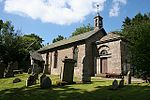
Farnell Parish Kirk
|
Farnell
56 ° 41 ′ 20.6 " N , 2 ° 36 ′ 35.5" W.56.689055555556 -2.6098611111111
|
church
|
11497
|
|
|
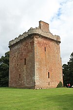
Farnell Castle
|
Farnell
56 ° 41 ′ 22.5 " N , 2 ° 36 ′ 35.6" W.56.689583333333 -2.6098888888889
|
Tower House
|
11501
|
|
|
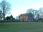
Strathmore Aisle
|
Glamis
56 ° 36 '34.4 " N , 3 ° 0' 4.3" W.56.609555555556 -3.0011944444444
|
Church remnants
|
11556
|
|
|
Inverquharity Castle
|
near Kirriemuir
56 ° 42 ′ 34.3 " N , 2 ° 57 ′ 48.2" W.56.709527777778 -2.9633888888889
|
Tower House
|
11665
|
|
|
Rochelhill Pigeon House
|
near Glamis
56 ° 35 ′ 38.5 " N , 3 ° 1 ′ 9.7" W.56.594027777778 -3.0193611111111
|
Pigeon house
|
11670
|

|
|
Glamis Castle
|
near Glamis
56 ° 37 '12.7 " N , 3 ° 0' 6.1" W.56.620194444444 -3.0016944444444
|
lock
|
11701
|

|
|
Glamis Castle Sundial
|
near Glamis
56 ° 37 ′ 11 " N , 3 ° 0 ′ 5.4" W.56.619722222222 -3.0015
|
sundial
|
11705
|
|
|
Pigeon House at Glamis Castle
|
near Glamis
56 ° 36 ′ 48.1 " N , 3 ° 0 ′ 18.4" W.56.613361111111 -3.0051111111111
|
Pigeon house
|
11710
|

|
|
Pitmuies House
|
near Friockheim
56 ° 38 ′ 17.7 ″ N , 2 ° 42 ′ 25.6 ″ W.56.63825 -2.7071111111111
|
farm
|
11875
|
|
|
Gardyne Castle
|
near Friockheim
56 ° 37 ′ 44.1 ″ N , 2 ° 41 ′ 46.8 ″ W.56.628916666667 -2.6963333333333
|
Tower House
|
11914
|
|
|
Edzell Castle pigeon house
|
Edzell
56 ° 48 ′ 41.1 " N , 2 ° 40 ′ 31" W.56.811416666667 -2.6752777777778
|
Pigeon house
|
12385
|
|
|
Pitmuies House
|
near Friockheim
56 ° 38 ′ 15.5 ″ N , 2 ° 42 ′ 25.7 ″ W.56.637638888889 -2.7071388888889
|
Mansion
|
13076
|

|
|
Lundie Parish Church
|
Lundie
56 ° 30 '58 .1 " N , 3 ° 9' 16.1" W.56.516138888889 -3.1544722222222
|
church
|
13090
|
|
|
Fowlis Easter Parish Church
|
Fowlis Easter
56 ° 29 ′ 17.9 ″ N , 3 ° 6 ′ 9.4 ″ W.56.488305555556 -3.1026111111111
|
church
|
13144
|

|
|
Balintore Castle
|
near Kirriemuir
56 ° 43 ′ 2.8 ″ N , 3 ° 9 ′ 40 ″ W.56.717444444444 -3.1611111111111
|
Mansion
|
13757
|
|
|
Tealing Parish Church
|
near tealing
56 ° 31 '47 " N , 2 ° 58' 16.9" W.56.529722222222 -2.9713611111111
|
church
|
17450
|

|
|
South Balluderon Farm
|
near tealing
56 ° 31 '50 " N , 3 ° 1' 0" W.56.530555555556 -3.0166666666667
|
farm
|
17458
|
|
|
Pitscandly House
|
near Lunanhead
56 ° 39 ′ 42.2 " N , 2 ° 50 ′ 34.2" W.56.661722222222 -2.8428333333333
|
Mansion
|
17657
|
|
|
Sundial from Balnamoon House
|
near Brechin
56 ° 45 ′ 45.6 " N , 2 ° 44 ′ 7.1" W.56.762666666667 -2.7353055555556
|
sundial
|
17700
|
|
|
House of Kinnaber
|
near Montrose
56 ° 44 '47.5 " N , 2 ° 27' 0.7" W.56.746527777778 -2.4501944444444
|
Mansion
|
17762
|

|
|
Stracathro House
|
near Edzell
56 ° 46 ′ 47.5 " N , 2 ° 36 ′ 51.6" W.56.779861111111 -2.6143333333333
|
Mansion
|
17803
|

|
|
Stables by Stracathro House
|
near Edzell
56 ° 46 '48.7 " N , 2 ° 37' 2.8" W.56.780194444444 -2.6174444444444
|
Stables
|
17804
|
|
|
Downie Park House
|
near Kirriemuir
56 ° 42 '54.3 " N , 2 ° 58' 3.6" W.56.715083333333 -2.9676666666667
|
villa
|
18034
|
|
|
West Gate
|
near Carnoustie
56 ° 32 ′ 8.2 " N , 2 ° 45 ′ 51.5" W.56.535611111111 -2.7643055555556
|
goal
|
18418
|
|
|
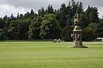
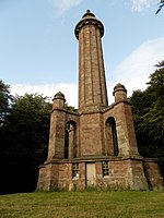
Panmure House memorial column
|
near Carnoustie
56 ° 32 ′ 25.1 " N , 2 ° 45 ′ 13.3" W.56.540305555556 -2.7536944444444
|
monument
|
18419
|
|
|
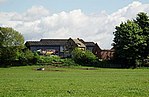
Gagie House
|
near corrugated bank 56 ° 31 '37.2
" N , 2 ° 53' 48.3" W.56,527 -2.89675
|
villa
|
19001
|

|
|
Summer home by Gagie House
|
near corrugated bank 56 ° 31 '36.7
" N , 2 ° 53' 47.8" W.56.526861111111 -2.8966111111111
|
Residential buildings
|
19004
|
|
|
Murroes House
|
near corrugated bank 56 ° 30 '15 .5
" N , 2 ° 52' 37" W.56.504305555556 -2.8769444444444
|
villa
|
19011
|
|
|
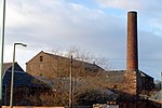
Baltic Works
|
Arbroath
56 ° 33 '50.2 " N , 2 ° 35' 18.1" W.56.563944444444 -2.5883611111111
|
Mill
|
21141
|
|
|
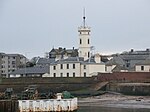
Signal Tower Museum
|
Arbroath
56 ° 33 '16.9 " N , 2 ° 35' 11.3" W.56.554694444444 -2.5864722222222
|
museum
|
21230
|
|
|
The Elms
|
Arbroath
56 ° 33 '58.9 " N , 2 ° 36' 0.9" W.56.566361111111 -2.60025
|
villa
|
21250
|
|
|
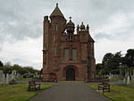
Chapel of the Western Cemetery
|
Arbroath
56 ° 33 ′ 58.7 " N , 2 ° 36 ′ 43.3" W.56.566305555556 -2.6120277777778
|
church
|
21252
|
|
|
Hospitalfield House
|
Arbroath
56 ° 33 '15.8 " N , 2 ° 36' 36.9" W.56.554388888889 -2.61025
|
villa
|
21253
|

|
|
Brechin Cathedral
|
Brechin
56 ° 43 ′ 50.5 " N , 2 ° 39 ′ 40.8" W.56.730694444444 -2.6613333333333
|
church
|
22439
|
|
|
25-27 High Street
|
Brechin
56 ° 43 ′ 53.7 " N , 2 ° 39 ′ 35.3" W.56.731583333333 -2.6598055555556
|
Residential and commercial buildings
|
22476
|
|
|
68-74 High Street
|
Brechin
56 ° 43 ′ 50.9 " N , 2 ° 39 ′ 32.8" W.56.730805555556 -2.6591111111111
|
Residential and commercial buildings
|
22505
|
|
|
Maison Dieu Chapel
|
Brechin
56 ° 43 ′ 58.2 " N , 2 ° 39 ′ 38.5" W.56.732833333333 -2.6606944444444
|
Church ruin
|
22508
|

|
|
West and St Columba's Parish Church
|
Brechin
56 ° 44 '0.9 " N , 2 ° 39' 26.4" W.56.733583333333 -2.6573333333333
|
church
|
22522
|
|
|
Brechin Bridge
|
Brechin
56 ° 43 '24 " N , 2 ° 38' 52.8" W.56.723333333333 -2.648
|
bridge
|
22549
|

|
|
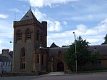
Gardner Memorial Church
|
Brechin
56 ° 43 ′ 53 " N , 2 ° 39 ′ 16.2" W.56.731388888889 -2.6545
|
church
|
22568
|
|
|
Sheriff Court Building
|
Forfar
56 ° 38 '40.4 " N , 2 ° 53' 18.4" W.56.644555555556 -2.8884444444444
|
public building
|
31542
|

|
|
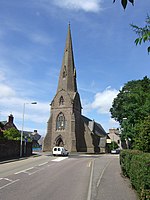
Lowson Memorial Parish Church
|
Forfar
56 ° 38 '47.8 " N , 2 ° 52' 26.2" W.56.646611111111 -2.8739444444444
|
church
|
31604
|

|
|
St Mary's Church
|
Kirriemuir
56 ° 40 ′ 37.2 " N , 3 ° 0 ′ 29.3" W.56,677 -3,0081388888889
|
church
|
36899
|
|
|
Holly House
|
Montrose
56 ° 42 ′ 38.6 " N , 2 ° 28 ′ 8" W.56.710722222222 -2.4688888888889
|
Residential buildings
|
38041
|
|
|
The retreat
|
Montrose
56 ° 42 '37.5 " N , 2 ° 28" 8.4 " W.56.710416666667 -2,469
|
Residential buildings
|
38046
|
|
|
Carnegie Free Library
|
Montrose
56 ° 42 '35.5 " N , 2 ° 28' 8.9" W.56.709861111111 -2.4691388888889
|
Library
|
38051
|

|
|
Montrose Town Hall
|
Montrose
56 ° 42 ′ 39.3 " N , 2 ° 28 ′ 4.9" W.56.710916666667 -2.4680277777778
|
town hall
|
38083
|

|
|
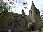
Old and St Andrew's Church
|
Montrose
56 ° 42 ′ 38.3 " N , 2 ° 28 ′ 3.7" W.56.710638888889 -2.4676944444444
|
church
|
38084
|
|
|
Straton House
|
Montrose
56 ° 42 ′ 33.2 " N , 2 ° 28 ′ 6.1" W.56.709222222222 -2.4683611111111
|
Residential buildings
|
38095
|
|
|
Montrose Royal Infirmary
|
Montrose
56 ° 42 ′ 28 " N , 2 ° 28 ′ 28.3" W.56.707777777778 -2.4745277777778
|
hospital
|
38112
|
|
|
1-8 Panmure Terrace
|
Montrose
56 ° 42 ′ 38.4 " N , 2 ° 27 ′ 52.9" W.56.710666666667 -2.4646944444444
|
Residential buildings
|
38195
|

|
|
St Mary's and St Peter's Episcopal Church
|
Montrose
56 ° 42 ′ 38.8 " N , 2 ° 27 ′ 48.1" W.56.710777777778 -2.4633611111111
|
church
|
38204
|

|
|
Chapel Works
|
Montrose
56 ° 42 ′ 37.7 " N , 2 ° 27 ′ 40" W.56.710472222222 -2.4611111111111
|
Mill
|
38212
|

|
|
Montrose Airfield Building 48
|
Montrose
56 ° 43 ′ 27.1 " N , 2 ° 27 ′ 46.8" W.56.724194444444 -2,463
|
Military installation
|
38228
|

|
|
Bell Rock Lighthouse
|
near Arbroath
56 ° 25 ′ 58.3 " N , 2 ° 23 ′ 17.1" W.56.432861111111 -2.3880833333333
|
lighthouse
|
45197
|

|
|
Logie Schoolhouse
|
near Montrose
56 ° 45 ′ 45.4 " N , 2 ° 29 ′ 43.7" W.56.762611111111 -2.4954722222222
|
school
|
50209
|
|


.jpg)


_(3870333250).jpg)


.jpg)
_(14801986203).jpg)


.jpg)


