| Surname |
location |
Type |
entry |
image
|
|
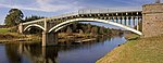
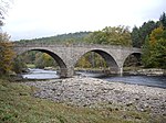
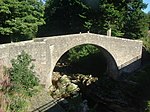
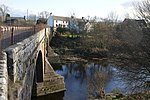
North Bridge
|
Arbuthnott
56 ° 52 ′ 2.2 " N , 2 ° 20 ′ 16.3" W.56.867277777778 -2.3378611111111
|
bridge
|
31
|

|
|
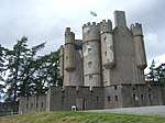
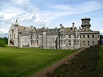
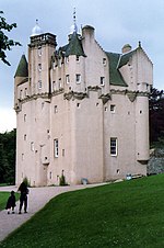
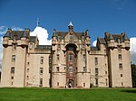
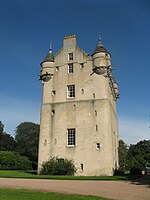
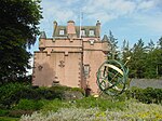
Braemar Castle
|
Braemar
57 ° 0 ′ 53 " N , 3 ° 23 ′ 29.2" W.57.014722222222 -3.3914444444444
|
lock
|
36
|
|
|
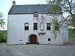
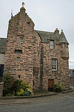
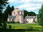
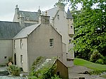
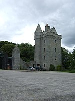
Tilquhillie Castle
|
near Banchory,
57 ° 2 ′ 15.1 " N , 2 ° 27 ′ 36.2" W.57.037527777778 -2.4600555555556
|
Tower House
|
38
|
|
|
Park Bridge
|
near Drumoak
57 ° 4 ′ 27 " N , 2 ° 20 ′ 14.2" W.57.074166666667 -2.3372777777778
|
bridge
|
45
|
|
|
Craig Castle
|
near Rhynie
57 ° 18 '39.3 " N , 2 ° 52' 49.1" W.57.310916666667 -2.8803055555556
|
Tower House
|
2736
|
|
|
Druminnor Castle
|
near Rhynie
57 ° 19 ′ 32.2 " N , 2 ° 48 ′ 36.4" W.57.325611111111 -2.8101111111111
|
Tower House
|
2743
|
|
|
Aberdour House
|
near New Aberdour
57 ° 39 ′ 54.7 ″ N , 2 ° 9 ′ 10 ″ W.57.665194444444 -2.1527777777778
|
Mansion
|
2768
|
|
|
Orrok House
|
near Balmedie
57 ° 16 '0.1 " N , 2 ° 3' 41.1" W.57.266694444444 -2.0614166666667
|
villa
|
2778
|

|
|
Mounie Castle
|
near Oldmeldrum
57 ° 20 ′ 52.4 ″ N , 2 ° 23 ′ 21.9 ″ W.57.347888888889 -2.3894166666667
|
Mansion
|
2793
|
|
|
Mill of Benholm
|
near Benholm
56 ° 48 '46.3 " N , 2 ° 19' 6.5" W.56.812861111111 -2.3184722222222
|
Mill
|
2805
|

|
|
Benholm Castle
|
Benholm
56 ° 49 ′ 29.4 " N , 2 ° 19 ′ 21.1" W.56.824833333333 -2.3225277777778
|
Mansion
|
2807
|
|
|
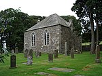
Benholm Parish Church
|
Benholm
56 ° 48 ′ 51.6 " N , 2 ° 19 ′ 18.9" W.56.814333333333 -2.3219166666667
|
church
|
2813
|
|
|
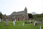
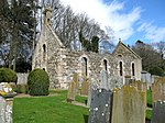
Bourtie Parish Church
|
near Oldmeldrum
57 ° 18 ′ 49.9 ″ N , 2 ° 19 ′ 34.2 ″ W.57.313861111111 -2.3261666666667
|
church
|
2815
|
|
|
Bourtie House
|
near Inverurie
57 ° 18 ′ 23.4 " N , 2 ° 21 ′ 27.9" W.57.3065 -2.35775
|
Mansion
|
2819
|
|
|
Barra Castle
|
near Oldmeldrum
57 ° 19 ′ 18.8 ″ N , 2 ° 20 ′ 48 ″ W.57.321888888889 -2.3466666666667
|
Mansion
|
2821
|

|
|
Pitcaple Castle
|
near pit caple
57 ° 19 ′ 27.8 " N , 2 ° 27 ′ 16.3" W.57.324388888889 -2.4545277777778
|
Mansion
|
2830
|
|
|
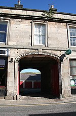
Pittodrie's Yate
|
Chapel of Garioch
57 ° 18 ′ 25.1 " N , 2 ° 28 ′ 23.3" W.57.306972222222 -2.4731388888889
|
goal
|
2846
|

|
|
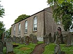
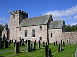
Arbuthnott Parish Church
|
Arbuthnott
56 ° 51 ′ 46 " N , 2 ° 19 ′ 37.5" W.56.862777777778 -2.3270833333333
|
church
|
2876
|
|
|
Allardice Castle
|
near Inverbervie
56 ° 51 '23.6 " N , 2 ° 18' 4.1" W.56.856555555556 -2.3011388888889
|
Mansion
|
2878
|
|
|
Gate of Allardice Castle
|
near Inverbervie
56 ° 51 '23.2 " N , 2 ° 18' 4.4" W.56.856444444444 -2.3012222222222
|
goal
|
2879
|
|
|
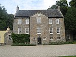
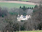
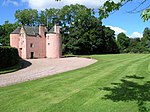
Arbuthnott House
|
Arbuthnott
56 ° 52 ′ 0 " N , 2 ° 20 ′ 16.9" W.56.866666666667 -2.3380277777778
|
Mansion
|
2880
|

|
|
Bridge of Alvah
|
near Banff
57 ° 38 ′ 18.3 " N , 2 ° 32 ′ 14.4" W.57.638416666667 -2.5373333333333
|
bridge
|
2883
|

|
|
Fishing Temple
|
near Banff
57 ° 39 ′ 16.1 " N , 2 ° 31 ′ 11.8" W.57.654472222222 -2.5199444444444
|
temple
|
2885
|

|
|
Dunlugas House
|
near turret
57 ° 35 ′ 18.3 ″ N , 2 ° 30 ′ 38.9 ″ W.57.588416666667 -2.5108055555556
|
Mansion
|
2888
|
|
|
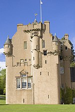
Castle Fraser
|
near Kemnay
57 ° 12 ′ 10.8 " N , 2 ° 27 ′ 38" W.57.203 -2.4605555555556
|
lock
|
2924
|

|
|
Castle Fraser stables
|
near Kemnay
57 ° 12 ′ 7.4 " N , 2 ° 27 ′ 52.7" W.57.202055555556 -2.4646388888889
|
stables
|
2925
|

|
|
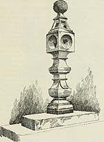
Castle Fraser Sundial
|
near Kemnay
57 ° 12 ′ 15.4 " N , 2 ° 27 ′ 34.3" W.57.204277777778 -2.4595277777778
|
sundial
|
2927
|

|
|
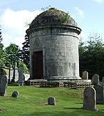
Fraser Mausoleum
|
near Sauchen 57 ° 12 '10 .2
" N , 2 ° 31' 23.9" W.57.202833333333 -2.5233055555556
|
mausoleum
|
2947
|
|
|
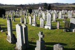
Cluny old cemetery
|
near Sauchen,
57 ° 12 ′ 9.9 ″ N , 2 ° 31 ′ 24.5 ″ W.57.20275 -2.5234722222222
|
graveyard
|
2948
|

|
|
Cluny Castle
|
near Sauchen
57 ° 12 ′ 16.3 " N , 2 ° 30 ′ 59.5" W.57.204527777778 -2.5165277777778
|
Castle
|
2949
|

|
|
Tillycairn Castle
|
near Sauchen
57 ° 11 ′ 32.6 " N , 2 ° 33 ′ 22.3" W.57.192388888889 -2.5561944444444
|
Tower House
|
2959
|
|
|
Culsalmond Old Parish Church
|
near Colpy,
57 ° 23 '8 " N , 2 ° 35' 1.4" W.57.385555555556 -2.5837222222222
|
Church ruin
|
2960
|
|
|
Crathie Suspension Bridge
|
near Crathie
57 ° 2 '0.6 " N , 3 ° 12' 39.7" W.57.0335 -3.2110277777778
|
bridge
|
2988
|

|
|
Crathie Girder Bridge
|
near Crathie
57 ° 2 '21.9 " N , 3 ° 13' 4" W.57.039416666667 -3.2177777777778
|
bridge
|
2989
|
|
|
Invercauld House
|
near Braemar
57 ° 0 ′ 57 " N , 3 ° 21 ′ 43.2" W.57.015833333333 -3,362
|
Mansion
|
2995
|
|
|
Abergeldie Castle
|
near Crathie
57 ° 2 '35.8 " N , 3 ° 10' 35.1" W.57.043277777778 -3.1764166666667
|
Tower House
|
3005
|

|
|
Auchanachie Castle
|
near Huntly
57 ° 30 '35.1 " N , 2 ° 50' 18.8" W.57.50975 -2.8385555555556
|
Tower House
|
3016
|
|
|
Crimond Parish Church
|
Crimond
57 ° 36 '3.1 " N , 1 ° 54" 41.9 " W.57.600861111111 -1.9116388888889
|
church
|
3028
|
|
|
Finzean Turning Mill
|
near Aboyne
57 ° 0 ′ 49 " N , 2 ° 40 ′ 29.2" W.57.013611111111 -2.6747777777778
|
Mill
|
3046
|

|
|
Inchdrewer Castle
|
near Banff
57 ° 38 ′ 6.1 " N , 2 ° 34 ′ 40.3" W.57.635027777778 -2.5778611111111
|
Castle
|
3049
|
|
|
Potarch Bridge
|
near Kincardine O'Neil
57 ° 3 '54.5 " N , 2 ° 38' 55.7" W.57.065138888889 -2.6488055555556
|
bridge
|
3095
|
|
|
Finzean Bucket Mill
|
near Aboyne
57 ° 0 ′ 36.2 " N , 2 ° 41 ′ 49.5" W.57.010055555556 -2.6970833333333
|
Mill
|
3100
|
|
|
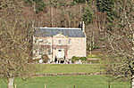
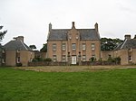
Park House
|
near Drumoak
57 ° 4 ′ 6.1 " N , 2 ° 21 ′ 52" W.57.068361111111 -2.3644444444444
|
Mansion
|
3103
|

|
|
Drum Castle
|
near Drumoak
57 ° 5 '42.2 " N , 2 ° 20' 16.7" W.57.095055555556 -2.3379722222222
|
Castle
|
3113
|

|
|
Rhu-na-Haven
|
Aboyne
57 ° 4 '5.1 " N , 2 ° 48' 10.7" W.57.068083333333 -2.8029722222222
|
villa
|
3126
|
|
|
Dunecht House
|
near Dunecht,
57 ° 9 '39.3 " N , 2 ° 24' 47.6" W.57.160916666667 -2.4132222222222
|
Mansion
|
3133
|
|
|
Real Parish Church
|
near real
57 ° 8 ′ 28.1 ″ N , 2 ° 25 ′ 57.6 ″ W.57.141138888889 -2.4326666666667
|
church
|
3152
|

|
|
The Ha House
|
near Banchory
57 ° 5 ′ 8.7 " N , 2 ° 30 ′ 17.2" W.57.08575 -2.5047777777778
|
hotel
|
3247
|

|
|
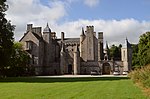
Crathes Castle
|
near Banchory
57 ° 3 ′ 41.5 " N , 2 ° 26 ′ 23.3" W.57.061527777778 -2.4398055555556
|
Tower House
|
3262
|
|
|
Balfluig Castle
|
Alford
57 ° 13 ′ 27.2 " N , 2 ° 41 ′ 11.3" W.57.224222222222 -2.6864722222222
|
Tower House
|
3278
|

|
|
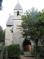
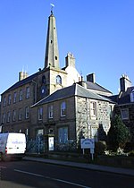
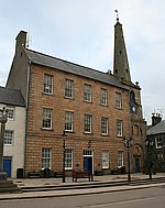
St Margaret's Episcopal Church
|
Braemar
57 ° 0 ′ 20.7 " N , 3 ° 23 ′ 50.1" W.57.00575 -3.39725
|
church
|
6266
|
|
|
South Colleonard
|
near Banff
57 ° 39 '11.1 " N , 2 ° 33' 28.9" W.57.653083333333 -2.5580277777778
|
villa
|
6662
|
|
|
Gairnshiel Bridge
|
near Crathie
57 ° 5 '36 " N , 3 ° 9' 55" W.57.093333333333 -3.1652777777778
|
bridge
|
6747
|

|
|
Castle of Fiddes
|
near Stonehaven
56 ° 55 ′ 21 ″ N , 2 ° 17 ′ 25 ″ W.56.9225 -2.2902777777778
|
Tower House
|
6753
|
|
|
Balbegno Castle
|
near Fettercairn
56 ° 50 '48.9 " N , 2 ° 35' 34.4" W.56.846916666667 -2.5928888888889
|
Tower House
|
6754
|

|
|
Market cross by Fettercairn
|
Fettercairn
56 ° 51 ′ 7.3 " N , 2 ° 34 ′ 28.7" W.56.852027777778 -2.5746388888889
|
Market cross
|
6755
|

|
|
Findlater Castle's pigeon tower
|
near Cullen
57 ° 41 '17.4 " N , 2 ° 46' 23.6" W.57.688166666667 -2.7732222222222
|
Pigeon tower
|
6759
|

|
|
Bridge of Keig
|
near Keig
57 ° 15 '26.1 " N , 2 ° 38' 6" W.57.25725 -2.635
|
bridge
|
9057
|
|
|
Aquhorthies House
|
near Inverurie
57 ° 16 '11.9 " N , 2 ° 27' 3.9" W.57.269972222222 -2.4510833333333
|
villa
|
9073
|

|
|
Castle Bridge
|
Huntly
57 ° 27 '20.3 " N , 2 ° 46' 49.9" W.57.455638888889 -2.7805277777778
|
bridge
|
9081
|
|
|
Auchmacoy Dovecot
|
near Ellon
57 ° 22 '23.5 " N , 2 ° 1' 7.5" W.57.373194444444 -2.01875
|
Pigeon tower
|
9089
|

|
|
Kildrummy Parish Church
|
Kildrummy
57 ° 14 '45.1 " N , 2 ° 52' 34.4" W.57.245861111111 -2.8762222222222
|
church
|
9093
|

|
|
Nether Ardgrain
|
near Ellon
57 ° 23 '45.7 " N , 2 ° 4' 47.6" W.57.396027777778 -2.0798888888889
|
Farmhouse
|
9106
|

|
|
Old Parish Church
|
near Bellabeg
57 ° 13 '21.6 " N , 3 ° 2' 8.3" W.57.222666666667 -3.0356388888889
|
church
|
9126
|

|
|
Keith Hall
|
near Inverurie
57 ° 16 ′ 51.3 " N , 2 ° 21 ′ 11.9" W.57.280916666667 -2.3533055555556
|
Mansion
|
9136
|

|
|
Balbithan House
|
near Inverurie
57 ° 15 ′ 36.9 " N , 2 ° 18 ′ 47" W.57.26025 -2.3130555555556
|
Tower House
|
9140
|
|
|
Beldorney Castle
|
near Dufftown
57 ° 25 ′ 10.4 " N , 2 ° 57 ′ 46.8" W.57.419555555556 -2,963
|
Tower House
|
9163
|

|
|
Grave slab at Foveran Parish Church
|
Foveran 57 ° 18 '28.2
" N , 2 ° 1' 35.9" W.57.307833333333 -2.0266388888889
|
plate
|
9166
|
|
|
Leith Hall
|
near Kennethmont
57 ° 21 ′ 22.6 " N , 2 ° 45 ′ 53.4" W.57.356277777778 -2.7648333333333
|
Mansion
|
9183
|

|
|
Kemnay House
|
Kemnay
57 ° 13 ′ 41.6 " N , 2 ° 26 ′ 34.3" W.57.228222222222 -2.4428611111111
|
Tower House
|
9212
|

|
|
Mains of Hallhead House
|
near Alford
57 ° 10 ′ 12.8 " N , 2 ° 47 ′ 14.9" W.57.170222222222 -2.7874722222222
|
Farmhouse
|
9218
|
|
|
Craigievar Castle
|
near Alford
57 ° 10 ′ 27.1 " N , 2 ° 43 ′ 5.1" W.57.174194444444 -2.7180833333333
|
Tower House
|
9229
|
|
|
Cairness House
|
near Crimond
57 ° 38 '17.4 " N , 1 ° 56' 15.2" W.57.638166666667 -1.9375555555556
|
Mansion
|
9263
|
|
|
Lodge by Cairness House
|
near Crimond
57 ° 38 '21.3 " N , 1 ° 56' 0.4" W.57.63925 -1.9334444444444
|
Lodge
|
9264
|

|
|
Crimonmogate House
|
near Crimond
57 ° 37 '5.6 " N , 1 ° 56" 4.9 " W.57.618222222222 -1.9346944444444
|
Mansion
|
9270
|
|
|
Muchalls Castle
|
near Stonehaven
57 ° 1 '3.1 " N , 2 ° 10' 47.3" W.57.017527777778 -2.1798055555556
|
Mansion
|
9352
|
|
|
Pigeon tower of Fetteresso Castle
|
near Stonehaven
56 ° 57 ′ 34.2 " N , 2 ° 15 ′ 30.3" W.56.9595 -2.2584166666667
|
Pigeon tower
|
9371
|
|
|
Craigston Castle
|
near turret
57 ° 35 ′ 4.5 ″ N , 2 ° 23 ′ 57.6 ″ W.57.584583333333 -2.3993333333333
|
Tower House
|
9392
|

|
|
Old Parish Church of Longside
|
Longside
57 ° 30 '54.7 " N , 1 ° 56" 20.8 " W.57.515194444444 -1.9391111111111
|
Church ruin
|
9410
|

|
|
Gate of the Old Parish Church of Longside
|
Longside
57 ° 30 '55 " N , 1 ° 56" 22.3 " W.57.515277777778 -1.9395277777778
|
goal
|
9412
|

|
|
Frendraught House
|
near Huntly
57 ° 27 '56.4 " N , 2 ° 38' 1.4" W.57.465666666667 -2.6337222222222
|
Mansion
|
9449
|
|
|
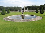
Gardens of Balbegno Castle
|
near Fettercairn
56 ° 50 ′ 47.6 " N , 2 ° 35 ′ 33.3" W.56.846555555556 -2.5925833333333
|
Gardens
|
9495
|
|
|
Pigeon House at Balbegno Castle
|
near Fettercairn
56 ° 50 ′ 49 " N , 2 ° 35 ′ 29.4" W.56.846944444444 -2.5915
|
Pigeon house
|
9497
|

|
|
Fasque House
|
near Fettercairn
56 ° 52 ′ 11.6 " N , 2 ° 34 ′ 40.9" W.56.869888888889 -2.5780277777778
|
Mansion
|
9503
|

|
|
Fyvie Castle
|
near turret
57 ° 26 ′ 36.4 ″ N , 2 ° 23 ′ 42 ″ W.57.443444444444 -2,395
|
Castle
|
9615
|
|
|
St Palladius Episcopal Church
|
near Auchenblae
56 ° 54 ′ 33.4 " N , 2 ° 28 ′ 55.4" W.56.909277777778 -2.4820555555556
|
church
|
9634
|

|
|
Phesdo House
|
near Fettercairn
56 ° 52 ′ 15.6 ″ N , 2 ° 32 ′ 0 ″ W.56.871 -2.5333333333333
|
villa
|
9646
|
|
|
Drumtochty Castle
|
near Auchenblae
56 ° 54 ′ 38.7 ″ N , 2 ° 29 ′ 40 ″ W.56.91075 -2.4944444444444
|
Mansion
|
9664
|

|
|
Troup Home Farm
|
near Gardenstown
57 ° 40 ′ 50.6 " N , 2 ° 16 ′ 59.3" W.57.680722222222 -2.2831388888889
|
farm
|
10585
|
|
|
Birkenbog House
|
near Fordyce
57 ° 40 ′ 24.7 " N , 2 ° 46 ′ 42.6" W.57.673527777778 -2.7785
|
Residential buildings
|
10586
|

|
|
Fordyce Castle
|
Fordyce
57 ° 39 ′ 42.6 " N , 2 ° 44 ′ 46.1" W.57.661833333333 -2.7461388888889
|
Tower House
|
10623
|
|
|
Glassaugh House pigeon tower
|
near Fordyce
57 ° 40 ′ 14.8 " N , 2 ° 44 ′ 27.3" W.57.670777777778 -2.7409166666667
|
Pigeon tower
|
10650
|
|
|
Glassaugh House
|
near Fordyce
57 ° 40 ′ 14.4 " N , 2 ° 44 ′ 31.5" W.57.670666666667 -2.7420833333333
|
Mansion
|
10694
|
|
|
Forglen House
|
near turret
57 ° 33 ′ 21.2 ″ N , 2 ° 30 ′ 16.5 ″ W.57.555888888889 -2.5045833333333
|
Mansion
|
13603
|

|
|
Bridge of Dye
|
near Banchory
56 ° 57 ′ 52.5 " N , 2 ° 34 ′ 31.7" W.56.964583333333 -2.5754722222222
|
bridge
|
13878
|
|
|
Terpersie Castle
|
near Alford
57 ° 16 ′ 13.7 " N , 2 ° 45 ′ 13.3" W.57.270472222222 -2.7536944444444
|
Tower House
|
13879
|
|
|
Marykirk Bridge
|
near Marykirk
56 ° 46 '32.1 " N , 2 ° 30' 55.4" W.56.775583333333 -2.5153888888889
|
bridge
|
13891
|
|
|
Upper North Water Bridge
|
near Marykirk
56 ° 47 '7.6 " N , 2 ° 34" 12.3 " W.56.785444444444 -2.5700833333333
|
bridge
|
13892
|
|
|
Mounthooley pigeon tower
|
near Peathill 57 ° 40 '59 .6
" N , 2 ° 7' 40.8" W.57.683222222222 -2.128
|
Pigeon tower
|
15909
|

|
|
Hill Curch of Rosehearty
|
Peathill 57 ° 41 '10 .6
" N , 2 ° 6' 42.5" W.57.686277777778 -2.1118055555556
|
church
|
15911
|

|
|
Mains of Pittendrum House
|
Sandhaven
57 ° 41 '34.3 " N , 2 ° 3' 40.7" W.57.692861111111 -2.0613055555556
|
Farmhouse
|
15914
|

|
|
Udny Castle
|
near Pitmedden
57 ° 19 '53.4 " N , 2 ° 11' 50.3" W.57.3315 -2.1973055555556
|
Tower House
|
15922
|
|
|
Pitmedden Great Garden
|
Pitmedden
57 ° 20 '33.8 " N , 2 ° 11' 30.4" W.57.342722222222 -2.1917777777778
|
Gardens
|
15925
|
|
|
Glenkindie House
|
near Kildrummy
57 ° 13 '1.8 " N , 2 ° 57' 27.3" W.57.217166666667 -2.9575833333333
|
Mansion
|
15945
|
|
|
House of Monymusk
|
Monymusk
57 ° 13 '43.6 " N , 2 ° 31' 1.4" W.57.228777777778 -2.5170555555556
|
Mansion
|
15967
|
|
|
Monymusk Parish Church
|
Monymusk
57 ° 13 ′ 36.8 " N , 2 ° 31 ′ 24.8" W.57.226888888889 -2.5235555555556
|
church
|
15987
|
|
|
Old Rayne Market Cross
|
Old Rayne
57 ° 20 ′ 38.9 " N , 2 ° 32 ′ 31.9" W.57.344138888889 -2.5421944444444
|
Market cross
|
16019
|
|
|
Aberdeenshire Farming Museum
|
Old Deer
57 ° 31 '18.4 " N , 2 ° 1' 58.1" W.57.521777777778 -2.0328055555556
|
museum
|
16096
|
|
|
Straloch House
|
near Newmachar
57 ° 16 ′ 47.7 " N , 2 ° 13 ′ 58" W.57.279916666667 -2.2327777777778
|
Mansion
|
16125
|
|
|
Harthill Castle
|
near Insch
57 ° 18 '57.9 " N , 2 ° 31' 19.1" W.57.316083333333 -2.5219722222222
|
Tower House
|
16132
|

|
|
Westhall House
|
near Old Rayne
57 ° 19 ′ 45.2 " N , 2 ° 32 ′ 38.3" W.57.329222222222 -2.5439722222222
|
Mansion
|
16134
|

|
|
Cairnbulg Castle
|
near Fraserburgh
57 ° 39 ′ 56.2 ″ N , 1 ° 58 ′ 25 ″ W.57.665611111111 -1.9736111111111
|
Castle
|
16143
|

|
|
House of Memsie
|
near Fraserburgh
57 ° 38 ′ 28 " N , 2 ° 2 ′ 48.8" W.57.641111111111 -2.0468888888889
|
Mansion
|
16146
|
|
|
Skellater House
|
near Bellabeg
57 ° 10 '57 " N , 3 ° 8' 7.4" W.57.1825 -3.1353888888889
|
Mansion
|
16173
|
|
|
Bellabeg House
|
Bellabeg
57 ° 12 ′ 13.5 ″ N , 3 ° 4 ′ 6.8 ″ W.57.20375 -3.0685555555556
|
Mansion
|
16188
|
|
|
Montgarrie Mill
|
Montgarrie
57 ° 14 ′ 53.3 " N , 2 ° 42 ′ 23" W.57.248138888889 -2.7063888888889
|
Mill
|
16207
|
|
|
Meldrum House Gate
|
Oldmeldrum
57 ° 21 ′ 6.7 ″ N , 2 ° 18 ′ 50.1 ″ W.57.351861111111 -2.3139166666667
|
goal
|
16225
|

|
|
Lickleyhead Castle
|
near Insch
57 ° 18 '7.5 " N , 2 ° 37' 13.8" W.57.302083333333 -2.6205
|
Tower House
|
16234
|
|
|
Midmar Castle
|
near real
57 ° 8 ′ 13.8 ″ N , 2 ° 29 ′ 23.6 ″ W.57.137166666667 -2.4898888888889
|
Castle
|
16262
|

|
|
Sundial from Midmar Castle
|
near real
57 ° 8 ′ 13.6 ″ N , 2 ° 29 ′ 24.1 ″ W.57.137111111111 -2.4900277777778
|
sundial
|
16263
|
|
|
Gardens of Midmar Castle
|
near real
57 ° 8 ′ 13.7 ″ N , 2 ° 29 ′ 20.6 ″ W.57.137138888889 -2.4890555555556
|
Gardens
|
16264
|
|
|
Linton House
|
near Sauchen
57 ° 10 ′ 47.8 " N , 2 ° 29 ′ 22.5" W.57.179944444444 -2.4895833333333
|
Mansion
|
16274
|
|
|
Balmanno House
|
near Marykirk
56 ° 47 ′ 21.2 " N , 2 ° 30 ′ 25.3" W.56.789222222222 -2.5070277777778
|
Mansion
|
16278
|
|
|
Pigeon House by Inglismaldie Castle
|
near Marykirk
56 ° 47 ′ 21.6 " N , 2 ° 35 ′ 14" W.56.789333333333 -2.5872222222222
|
Pigeon house
|
16289
|

|
|
Forebank House
|
near Marykirk
56 ° 46 ′ 23.1 " N , 2 ° 29 ′ 27" W.56.773083333333 -2.4908333333333
|
villa
|
16328
|

|
|
Lower North Water Bridge
|
near St Cyrus
56 ° 45 ′ 1.5 " N , 2 ° 27 ′ 7.1" W.56.750416666667 -2.4519722222222
|
bridge
|
16330
|

|
|
Buchan Ness Lighthouse
|
Boddam
57 ° 28 '13.5 " N , 1 ° 46" 27.7 " W.57.470416666667 -1.7743611111111
|
lighthouse
|
16367
|

|
|
Towie Barclay Castle
|
near turret
57 ° 29 ′ 5.6 " N , 2 ° 25 ′ 41" W.57.484888888889 -2.4280555555556
|
Tower House
|
16405
|
|
|
Delgatie Castle
|
near turret
57 ° 32 ′ 39.4 ″ N , 2 ° 24 ′ 42.6 ″ W.57.544277777778 -2.4118333333333
|
Tower House
|
16421
|

|
|
Hatton Castle
|
near turret
57 ° 30 ′ 44.3 ″ N , 2 ° 24 ′ 25.1 ″ W.57.512305555556 -2.4069722222222
|
Mansion
|
16431
|

|
|
St John's Episcopal Church
|
New Pitsligo
57 ° 35 '35.1 " N , 2 ° 11' 50.7" W.57.593083333333 -2.1974166666667
|
church
|
16440
|
|
|
Haddo House
|
near Ellon
57 ° 24 '10.9 " N , 2 ° 13' 13.3" W.57.403027777778 -2.2203611111111
|
Mansion
|
16470
|

|
|
Dunecht House lodges
|
near Dunecht,
57 ° 9 '46.8 " N , 2 ° 21' 23.1" W.57.163 -2.3564166666667
|
Lodge
|
16505
|
|
|
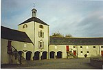
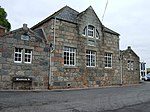
Garlogie Village Hall
|
Garlogie 57 ° 8 '23 .2
" N , 2 ° 21' 41.1" W.57.139777777778 -2.3614166666667
|
Industrial building
|
16506
|
|
|
Skene House
|
Skene
57 ° 10 '40.3 " N , 2 ° 23' 8.3" W.57.177861111111 -2.3856388888889
|
Mansion
|
16530
|
|
|
Town hall of strokes
|
Strokes
57 ° 35 '11.3 " N , 2 ° 5' 26.7" W.57.586472222222 -2.09075
|
town hall
|
16551
|
|
|
New Chapel
|
near Milltimber
57 ° 5 '56.5 " N , 2 ° 11' 39" W.57.099027777778 -2.1941666666667
|
church
|
19227
|

|
|
Castle of Park
|
near Cornhill,
57 ° 36 '8.7 " N , 2 ° 41' 21.9" W.57.602416666667 -2.6894166666667
|
Mansion
|
19597
|

|
|
Crombie Castle
|
near Aberchirder
57 ° 33 ′ 30.5 ″ N , 2 ° 41 ′ 6.4 ″ W.57.558472222222 -2.6851111111111
|
Tower House
|
19602
|

|
|
Kinnairdy Castle
|
near Aberchirder
57 ° 32 ′ 12.1 ″ N , 2 ° 39 ′ 17.1 ″ W.57.536694444444 -2.65475
|
Tower House
|
19606
|

|
|
Marnoch cemetery
|
near Aberchirder
57 ° 32 ′ 16.7 ″ N , 2 ° 40 ′ 40.8 ″ W.57.537972222222 -2,678
|
graveyard
|
19610
|
|
|
11 Boyndie Street
|
Banff
57 ° 39 '53.9 " N , 2 ° 31' 26.6" W.57.664972222222 -2.5240555555556
|
Clubhouse
|
21885
|
|
|
Bridge of Banff
|
Banff
57 ° 39 '46.3 " N , 2 ° 30' 47.9" W.57.662861111111 -2.5133055555556
|
bridge
|
21893
|

|
|
Banff Town Hall
|
Banff
57 ° 40 ′ 0 ″ N , 2 ° 31 ′ 26 ″ W.57.666666666667 -2.5238888888889
|
Hall
|
21941
|
|
|
Banff Castle
|
Banff
57 ° 39 '59.8 " N , 2 ° 31' 20.7" W.57.666611111111 -2.5224166666667
|
villa
|
21957
|

|
|
Duff House
|
Banff
57 ° 39 '31.3 " N , 2 ° 31' 12.2" W.57.658694444444 -2.5200555555556
|
lock
|
21985
|

|
|
Duff House mausoleum
|
Banff
57 ° 39 '15.1 " N , 2 ° 32' 13.7" W.57.654194444444 -2.5371388888889
|
mausoleum
|
21988
|

|
|
1 high shore
|
Banff
57 ° 39 '53.6 " N , 2 ° 31' 15.8" W.57.664888888889 -2.5210555555556
|
Residential buildings
|
22004
|

|
|
Banff Primary School
|
Banff
57 ° 39 ′ 45.6 " N , 2 ° 31 ′ 27.4" W.57.662666666667 -2.5242777777778
|
school
|
22035
|
|
|
8-16 Low Street
|
Banff
57 ° 39 '48.2 " N , 2 ° 31' 17" W.57.663388888889 -2.5213888888889
|
Residential and commercial buildings
|
22056
|
|
|
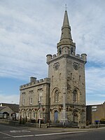
Tolbooth Steeple
|
Banff
57 ° 39 '51.7 " N , 2 ° 31' 17.2" W.57.664361111111 -2.5214444444444
|
town hall
|
22062
|
|
|
Banff Town Hall
|
Banff
57 ° 39 '52 " N , 2 ° 31' 17.4" W.57.664444444444 -2.5215
|
town hall
|
22063
|
|
|
Banff Harbor
|
Banff
57 ° 40 ′ 13.1 " N , 2 ° 31 ′ 21.3" W.57.670305555556 -2.5225833333333
|
port
|
22077
|
|
|
St Catherine's
|
Banff
57 ° 40 ′ 3.7 " N , 2 ° 31 ′ 26.3" W.57.667694444444 -2.5239722222222
|
villa
|
22098
|
|
|
Ingleneuk House
|
Banff
57 ° 39 '55.1 " N , 2 ° 31' 17.2" W.57.665305555556 -2.5214444444444
|
Residential buildings
|
22111
|
|
|
Sundial from Ellon Castle
|
Ellon
57 ° 21 '59.2 " N , 2 ° 4' 5.4" W.57.366444444444 -2.0681666666667
|
sundial
|
31108
|

|
|
Old Bridge of Ellon
|
Ellon
57 ° 21 '48.3 " N , 2 ° 4' 23.1" W.57.363416666667 -2.0730833333333
|
bridge
|
31110
|

|
|
St Mary on the Rock Episcopal Church
|
Ellon
57 ° 21 '42.2 " N , 2 ° 4' 17.9" W.57.361722222222 -2.0716388888889
|
church
|
31111
|

|
|
Fraserburgh Market Cross
|
Fraserburgh
57 ° 41 ′ 37.2 " N , 2 ° 0 ′ 18.6" W.57.693666666667 -2.0051666666667
|
Market cross
|
31867
|

|
|
Old Fraserburgh Custom House
|
Fraserburgh
57 ° 41 ′ 32 " N , 2 ° 0 ′ 18.4" W.57.692222222222 -2.0051111111111
|
Commercial building
|
31873
|

|
|
Kinnaird Head Lighthouse
|
Fraserburgh
57 ° 41 ′ 51.5 " N , 2 ° 0 ′ 14.2" W.57.697638888889 -2.0039444444444
|
lighthouse
|
31888
|

|
|
The Gordon Schools
|
Huntly
57 ° 27 '2 " N , 2 ° 47' 0.2" W.57.450555555556 -2.7833888888889
|
school
|
34943
|
|
|
St Margaret's Church
|
Huntly
57 ° 26 ′ 57.7 " N , 2 ° 47 ′ 15" W.57.449361111111 -2.7875
|
church
|
34945
|

|
|
Alexander Scott's Hospital
|
Huntly
57 ° 26 ′ 41.7 " N , 2 ° 46 ′ 51.6" W.57.444916666667 -2.781
|
Nursing home
|
34962
|

|
|
Old Bervie Bridge
|
Inverbervie
56 ° 50 '50.2 " N , 2 ° 16' 40.3" W.56.847277777778 -2.2778611111111
|
bridge
|
35070
|

|
|
Kintore Town Hall
|
Kintore
57 ° 14 ′ 13.3 " N , 2 ° 20 ′ 44.6" W.57.237027777778 -2.3457222222222
|
town hall
|
36312
|
|
|
Peterhead Old Parish Church
|
Peterhead
57 ° 30 '17.9 " N , 1 ° 46" 58.1 " W.57.504972222222 -1.7828055555556
|
church
|
39671
|

|
|
23-27 North High Street
|
Portsoy
57 ° 41 ′ 2.3 ″ N , 2 ° 41 ′ 29 ″ W.57.683972222222 -2.6913888888889
|
Residential buildings
|
40262
|

|
|
16-20 North High Street
|
Portsoy
57 ° 41 ′ 2.4 ″ N , 2 ° 41 ′ 28.2 ″ W.57.684 -2.6911666666667
|
Residential buildings
|
40268
|
|
|
10 Shorehead
|
Portsoy
57 ° 41 ′ 5 ″ N , 2 ° 41 ′ 30.5 ″ W.57.684722222222 -2.6918055555556
|
Residential buildings
|
40292
|

|
|
Corf Warehouse
|
Portsoy
57 ° 41 ′ 5.8 ″ N , 2 ° 41 ′ 30 ″ W.57.684944444444 -2.6916666666667
|
Storage
|
40293
|

|
|
Portsoy old harbor
|
Portsoy
57 ° 41 ′ 6.1 ″ N , 2 ° 41 ′ 27.9 ″ W.57.685027777778 -2.6910833333333
|
port
|
40296
|

|
|
St James the Great Episcopal Church
|
Stonehaven
56 ° 57 '44.8 " N , 2 ° 12' 36.4" W.56.962444444444 -2.2101111111111
|
church
|
41552
|

|
|
Fetteresso Parish Church
|
Stonehaven
56 ° 58 '6.5 " N , 2 ° 13' 1.2" W.56.968472222222 -2.217
|
church
|
41576
|

|
|
Carronbank
|
Stonehaven
56 ° 57 ′ 45 ″ N , 2 ° 13 ′ 10 ″ W.56.9625 -2.2194444444444
|
villa
|
41593
|
|
|
6 Keith Place
|
Stonehaven
56 ° 57 ′ 40 " N , 2 ° 12 ′ 12.7" W.56.961111111111 -2.2035277777778
|
Residential buildings
|
41638
|
|
|
Tolbooth from Stonehaven
|
Stonehaven
56 ° 57 '38.7 " N , 2 ° 12' 7.8" W.56.96075 -2.2021666666667
|
town hall
|
41655
|

|
|
Old Parish Church of St Congan
|
Turriff
57 ° 32 ′ 15.9 ″ N , 2 ° 27 ′ 56.1 ″ W.57.53775 -2.4655833333333
|
Church ruin
|
42163
|
|
|
St Thomas's Episcopal Church
|
Aboyne
57 ° 4 ′ 31.8 " N , 2 ° 47 ′ 35.3" W.57.0755 -2.7931388888889
|
church
|
47053
|

|
|
Souter's shop
|
Ballogy
57 ° 3 '19.3 " N , 2 ° 41' 57" W.57.055361111111 -2.6991666666667
|
Residential and commercial buildings
|
47119
|
|
|
Auchtavan Cottage
|
near Crathie
57 ° 2 ′ 38 " N , 3 ° 18 ′ 51.8" W.57.043888888889 -3.3143888888889
|
Residential buildings
|
50074
|

|
|
Tarlair swimming pool
|
Macduff
57 ° 40 ′ 14.8 " N , 2 ° 28 ′ 15.7" W.57.670777777778 -2.4710277777778
|
swimming pool
|
50788
|
|
|
Balmoral Castle
|
near Crathie
57 ° 2 '26.1 " N , 3 ° 13' 49" W.57.040583333333 -3.2302777777778
|
lock
|
51460
|

|
|
Dairy Cottages
|
near Crathie
57 ° 2 '8.9 " N , 3 ° 13' 12.6" W.57.035805555556 -3.2201666666667
|
Residential buildings
|
51468
|
|
|
Balmoral Castle workshops
|
near Crathie
57 ° 2 '26.9 " N , 3 ° 13' 39.2" W.57.040805555556 -3.2275555555556
|
workshops
|
51479
|
|
|
Stables at Balmoral Castle
|
near Crathie
57 ° 2 '8 " N , 3 ° 13' 14.1" W.57.035555555556 -3.2205833333333
|
stables
|
51491
|
|
|
John Brown statue
|
near Crathie
57 ° 2 '3.2 " N , 3 ° 13' 14.7" W.57.034222222222 -3.22075
|
statue
|
51493
|
|
|
Prince Albert statue
|
near Crathie
57 ° 2 '14.4 " N , 3 ° 13' 6.5" W.57.037333333333 -3.2184722222222
|
statue
|
51494
|
|
|
Queen Victoria statue
|
near Crathie
57 ° 2 '18.6 " N , 3 ° 13' 10.5" W.57.0385 -3.2195833333333
|
statue
|
51495
|
|
|
Venison Larder
|
near Crathie
57 ° 2 '25.7 " N , 3 ° 13' 31.8" W.57.040472222222 -3.2255
|
statue
|
51497
|
|
|
Garbh Allt Falls Bridge
|
near Crathie
57 ° 2 '25.7 " N , 3 ° 13' 31.8" W.57.040472222222 -3.2255
|
bridge
|
51513
|
|
|
Tomintoul Croft
|
near Braemar
56 ° 59 ′ 51.7 " N , 3 ° 24 ′ 37.6" W.56.997694444444 -3.4104444444444
|
Residential buildings
|
51797
|
|


.jpg)


,_Chapel_of_Garioch_(geograph_4647329).jpg)
.jpg)


_(cropped).jpg)

.jpg)


.jpg)
.jpg)


.jpg)


.jpg)
.jpg)


_(14782477005).jpg)

.jpg)


.jpg)


.jpg)
.jpg)


.jpg)
.jpg)

.jpg)


.jpg)
.jpg)


.jpg)

_(cropped).jpg)

.jpg)

_-_geograph.org.uk_-_1371995.jpg)

.jpg)


