| Surname |
location |
Type |
entry |
image
|
|
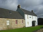
Brownsbank Cottage
|
near Elsrickle
55 ° 39 ′ 41.1 " N , 3 ° 28 ′ 18.8" W.55.661416666667 -3.4718888888889
|
Residential buildings
|
640
|
|
|
St Mary's Aisle
|
Carnwath
55 ° 42 ′ 1.1 " N , 3 ° 37 ′ 54.6" W.55.700305555556 -3.6318333333333
|
mausoleum
|
692
|

|
|
Carnwath Market Cross
|
Carnwath
55 ° 42 ′ 1 " N , 3 ° 37 ′ 32.6" W.55.700277777778 -3.6257222222222
|
Market cross
|
694
|

|
|
Carstairs House
|
near Carstairs
55 ° 40 ′ 51.6 " N , 3 ° 41 ′ 0.5" W.55.681 -3.6834722222222
|
Mansion
|
712
|

|
|
Tower of Hallbar
|
near Crossford
55 ° 42 ′ 12.9 " N , 3 ° 50 ′ 54.7" W.55.703583333333 -3.8485277777778
|
Tower House
|
723
|

|
|
High mill
|
Carluke
55 ° 44 ′ 12 ″ N , 3 ° 50 ′ 3 ″ W.55.736666666667 -3.8341666666667
|
Mill
|
726
|

|
|
Scots Mining Company House
|
Leadhills
55 ° 24 ′ 52.5 " N , 3 ° 45 ′ 39.4" W.55.414583333333 -3.7609444444444
|
villa
|
732
|
|
|
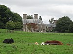
Crossbasket
|
near East Kilbride,
55 ° 47 ′ 0.5 " N , 4 ° 7 ′ 39.4" W.55.783472222222 -4.1276111111111
|
Mansion
|
1004
|

|
|
The peel
|
near East Kilbride,
55 ° 46 ′ 40.4 " N , 4 ° 14 ′ 40.9" W.55.777888888889 -4.2446944444444
|
Tower House
|
1005
|

|
|
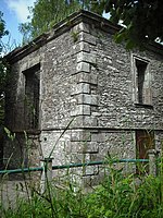
The Peel stables
|
near East Kilbride,
55 ° 46 ′ 38.7 " N , 4 ° 14 ′ 37.8" W.55.777416666667 -4.2438333333333
|
stables
|
1006
|
|
|
Wester Kittochside Farm
|
near East Kilbride,
55 ° 46 ′ 49.1 " N , 4 ° 13 ′ 14" W.55.780305555556 -4.2205555555556
|
farm
|
1008
|

|
|
Earl of Angus' Monument
|
Douglas
55 ° 33 ′ 30 " N , 3 ° 50 ′ 56.6" W.55.558333333333 -3.8490555555556
|
monument
|
1457
|

|
|
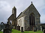
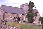
St Bride's Church
|
Douglas
55 ° 33 '30.4 " N , 3 ° 50' 49" W.55.558444444444 -3.8469444444444
|
church
|
1490
|
|
|
Covington Parish Church
|
near Thankerton
55 ° 38 '25.9 " N , 3 ° 37' 47.6" W.55.640527777778 -3.6298888888889
|
church
|
5094
|

|
|
Bothwell Parish Church
|
Bothwell
55 ° 48 '11.9 " N , 4 ° 4' 4.8" W.55.803305555556 -4.068
|
church
|
5134
|

|
|
Joanna Baillie Monument
|
Bothwell
55 ° 48 '11.5 " N , 4 ° 4' 6.5" W.55.803194444444 -4.0684722222222
|
monument
|
5135
|
|
|
Bothwell Castle
|
Bothwell
55 ° 48 '34 " N , 4 ° 5' 42" W.55.809444444444 -4.095
|
Castle ruins
|
5136
|

|
|
Bothwell Bridge
|
Bothwell
55 ° 47 '45.1 " N , 4 ° 3' 28.3" W.55.795861111111 -4.0578611111111
|
bridge
|
5138
|

|
|
Gleneden
|
Bothwell
55 ° 48 '8.9 " N , 4 ° 3' 39.6" W.55.802472222222 -4.061
|
villa
|
5151
|
|
|
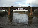
Uddingston Viaduct
|
Uddingston
55 ° 49 '23.9 " N , 4 ° 5' 44.7" W.55.823305555556 -4.09575
|
bridge
|
5153
|
|
|
David Livingstone Center
|
Blantyre
55 ° 48 '8.4 " N , 4 ° 5' 0.3" W.55.802333333333 -4.0834166666667
|
museum
|
5162
|
|
|
Dalserf Parish Church
|
Dalserf
55 ° 44 ′ 5.5 ″ N , 3 ° 54 ′ 46.7 ″ W.55.734861111111 -3.9129722222222
|
church
|
5170
|

|
|
Mauldslie Bridge
|
Dalserf
55 ° 43 ′ 50.7 " N , 3 ° 54 ′ 23.9" W.55.73075 -3.9066388888889
|
bridge
|
5175
|

|
|
Canderside Bridge
|
Stonehouse
55 ° 42 ′ 16.6 " N , 3 ° 57 ′ 58.5" W.55.704611111111 -3.96625
|
bridge
|
6452
|

|
|
Corehouse
|
near Lanark
55 ° 39 ′ 17.6 " N , 3 ° 46 ′ 39.9" W.55.654888888889 -3.77775
|
villa
|
7679
|
|
|
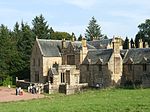
Chatelherault Hunting Lodge
|
Hamilton
55 ° 45 '44.2 " N , 4 ° 0' 55.4" W.55.762277777778 -4.0153888888889
|
Hunting lodge
|
12485
|

|
|
Avon Bridge
|
Hamilton
55 ° 46 '10.7 " N , 4 ° 1' 3.9" W.55.769638888889 -4.01775
|
bridge
|
12516
|

|
|
Old Avon Bridge
|
Hamilton
55 ° 46 '6.3 " N , 4 ° 1' 14.6" W.55.768416666667 -4.0207222222222
|
bridge
|
12518
|
|
|
Hamilton Monument
|
Hamilton
55 ° 45 '57.7 " N , 4 ° 1' 38.2" W.55.766027777778 -4.0272777777778
|
monument
|
12520
|

|
|
Gardens of Barncluith House
|
Hamilton
55 ° 45 '59.4 " N , 4 ° 1' 35.1" W.55.7665 -4.0264166666667
|
Gardens
|
12522
|

|
|
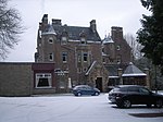
Cartland Bridge Hotel
|
Lanark
55 ° 40 ′ 54.7 " N , 3 ° 47 ′ 34.8" W.55.681861111111 -3.793
|
hotel
|
12967
|
|
|
Jerviswood
|
Lanark
55 ° 41 '25 " N , 3 ° 46" 37.7 " W.55.690277777778 -3.7771388888889
|
Mansion
|
13053
|
|
|
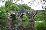
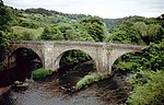
Hyndford Bridge
|
near Lanark
55 ° 39 ′ 16.3 " N , 3 ° 43 ′ 34.8" W.55.654527777778 -3.7263333333333
|
bridge
|
13055
|

|
|
Bonnington Pavilion
|
near Lanark
55 ° 39 ′ 14.2 " N , 3 ° 46 ′ 25.4" W.55.653944444444 -3.7737222222222
|
pavilion
|
13065
|
|
|
Symington House
|
near Symington
55 ° 36 ′ 1.1 " N , 3 ° 34 ′ 23.6" W.55.600305555556 -3.5732222222222
|
villa
|
19673
|
|
|
Gas showrooms
|
Biggar
55 ° 37 '24.2 " N , 3 ° 31" 39.9 " W.55.623388888889 -3.52775
|
Industrial building
|
22170
|

|
|
Manager's House
|
Biggar
55 ° 37 '24.1 " N , 3 ° 31" 39.1 " W.55.623361111111 -3.5275277777778
|
Residential buildings
|
22171
|
|
|
Biggar Gasworks
|
Biggar
55 ° 37 ′ 23.7 " N , 3 ° 31 ′ 40.7" W.55.62325 -3.5279722222222
|
Industrial building
|
22172
|

|
|
Cadger's Brig
|
Biggar
55 ° 37 ′ 21.3 " N , 3 ° 31 ′ 40.7" W.55.622583333333 -3.5279722222222
|
bridge
|
22173
|

|
|
St Mary's Church
|
Biggar
55 ° 37 ′ 30.4 " N , 3 ° 31 ′ 31.3" W.55.625111111111 -3.5253611111111
|
church
|
22257
|
|
|
Hunter House
|
East Kilbride
55 ° 46 ′ 36.2 " N , 4 ° 9 ′ 1.2" W.55.776722222222 -4.1503333333333
|
Residential buildings
|
26607
|
|
|
Brousterlands
|
East Kilbride
55 ° 45 ′ 49.3 " N , 4 ° 10 ′ 40.1" W.55.763694444444 -4.1778055555556
|
Residential buildings
|
26619
|

|
|
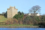
Mains Castle
|
East Kilbride
55 ° 46 ′ 41.4 " N , 4 ° 11 ′ 21" W.55.778166666667 -4.1891666666667
|
Tower House
|
26626
|
|
|
St Bride's Roman Catholic Church
|
East Kilbride
55 ° 45 ′ 46.8 " N , 4 ° 10 ′ 5.5" W.55.763 -4.1681944444444
|
church
|
26630
|

|
|
Rutherglen Tower
|
Rutherglen
55 ° 49 '43 " N , 4 ° 12' 55.1" W.55.828611111111 -4.2153055555556
|
tower
|
33563
|

|
|
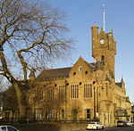
Rutherglen Town Hall
|
Rutherglen
55 ° 49 '43 " N , 4 ° 12' 52.8" W.55.828611111111 -4.2146666666667
|
town hall
|
33563
|
|
|
St Columbkille's Roman Catholic Church
|
Rutherglen
55 ° 49 '39.9 " N , 4 ° 12' 50.7" W.55.82775 -4.2140833333333
|
church
|
33567
|

|
|
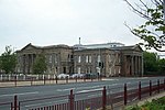
Hamilton Courthouse
|
Hamilton
55 ° 46 '45.7 " N , 4 ° 2' 55.9" W.55.779361111111 -4.0488611111111
|
Courthouse
|
34470
|
|
|
Lanark County Buildings
|
Hamilton
55 ° 46 '45.2 " N , 4 ° 3' 1.7" W.55.779222222222 -4.0504722222222
|
town hall
|
34472
|

|
|
Hamilton Old Parish Church
|
Hamilton
55 ° 46 '34.4 " N , 4 ° 2' 13.1" W.55.776222222222 -4.0369722222222
|
church
|
34473
|

|
|
Hamilton Old Parish Church graveyard
|
Hamilton
55 ° 46 '34.4 " N , 4 ° 2' 12" W.55.776222222222 -4.0366666666667
|
graveyard
|
34474
|
|
|
92-94 Cadzow Street
|
Hamilton
55 ° 46 '37.6 " N , 4 ° 2' 13" W.55.777111111111 -4.0369444444444
|
Residential and commercial buildings
|
34503
|
|
|
Cadzow Bridge
|
Hamilton
55 ° 46 '37.9 " N , 4 ° 2' 16.7" W.55.777194444444 -4.0379722222222
|
bridge
|
34504
|

|
|
Hamilton mausoleum
|
Hamilton
55 ° 47 '0 " N , 4 ° 1' 53.5" W.55.783333333333 -4.0315277777778
|
mausoleum
|
34518
|

|
|
Low Parks Museum
|
Hamilton
55 ° 46 '46.2 " N , 4 ° 2' 7.2" W.55.7795 -4.0353333333333
|
museum
|
34521
|

|
|
Gate at Lanark's livestock market
|
Lanark
55 ° 40 '14.1 " N , 3 ° 46' 5.4" W.55.670583333333 -3.7681666666667
|
goal
|
37024
|
|
|
Murray Chapel
|
Lanark
55 ° 40 ′ 10.1 ″ N , 3 ° 46 ′ 5.9 ″ W.55.669472222222 -3.7683055555556
|
church
|
37029
|

|
|
Clydesholm Bridge
|
Lanark
55 ° 40 ′ 32 " N , 3 ° 48 ′ 1.6" W.55.675555555556 -3.8004444444444
|
bridge
|
37032
|
|
|
New Lanark Church
|
New Lanark
55 ° 39 ′ 51.8 " N , 3 ° 46 ′ 54.4" W.55.664388888889 -3.7817777777778
|
church
|
37037
|

|
|
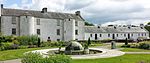
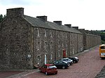
1-10 Braxfield Row
|
New Lanark
55 ° 39 '54.9 " N , 3 ° 47' 3.6" W.55.66525 -3.7843333333333
|
Residential buildings
|
37038
|

|
|
1-8 Caithness Row
|
New Lanark
55 ° 39 ′ 46.7 " N , 3 ° 46 ′ 47.1" W.55.662972222222 -3.77975
|
Residential buildings
|
37039
|

|
|
9-16 Caithness Row
|
New Lanark
55 ° 39 ′ 45.2 " N , 3 ° 46 ′ 45.5" W.55.662555555556 -3.7793055555556
|
Residential buildings
|
37040
|
|
|
1-4 double row
|
New Lanark
55 ° 39 ′ 51.3 " N , 3 ° 46 ′ 58.2" W.55.66425 -3.7828333333333
|
Residential buildings
|
37041
|
|
|
5-12 double row
|
New Lanark
55 ° 39 '52.4 " N , 3 ° 47' 2.2" W.55.664555555556 -3.7839444444444
|
Residential buildings
|
37042
|
|
|
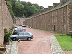
1-14 Long Row
|
New Lanark
55 ° 39 ′ 53 " N , 3 ° 47 ′ 2.1" W.55.664722222222 -3.7839166666667
|
Residential buildings
|
37043
|
|
|
New Buildings
|
New Lanark
55 ° 39 ′ 49.4 " N , 3 ° 46 ′ 50.7" W.55.663722222222 -3.78075
|
Residential buildings
|
37045
|

|
|
1–11 Nursery Buildings
|
New Lanark
55 ° 39 ′ 48.2 " N , 3 ° 46 ′ 48.4" W.55.663388888889 -3.7801111111111
|
Residential buildings
|
37046
|

|
|
Robert Owen's House
|
New Lanark
55 ° 39 ′ 50.1 " N , 3 ° 46 ′ 53.8" W.55.663916666667 -3.7816111111111
|
Residential buildings
|
37047
|

|
|
David Dale's House
|
New Lanark
55 ° 39 ′ 50.5 " N , 3 ° 46 ′ 55.5" W.55.664027777778 -3.7820833333333
|
Residential buildings
|
37048
|
|
|
New Institution for the Formation of Character
|
New Lanark
55 ° 39 ′ 47.2 " N , 3 ° 46 ′ 50.4" W.55.663111111111 -3.7806666666667
|
school
|
37049
|

|
|
New Lanark School
|
New Lanark
55 ° 39 ′ 45 " N , 3 ° 46 ′ 49" W.55.6625 -3.7802777777778
|
school
|
37050
|

|
|
New Lanark Mill No. 1
|
New Lanark
55 ° 39 ′ 49.4 " N , 3 ° 46 ′ 57.9" W.55.663722222222 -3.78275
|
Industrial building
|
37051
|

|
|
New Lanark Mill No. 2
|
New Lanark
55 ° 39 ′ 48.2 " N , 3 ° 46 ′ 56" W.55.663388888889 -3.7822222222222
|
Industrial building
|
37052
|

|
|
New Lanark Mill No. 3
|
New Lanark
55 ° 39 ′ 47.4 " N , 3 ° 46 ′ 53.6" W.55.663166666667 -3.7815555555556
|
Industrial building
|
37053
|
|
|
Old New Lanark Workshop
|
New Lanark
55 ° 39 ′ 42.6 " N , 3 ° 46 ′ 48.1" W.55.661833333333 -3.7800277777778
|
Industrial building
|
37054
|
|
|
Old New Lanark Foundry
|
New Lanark
55 ° 39 ′ 42.6 " N , 3 ° 46 ′ 49.2" W.55.661833333333 -3.7803333333333
|
Industrial building
|
37055
|

|
|
Old New Lanark Gas Works
|
New Lanark
55 ° 39 ′ 40 " N , 3 ° 46 ′ 49.6" W.55.661111111111 -3.7804444444444
|
Industrial building
|
37056
|
|
|
St Mary's Church
|
Lanark
55 ° 40 ′ 20.2 " N , 3 ° 46 ′ 23.4" W.55.672277777778 -3.7731666666667
|
church
|
37062
|

|
|
Parish Hall of St Mary's Church
|
Lanark
55 ° 40 ′ 21.5 " N , 3 ° 46 ′ 24.3" W.55.672638888889 -3.7734166666667
|
Hall
|
37065
|
|
|
Rectory of St Mary's Church
|
Lanark
55 ° 40 ′ 20.2 " N , 3 ° 46 ′ 22.2" W.55.672277777778 -3.7728333333333
|
Residential buildings
|
37066
|
|
|
New Lanark Mill Canal
|
New Lanark
55 ° 39 ′ 46 " N , 3 ° 46 ′ 48.8" W.55.662777777778 -3.7802222222222
|
channel
|
44552
|

|
|
Mauldslie Lodge
|
Dalserf
55 ° 43 ′ 50.5 ″ N , 3 ° 54 ′ 26 ″ W.55.730694444444 -3.9072222222222
|
Residential buildings
|
45125
|
|
|
Water Houses
|
New Lanark
55 ° 39 ′ 48.1 " N , 3 ° 46 ′ 58.2" W.55.663361111111 -3.7828333333333
|
Industrial building
|
46471
|
|
|
Torrance House
|
East Kilbride
55 ° 44 ′ 54.6 " N , 4 ° 8 ′ 40.8" W.55.7485 -4.1446666666667
|
Mansion
|
48654
|
|
|
Dollan Aqua Center
|
East Kilbride
55 ° 45 ′ 43 " N , 4 ° 10 ′ 54.9" W.55.761944444444 -4.1819166666667
|
Bathing establishment
|
48682
|

|
|
Stonebyres hydroelectric power station
|
near Lanark
55 ° 40 ′ 38.1 " N , 3 ° 49 ′ 48.2" W.55.67725 -3.8300555555556
|
power plant
|
51719
|

|
|
Weir of the Stonebyres hydroelectric power station
|
near Lanark
55 ° 40 ′ 34.2 " N , 3 ° 49 ′ 19.9" W.55.676166666667 -3.8221944444444
|
Dam
|
51720
|
|
|
Bonnington Hydroelectric Power Station
|
near New Lanark
55 ° 39 ′ 20.4 " N , 3 ° 46 ′ 30.8" W.55.655666666667 -3.7752222222222
|
power plant
|
51727
|

|
|
Weir of the Bonnington hydropower station
|
near New Lanark
55 ° 38 ′ 48.7 " N , 3 ° 46 ′ 25.4" W.55.646861111111 -3.7737222222222
|
Dam
|
51728
|

|


.jpg)


.jpg)


_(14760846574).jpg)


.jpg)


.jpg)


.jpg)


.jpg)


