| Surname |
location |
Type |
entry |
image
|
|
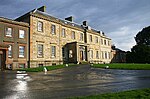
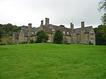
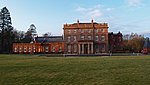
Oswald Hall
|
Auchincruive
55 ° 28 ′ 42 ″ N , 4 ° 33 ′ 8.8 ″ W.55.478333333333 -4.5524444444444
|
Mansion
|
99
|
|
|
Dalquharran Castle
|
near Dailly
55 ° 16 ′ 59 " N , 4 ° 43 ′ 28.5" W.55.283055555556 -4.7245833333333
|
Mansion
|
125
|

|
|
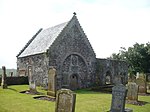
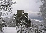
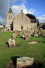
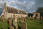
Old Parish Church of Ballantrae
|
Ballantrae
55 ° 5 ′ 57.2 " N , 5 ° 0 ′ 17.6" W.55.099222222222 -5.0048888888889
|
church
|
869
|
|
|
Auchan's Castle
|
near Dundonald
55 ° 34 ′ 38.4 " N , 4 ° 36 ′ 40.6" W.55.577333333333 -4.6112777777778
|
Mansion
|
984
|
|
|
Fairlie House
|
near Dundonald
55 ° 35 '26.2 " N , 4 ° 33' 49.3" W.55.590611111111 -4.5636944444444
|
Mansion
|
985
|
|
|
Lodge by Fairlie House
|
near Dundonald
55 ° 35 '16.5 " N , 4 ° 33' 30.3" W.55.587916666667 -4.5584166666667
|
Lodge
|
987
|
|
|
Laigh Milton Viaduct
|
near Gatehead
55 ° 35 '55.7 " N , 4 ° 34' 1.8" W.55.598805555556 -4.5671666666667
|
bridge
|
990
|

|
|
Oswald's Temple
|
Auchincruive
55 ° 28 ′ 49 ″ N , 4 ° 33 ′ 41.7 ″ W.55.480277777778 -4.5615833333333
|
tea house
|
996
|
|
|
Kildonan House
|
near Barrhill,
55 ° 6 '39 " N , 4 ° 46" 49.3 " W.55.110833333333 -4.7803611111111
|
Mansion
|
1052
|
|
|
Kilkerran House
|
near Dailly
55 ° 17 ′ 32.1 " N , 4 ° 40 ′ 17.5" W.55.29225 -4.6715277777778
|
Mansion
|
1114
|
|
|
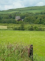
Drumburle
|
near Dailly
55 ° 17 ′ 31.8 " N , 4 ° 41 ′ 43.6" W.55.292166666667 -4.6954444444444
|
Residential buildings
|
1119
|
|
|
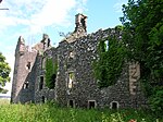
Penkill Castle
|
near Old Dailly
55 ° 14 '57.4 " N , 4 ° 47' 1.1" W.55.249277777778 -4.7836388888889
|
lock
|
1148
|
|
|
Bargany House
|
near Old Dailly
55 ° 15 ′ 53.8 " N , 4 ° 45 ′ 54.8" W.55.264944444444 -4.7652222222222
|
Mansion
|
1171
|

|
|
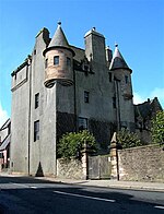
Killochan Castle
|
Old Dailly
55 ° 15 ′ 54.4 " N , 4 ° 47 ′ 29.5" W.55.265111111111 -4.7915277777778
|
Mansion
|
1173
|
|
|
Killochan Castle stables
|
Old Dailly
55 ° 15 ′ 55.3 ″ N , 4 ° 47 ′ 30 ″ W.55.265361111111 -4.7916666666667
|
Stables
|
1174
|
|
|
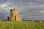
Wallace's Monument
|
near Symington
55 ° 31 '58.9 " N , 4 ° 31' 34.6" W.55.533027777778 -4.5262777777778
|
tower
|
4856
|

|
|
3 gray gables
|
near Monkton
55 ° 31 ′ 35.5 ″ N , 4 ° 37 ′ 44.5 ″ W.55.526527777778 -4.6290277777778
|
villa
|
6385
|
|
|
Ballantrae windmill
|
Ballantrae
55 ° 6 ′ 23.5 " N , 4 ° 59 ′ 42.6" W.55.106527777778 -4.9951666666667
|
Windmill
|
6634
|

|
|
Kirkmichael pigeon tower
|
near Kirkmichael
55 ° 20 ′ 20.6 " N , 4 ° 35 ′ 7.6" W.55.339055555556 -4.5854444444444
|
Pigeon tower
|
7558
|
|
|
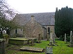
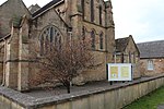
Kirkoswald Parish Church
|
Kirkoswald
55 ° 19 ′ 43.8 ″ N , 4 ° 46 ′ 35 ″ W.55.328833333333 -4.7763888888889
|
church
|
7583
|
|
|
Souter Johnnie's Cottage
|
Kirkoswald
55 ° 19 ′ 48.9 ″ N , 4 ° 46 ′ 33.9 ″ W.55.33025 -4.7760833333333
|
Residential buildings
|
7586
|

|
|
Baltersan Castle
|
near Maybole
55 ° 20 ′ 34.1 " N , 4 ° 42 ′ 35.3" W.55.342805555556 -4.7098055555556
|
Tower House
|
7588
|

|
|
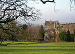
Culzean Castle
|
near Maidens
55 ° 21 ′ 16.7 " N , 4 ° 47 ′ 21.3" W.55.354638888889 -4.78925
|
lock
|
7595
|

|
|
Culzean Castle Home Farm
|
near Maidens
55 ° 21 ′ 21.8 " N , 4 ° 46 ′ 57.7" W.55.356055555556 -4.7826944444444
|
farm
|
7596
|

|
|
Camellia House
|
near Maidens
55 ° 21 ′ 8.3 " N , 4 ° 47 ′ 22.4" W.55.352305555556 -4.7895555555556
|
Glasshouse
|
7597
|

|
|
Hoolity ha '
|
near Maidens
55 ° 21 ′ 19 ″ N , 4 ° 46 ′ 32.3 ″ W.55.355277777778 -4.7756388888889
|
Lodge
|
7603
|

|
|
Swan pond by Culzean Castle
|
near Maidens
55 ° 20 ′ 51.9 " N , 4 ° 48 ′ 4.9" W.55.34775 -4.8013611111111
|
Garden area
|
7605
|

|
|
Bathhouse at Culzean Castle
|
near Maidens
55 ° 21 ′ 13 " N , 4 ° 47 ′ 33.9" W.55.353611111111 -4.79275
|
Bathhouse
|
7609
|
|
|
Gardens of Culzean Castle
|
near Maidens
55 ° 21 ′ 2.1 " N , 4 ° 47 ′ 28.1" W.55.350583333333 -4.7911388888889
|
Gardens
|
7612
|

|
|
Cat Gates
|
near Maidens
55 ° 20 ′ 42.5 " N , 4 ° 47 ′ 40.3" W.55.345138888889 -4.7945277777778
|
Gate entrance
|
7614
|
|
|
Cassillis Castle
|
near Maybole
55 ° 22 ′ 52.4 " N , 4 ° 37 ′ 14.9" W.55.381222222222 -4.6208055555556
|
Mansion
|
13655
|
|
|
St Cuthbert's Church
|
Monkton
55 ° 30 ′ 54.9 ″ N , 4 ° 36 ′ 6.9 ″ W.55.51525 -4.6019166666667
|
Church ruin
|
14251
|

|
|
Monkton Windmill
|
Monkton
55 ° 31 ′ 7.1 ″ N , 4 ° 35 ′ 44.9 ″ W.55.518638888889 -4.5958055555556
|
Windmill
|
14252
|

|
|
Macrae's Monument
|
Monkton
55 ° 31 ′ 14.2 " N , 4 ° 35 ′ 26.5" W.55.520611111111 -4.5906944444444
|
monument
|
14253
|

|
|
Newark Castle
|
Alloway
55 ° 25 ′ 17.4 ″ N , 4 ° 39 ′ 7.6 ″ W.55.4215 -4.6521111111111
|
lock
|
14300
|
|
|
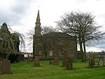
Tarbolton Parish Church
|
Tarbolton
55 ° 30 '47.1 " N , 4 ° 29" 14.3 " W.55.513083333333 -4.4873055555556
|
church
|
14349
|
|
|
Neilshill House
|
Mossblown
55 ° 30 ′ 12.3 " N , 4 ° 31 ′ 13.1" W.55.503416666667 -4.5203055555556
|
villa
|
14355
|
|
|
Symington Parish Church
|
Symington
55 ° 32 '58.6 " N , 4 ° 33' 45.2" W.55.549611111111 -4.5625555555556
|
church
|
14357
|
|
|
Coodham House
|
near Symington
55 ° 33 '40.1 " N , 4 ° 32' 42.4" W.55.561138888889 -4.5451111111111
|
Mansion
|
14368
|
|
|
Straiton Parish Church
|
Straiton
55 ° 18 ′ 41.5 " N , 4 ° 33 ′ 11.5" W.55.311527777778 -4.5531944444444
|
church
|
19089
|
|
|
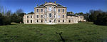
Blairquhan House
|
near Straiton
55 ° 18 ′ 58.1 " N , 4 ° 34 ′ 39.1" W.55.316138888889 -4.5775277777778
|
Mansion
|
19094
|

|
|
Burns Bachelors' Club
|
Tarbolton
55 ° 30 ′ 47.4 " N , 4 ° 29 ′ 10.1" W.55.513166666667 -4.4861388888889
|
Cottage
|
19689
|

|
|
Brig o 'Doon
|
Alloway
55 ° 25 ′ 33.3 " N , 4 ° 38 ′ 12.4" W.55.425916666667 -4.6367777777778
|
bridge
|
21474
|

|
|
Burns Cottage
|
Alloway
55 ° 25 ′ 58.2 ″ N , 4 ° 38 ′ 0.5 ″ W.55.432833333333 -4.6334722222222
|
Residential buildings
|
21476
|

|
|
Robert Burns Monument
|
Alloway
55 ° 25 ′ 37 " N , 4 ° 38 ′ 12.3" W.55.426944444444 -4.63675
|
monument
|
21477
|

|
|
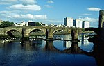
Old Bridge of Ayr
|
Ayr
55 ° 27 ′ 52.6 " N , 4 ° 37 ′ 46" W.55.464611111111 -4.6294444444444
|
bridge
|
21495
|
|
|
Barns House
|
Ayr
55 ° 27 '34.6 " N , 4 ° 38' 0.4" W.55.459611111111 -4.6334444444444
|
villa
|
21496
|
|
|
Craigie House
|
Ayr
55 ° 27 '30.4 " N , 4 ° 36" 42.1 " W.55.458444444444 -4.6116944444444
|
Mansion
|
21556
|
|
|
Holy Trinity Church
|
Ayr
55 ° 27 ′ 41 " N , 4 ° 37 ′ 58.2" W.55.461388888889 -4.6328333333333
|
church
|
21586
|
|
|
Auld Kirk of Ayr
|
Ayr
55 ° 27 ′ 46.1 " N , 4 ° 37 ′ 43.3" W.55.462805555556 -4.6286944444444
|
church
|
21653
|

|
|
Gatehouse of the Auld Kirk of Ayr
|
Ayr
55 ° 27 ′ 46.9 " N , 4 ° 37 ′ 45.3" W.55.463027777778 -4.62925
|
Gatehouse
|
21654
|
|
|
Loudoun Hall
|
Ayr
55 ° 27 '53.4 " N , 4 ° 37' 57.6" W.55.464833333333 -4.6326666666667
|
Residential buildings
|
21656
|

|
|
1-3 New Bridge Street
|
Ayr
55 ° 27 '53.6 " N , 4 ° 37' 53.3" W.55.464888888889 -4.6314722222222
|
Residential and commercial buildings
|
21689
|

|
|
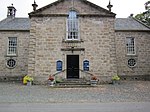
Ayr Town Hall
|
Ayr
55 ° 27 ′ 51.5 ″ N , 4 ° 37 ′ 55 ″ W.55.464305555556 -4.6319444444444
|
town hall
|
21692
|
|
|
34 New Bridge Street
|
Ayr
55 ° 27 '51.1 " N , 4 ° 37' 57.5" W.55.464194444444 -4.6326388888889
|
Commercial building
|
21700
|
|
|
Rozelle House
|
Ayr
55 ° 26 ′ 11.5 " N , 4 ° 37 ′ 42.4" W.55.436527777778 -4.6284444444444
|
Mansion
|
21763
|
|
|
Queen's Court House
|
Ayr
55 ° 27 '48.1 " N , 4 ° 37' 58.6" W.55.463361111111 -4.6329444444444
|
Commercial building
|
21777
|
|
|
Lady Cathcart's House
|
Ayr
55 ° 27 ′ 49.5 " N , 4 ° 38 ′ 0" W.55.46375 -4.6333333333333
|
Residential and commercial buildings
|
21788
|

|
|
Savoy Croft
|
Ayr
55 ° 27 '22.1 " N , 4 ° 38' 18.2" W.55.456138888889 -4.6383888888889
|
villa
|
21795
|
|
|
14 Wellington Square
|
Ayr
55 ° 27 ′ 40.8 " N , 4 ° 38 ′ 16.2" W.55.461333333333 -4.6378333333333
|
Administration building
|
21820
|

|
|
St Mary's Church
|
Maybole
55 ° 21 ′ 12.5 " N , 4 ° 40 ′ 49.7" W.55.353472222222 -4.6804722222222
|
Church ruin
|
37688
|

|
|
Maybole Castle
|
Maybole
55 ° 21 ′ 17.3 " N , 4 ° 40 ′ 51.7" W.55.354805555556 -4.6810277777778
|
Mansion
|
37709
|
|
|
St John's Cottage
|
Maybole
55 ° 21 ′ 23.2 " N , 4 ° 40 ′ 13.4" W.55.356444444444 -4.6703888888889
|
villa
|
37718
|
|
|
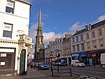
Prestwick Market Cross
|
Prestwick
55 ° 30 '5.3 " N , 4 ° 36" 39.9 " W.55.501472222222 -4.6110833333333
|
Market cross
|
40328
|

|
|
Salt Pan Houses
|
Prestwick
55 ° 29 ′ 26 " N , 4 ° 37 ′ 24" W.55.490555555556 -4.6233333333333
|
Industrial building
|
40332
|

|
|
Piersland House Hotel
|
Troon
55 ° 32 '2.7 " N , 4 ° 38" 49.2 " W.55.534083333333 -4.647
|
hotel
|
42114
|
|
Church of Our Lady of the
Assumption and St Meddan
|
Troon
55 ° 32 ′ 42.2 " N , 4 ° 39 ′ 12.5" W.55.545055555556 -4.6534722222222
|
church
|
42129
|

|
|
Mausoleum of St Quivox
|
St Quivox
55 ° 28 ′ 59.6 " N , 4 ° 34 ′ 21.5" W.55.483222222222 -4.5726388888889
|
mausoleum
|
47011
|
|
|
St Quivox Parish Church
|
St Quivox
55 ° 29 ′ 0 ″ N , 4 ° 34 ′ 22.7 ″ W.55.483333333333 -4.5729722222222
|
church
|
48638
|

|
|
Courtyard of Culzean Castle
|
near Maidens
55 ° 21 ′ 17.6 " N , 4 ° 47 ′ 18.3" W.55.354888888889 -4.7884166666667
|
court
|
51823
|
|
|
Fountain of Culzean Castle
|
near Maidens
55 ° 21 ′ 14.8 " N , 4 ° 47 ′ 19.2" W.55.354111111111 -4.7886666666667
|
Fountain
|
51824
|

|
|
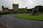
Gatehouse of Culzean Castle
|
near Maidens
55 ° 21 ′ 14 " N , 4 ° 47 ′ 12.7" W.55.353888888889 -4.7868611111111
|
goal
|
51827
|

|
|
Stables at Culzean Castle
|
near Maidens
55 ° 21 ′ 18.3 " N , 4 ° 47 ′ 15.7" W.55.355083333333 -4.7876944444444
|
Stables
|
51829
|

|


.jpg)


.jpg)
.jpg)


.jpg)


.jpg)


.jpg)


.jpg)
.jpg)


