| Surname |
location |
Type |
entry |
image
|
|
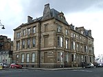
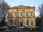
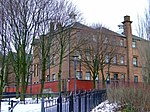
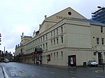
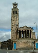
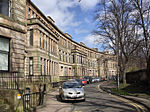
Former Trinity College
|
55 ° 52 '5.4 " N , 4 ° 16" 33.4 " W.55.868166666667 -4.2759444444444
|
school
|
32171
|

|
|
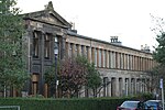
Arlington Baths Club
|
55 ° 52 ′ 14.6 " N , 4 ° 16 ′ 24.3" W.55.870722222222 -4.2734166666667
|
Bathing establishment
|
32173
|

|
|
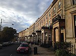
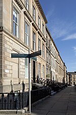
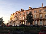
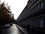
1-12 Claremont Terrace
|
55 ° 52 '3.6 " N , 4 ° 16" 40.1 " W.55.867666666667 -4.2778055555556
|
Residential buildings
|
32185
|
|
|
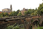
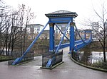
Great Western Road Bridge
|
55 ° 52 ′ 29.2 " N , 4 ° 16 ′ 47.5" W.55.874777777778 -4.2798611111111
|
bridge
|
32197
|

|
|
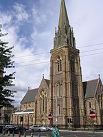
St Mary's Episcopal Cathedral
|
55 ° 52 '24.8 " N , 4 ° 16" 30.4 " W.55.873555555556 -4.2751111111111
|
church
|
32198
|
|
|
445-459 Great Western Road
|
55 ° 52 ′ 29.8 " N , 4 ° 16 ′ 51.5" W.55.874944444444 -4.2809722222222
|
Residential and commercial buildings
|
32200
|
|
|
Lansdowne Parish Church
|
55 ° 52 '28.1 " N , 4 ° 16" 41 " W.55.874472222222 -4.2780555555556
|
church
|
32205
|

|
|
Roberts Memorial
|
55 ° 52 ′ 13.2 " N , 4 ° 16 ′ 54.6" W.55.870333333333 -4.2818333333333
|
monument
|
32211
|

|
|
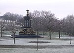
Stewart Memorial Fountain
|
55 ° 52 ′ 5 ″ N , 4 ° 17 ′ 1.8 ″ W.55.868055555556 -4.2838333333333
|
Fountain
|
32213
|

|
|
41-53 Oakfield Avenue
|
55 ° 52 '26.5 " N , 4 ° 17' 4.4" W.55.874027777778 -4.2845555555556
|
Residential buildings
|
32235
|
|
|
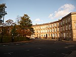
1–29 Park Circus
|
55 ° 52 '11.6 " N , 4 ° 16" 42.7 " W.55.869888888889 -4.2785277777778
|
Residential buildings
|
32238
|
|
|
1-17 Park Circus Place
|
55 ° 52 '8.7 " N , 4 ° 16" 37.5 " W.55.869083333333 -4.2770833333333
|
Residential buildings
|
32239
|
|
|
1-6 Park Gardens
|
55 ° 52 '4.2 " N , 4 ° 16" 47.2 " W.55.867833333333 -4.2797777777778
|
Residential buildings
|
32240
|
|
|
Stairs on Park Street
|
55 ° 52 '5.7 " N , 4 ° 16" 48.9 " W.55.86825 -4.28025
|
stairway
|
32241
|
|
|
1-5 Park Gate
|
55 ° 52 ′ 11.8 " N , 4 ° 16 ′ 48" W.55.869944444444 -4.28
|
Residential buildings
|
32242
|
|
|
1-10 Park Quadrant
|
55 ° 52 ′ 13.5 " N , 4 ° 16 ′ 46" W.55.870416666667 -4.2794444444444
|
Residential buildings
|
32243
|

|
|
1-21 Park Terrace
|
55 ° 52 '8.6 " N , 4 ° 16" 51.4 " W.55.869055555556 -4.2809444444444
|
Residential buildings
|
32245
|
|
|
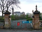
Gate at Kelvingrove Park
|
55 ° 52 ′ 12.4 " N , 4 ° 16 ′ 52" W.55.870111111111 -4.2811111111111
|
goal
|
32246
|
|
|
Staircase on Clifton Street
|
55 ° 52 '5.2 " N , 4 ° 16" 44.8 " W.55.868111111111 -4.2791111111111
|
stairway
|
32267
|

|
|
6-19 Woodside Crescent
|
55 ° 52 '3.2 " N , 4 ° 16" 19.5 " W.55.867555555556 -4.2720833333333
|
Residential buildings
|
32268
|

|
|
1-28 Woodside Place
|
55 ° 52 ′ 1 ″ N , 4 ° 16 ′ 28.5 ″ W.55.866944444444 -4.2745833333333
|
Residential buildings
|
32270
|

|
|
1-22 Woodside Terrace
|
55 ° 52 '3.8 " N , 4 ° 16" 28.6 " W.55.867722222222 -4.2746111111111
|
Residential buildings
|
32271
|

|
|
North British Engine Works
|
55 ° 52 '22.6 " N , 4 ° 20' 40.4" W.55.872944444444 -4.3445555555556
|
Industrial building
|
32280
|
|
|
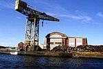
Titan Crane
|
55 ° 52 '20.6 " N , 4 ° 20' 43.9" W.55.872388888889 -4.3455277777778
|
crane
|
32281
|
|
|
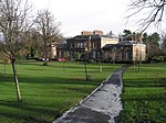
Stoneleigh
|
55 ° 53 '1.4 " N , 4 ° 18" 14.8 " W.55.883722222222 -4.3041111111111
|
villa
|
32306
|
|
|
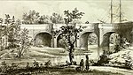
Kelvin Aqueduct
|
55 ° 53 ′ 32.7 " N , 4 ° 18 ′ 6" W.55.892416666667 -4.3016666666667
|
bridge
|
32316
|
|
|
Gartnavel Royal Hospital
|
55 ° 53 '0.5 " N , 4 ° 19" 9.4 " W.55.883472222222 -4.3192777777778
|
hospital
|
32318
|

|
|
St Mungo's Academy Centenary Club
|
55 ° 53 '0.7 " N , 4 ° 18" 18.4 " W.55.883527777778 -4.3051111111111
|
villa
|
32334
|
|
|
11 Whittinghame Drive
|
55 ° 53 '5.5 " N , 4 ° 18" 54.5 " W.55.884861111111 -4.3151388888889
|
villa
|
32342
|
|
|
Ruchill Parish Church meetinghouse
|
55 ° 53 '12.2 " N , 4 ° 17' 1.3" W.55.886722222222 -4.2836944444444
|
public building
|
32356
|

|
|
Queen's Park Church
|
55 ° 50 '2.4 " N , 4 ° 16" 15.5 " W.55.834 -4.2709722222222
|
church
|
32359
|

|
|
Langside Hall
|
55 ° 49 ′ 53.2 " N , 4 ° 16 ′ 39.5" W.55.831444444444 -4.2776388888889
|
public building
|
32369
|
|
|
Maria Villa
|
55 ° 49 ′ 32.3 " N , 4 ° 16 ′ 29.8" W.55.825638888889 -4.2749444444444
|
villa
|
32373
|
|
|
2-38 Millbrae Crescent
|
55 ° 49 ′ 20.1 " N , 4 ° 16 ′ 32.6" W.55.82225 -4.2757222222222
|
Residential buildings
|
32384
|

|
|
1-10 Moray Place
|
55 ° 50 ′ 14.7 " N , 4 ° 16 ′ 23.8" W.55.837416666667 -4.2732777777778
|
Residential buildings
|
32386
|
|
|
Camphill House
|
55 ° 49 ′ 56 " N , 4 ° 16 ′ 30.3" W.55.832222222222 -4.2750833333333
|
villa
|
32401
|
|
|
265-289 Allison Street
|
55 ° 50 '8.7 " N , 4 ° 15" 33.8 " W.55.83575 -4.2593888888889
|
Residential and commercial buildings
|
32423
|
|
|
Crosshill Queen's Park Church
|
55 ° 49 ′ 55 " N , 4 ° 15 ′ 41" W.55.831944444444 -4.2613888888889
|
church
|
32451
|

|
|
Kelvinside Academy
|
55 ° 52 ′ 58.6 " N , 4 ° 17 ′ 41.6" W.55.882944444444 -4.2948888888889
|
school
|
32476
|
|
|
15 Cleveden Gardens
|
55 ° 53 '5 " N , 4 ° 17" 58.8 " W.55.884722222222 -4.2996666666667
|
villa
|
32486
|
|
|
3–10 Crown Circus
|
55 ° 52 '33.1 " N , 4 ° 18" 2.4 " W.55.875861111111 -4.3006666666667
|
Residential buildings
|
32489
|
|
|
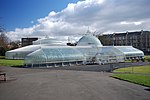
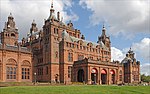
Kibble Palace
|
55 ° 52 '43.9 " N , 4 ° 17' 18.1" W.55.878861111111 -4.2883611111111
|
Glasshouse
|
32513
|
|
|
1-11 Great Western Terrace
|
55 ° 52 ′ 52.7 " N , 4 ° 18 ′ 4" W.55.881305555556 -4.3011111111111
|
Residential buildings
|
32517
|
|
|
1-17 Grosvenor Terrace
|
55 ° 52 ′ 41.2 " N , 4 ° 17 ′ 29.7" W.55.878111111111 -4.2915833333333
|
Residential buildings
|
32520
|
|
|
21-39 Hyndland Road
|
55 ° 52 ′ 53.3 " N , 4 ° 18 ′ 13.8" W.55.881472222222 -4.3038333333333
|
Residential buildings
|
32530
|
|
|
Broomhill Hyndland Parish Church
|
55 ° 52 '44.9 " N , 4 ° 18" 19.1 " W.55.879138888889 -4.3053055555556
|
church
|
32532
|
|
|
3 Kirklee Road
|
55 ° 52 '52.6 " N , 4 ° 17" 49.6 " W.55.881277777778 -4.2971111111111
|
villa
|
32550
|
|
|
7-23 Kirklee Road
|
55 ° 52 ′ 54.8 " N , 4 ° 17 ′ 45.7" W.55.881888888889 -4.2960277777778
|
Residential buildings
|
32551
|
|
|
1-14 Kirklee Terrace
|
55 ° 52 ′ 48.7 " N , 4 ° 17 ′ 41.5" W.55.880194444444 -4.2948611111111
|
Residential buildings
|
32553
|
|
|
9 Lowther Terrace
|
55 ° 52 '52.8 " N , 4 ° 17' 55.5" W.55.881333333333 -4.29875
|
Residential buildings
|
32563
|
|
|
10 Lowther Terrace
|
55 ° 52 ′ 53 " N , 4 ° 17 ′ 56.3" W.55.881388888889 -4.2989722222222
|
Residential buildings
|
32564
|
|
|
Notre Dame High School
|
55 ° 52 ′ 41.8 " N , 4 ° 17 ′ 56.5" W.55.878277777778 -4.2990277777778
|
school
|
32571
|

|
|
1 Prince's Terrace
|
55 ° 52 '37.1 " N , 4 ° 18" 2.4 " W.55.876972222222 -4.3006666666667
|
Residential buildings
|
32576
|

|
|
Kelvinside Hillhead Parish Church
|
55 ° 52 '39.1 " N , 4 ° 17" 35.7 " W.55.877527777778 -4.29325
|
church
|
32584
|

|
|
Belhaven-Westbourne Church
|
55 ° 52 ′ 53.6 " N , 4 ° 18 ′ 11" W.55.881555555556 -4.3030555555556
|
church
|
32605
|
|
|
Daily Express Building
|
55 ° 51 '36 " N , 4 ° 14" 38.2 " W.55.86 -4.2439444444444
|
Commercial building
|
32607
|
|
|
Buck's Head Building
|
55 ° 51 '27.2 " N , 4 ° 15' 4.4" W.55.857555555556 -4.2512222222222
|
Commercial building
|
32608
|

|
|
Argyll Arcade
|
55 ° 51 ′ 31.6 " N , 4 ° 15 ′ 12.4" W.55.858777777778 -4.2534444444444
|
Commercial building
|
32613
|

|
|
David Sloan's Arcade Cafe
|
55 ° 51 '30.7 " N , 4 ° 15' 13.3" W.55.858527777778 -4.2536944444444
|
restaurant
|
32614
|

|
|
Martyrs' Public School
|
55 ° 51 '55 " N , 4 ° 14" 14.3 " W.55.865277777778 -4.2373055555556
|
school
|
32619
|
|
|
60-62 Buchanan Street
|
55 ° 51 '34.5 " N , 4 ° 15" 14.9 " W.55.859583333333 -4.2541388888889
|
Commercial building
|
32635
|
|
|
92-100 Buchanan Street
|
55 ° 51 '37.2 " N , 4 ° 15' 13.9" W.55.860333333333 -4.2538611111111
|
Commercial building
|
32639
|
|
|
Britannia Buildings
|
55 ° 51 '44.6 " N , 4 ° 15' 10.6" W.55.862388888889 -4.2529444444444
|
Commercial building
|
32643
|
|
|
Glasgow City Halls
|
55 ° 51 '31 " N , 4 ° 14" 41.5 " W.55.858611111111 -4.2448611111111
|
Commercial building
|
32647
|

|
|
Provand's Lordship
|
55 ° 51 '44.5 " N , 4 ° 14" 12.7 " W.55.862361111111 -4.2368611111111
|
villa
|
32648
|

|
|
Bridge of Sighs
|
55 ° 51 '44 " N , 4 ° 14' 1.3" W.55.862222222222 -4.2336944444444
|
bridge
|
32651
|
|
|
Glasgow Evangelical Church
|
55 ° 51 ′ 40.8 " N , 4 ° 14 ′ 6" W.55.861333333333 -4.235
|
church
|
32652
|
|
|
St Mungo's Cathedral
|
55 ° 51 '46.8 " N , 4 ° 14' 4.2" W.55.863 -4.2345
|
church
|
32654
|

|
|
Equestrian monument of Wilhelm III.
|
55 ° 51 '42.5 " N , 4 ° 14" 10.7 " W.55.861805555556 -4.2363055555556
|
monument
|
32660
|

|
|
Our Lady and St Francis Secondary School
|
55 ° 51 '12.9 " N , 4 ° 14' 28.3" W.55.853583333333 -4.2411944444444
|
school
|
32662
|

|
|
52 Charlotte Street
|
55 ° 51 '15.9 " N , 4 ° 14' 26.4" W.55.854416666667 -4.2406666666667
|
Residential buildings
|
32663
|
|
|
The Briggait
|
55 ° 51 '15.7 " N , 4 ° 14' 58.3" W.55.854361111111 -4.2495277777778
|
Commercial building
|
32664
|

|
|
Merchant steeple
|
55 ° 51 '16.7 " N , 4 ° 14' 57" W.55.854638888889 -4.2491666666667
|
tower
|
32665
|

|
|
St Andrew's Cathedral
|
55 ° 51 '19.9 " N , 4 ° 15' 10.6" W.55.855527777778 -4.2529444444444
|
church
|
32666
|

|
|
Albert Bridge
|
55 ° 51 '9.6 " N , 4 ° 14" 50.3 " W.55.852666666667 -4.2473055555556
|
bridge
|
32667
|

|
|
South Portland Street Suspension Bridge
|
55 ° 51 ′ 18 ″ N , 4 ° 15 ′ 20 ″ W.55.855 -4.2555555555556
|
bridge
|
32668
|

|
|
Victoria Bridge
|
55 ° 51 '13.7 " N , 4 ° 15' 4.2" W.55.853805555556 -4.2511666666667
|
bridge
|
32669
|
|
|
John Street Church
|
55 ° 51 '36.8 " N , 4 ° 14' 50.8" W.55.860222222222 -4.2474444444444
|
church
|
32672
|

|
|
Extension of the Glasgow City Chambers
|
55 ° 51 '38.9 " N , 4 ° 14' 48.7" W.55.860805555556 -4.2468611111111
|
town hall
|
32675
|

|
|
Old main post office
|
55 ° 51 '37.6 " N , 4 ° 14" 59.5 " W.55.860444444444 -4.2498611111111
|
public building
|
32685
|

|
|
24 George Square
|
55 ° 51 '40.8 " N , 4 ° 15" 6.5 " W.55.861333333333 -4.2518055555556
|
Commercial building
|
32688
|
|
|
Merchants' House
|
55 ° 51 ′ 41.5 " N , 4 ° 15 ′ 6.2" W.55.861527777778 -4.2517222222222
|
Commercial building
|
32689
|

|
|
Glasgow City Chambers
|
55 ° 51 '39.2 " N , 4 ° 14' 53.8" W.55.860888888889 -4.2482777777778
|
town hall
|
32691
|

|
|
Walter Scott Memorial Column
|
55 ° 51 '40.2 " N , 4 ° 15' 0.6" W.55.861166666667 -4.2501666666667
|
monument
|
32696
|
|
|
Statue of James Watt
|
55 ° 51 '39.7 " N , 4 ° 15' 4.3" W.55.861027777778 -4.2511944444444
|
monument
|
32697
|

|
|
Statue of Sir John Moore
|
55 ° 51 '39.3 " N , 4 ° 15' 1.3" W.55.860916666667 -4.2503611111111
|
monument
|
32698
|

|
|
Prince Albert equestrian monument
|
55 ° 51 '40.2 " N , 4 ° 15' 4.1" W.55.861166666667 -4.2511388888889
|
monument
|
32701
|
|
|
Equestrian Monument to Queen Victoria
|
55 ° 51 ′ 41 ″ N , 4 ° 15 ′ 3.8 ″ W.55.861388888889 -4.2510555555556
|
monument
|
32702
|

|
|
266 George Street
|
55 ° 51 ′ 41.8 " N , 4 ° 14 ′ 52.8" W.55.861611111111 -4.248
|
town hall
|
32709
|
|
|
Trades Hall of Glasgow
|
55 ° 51 ′ 33.5 " N , 4 ° 14 ′ 56.4" W.55.859305555556 -4.249
|
Commercial building
|
32713
|

|
|
Tolbooth Steeple
|
55 ° 51 '24.5 " N , 4 ° 14" 37 " W.55.856805555556 -4.2436111111111
|
tower
|
32717
|

|
|
Glasgow Savings Bank headquarters
|
55 ° 51 ′ 34.6 " N , 4 ° 14 ′ 56.4" W.55.859611111111 -4.249
|
Commercial building
|
32734
|
|
|
Lanarkshire House
|
55 ° 51 '34.4 " N , 4 ° 14' 58.9" W.55.859555555556 -4.2496944444444
|
Commercial building
|
32735
|

|
|
Ramshorn Theater
|
55 ° 51 '34.9 " N , 4 ° 14" 42.2 " W.55.859694444444 -4.2450555555556
|
church
|
32740
|

|
|
Hutchesons' Hall
|
55 ° 51 '35.7 " N , 4 ° 14' 51.2" W.55.859916666667 -4.2475555555556
|
hospital
|
32744
|

|
|
16 Mcphater Street
|
55 ° 52 '1.9 " N , 4 ° 15" 18.7 " W.55.867194444444 -4.2551944444444
|
Commercial building
|
32754
|

|
|
61-63 Miller Street
|
55 ° 51 '33.1 " N , 4 ° 15' 4.5" W.55.859194444444 -4.25125
|
Residential and commercial buildings
|
32758
|
|
|
Arthur's Warehouse
|
55 ° 51 '33.8 " N , 4 ° 15' 3.8" W.55.859388888889 -4.2510555555556
|
Commercial building
|
32759
|
|
|
Tobacco Merchant's House
|
55 ° 51 '31.4 " N , 4 ° 15' 3.3" W.55.858722222222 -4.2509166666667
|
villa
|
32760
|

|
|
48-54 Miller Street
|
55 ° 51 '32 " N , 4 ° 15' 3.1" W.55.858888888889 -4.2508611111111
|
Commercial building
|
32761
|
|
|
Tron steeple
|
55 ° 51 '24.9 " N , 4 ° 14" 43.8 " W.55.856916666667 -4.2455
|
tower
|
32769
|

|
|
Britannia Music Hall
|
55 ° 51 '25 " N , 4 ° 14" 49.1 " W.55.856944444444 -4.2469722222222
|
theatre
|
32774
|

|
|
60-90 Trongate
|
55 ° 51 '26 " N , 4 ° 14" 43.4 " W.55.857222222222 -4.2453888888889
|
Commercial building
|
32782
|

|
|
190 Trongate
|
55 ° 51 ′ 27.5 " N , 4 ° 14 ′ 56.5" W.55.857638888889 -4.2490277777778
|
Residential and commercial buildings
|
32789
|

|
|
St Andrew's-by-the-Green
|
55 ° 51 '14.9 " N , 4 ° 14' 39.2" W.55.854138888889 -4.2442222222222
|
church
|
32790
|

|
|
37-47 Virginia Street
|
55 ° 51 '31.7 " N , 4 ° 15' 0.3" W.55.858805555556 -4.2500833333333
|
Residential buildings
|
32795
|
|
|
49-53 Virginia Street
|
55 ° 51 '32.2 " N , 4 ° 15' 0.2" W.55.858944444444 -4.2500555555556
|
Residential buildings
|
32796
|
|
|
42 Virginia Street
|
55 ° 51 '30.7 " N , 4 ° 14' 59.1" W.55.858527777778 -4.24975
|
Commercial building
|
32798
|
|
|
Tron Theater
|
55 ° 51 '24.6 " N , 4 ° 14" 43.7 " W.55.856833333333 -4.2454722222222
|
theatre
|
32812
|
|
|
Gallery of Modern Art
|
55 ° 51 '36.6 " N , 4 ° 15" 9.3 " W.55.860166666667 -4.2525833333333
|
museum
|
32818
|

|
|
St George's Buildings
|
55 ° 51 ′ 38.3 " N , 4 ° 15 ′ 7" W.55.860638888889 -4.2519444444444
|
Commercial building
|
32819
|
|
|
Glasgow Queen Street Railway Station
|
55 ° 51 ′ 45.5 " N , 4 ° 15 ′ 4" W.55.862638888889 -4.2511111111111
|
railway station
|
32822
|
|
|
Equestrian statue of the Duke of Wellington
|
55 ° 51 '36.4 " N , 4 ° 15' 7.2" W.55.860111111111 -4.252
|
monument
|
32823
|

|
|
Barony Hall
|
55 ° 51 '42.5 " N , 4 ° 14" 13.6 " W.55.861805555556 -4.2371111111111
|
church
|
32824
|
|
|
1-40 Royal Exchange Square
|
55 ° 51 '37.8 " N , 4 ° 15' 8.8" W.55.8605 -4.2524444444444
|
Commercial building
|
32826
|

|
|
Royal Bank of Scotland
|
55 ° 51 ′ 37 " N , 4 ° 15 ′ 12.6" W.55.860277777778 -4.2535
|
Commercial building
|
32827
|

|
|
Townhead and Blochairn Parish Church
|
55 ° 52 '4.7 " N , 4 ° 13" 38.3 " W.55.867972222222 -4.2273055555556
|
Church ruin
|
32828
|

|
|
St Andrew's in the Square
|
55 ° 51 '17.7 " N , 4 ° 14' 34.7" W.55.854916666667 -4.2429722222222
|
church
|
32830
|

|
|
St Enoch Square Travel Center
|
55 ° 51 '27.1 " N , 4 ° 15' 18.7" W.55.857527777778 -4.2551944444444
|
Commercial building
|
32833
|

|
|
Scottish Provident Institution
|
55 ° 51 ′ 39 " N , 4 ° 15 ′ 10.6" W.55.860833333333 -4.2529444444444
|
Commercial building
|
32836
|
|
|
2 St Vincent Place
|
55 ° 51 '40.1 " N , 4 ° 15' 6.7" W.55.861138888889 -4.2518611111111
|
Commercial building
|
32838
|
|
|
Anchor building
|
55 ° 51 '40.4 " N , 4 ° 15' 8.5" W.55.861222222222 -4.2523611111111
|
Commercial building
|
32839
|

|
|
Citizen Building
|
55 ° 51 '40.6 " N , 4 ° 15" 9.5 " W.55.861277777778 -4.2526388888889
|
Commercial building
|
32840
|

|
|
30 St Vincent Place
|
55 ° 51 '40.7 " N , 4 ° 15' 10.8" W.55.861305555556 -4.253
|
Commercial building
|
32841
|
|
|
Glasgow Justice Building
|
55 ° 51 '13.3 " N , 4 ° 14' 49.2" W.55.853694444444 -4.247
|
public building
|
32844
|

|
|
1-16 Buckingham Terrace
|
55 ° 52 ′ 37.9 " N , 4 ° 17 ′ 12" W.55.877194444444 -4.2866666666667
|
Residential buildings
|
32850
|
|
|
Lilybank House
|
55 ° 52 ′ 26.5 " N , 4 ° 17 ′ 25.3" W.55.874027777778 -4.2903611111111
|
university
|
32853
|

|
|
Western Baths Club
|
55 ° 52 '35.9 " N , 4 ° 17' 26.4" W.55.876638888889 -4.2906666666667
|
Bathing establishment
|
32859
|
|
|
35-51 Hamilton Drive
|
55 ° 52 '38.9 " N , 4 ° 17' 8.8" W.55.877472222222 -4.2857777777778
|
Residential buildings
|
32874
|
|
|
Dowanhill United Presbyterian Church
|
55 ° 52 ′ 27 " N , 4 ° 18 ′ 6.4" W.55.874166666667 -4.3017777777778
|
church
|
32879
|

|
|
Woodbank
|
55 ° 52 ′ 28.3 " N , 4 ° 18 ′ 31.1" W.55.874527777778 -4.3086388888889
|
villa
|
32895
|
|
|
1-9 Ruskin Terrace
|
55 ° 52 ′ 35 " N , 4 ° 17 ′ 2" W.55.876388888889 -4.2838888888889
|
Residential buildings
|
32903
|
|
|
Wellington Church
|
55 ° 52 ′ 21.2 " N , 4 ° 17 ′ 13.1" W.55.872555555556 -4.2869722222222
|
church
|
32912
|

|
|
Gilbert Scott Building
|
55 ° 52 '18.6 " N , 4 ° 17" 19.9 " W.55.871833333333 -4.2888611111111
|
university
|
32913
|

|
|
Joseph Black Building
|
55 ° 52 '19.4 " N , 4 ° 17" 35.5 " W.55.872055555556 -4.2931944444444
|
university
|
32918
|
|
|
Pearce Lodge
|
55 ° 52 '18.9 " N , 4 ° 17" 8.9 " W.55.871916666667 -4.2858055555556
|
university
|
32925
|
|
|
McMillan Reading Room
|
55 ° 52 ′ 21.8 " N , 4 ° 17 ′ 16.5" W.55.872722222222 -4.2879166666667
|
university
|
32927
|
|
|
Graham Kerr Building
|
55 ° 52 '17.6 " N , 4 ° 17' 34.1" W.55.871555555556 -4.2928055555556
|
university
|
32928
|
|
|
2-10 University Gardens
|
55 ° 52 '22 .7 " N , 4 ° 17" 24.7 " W.55.872972222222 -4.2901944444444
|
university
|
32931
|

|
|
Salmon House
|
55 ° 52 ′ 23.5 " N , 4 ° 17 ′ 26.3" W.55.873194444444 -4.2906388888889
|
university
|
32932
|
|
|
14 University Gardens
|
55 ° 52 ′ 23.8 " N , 4 ° 17 ′ 26.7" W.55.873277777778 -4.29075
|
university
|
32933
|
|
|
The Salon
|
55 ° 52 ′ 37 " N , 4 ° 17 ′ 26.2" W.55.876944444444 -4.2906111111111
|
movie theater
|
32934
|

|
|
Botanic Gardens garage
|
55 ° 52 '37.8 " N , 4 ° 17" 24.9 " W.55.877166666667 -4.29025
|
Commercial building
|
32935
|

|
|
Savings Bank of Glasgow building
|
55 ° 51 '42.5 " N , 4 ° 16" 27.3 " W.55.861805555556 -4.27425
|
Residential and commercial buildings
|
32953
|

|
|
181-199 Bath Street
|
55 ° 51 '51.9 " N , 4 ° 15' 46.2" W.55.864416666667 -4.2628333333333
|
Commercial building
|
32960
|
|
|
King's Theater
|
55 ° 51 ′ 54 ″ N , 4 ° 16 ′ 7 ″ W.55,865 -4.2686111111111
|
theatre
|
32963
|

|
|
Mercantile Chambers
|
55 ° 51 ′ 39.9 " N , 4 ° 15 ′ 40" W.55.861083333333 -4.2611111111111
|
Commercial building
|
32980
|

|
|
2-28 Bothwell Street
|
55 ° 51 '40.4 " N , 4 ° 15' 32.2" W.55.861222222222 -4.2589444444444
|
Commercial building
|
32983
|
|
|
Stewart & McDonald's Warehouse
|
55 ° 51 ′ 31.4 " N , 4 ° 15 ′ 19.4" W.55.858722222222 -4.2553888888889
|
Commercial building
|
32991
|

|
|
45 Buchanan Street
|
55 ° 51 '32.5 " N , 4 ° 15" 19.2 " W.55.859027777778 -4.2553333333333
|
Commercial building
|
32992
|
|
|
91 Buchanan Street
|
55 ° 51 '35.7 " N , 4 ° 15' 16.8" W.55.859916666667 -4.2546666666667
|
Commercial building
|
32998
|
|
|
113-115 Buchanan Street
|
55 ° 51 ′ 37.8 " N , 4 ° 15 ′ 16" W.55.8605 -4.2544444444444
|
Commercial building
|
33000
|

|
|
147 Buchanan Street
|
55 ° 51 ′ 41.1 ″ N , 4 ° 15 ′ 15 ″ W.55.861416666667 -4.2541666666667
|
Commercial building
|
33002
|

|
|
St George's Tron Church
|
55 ° 51 '43.3 " N , 4 ° 15' 14.4" W.55.862027777778 -4.254
|
church
|
33003
|
|
|
Athenaeum Theater
|
55 ° 51 '45.2 " N , 4 ° 15' 13.6" W.55.862555555556 -4.2537777777778
|
theatre
|
33004
|
|
|
4 Clairmont Gardens
|
55 ° 52 '0.3 " N , 4 ° 16" 38.3 " W.55.86675 -4.2773055555556
|
Residential buildings
|
33008
|
|
|
Old customs house
|
55 ° 51 '23 " N , 4 ° 15' 23.9" W.55.856388888889 -4.2566388888889
|
public building
|
33012
|

|
|
Kelvingrove Parish Church
|
55 ° 51 '59.6 " N , 4 ° 17' 5.1" W.55.866555555556 -4.28475
|
church
|
33015
|

|
|
Horse Shoe Bar
|
55 ° 51 ′ 39.2 " N , 4 ° 15 ′ 23" W.55.860888888889 -4.2563888888889
|
restaurant
|
33016
|
|
|
120 Elmbank Street
|
55 ° 51 '51.5 " N , 4 ° 16" 3.8 " W.55.864305555556 -4.2677222222222
|
public building
|
33022
|
|
|
Glasgow Central Railway Station
|
55 ° 51 ′ 32 " N , 4 ° 15 ′ 30" W.55.858888888889 -4.2583333333333
|
railway station
|
33029
|

|
|
6 Gordon Street
|
55 ° 51 '37.9 " N , 4 ° 15' 17.4" W.55.860527777778 -4.2548333333333
|
Commercial building
|
33030
|
|
|
20-40 Gordon Street
|
55 ° 51 '38.3 " N , 4 ° 15' 21.1" W.55.860638888889 -4.2558611111111
|
Commercial building
|
33031
|
|
|
Grosvenor Building
|
55 ° 51 ′ 39 " N , 4 ° 15 ′ 27.7" W.55.860833333333 -4.2576944444444
|
Commercial building
|
33034
|

|
|
Mitchell Theater
|
55 ° 51 '54 " N , 4 ° 16" 23.2 " W.55.865 -4.2731111111111
|
theatre
|
33036
|

|
|
Breadalbane Terrace
|
55 ° 52 ′ 1.5 " N , 4 ° 15 ′ 57.8" W.55.867083333333 -4.2660555555556
|
Residential buildings
|
33038
|
|
|
Garnethill Synagogue
|
55 ° 52 '1.8 " N , 4 ° 16" 4.1 " W.55.867166666667 -4.2678055555556
|
synagogue
|
33040
|

|
|
Peel Terrace
|
55 ° 52 ′ 2.6 " N , 4 ° 15 ′ 58" W.55.867388888889 -4.2661111111111
|
Residential buildings
|
33044
|

|
|
Atlantic Chambers
|
55 ° 51 '34.7 " N , 4 ° 15' 33.5" W.55.859638888889 -4.2593055555556
|
Commercial building
|
33050
|

|
|
91-115 Hope Street
|
55 ° 51 '37.8 " N , 4 ° 15' 33.6" W.55.8605 -4.2593333333333
|
Commercial building
|
33052
|
|
|
157-167 Hope Street
|
55 ° 51 '44.5 " N , 4 ° 15" 30.2 " W.55.862361111111 -4.2583888888889
|
Commercial building
|
33053
|
|
|
108 Hope Street
|
55 ° 51 '40.2 " N , 4 ° 15' 29.5" W.55.861166666667 -4.2581944444444
|
Commercial building
|
33056
|

|
|
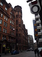
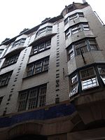
Lion Chambers
|
55 ° 51 '48.6 " N , 4 ° 15' 26.7" W.55.8635 -4.2574166666667
|
Commercial building
|
33059
|

|
|
Theater Royal
|
55 ° 51 '58.7 " N , 4 ° 15' 22.7" W.55.866305555556 -4.2563055555556
|
theatre
|
33061
|
|
|
Gardner's Warehouse
|
55 ° 51 '27 .4 " N , 4 ° 15' 27.1" W.55.857611111111 -4.2575277777778
|
Commercial building
|
33065
|

|
|
Atlantic Apartments
|
55 ° 51 ′ 30.5 " N , 4 ° 15 ′ 51.2" W.55.858472222222 -4.2642222222222
|
Commercial building
|
33068
|
|
|
60 James Watt Street
|
55 ° 51 '29.1 " N , 4 ° 15' 49.8" W.55.858083333333 -4.2638333333333
|
Commercial building
|
33069
|

|
|
72 James Watt Street
|
55 ° 51 '30.3 " N , 4 ° 15' 49.7" W.55.858416666667 -4.2638055555556
|
Commercial building
|
33070
|
|
|
Kelvingrove Art Gallery and Museum
|
55 ° 52 '6.9 " N , 4 ° 17' 26" W.55.868583333333 -4.2905555555556
|
museum
|
33071
|
|
|
Queen's Rooms
|
55 ° 51 '59.6 " N , 4 ° 16" 44.9 " W.55.866555555556 -4.2791388888889
|
Commercial building
|
33082
|
|
|
2-5 La Belle Place
|
55 ° 51 '59.7 " N , 4 ° 16' 46.4" W.55.866583333333 -4.2795555555556
|
Residential buildings
|
33083
|
|
|
The lighthouse
|
55 ° 51 ′ 34.8 " N , 4 ° 15 ′ 20.1" W.55.859666666667 -4.2555833333333
|
Commercial building
|
33087
|
|
|
Glasgow Stock Exchange
|
55 ° 51 '42.1 " N , 4 ° 15' 15.3" W.55.861694444444 -4.25425
|
Commercial building
|
33089
|

|
|
Daily Record Building
|
55 ° 51 ′ 40 " N , 4 ° 15 ′ 28.5" W.55.861111111111 -4.2579166666667
|
Commercial building
|
33099
|
|
|
Pavilion Theater
|
55 ° 51 '54.4 " N , 4 ° 15' 20.8" W.55.865111111111 -4.2557777777778
|
theatre
|
33103
|

|
|
Glasgow School of Art
|
55 ° 51 '57.8 " N , 4 ° 15" 49.5 " W.55.866055555556 -4.26375
|
school
|
33105
|

|
|
71-75 Robertson Street
|
55 ° 51 ′ 29.8 " N , 4 ° 15 ′ 41.6" W.55.858277777778 -4.2615555555556
|
Commercial building
|
33112
|
|
|
Clyde Navigation Trust
|
55 ° 51 '25.1 " N , 4 ° 15' 38.9" W.55.856972222222 -4.2608055555556
|
Commercial building
|
33113
|
|
|
St Aloysius Church
|
55 ° 51 '59.5 " N , 4 ° 15" 42.6 " W.55.866527777778 -4.2618333333333
|
church
|
33115
|

|
|
Charing Cross Mansions
|
55 ° 51 '59.5 " N , 4 ° 16" 14.4 " W.55.866527777778 -4.2706666666667
|
Residential and commercial buildings
|
33127
|

|
|
19-30 St. Vincent Crescent
|
55 ° 51 '48 " N , 4 ° 16" 59.9 " W.55.863333333333 -4.2833055555556
|
Residential buildings
|
33128
|

|
|
31-70 St Vincent Crescent
|
55 ° 51 '51.3 " N , 4 ° 17' 15.9" W.55.86425 -4.28775
|
Residential buildings
|
33129
|

|
|
115-117 St Vincent Street
|
55 ° 51 ′ 41 " N , 4 ° 15 ′ 28.2" W.55.861388888889 -4.2578333333333
|
Commercial building
|
33138
|
|
|
St Vincent Street Church
|
55 ° 51 '44.2 " N , 4 ° 15' 56.1" W.55.862277777778 -4.2655833333333
|
church
|
33150
|

|
|
84-94 St Vincent Street
|
55 ° 51 ′ 41.7 " N , 4 ° 15 ′ 21.4" W.55.861583333333 -4.2559444444444
|
Commercial building
|
33153
|
|
|
110-120 St Vincent Street
|
55 ° 51 '42.4 " N , 4 ° 15' 25.6" W.55.861777777778 -4.2571111111111
|
Commercial building
|
33156
|

|
|
140-142 St Vincent Street
|
55 ° 51 '42.8 " N , 4 ° 15' 30.6" W.55.861888888889 -4.2585
|
Commercial building
|
33159
|
|
|
142a-144 St Vincent Street
|
55 ° 51 '42.9 " N , 4 ° 15' 31.2" W.55.861916666667 -4.2586666666667
|
Commercial building
|
33160
|
|
|
North British and Mercantile Building
|
55 ° 51 '44.1 " N , 4 ° 15' 39.5" W.55.86225 -4.2609722222222
|
Commercial building
|
33162
|
|
|
Willow tearooms
|
55 ° 51 '54 " N , 4 ° 15" 40.2 " W.55.865 -4.2611666666667
|
restaurant
|
33173
|

|
|
901-903 Sauchiehall Street
|
55 ° 51 '55.3 " N , 4 ° 17' 3.8" W.55.865361111111 -4.2843888888889
|
Residential buildings
|
33184
|
|
|
336-356 Sauchiehall Street
|
55 ° 51 '56.7 " N , 4 ° 15' 53.6" W.55.86575 -4.2648888888889
|
Commercial building
|
33193
|
|
|
Albany Chambers
|
55 ° 51 ′ 59 " N , 4 ° 16 ′ 12.5" W.55.866388888889 -4.2701388888889
|
Residential and commercial buildings
|
33199
|
|
|
Egyptian Halls
|
55 ° 51 '35.5 " N , 4 ° 15" 23.7 " W.55.859861111111 -4.2565833333333
|
Commercial building
|
33208
|

|
|
Ca d'Oro Building
|
55 ° 51 ′ 37 " N , 4 ° 15 ′ 23.6" W.55.860277777778 -4.2565555555556
|
Commercial building
|
33209
|

|
|
Waterloo Street Post Office
|
55 ° 51 '38.4 " N , 4 ° 15' 40.2" W.55.860666666667 -4.2611666666667
|
Commercial building
|
33214
|
|
|
Sun Life Building
|
55 ° 51 '43.7 " N , 4 ° 15' 22.2" W.55.862138888889 -4.2561666666667
|
Residential and commercial buildings
|
33223
|
|
|
4 Nelson Mandela Place
|
55 ° 51 '44.4 " N , 4 ° 15' 13.7" W.55.862333333333 -4.2538055555556
|
Commercial building
|
33233
|
|
|
Athenaeum Theater (Nelson Mandela Place)
|
55 ° 51 '44.7 " N , 4 ° 15' 14.7" W.55.862416666667 -4.2540833333333
|
theatre
|
33234
|
|
|
Royal Faculty of Procurators
|
55 ° 51 '44.1 " N , 4 ° 15' 16.5" W.55.86225 -4.2545833333333
|
Commercial building
|
33235
|

|
|
Cornhill House
|
55 ° 51 '45.5 " N , 4 ° 15" 25.9 " W.55.862638888889 -4.2571944444444
|
Commercial building
|
33241
|
|
|
196-198 West George Street
|
55 ° 51 '46.3 " N , 4 ° 15' 33.3" W.55.862861111111 -4.25925
|
Commercial building
|
33246
|
|
|
Finnieston Crane
|
55 ° 51 '29.9 " N , 4 ° 17' 4.5" W.55.858305555556 -4.2845833333333
|
crane
|
33285
|

|
|
140-142 Balgrayhill Road
|
55 ° 53 '17.7 " N , 4 ° 13' 49.1" W.55.88825 -4.2303055555556
|
villa
|
33288
|
|
|
Conservatory in Springburn Park
|
55 ° 53 '20.5 " N , 4 ° 13" 37.1 " W.55.889027777778 -4.2269722222222
|
Glasshouse
|
33298
|

|
|
Elder Cottage Hospital
|
55 ° 51 ′ 38.4 " N , 4 ° 19 ′ 40" W.55.860666666667 -4.3277777777778
|
hospital
|
33300
|
|
|
Isabella Elder statue
|
55 ° 51 ′ 41.3 " N , 4 ° 19 ′ 31.8" W.55.861472222222 -4.3255
|
monument
|
33304
|

|
|
Elder Park Library
|
55 ° 51 '43.3 " N , 4 ° 19" 19.2 " W.55.862027777778 -4.322
|
Library
|
33310
|
|
|
Govan Graving Docks
|
55 ° 51 '37.9 " N , 4 ° 18" 1.2 " W.55.860527777778 -4.3003333333333
|
Docks
|
33336
|

|
|
816-818 Govan Road
|
55 ° 51 ′ 47.7 " N , 4 ° 18 ′ 42" W.55.86325 -4.3116666666667
|
Commercial building
|
33351
|

|
|
Pearce Institute
|
55 ° 51 ′ 48.7 " N , 4 ° 18 ′ 45" W.55.863527777778 -4.3125
|
Auxiliary device
|
33352
|

|
|
Govan Old Parish Church
|
55 ° 51 '52.4 " N , 4 ° 18" 46.9 " W.55.864555555556 -4.3130277777778
|
church
|
33353
|

|
|
Headquarters of Govan Shipbuilders
|
55 ° 51 '50.9 " N , 4 ° 19" 12.5 " W.55.864138888889 -4.3201388888889
|
Commercial building
|
33356
|
|
|
Engine production by Govan Shipbuilders
|
55 ° 51 '53 " N , 4 ° 19" 21.1 " W.55.864722222222 -4.3225277777778
|
Industrial building
|
33357
|
|
|
Four Winds Building
|
55 ° 51 '24.8 " N , 4 ° 17" 15.5 " W.55.856888888889 -4.2876388888889
|
Port building
|
33360
|

|
|
The Knowe
|
55 ° 50 ′ 32.3 " N , 4 ° 16 ′ 39.9" W.55.842305555556 -4.27775
|
villa
|
33371
|
|
|
Miller and Lang Building
|
55 ° 50 ′ 34.6 " N , 4 ° 16 ′ 9.8" W.55.842944444444 -4.2693888888889
|
Commercial building
|
33402
|
|
|
Pollokshields Burgh Hall
|
55 ° 50 '20.1 " N , 4 ° 17' 13.2" W.55.838916666667 -4.287
|
public building
|
33411
|
|
|
Ellisland
|
55 ° 50 ′ 31.4 " N , 4 ° 17 ′ 10.4" W.55.842055555556 -4.2862222222222
|
villa
|
33450
|
|
|
Castlehill
|
55 ° 50 ′ 31.8 " N , 4 ° 17 ′ 12.7" W.55.842166666667 -4.2868611111111
|
villa
|
33451
|
|
|
Pollok House
|
55 ° 49 ′ 40.6 " N , 4 ° 19 ′ 5.6" W.55.827944444444 -4.3182222222222
|
Mansion
|
33455
|

|
|
Bridge over White Cart Water
|
55 ° 49 '37.1 " N , 4 ° 19' 5.2" W.55.826972222222 -4.3181111111111
|
bridge
|
33456
|

|
|
Stables by Pollok House
|
55 ° 49 ′ 34.4 " N , 4 ° 18 ′ 58.1" W.55.826222222222 -4.3161388888889
|
stables
|
33457
|
|
|
Beneffrey
|
55 ° 50 ′ 20.9 " N , 4 ° 18 ′ 16.6" W.55.839138888889 -4.3046111111111
|
villa
|
33486
|
|
|
Caledonia Road Church
|
55 ° 50 ′ 50 " N , 4 ° 15 ′ 17" W.55.847222222222 -4.2547222222222
|
Church ruin
|
33497
|
|
|
40-61 Carlton Place
|
55 ° 51 '13.8 " N , 4 ° 15' 18.9" W.55.853833333333 -4.25525
|
villa
|
33499
|

|
|
Eglinton Engine Works
|
55 ° 51 '3.2 " N , 4 ° 15' 53.8" W.55.850888888889 -4.2649444444444
|
Industrial building
|
33504
|
|
|
162-170 Gorbals Street
|
55 ° 51 ′ 0.4 " N , 4 ° 15 ′ 15.2" W.55.850111111111 -4.2542222222222
|
Residential and commercial buildings
|
33513
|

|
|
Scotland Street School
|
55 ° 50 ′ 58.3 " N , 4 ° 16 ′ 25.6" W.55.849527777778 -4.2737777777778
|
museum
|
33534
|

|
|
Craigie Hall
|
55 ° 50 ′ 48.8 " N , 4 ° 18 ′ 32" W.55.846888888889 -4.3088888888889
|
villa
|
33583
|
|
|
Towerview Unit
|
55 ° 50 '4.7 " N , 4 ° 22" 14.2 " W.55.834638888889 -4.3706111111111
|
hospital
|
33597
|

|
|
110-136 Flemington Street
|
55 ° 52 '46.6 " N , 4 ° 13' 49.7" W.55.879611111111 -4.2304722222222
|
Commercial building
|
33612
|
|
|
Great cross house
|
55 ° 50 '46.6 " N , 4 ° 10' 47.1" W.55.846277777778 -4.17975
|
Mansion
|
33648
|
|
|
Daldowie Dovecot
|
55 ° 50 '27.1 " N , 4 ° 7' 44.4" W.55.840861111111 -4.129
|
Pigeon tower
|
33668
|
|
|
Gatehouse of the Southern Necropolis
|
55 ° 50 '38.3 " N , 4 ° 14' 42.9" W.55.843972222222 -4.24525
|
goal
|
33685
|

|
|
St Francis Church
|
55 ° 50 '46.9 " N , 4 ° 14' 44.1" W.55.846361111111 -4.2455833333333
|
church
|
33690
|

|
|
St Andrew's Suspension Bridge
|
55 ° 50 ′ 56 " N , 4 ° 14 ′ 17.8" W.55.848888888889 -4.2382777777778
|
bridge
|
33692
|
|
|
Sentinel Works
|
55 ° 50 ′ 6.8 " N , 4 ° 14 ′ 31.6" W.55.835222222222 -4.2421111111111
|
Industrial building
|
33693
|
|
|
Aikenhead House
|
55 ° 48 '54.8 " N , 4 ° 14" 29.5 " W.55.815222222222 -4.2415277777778
|
Mansion
|
33708
|
|
|
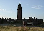
Ruchill Hospital water tower
|
55 ° 53 '12.8 " N , 4 ° 15' 56.7" W.55.886888888889 -4.26575
|
tower
|
33750
|
|
|
Kelvinbridge Parish Church
|
55 ° 52 '39.6 " N , 4 ° 16" 44.4 " W.55.877666666667 -4.279
|
church
|
33753
|

|
|
Queen's Cross Church
|
55 ° 52 ′ 49.1 ″ N , 4 ° 16 ′ 19 ″ W.55.880305555556 -4.2719444444444
|
church
|
33764
|

|
|
St Columba of Iona Roman Catholic Church
|
55 ° 52'35.3 " N , 4 ° 16'0" W.55.876472222222 -4.2666666666667
|
church
|
33765
|

|
|
St George's In the Fields
|
55 ° 52 ′ 26.8 " N , 4 ° 15 ′ 50" W.55.874111111111 -4.2638888888889
|
church
|
33782
|

|
|
St Mary's Church
|
55 ° 51 '13.9 " N , 4 ° 13' 36.2" W.55.853861111111 -4.2267222222222
|
church
|
33810
|

|
|
105-169 Bell Street
|
55 ° 51 ′ 26.6 " N , 4 ° 14 ′ 29" W.55.857388888889 -4.2413888888889
|
Residential buildings
|
33814
|
|
|
Roundabout at Bridgeton Cross
|
55 ° 50 '56.5 " N , 4 ° 13" 35.4 " W.55.849027777778 -4.2265
|
Shelter
|
33818
|
|
|
Alexander's School
|
55 ° 51 '34.4 " N , 4 ° 14" 7.5 " W.55.859555555556 -4.2354166666667
|
school
|
33827
|

|
|
Doulton Fountain
|
55 ° 51 '6 " N , 4 ° 14" 10.4 " W.55.851666666667 -4.2362222222222
|
Fountain
|
33836
|

|
|
Nelson Monument
|
55 ° 51 '5.4 " N , 4 ° 14" 26.4 " W.55.8515 -4.2406666666667
|
monument
|
33837
|

|
|
People's Palace
|
55 ° 51 '4.5 " N , 4 ° 14" 14.3 " W.55.85125 -4.2373055555556
|
museum
|
33838
|
|
|
Mercat Building
|
55 ° 51 '22.9 " N , 4 ° 14" 35.2 " W.55.856361111111 -4.2431111111111
|
Commercial building
|
33851
|
|
|
Church of the Sacred Heart
|
55 ° 50 '45.8 " N , 4 ° 13" 23.5 " W.55.846055555556 -4.2231944444444
|
church
|
33855
|
|
|
Templeton Carpet Factory
|
55 ° 51 ′ 1 ″ N , 4 ° 13 ′ 57.6 ″ W.55.850277777778 -4.2326666666667
|
Industrial building
|
33857
|
|
|
Provan Hall
|
55 ° 52 ′ 17.8 " N , 4 ° 7 ′ 52" W.55.871611111111 -4.1311111111111
|
Mansion
|
33863
|

|
|
Gartloch Hospital
|
55 ° 52 ′ 45.7 " N , 4 ° 6 ′ 21.1" W.55.879361111111 -4.1058611111111
|
hospital
|
33868
|

|
|
1-18 Walmer Crescent
|
55 ° 51 '7.9 " N , 4 ° 17' 44.2" W.55.852194444444 -4.2956111111111
|
Residential buildings
|
33876
|
|
|
St Andrew's East Church
|
55 ° 51 '47.2 " N , 4 ° 12' 30.9" W.55.863111111111 -4.2085833333333
|
church
|
33879
|

|
|
Saracen Fountain
|
55 ° 51 '52.3 " N , 4 ° 12' 29.7" W.55.864527777778 -4.20825
|
Fountain
|
33880
|
|
|
Glasgow Necropolis
|
55 ° 51 '45.8 " N , 4 ° 13' 52.4" W.55.862722222222 -4.2312222222222
|
graveyard
|
33890
|

|
|
Our Lady of Good Counsel Roman Catholic Church
|
55 ° 51 '45.4 " N , 4 ° 13" 20.6 " W.55.862611111111 -4.2223888888889
|
church
|
33891
|

|
|
Trinity Duke Street Church
|
55 ° 51 '31.6 " N , 4 ° 13' 47.3" W.55.858777777778 -4.2298055555556
|
church
|
33899
|
|
|
St Anne's Church
|
55 ° 51 '27.6 " N , 4 ° 12' 57.6" W.55.857666666667 -4.216
|
church
|
33912
|
|
|
52-54 Langside Drive
|
55 ° 48 '54.6 " N , 4 ° 16" 42.7 " W.55.815166666667 -4.2785277777778
|
villa
|
33936
|
|
|
Waverley Cinema
|
55 ° 49 '52.2 " N , 4 ° 16" 54.4 " W.55.831166666667 -4.2817777777778
|
movie theater
|
33941
|
|
|
Holmwood House
|
55 ° 48 '35.2 " N , 4 ° 15' 32.9" W.55.809777777778 -4.2591388888889
|
villa
|
33944
|

|
|
Pollokshaws Burgh Hall
|
55 ° 49 ′ 31.5 " N , 4 ° 17 ′ 54.1" W.55.825416666667 -4.2983611111111
|
public building
|
33953
|

|
|
Anniesland Court
|
55 ° 53 ′ 27.4 " N , 4 ° 19 ′ 30" W.55.890944444444 -4.325
|
Residential buildings
|
43034
|

|
|
Congregational Hall of St Andrew's East Church
|
55 ° 51 '46.8 " N , 4 ° 12' 29.7" W.55.863 -4.20825
|
Community Hall
|
48569
|
|
|
St Andrew's House
|
55 ° 52 '3.7 " N , 4 ° 15" 24.2 " W.55.867694444444 -4.2567222222222
|
Commercial building
|
50073
|

|
|
Burrell Collection
|
55 ° 49 ′ 51.2 " N , 4 ° 18 ′ 27.9" W.55.830888888889 -4.30775
|
museum
|
52002
|

|


.jpg)


.jpg)


.jpg)


.jpg)


.jpg)


_on_horseback_statue,_Glasgow_Cathedral_Square,_Scotland.jpg)
.jpg)


.jpg)


.jpg)


.jpg)

.jpg)

_BUCHANAN_STREET_AND_4_GORDON_STREET.jpg)


.jpg)


_(3839582240).jpg)


.jpg)


.jpg)


.jpg)


