
Lockwitzbach
|
Lockwitzbach Grimm's Water |
||
 Lockwitzbach and Lockwitzgrund in Lockwitz |
||
| Data | ||
| location | Osterzgebirge , Saxony , Germany | |
| River system | Elbe | |
| Drain over | Elbe → North Sea | |
| source | near Oberfrauendorf | |
| Source height | 570 m | |
| muzzle | in Dresden - Kleinzschachwitz in the Elbe Coordinates: 51 ° 1 '0 " N , 13 ° 50' 51" E 51 ° 1 '0 " N , 13 ° 50' 51" E |
|
| Mouth height | 117 m | |
| Height difference | 453 m
|
|
| Catchment area | 80 km² | |
| Discharge at the Kreischa A Eo gauge : 43.7 km². Location: 14.5 km above the mouth |
NNQ (09/18/1972) MNQ 1963–2014 MQ 1963–2014 Mq 1963–2014 MHQ 1963–2014 HHQ (08/13/2002) |
0 l / s 24 l / s 361 l / s 8.3 l / (s km²) 6.02 m³ / s 45 m³ / s |
| Left tributaries | Hirschbach , Wilischbach, Quohrener Bach, Possendorfer Bach | |
| Right tributaries | Langer Grundbach, Followbach, Hausdorfer Bach, Maltengraben | |
| Big cities | Dresden | |
| Communities | Kreischa , glassworks | |
The Lockwitzbach is a low mountain range in the Saxon Lower Eastern Ore Mountains and left tributary of the upper Elbe .
When the Lockwitzbach enters the Lockwitz district of Dresden , the 64-meter-high Lockwitztal Bridge, built between 2002 and 2005, spans the Lockwitztal to more than 700 meters.
Surname
Lockwitzbach as a word is based on Lockwitz and refers to itself: Lockwitz was first mentioned as "Lucawicz". "Luca" (cf. Czech. Louka for meadow or meadow ground ) roughly means Wiesenbach, Lockwitz therefore means "Dorf am Wiesenbach" ("Wicz" means village).
In the upper watercourse it is sometimes called Grimm's water . This name refers to the place Reinhardtsgrimma and the brook keeps it until the confluence of the Hirschbach, southeast of the Wilisch .
course


It rises in a at 570 m above sea level. NN lying headwaters above Oberfrauendorf with the water name Grimmsches Wasser .
On the 20 km long way to the north, the stream breaks through two lower mountain ranges. These are:
- the Wilischgrund , breakthrough valley through the Karsdorfer fault above Lungkwitz
- the Lockwitzgrund , a narrow valley section on the southern edge of the Elbe valley below Burgstädtel . Here he leaves the area of the Kreischa Basin , cuts metamorphic rocks of the Elbe Valley Slate Mountains that run from southeast to northwest and, at the southern exit of Lockwitz, in the area of the former Emil Donath juice press house, comes into contact with the Cambrian granodiorite from Dohna (about 535 mya old).
Between these there is a depression in the Kreischa , the Kreischa basin . It is a part of the Döhlen depression with rocks from the Rotliegend .
In Dresden, the brook south of Großzschachwitz is taken up by an old Elbarm , which it follows to the Laubegast district boundary . Here, with an almost right-angled bend in its course at the former sawmill, it breaks through a Quaternary embankment exactly on the border between Elbe gravel and Pleistocene sands . After a few meters, it flows into the Elbe between the Laubegast and Kleinzschachwitz districts of Dresden .
In the event of a flood , the Lockwitzbach feeds the Niedersedlitzer flood ditch , which flows into the Elbe with the more western Geberbach near Tolkewitz .
Old rivers
At the time of the Old Pleistocene and the early Elster Cold Age (1.8 to about 0.38 mya ), the Lockwitzbach, together with the Bahre , Seidewitz , Müglitz , Roten and Wilden Weißeritz , Triebisch and the Freiberg Mulde, formed the United Eastern Ore Mountains River , the traces of which are known as Relics of mixed gravel at Diera and Naundörfel are still preserved. Its mouth on the Elbe was near Althirschstein .
Old gravel terraces near Kleinluga show that the Lockwitzbach was temporarily pushed back in an easterly direction. During the ice age period, he filled up a mighty alluvial fan made of rubble in the Elbe valley. The sands in its estuary are now seen as the right Elbe wash-in ( sander ) of the meltwater during the Saale Ice Age .
Former mills


Many mills no longer exist, some have been rebuilt and serve other purposes.
At the Lockwitzbach:
- Upper mill Niederfrauendorf
- Middle mill (also Richtersmühle) Niederfrauendorf
- Niederfrauendorf Lower Mill
- Obermühle Reinhardtsgrimma
- Mittelmühle Reinhardtsgrimma
- Castle mill Reinhardtsgrimma
- Brettmühle (Niedermühle) Reinhardtsgrimma
- Hirschbachmühle Reinhardtsgrimma

- The location of the Hirschbachmühle was probably already used as such in the early 16th century. In 1651 a sawmill was built. In the meantime, the mill was owned by August the Strong (1670–1733), who had purchased it for 16,000 Meißnian guilders. The mill has been used as an inn since the 19th century. The current owners advertise that once Robert and Clara Schumann and more recently the famous tenor Peter Schreier were among his guests.
- Teufelsmühle (grinding mill of the Hausdorfer manor)
- Lungkwitzer Mühle Lungkwitz
- Brandmühle Kautzsch
- Hummelmühle Sobrigau
- Lobeckmühle Sobrigau (linseed oil mill, later part of the Otto Rüger chocolate factory as the “Lockwitzgrund” factory - “Obere Fabrik”)
- Schmidtsmühle Lockwitz (later a paper mill)
- Kakaomühle Lockwitz (also Hintermühle, part of the Otto Rüger chocolate factory - "Lower Factory")
- Obermühle Lockwitz (later the Blischke steam mill)
- Hänichenmühle (Mittelmühle) Lockwitz
- Niedermühle Lockwitz
- Dankelmannmühle in Niedersedlitz
- Old mill in Großzschachwitz
- Paper mill (later malting) in Kleinzschachwitz
- Sawmill split wood in Laubegast
At the Quohrener Bach:
- Grimmsmühle in Quohren near Kreischa
- Obermühle in Quohren
- Königsmühle (Hintermühle) in Quohren
- Mittelmühle Kreischa
- Schenkmühle Kreischa
- Ufermühle (Niedermühle) Kreischa
At the Possendorfer Bach :
- Zscheckwitzmühle ( Zscheckwitz near Kreischa)
- Hauswaldmühle Kreischa
Neighboring rivers

- southwest: Oelsabach → Rote Weißeritz → Weißeritz → Elbe
- northwest: Geberbach → Niedersedlitzer Flutgraben → Elbe
- east: Müglitz → Elbe
Flood
Above Reinhardtsgrimma it is dammed in the flood retention basin Reinhardtsgrimma .
In the urban area of Dresden, the Lockwitzbach represents a potential flood risk for numerous districts in the southeast.
gallery
- The Lockwitzbach

As an integrated watercourse in the Kreischa spa park

The Lockwitzbachtal at the Hummelmühle

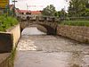
The road bridge in Dresden-Lockwitz
collected course in Dresden-Niedersedlitz, on the left the Niedersedlitzer flood ditch

last road bridge at the confluence with the Elbe


See also
- Lockwitztalbahn , a former interurban tram
- List of bodies of water in Saxony
- List of rivers in the Ore Mountains
literature
- Between Tharandt forest, Freital and the Lockwitztal (= values of our homeland . Volume 21). 1st edition. Akademie Verlag, Berlin 1973.
- Kathrin Lehmann: The Lockwitz - A water on the way to the Elbe. In: Petra Binder (ed.): Land calendar book for Saxon Switzerland and the Eastern Ore Mountains 2009. Schütze-Engler-Weber Verlag GbR, Dresden 2008, pp. 119–123, ISBN 978-3-936203-11-0 .
- W. Paelchen, H. Walter (Ed.): Geology of Saxony. Stuttgart (Schweizerbart) 2008, ISBN 978-3-510-65239-6 .
Web links
- Lockwitzbach on Stadtwiki Dresden
- Mills on the Lockwitzbach
Individual evidence
- ^ German Hydrological Yearbook Elbe Region, Part I 2014. (PDF) State Office for Flood Protection and Water Management Saxony-Anhalt, p. 110 , accessed on November 3, 2018 (from: lhw.sachsen-anhalt.de).
- ↑ Karel Kumprecht: Neubertovy slovníky "rarity" Nový Česko Německý-Slovník unique. Praze (Nakladatel A. Neubert Knihkupec) 1937, p. 209
- ^ H. Credner , R. Beck / F. Kossmat , K. Pietzsch : Geological special map of the Kingdom of Saxony, No. 82 sheet Kreischa. Royal Ministry of Finance (Ed.), Dresden 1890, 2nd edition 1912
- ↑ Paelchen, Walter: Geology of Saxony. 2008, p. 31
- ↑ G. Klemm, F. Etzold: Special Geological Map of the Kingdom of Saxony, Section Pillnitz-Weißig, Sheet No. 67. Königl. Finance Ministry (ed.), Dresden 1888, 2nd edition 1908
- ↑ Paelchen, Walter: Geology of Saxony . 2008, pp. 434-435, 447
- ↑ Valley of the Mills
- ↑ Hirschbachmühle website , accessed on January 19, 2020