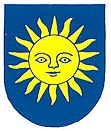
Luboměř
| Luboměř | ||||
|---|---|---|---|---|
|
||||
| Basic data | ||||
| State : |
|
|||
| Region : | Moravskoslezský kraj | |||
| District : | Nový Jičín | |||
| Area : | 762 ha | |||
| Geographic location : | 49 ° 41 ′ N , 17 ° 42 ′ E | |||
| Height: | 546 m nm | |||
| Residents : | 370 (Jan 1, 2019) | |||
| Postal code : | 742 35 | |||
| License plate : | T | |||
| structure | ||||
| Status: | local community | |||
| Districts: | 2 | |||
| administration | ||||
| Mayor : | Milada Šmatelková (status: 2009) | |||
| Address: | Luboměř 93 742 35 Luboměř |
|||
| Municipality number: | 599646 | |||
| Website : | www.lubomer.cz | |||
Luboměř ( German Laudmer ) is a municipality in Okres Nový Jičín in the Moravskoslezský kraj region in the Czech Republic .
location
Luboměř is located around 23 kilometers southeast of the town of Moravský Beroun and around 17 kilometers southeast of the military settlement Město Libavá .
history
The place Luboměř was first mentioned in 1394. From the first half of the 14th century until 1611 he was part of the neighboring Potštát domain . In 1611, Bernard Podstadtsky von Prussinowitz auf Potštát sold the village of Luboměř to Christina von Rogendorf and Mollenburg († 1621), who sided with the estates at the time of the Battle of White Mountain in addition to Spálov and Barnov .
Heltínov / Scherzdorf was founded as a settlement by Karl Ferdinand von Scherz in 1719.
In 1835 the district Luboměř had 93 houses with 635 inhabitants; the district of Heltínov then had 22 houses with 197 inhabitants.
After the Munich Agreement , the place was added to the German Reich and belonged to the Neu Titschein district until 1945 .
Local division
The districts Luboměř ( Laudmer ) and Heltínov ( Scherzdorf ) belong to the municipality Luboměř .
Individual evidence
- ↑ Český statistický úřad - The population of the Czech municipalities as of January 1, 2019 (PDF; 7.4 MiB)

