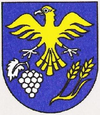
Modrany
| Modrany | ||
|---|---|---|
| coat of arms | map | |

|
|
|
| Basic data | ||
| State : | Slovakia | |
| Kraj : | Nitriansky kraj | |
| Okres : | Komarno | |
| Region : | Podunajsko | |
| Area : | 27.066 km² | |
| Residents : | 1,340 (Dec. 31, 2019) | |
| Population density : | 50 inhabitants per km² | |
| Height : | 128 m nm | |
| Postal code : | 946 33 | |
| Telephone code : | 0 35 | |
| Geographic location : | 47 ° 49 ' N , 18 ° 21' E | |
| License plate : | KN | |
| Kód obce : | 501263 | |
| structure | ||
| Community type : | local community | |
| Administration (as of November 2018) | ||
| Mayor : | Štefan Édes | |
| Address: | Obecný úrad Modrany Hlavná 337 946 33 Modrany |
|
| Website: | www.modrany.eu | |
| Statistics information on statistics.sk | ||
Modrany (up to 1948 Slovak "Madar"; Hungarian Madar ) is a municipality in the southwest of Slovakia with 1,340 inhabitants (as of December 31, 2019). It is located in Okres Komárno , part of the Nitriansky kraj .
geography
The municipality is located in the Slovak Danube lowlands at the southern end of the Pohronská pahorkatina part , in a small valley of the Modriansky creek . The northern part of the municipality is hilly with oak and robinia forest as well as vineyards and is covered by brown soils, while the lower corridor terrace with black soils is used for agriculture. The center of the village is located at an altitude of 131 m nm and is 16 kilometers from Hurbanovo and 23 kilometers from Komárno .
Neighboring communities are Pribeta in the north, Bátorove Kosihy in the east, Moča in the southeast, Radvaň nad Dunajom in the south, Šrobárová in the southwest, Mudroňovo in the west and Svätý Peter in the northwest.
history
The place was first mentioned in writing in 1205 as Modor , where royal falconers were based. Initially it belonged to the estate of Szolgagyőr Castle (located near today's Dvorníky parish ), in 1295 to the Archdiocese of Gran and the local families of Madari and Keszi , from 1485 to 1716 to the families of Pozsár , Sibrik and Maszlik, and from the 18th century to the family Gyulai . In 1763 the village was damaged by an earthquake. The inhabitants lived from forestry, agriculture and viticulture.
Until 1918/1919 the place in Komorn County belonged to the Kingdom of Hungary and then came to Czechoslovakia or now Slovakia. As a result of the First Vienna Arbitration Award , it was once again part of Hungary between 1938 and 1945. In 1951, today's Mudroňovo municipality was finally separated from Modrany after it had been independent between 1926 and 1938.
population
According to the 2011 census, Modrany had 1462 inhabitants, of which 1205 Magyars, 121 Slovaks, 112 Roma and four Czechs. 20 residents gave no information in this regard. 903 residents supported the Reformed Church, 441 residents the Roman Catholic Church, 18 residents to the Jehovah's Witnesses, 16 residents to the Evangelical Church AB, eleven residents to the Greek Catholic Church and one resident to the Baptists on the Seventh-day -Adventists as well as to the Evangelical-Methodist Church; one resident professed a different denomination. 24 residents had no denomination and the denomination of 45 residents was not determined.
Buildings
- Reformed church from the second half of the 18th century
- Catholic chapel from 1939
Individual evidence
- ↑ 2011 census by ethnicity (Slovak) ( Memento from October 6, 2014 in the Internet Archive )
- ↑ 2011 census by denomination (Slovak) ( Memento from September 7, 2012 in the Internet Archive )
Web links
- Entry on e-obce.sk (Slovak)


