
North German Lowlands

As a North German Plain , less aptly also North German Plain is called a landscape metropolitan areas in Germany, in the north of the coasts of the North and Baltic Sea and in the south of the Central European Low Mountain Range is limited and is part of the Central European lowlands . The North German lowland provides, in addition to low mountains, foothills and Alps, natural area a large region first order is.
In the western part of the Lower Saxony Uplands with the Teutoburg Forest , the Wiehen and Weser Mountains protrudes far to the northwest into the lowlands and partially separates the Westphalian Bay , which is also part of the lowlands . This is bordered in the south by the Sauerland north of the Süderbergland , which from the northwest is u. a. in history to Bergisch continues counting landscapes to the south. This continuation, together with the Eifel in the west, limits the Lower Rhine Bay , which stretches up the Rhine to around Bonn , where it meets the Siebengebirge in the southeast . The latter landscapes are all parts of the Rhenish Slate Mountains .
To the east of the Harz Mountains, which adjoin the north flank of the Lower Saxon mountainous region to the southeast, the lowland extends further south and stretches on the hill country of the Saxon loess region up to the Ore Mountains .
The north German lowlands continue seamlessly to the west ( Netherlands , small parts of Belgium ), north ( Denmark ) and east ( Poland ), and the term is occasionally used for the overall cross-border landscape.
Natural structure

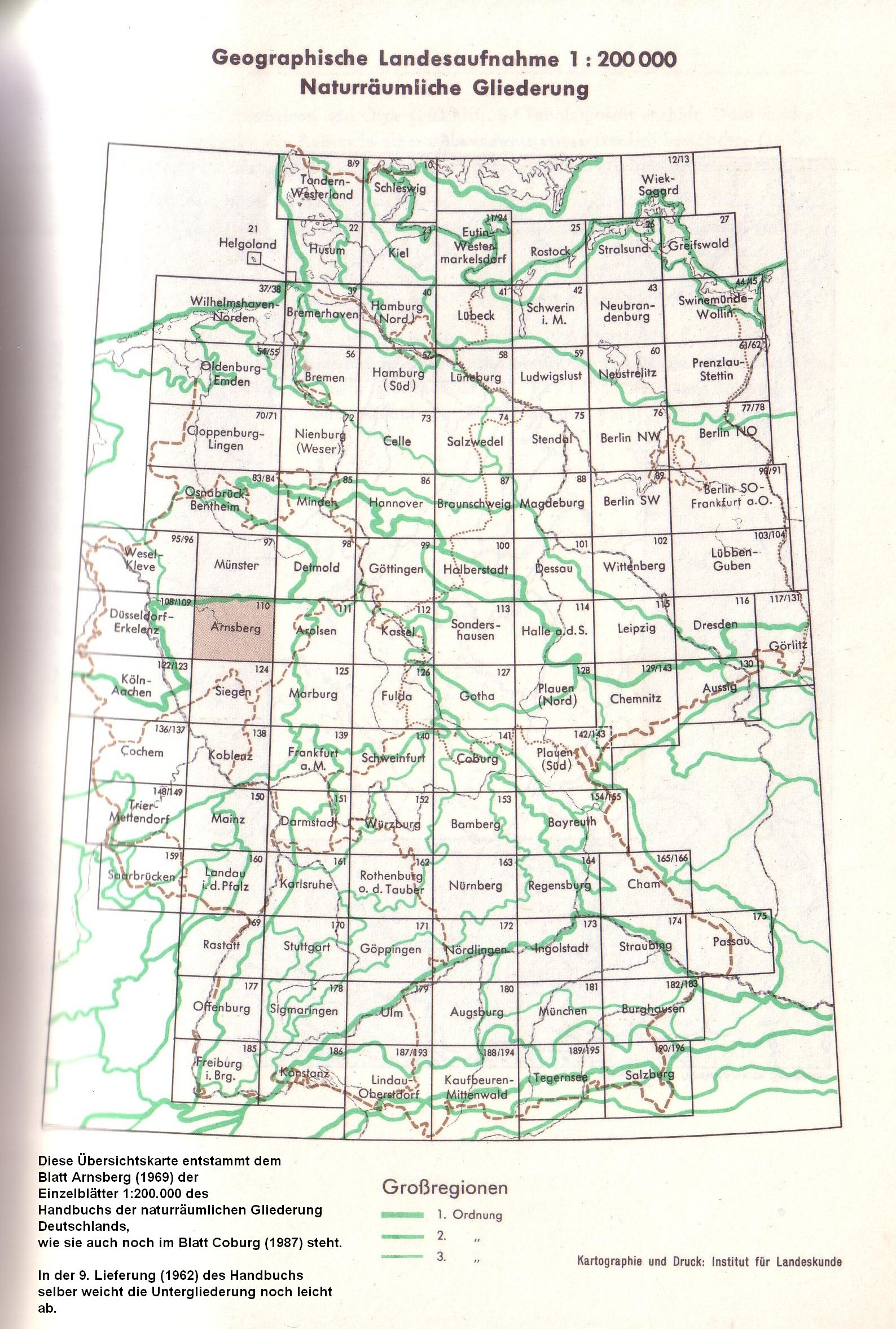
The majority of the North German lowlands lying in the territory of the Federal Republic of Germany has been divided into five major regions of the second order , the central part of which is finally divided into five major regions of the third order through work by the former Federal Institute for Regional Studies on the manual of the natural spatial structure of Germany and subsequent work as a major region of the first order . The large regions of the 3rd order were split up into one or more main unit groups with a two-digit code number, in each of which there are a maximum of ten, in individual cases more, three-digit main units. In Saxony, the division corresponds to the newer classification of natural areas in Saxony . Since the major regions of the 2nd order were only identified after the detailed work of the individual sheets 1: 200,000 , the limits of the 2nd order run across main unit groups or even main units in rare individual cases (especially Lößbörden). However, this does not affect the numbering.
The Federal Agency for Nature Conservation (BfN) has once again summarized some of these groups in an internal structure and renumbered the groups with a prefixed "D". However, this numbering is not compatible with the finer main and subdivisions, which is why it has not even caught on within the BfN.
For a better overview, the major regions of the 2nd order are listed from north to south, in the second line from west to east. Within a 2nd or 3rd order region, the listing then follows the preceding numbers according to the manual; the numbers according to BfN are put in brackets. Real large regions of the 3rd order are written in bold italics.
For better orientation, there are detail maps on the right of the lists, all of which are kept to the same scale.

Marshland
- 61 Ems- and Wesermarschen (D25)
- 67 Lower Elbe lowlands (Elbmarsch) (D24)
- 68 Schleswig-Holstein Marshes (D21)
Mecklenburg-Western Pomerania coastal area

- 71 Mecklenburg-Western Pomerania Coastal Area (D01)
North German Lake District
- 70 Schleswig-Holstein hill country (D23)
- Northeast Mecklenburg flatland with Oderhaff area (D02)
- 74 Backland of the Mecklenburg-Brandenburg Lake District (D03)
- 75 Mecklenburg Lake District (D04)
-
(to 80 Odertal (D07))
- Main unit 800 Lower Oder Valley Lowlands
- Main unit 801 sand terraces of the lower Oder valley

Central North German Lowland
-
Ems-Weser-Geest
- Dümmer-Geest lowlands and Ems-Hunte-Geest (D30)
- 60 East Frisian-Oldenburg Geest (D26)
- 62 Weser-Aller-Flachland (D31)
-
North Elbe Geest
- 63 Stader Geest (D27)
- 64 Lüneburg Heath (D28)
- 69 Schleswig-Holstein Geest (D22)

-
East German plateau and heathland
- Mecklenburg-Brandenburg plateau and hill country (D05)
- 79 East Brandenburg plate (D06)
-
(to 80 Odertal (D07))
- Main unit 802 Oderbruch (with Frankfurter Odertal)
- Main unit 803 Neuenhagener spur
- Lusatian Basin and Spreewald (D08)
-
Brandenburg Heath and Lake District (D12)
- 81 Central Brandenburg plateaus and lowlands
- 82 East Brandenburg Heath and Lake District
- 83 Spreewald
- 84 Lusatian basin and heathland
- 85 Fläming (D11)
- 86 Wendland and Altmark (D29)
- 87 Elbe valley lowlands (D09)
- 88 Elbe-Mulde-Lowland (D10)
- 89 Oberlausitzer Heidelandschaft (D13)

- 54 Westphalian Bay (Münsterländische Tieflandbucht) (D34)
-
Lower Rhine lowlands and Cologne Bay (D35)
- 55 Cologne Bay (Lower Rhine Bay)
- 57 Lower Rhine lowlands
Loessbörden
-
(to 44 Upper Lusatia (D14))
- Main units 440 and 442 to 444
- Saxon hill country and Erzgebirge foothills (D19)
- 45 Erzgebirge Foreland
- 46 Saxon hill country (including Leipziger Land )
- 50 Central German black earth region (also: Eastern Harz foreland and Börden ; D20)
- 51 Northern Harz Foreland (D33)
- 52 Lower Saxony Börden (D32)
-
(to Dümmer-Geestniederung and Ems-Hunte-Geest (D30))
-
(to 58 Dümmer-Geestniederung )
- Main Unit 582, south of 583
-
(to 58 Dümmer-Geestniederung )
-
(to 62 Weser-Aller-Flachland (D31))
- Main unit 628
Geology, landscape, soils and their formation

Geologically, the North German Plain is part of the North German Basin . Its upper, unconsolidated sediments were deposited and formed by the repeated succession of cold and warm periods with different marginal locations of the Scandinavian inland ice in the current ice age , the Quaternary . Its lower rock layers are partly of mining importance because of the salt , natural gas and oil deposits .
In the last ice age , northern Germany Weichselkaltzeit called the North German Plain was marked differently depending on whether the area was still hit by ice and as kuppiges young moraine left behind, or whether it of periglacial reshaped processes and flächenhafterem older glaciation periods prevail was. The lowest points are in fens and old marshland on the edge of Geestrücken in the west of Schleswig-Holstein ( Wilstermarsch : 3.5 meters below sea level) and in northwest Lower Saxony (near Freepsum: 2.3 meters below sea level). The highest elevations are found in the area of terminal moraines , either in the Saale period as in the Fläming (200 m above sea level) and the Lüneburg Heath (169 m above sea level) and the Bungsberg (168 m above sea level) or in the Vistula period such as the Helpter mountains (179 m above sea level). Formerly extensive ombrogenic raised bogs emerged in western and northern Lower Saxony post-glacial in warm periods with high precipitation (compare: Atlantic Ocean ).
The coastal areas consist of Holocene sea and river marshes or a lagoon landscape , which is followed by the Pleistocene old and young moraine landscape in various forms and weathering stages. In areas that had become ice-free and covered by meltwater sands, drifting sand dunes often formed, which were later defined by the vegetation . Human interventions later created open heathland areas like in the Lüneburg Heath and caused extensive impoverishment ( podsolization ) of the soil through deforestation and pest management and a renewed revival of the dune formation. The most fertile soils are the young marshes (Auen- Vegen ) and the Börden ( Magdeburger Börde , Soester Börde , Hildesheimer Börde ) with their loess soils and around 90 soil points . The poorest soils are the bog - peat , for example, in Teufelsmoor with less than 10 points on the ground. The loess areas of the lowlands belong to the Altsiedelland , the earliest settled areas in Germany ( Bandkeramische Kultur ).
In the geomorphologically particularly young northeastern part ( Jungmoränenland ) there is a multitude of lakes (including the Mecklenburg Lake District with the Müritz ) as relics of the last Ice Age. The receding glaciers left this landscape about 13,000 to 16,000 years ago. The surface shape in the north-west German Geest (Lower Saxony and western Schleswig-Holstein), on the other hand, is already significantly more weathered and leveled ( old moraine ), as the last large-scale glaciations here were at least 130,000 years ago.
The Rhine , Ems , Weser , Elbe and Havel are the most important rivers that drain the North German lowlands into the North Sea and in their lowlands created alluvial and swamp forests such as the Spreewald . Only a small part of the area belongs to the Oder and Neisse catchment areas and thus drains into the Baltic Sea.
Climate and vegetation
.jpg)

The Euoceanic climate characterizes the North Sea coast and the offshore East Frisian Islands and North Frisian Islands . A broad strip of oceanic (= Atlantic) or sub- oceanic climate connects to the south , which stretches from the east coast of Schleswig-Holstein to the western edges of the low mountain range. To the southeast and east the climate gradually becomes subcontinental; among other things, the temperature differences between summer and winter are gradually increasing. In the rain shadow of the Harz Mountains and some smaller elevations such as the Drawehn and the Fläming, a partly drier, continental local climate has developed . Microclimatic peculiarities are found in moors and heaths (with a rather unfavorable climate for agriculture ) and, for example, in the Altes Land near Hamburg , which is characterized by relatively mild temperatures of the North Sea and Lower Elbe all year round and is therefore a traditional fruit-growing area .
Azonal vegetation complexes of moors, alluvial forests, quarry forests and bodies of water were originally present on the Ems, Weser, Elbe, Havel and Spree. Pronounced salt marshes , tidal flats and Tideröhrichte the estuaries kept permanently on the flat North Sea coast in the intertidal zone . According to prevailing doctrine, the zonal vegetation of the north German lowlands is largely the association of the beech forests .
literature
- Heinz Ellenberg : Vegetation of Central Europe with the Alps from an ecological, dynamic and historical perspective. 5th, heavily changed and improved edition. Ulmer, Stuttgart 1996, ISBN 3-8001-2696-6 .
- H. Girard: The north German plain, especially between the Elbe and the Vistula, is shown geologically . Berlin 1855 ( full text )
- Margot Böse, Jürgen Ehlers, Frank Lehmkuhl: Germany's north - from ancient times to the present . Springer, Berlin / Heidelberg 2018, ISBN 978-3-662-55372-5 .