Place-name sign (Germany)

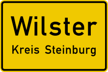
Sign 311
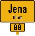
place-name sign (back), example sign of the road traffic regulations "exit" Wilster, direction Schotten (distance: 6 km) |
The place-name sign (colloquially also place-name sign ) in Germany denotes the beginning or the end of a place and is usually set up on incoming and outgoing streets in the local area . On the one hand, place-name signs provide information about the place name, and as traffic signs they are an essential part of road traffic law , for example for the start of speed restrictions within a built-up area. Accordingly, the back of the place-name sign is an indication that the restrictions should be lifted again. The maintenance burden for a street often begins and ends at the exit sign.
Character types
Place-name signs
The signs, which were uniformly regulated throughout Germany for the first time with the Reich Road Traffic Regulations of May 28, 1934, are now traffic signs 310 and 311 according to Appendix 3 to Section 42 Paragraph 2 StVO undeveloped land the closed development begins or ends on one of the two sides of the street.
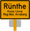
In addition to the name of the village, place-name signs also indicate administrative affiliations such as the municipality name and the district . They mark the beginning of the built -up area . Often city names on place-name signs are given an additional designation for the city such as district town , large district town , university town , state capital or, in the case of Bonn, federal city .
The exit signs in the Federal Republic of Germany (FRG) have been divided into two fields since 1976 . The lower field on a yellow background indicates the place that is just ending. This is crossed out with a red, diagonal line. Above it is also highlighted in yellow, the next place with a distance in kilometers. Since 1992 there has been an additional variant of the exit sign. The next place is announced in a white box. These boards are set up if the place you have just passed through belongs to the same municipality as the next.
The typographic design is based on the font family defined by DIN 1451 , the current version of which was announced in 1980 in the Verkehrsblatt and published in 1981.
The dimensions of the place-name signs are standardized. Basically two sizes are allowed: 900 × 600 millimeters and 1200 × 850 millimeters. As a rule, the smaller versions are used for reasons of cost and because they are less susceptible to wind, the larger ones are installed at motorway exits, for example. Place signs are not necessarily at the town limits; they should be set up at the beginning or end of the built-up area. Despite their local character, some places are not marked as urban areas.
The modern type of German place-name signs have changed their typographical specifications, their size, design and color several times in the course of their history. However, since the basic principle of their appearance has been retained throughout, the recognition value has grown steadily over generations. Until the 1960s, the boards were still often made by sign painters and, despite clear legal requirements, often showed various deviations. This only changed with the ever faster modern production processes. With the beginning of the use of computer technology for the production of traffic signs in the 1970s, a standardization that had never been achieved before was achieved.
- Development of place-name signs in the German Empire
Image d 2
Place-name sign (back) - example sign from 1934, direction Herford (distance: 11 km), including the long-distance road numbers
In the German Democratic Republic (GDR), the appearance of the place-name signs with slightly different colors and lettering developed optically almost parallel to the West German style, even if these innovations were only introduced a few years after the relevant ordinances in the Federal Republic of Germany. Even after the introduction of the West German Road Traffic Regulations in 1971 , which for the first time made further changes to the previous appearance, the East German signs retained their appearance, which was prescribed in 1964, until 1977. The same can be observed after the introduction of the FRG amendment of 1956 , when a modernized form of the place name sign with rounded corners was arranged for the first time in West Germany.
In the German Democratic Republic, those responsible only took the same step with the Road Traffic Regulations of 1964 . The TGL standards ( technical standards, quality regulations and delivery conditions ) established in the GDR , which became effective in the traffic signs sector especially from the 1960s and were intended to replace the DIN standards, were subject to much more frequent changes than the corresponding DIN standards in the West . In particular, the sometimes relatively rapid change in the visual appearance of some important traffic signs and the rapid change in the TGL standard fonts often caused a wide gap between demands and reality in the street scene. Only with the GDR-StVO introduced in 1978 in which the standard font was changed again, a far-reaching standardization could be achieved, especially with the place-name signs, by 1990.
- Development of place-name signs in the FRG
- Development of place-name signs in the GDR
- Current place-name signs with unusual content
Heiligenstedtenerkamp, the place-name sign with the longest connected name in Germany
Ilmenau , entrance from the direction of Neustadt
Federal city of Bonn , district of Bad Godesberg
Content-rich place-name sign in Boltenhagen
Gera (as a strong contrast to Boltenhagen)
Gescher town sign with the addition Glockenstadt
Illuminated place-name sign of Ehingen (Danube)
Special place-name sign with political message, Marl
Reference to the art exhibition in Kassel
Temporary plaque in Großenhain after a theft
The Mönchhof belongs to two cities: Raunheim and Kelsterbach
- Place-name signs with the addition of customs border district
Place name sign for the suburb of Wildenau (Selb) produced before 1980/81
Wiechs am Randen town sign
Place name sign Kressbronn on Lake Constance
- Common place-name signs
Groß Nordende left, Heidgraben right
Cross-district: Scheuerfeld (independent city of Coburg ) and Weitramsdorf - Weidach district Vogelherd (district of Coburg)
Bilingual signposted place-name signs
In some parts of the country the signs are bilingual, in German and
- Upper or Lower Sorbian in the Sorbian settlement area in Lusatia ,
- North Frisian in North Frisia and Sater Frisian in Saterland ,
- Low German in Lower Saxony and Schleswig-Holstein ,
- Danish in southern Schleswig .
With the TGL 10629, which became binding on January 1, 1968 , bilingual place-name signs for the regions inhabited by minorities were anchored in the road traffic regulations of the GDR.
In Schleswig-Holstein the use of bilingual boards was decreed on June 12, 2007. Multilingualism was favored by the European Charter of Regional or Minority Languages of 1992. The place name in the minority language is usually set smaller in Germany. In Brandenburg , both names have to be given in the same font size since 2014, in Saxony since 2019.
- Examples of bilingual place-name signs
German-Low German (Ostfriesisches Platt) place-name sign in Aurich in East Friesland
after the reunification: Uhyst / Delni Wujězd
German-Upper Sorbian place-name sign in Bautzen in Upper Lusatia
German-Lower Sorbian place-name sign in Cottbus in Niederlausitz , both with the same font size
German-North Frisian place-name sign in Dagebüll in North Frisia
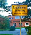
German-Low German place-name sign in Emlichheim ( Grafschaft Bentheim )
German-Danish place-name sign in Flensburg
Location information boards and district boards
Location signs (sign 385 according to Annex 3 to Section 42 Paragraph 2 StVO) have been green traffic signs with yellow letters and a yellow border since the road traffic regulations that were announced in 1970 came into force . They serve as a guideline for information about the names of localities that do not represent closed localities in the area of a thoroughfare in the sense of the road traffic regulations. Signposts are also bilingual in the corresponding regions.
In addition to these place information boards, separate boards were provided for the identification of individual districts until 2017, which provided information in black letters and with a black frame.
Traffic rules
Special traffic rules apply within a built-up area. Some examples are not exhaustive:
-
Speed limit to 50 km / h for all vehicles (see § 3 Paragraph 3 No. 1 StVO). In addition to sign 274
 , higher maximum speeds are permitted ( Section 41 Annex 2 StVO ).
 - Free choice of lanes for vehicles with a gross vehicle weight of up to 3.5 t on lanes with more than one marked lane in the relevant direction, except on motorways. The right driving is so far removed, can be driven faster than the left to the right lane (see § 7 para. 3 StVO).
-
No parking 5 m in front of a St. Andrew's cross (sign 201
 ) (see § 41 Annex 2 StVO); in contrast outside built-up areas 50 m.
 - Prohibition of regular parking with trucks over 7.5 t gross vehicle weight in pure and general residential areas as well as spa and clinic areas (see parking ban regulation , § 12 para. 3a StVO).
- When parking in the dark, parking lights are sufficient (see Section 17 (4) of the StVO).
- The intention to overtake must not be announced by horn or headlight flasher (see Section 16 (1) StVO).
- No parking is prohibited on priority roads (sign 306
 ) ( Section 42 Annex 3 StVO ).


