
Place name sign (Württemberg)

In the Kingdom of Württemberg were signposts installed in every community and were originally used for orientation local stranger. In contrast to today's place-name signs , however, they were not placed at the entrance to the village, but were either at the town hall , another public building or on a pillar called a local stock at a central place in the town.
From 1876 onwards, at the urging of the military administration, the town signs were supplemented with information about the Landwehr battalion and company districts. With this addition, the place-name signs were sometimes also referred to as troop panels.
At the latest with the conversion of the upper offices in counties in the 1930s, signposts were largely suspended. The place-name signs that have remained in public space are now considered to be minor monuments and are evidence of the administrative and military history of Württemberg.
history


Local and Oberamtsstocks were set up in the kingdom as early as 1811 in order to provide orientation for non-residents. At the beginning they were mostly made of wood, occasionally stone steles were also set up. The Oberamt was mentioned in the first line of the board, the place name in the line below. The place name was also referred to as hamlet , parish hamlet , village , parish village , parish , part or staff parish , city or district town .
From 1863 the wooden place-name signs were gradually replaced by cast iron variants . Uniform patterns were created as a template for the boards and chapels and were finally cast and sold by the Königlich Württembergischen Hüttenwerke in Wasseralfingen , Königsbronn and Schussenried . The iron and steel works published catalogs with price lists for the communities, in which the sample boards were shown.
The board was painted white with black highlighted writing, the border bronzed. The local stock that went with it had an octagonal base made of bronzed cast iron. While the pillar on top was painted in the black and red national colors, the protruding part of the pillar remained entirely in red and was covered with a bronzed cap. If necessary, additional signposts could be installed on the local floors.
The Württemberg Ministry of War saw the place-name signs as a way of indicating to the teams on leave of absence that they belong to their Landwehr battalion or company by adding the respective Landwehr battalion and company district . In addition, men who had just moved into a community were to be reminded in a simple way of their obligation to register.
Since the War Ministry itself had no way of influencing the communities by law, it asked the Ministry of the Interior for administrative assistance in 1876 . As a result, the request for a decision reached King Charles I , who decided in favor of the military. As a result, there was decree No. 7654 of November 21, 1876, in which the Ministry of the Interior instructed the higher offices to influence the municipalities to provide the town signs with the relevant information on the Landwehr battalion and company districts for new acquisitions and repairs should be.
With this addition, the sign was 50 cm high and 65 cm wide.
Since the costs of the place-name signs had to be borne by the communities and the decree of the Ministry of the Interior did not provide for any sanctions, there was resistance and delays in implementation from the start. The municipalities pointed to the high costs and felt that more urgent needs had to be met first. It was not until January 1878 that the higher offices were able to report execution for the approximately 4,000 parishes of the kingdom, although there were still a few exceptions. The Oberamt Schorndorf reported in July 1878, for example, that no further place-name signs had been put up by the municipalities since February 14, 1878, despite the action of the Oberamt. The implementation of the decree was also delayed in other higher offices. For example, the municipality of Rudersberg in the Oberamt Welzheim and the cities of Bietigheim ( Oberamt Besigheim ) and Niederstetten ( Oberamt Gerabronn ) remained behind. The important garrison town of Ludwigsburg was also lagging behind with implementation . It was not until 1879 that these communities could be persuaded to purchase their place-name signs.
In the case of some communities and hamlets, in the absence of other suitable prominent points, the height of the sea level was given in the Oberamt descriptions , which was measured on the town sign.
After the First World War , the place-name signs lost their military purpose and only retained their task of indicating the Oberamt and the community to strangers. The administrative reforms in Württemberg did not spare the town signs either. The Cannstatt Oberamt was dissolved as early as 1923, making the town signs obsolete. Most of the remaining place-name signs in Württemberg disappeared with the major district reform in 1938 at the latest. Many of them were melted down or used as covers for manholes or manure pits .
Since 2001, in Baden-Württemberg the piece of collaborative Swabian homeland Federal , the Swabian Alp Association , the Black Forest Association , the National Association Badische home and the Society for the Preservation and exploration of small monuments in cooperation with the State Conservation Office Baden-Wuerttemberg captures the small monuments in the country and documented, whereby the remaining place-name signs and the town blocks are also recorded. Local signs are also being restored or reconstructed through municipal or private initiative and re-attached to publicly accessible places.
The Spaichinger town sign

After the State Handbook for 1828 no longer listed Spaichingen as a “city” due to a lack of written documents, Spaichingen tried to underpin the supposed city law.
According to the Spaiching city fathers, this was awarded in 1811 by King Friedrich I while he was passing through, and the then senior bailiff Hezinger opened it up to the Spaichingen residents.
In the absence of documents and witnesses (both King Friedrich and Oberamtmann Hezinger had died in 1816), the place listed its place-name sign as “evidence”, which after all was called “Oberamtsstadt”. But even this argument could not support the alleged city law.
It was not until the town charter granted by King Wilhelm I in 1828 that the situation ended with the desired result for the town, which had 1500 inhabitants at the time, and the place-name sign had the title of the town as a "legal" town.
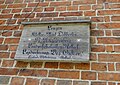
Place-name signs remaining in public space (selection)

Most of the historical place-name signs and town blocks have been removed or exhibited in museums . In some cases, there are still place-name signs in public space or have been put up again.
Casts of the remaining historical place-name signs in the area of today's Rems-Murr district were placed in the district building in Waiblingen , the originals are kept on site or at the respective communities.
Church at that time |
designation | Oberamt | Today's church |
district | Type (sample) | Location |
|---|---|---|---|---|---|---|
| Lossburg | Parish village | Freudenstadt | Lossburg | Freudenstadt | Ortsstock (1876) | |
| Lindach | Parish village | Gmuend | Schwäbisch Gmünd | Ostalbkreis | Place-name sign (1876) | Refuge of the Swabian Alb Association |
| Pfahlbronn | local community | Welzheim | Alfdorf | Rems-Murr district | Place-name sign (1876) | town hall |
| Rietenau | Parish village | Backnang | Aspach | Rems-Murr district | Place-name sign (1876) | |
| Büttelbronn | hamlet | Öhringen | Öhringen | Hohenlohe district | Ortsstock (1876) | Village square |
| Deufringen | Parish village | Boeblingen | Aidlingen | Boeblingen | Ortsstock (1863) | |
| Lehenweiler | hamlet | Boeblingen | Aidlingen | Boeblingen | Granite stone (1811) | Village center |
| Hanweiler | Village | Waiblingen | Winnenden | Rems-Murr district | Place-name sign (1876) | Town center |
| Unter-Regenbach | hamlet | Gerabronn | Langenburg | Schwäbisch Hall | Ortsstock (1876) | Town center |
| Sigisweiler | hamlet | Gerabronn | Schrozberg | Schwäbisch Hall | Ortsstock (1876) | Town center |
| Elzhausen | hamlet | Hall | Braunsbach | Schwäbisch Hall | Ortsstock (1876) | Entrance |
| Bühler rooms | hamlet | Hall | Braunsbach | Schwäbisch Hall | Ortsstock (1876) | Town center |
| Eschenau | hamlet | Hall | Vellberg | Schwäbisch Hall | Place-name sign (1876) | At the Rose Inn |
| Vellberg | city | Hall | Vellberg | Schwäbisch Hall | Place-name sign (1876) | In the town |
| Blaubach | Sub-municipality | Gerabronn | Blue heroes | Schwäbisch Hall | Ortsstock (1876) | Village entrance |
| Courtship wood | Village | Nürtingen | Beuren | Esslingen | Place-name sign (1876) | town hall |
| Unterwaldhausen | Parish village | Saulgau | Unterwaldhausen | Ravensburg | Place-name sign (1876) | town hall |
| Oberwaldhausen | hamlet | Saulgau | Unterwaldhausen | Ravensburg | Place-name sign (1876) | town hall |
| Sulzbach an der Murr | Pfarrdorf u. Market town | Backnang | Sulzbach an der Murr | Rems-Murr district | Place-name sign (1876) | town hall |
Place-name signs in other German states
In other German federal states, too, there were comparable place-name signs that mostly followed the Prussian model.
Wooden place-name sign ( Mecklenburg-Schwerin )
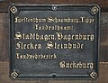
Cast iron plate ( Schaumburg-Lippe )

Signpost and place-name sign ( Kingdom of Bavaria )
_Schild_2011-05-24_208.JPG)


literature
- Walter Wannenwetsch: Documents made of iron. ( Memento from February 17, 2013 in the web archive archive.today ) In: An Rems and Murr. Half-yearly issues for home and culture. No. 29, June 1988. (reproduced on the website of the large district town of Winnenden, accessed on January 5, 2013). Archive version of February 17, 2013; accessed on December 8, 2017
- Walter Wannenwetsch, Renate Winkelbach: Administrative spaces - living spaces: Pictures tell from the history of the Rems-Murr district. published by the Rems-Murr-Kreis district office (district archive). Verlag Bernhard Albert Greiner, 2002, ISBN 3-935383-12-6 , pp. 19-22.
Web links
- “Memorable find in a coke cellar” , in the Backnanger district newspaper of July 7, 2012; Retrieved January 5, 2013
- On the trail of the puzzle of the blackboard. In: Reutlinger General-Anzeiger . November 12, 2011, accessed January 6, 2013
Remarks
- ↑ Historical photographs show place-name signs, for example at the village fountain, the village square or the village shell
- ↑ After the amalgamation of the municipalities, the sub-municipality that led the administrative seat of the entire municipality was referred to as the “staff municipality”
- ↑ At the same time the design of the upper office boundary lines and the signposts were regulated, which followed the same design pattern
Individual evidence
- ↑ "Altvordere insist on city status" from June 13, 2008 on schwaebische.de; Retrieved January 5, 2013.
- ↑ Historical place-name sign of Lossburg 2001 on leo-bw.de
- ↑ www.buettelbronn.de
- ↑ a b Hans Mozer: Small monuments on the Aidlinger district. In: www.zeitreise-bb.de. December 2002, accessed February 5, 2018 .
- ↑ Reinhard Wolf , Ulrike Plate, Martina Blaschka: The small monuments project is in the third round (2010/2011). on the website of the Swabian Heimatbund ; Retrieved January 5, 2013.
- ↑ Internet presence of the community of Blaufelden ( Memento from February 17, 2013 in the web archive archive.today ), accessed on January 13, 2013. Archive version from February 17, 2013; accessed on December 8, 2017