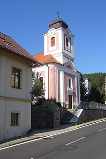
Perštejn
| Perštejn | ||||
|---|---|---|---|---|
|
||||
| Basic data | ||||
| State : |
|
|||
| Region : | Ústecký kraj | |||
| District : | Chomutov | |||
| Area : | 2058.1199 ha | |||
| Geographic location : | 50 ° 23 ' N , 13 ° 7' E | |||
| Height: | 365 m nm | |||
| Residents : | 1,145 (Jan 1, 2019) | |||
| Postal code : | 431 63 | |||
| License plate : | U | |||
| traffic | ||||
| Street: | Klášterec nad Ohří - Karlovy Vary | |||
| Next international airport : | Karlovy Vary Airport | |||
| structure | ||||
| Status: | local community | |||
| Districts: | 7th | |||
| administration | ||||
| Mayor : | Jiří Rajmann (as of 2018) | |||
| Address: | Hlavní 159 431 63 Perštejn |
|||
| Municipality number: | 563285 | |||
| Website : | www.obec-perstejn.cz | |||
| Location of Perštejn in the Chomutov district | ||||

|
||||
Perštejn (German Pürstein ) is a municipality in the Czech Republic . It is located in the valley of the Eger between the Ore Mountains and the Duppau Mountains and belongs to the Okres Chomutov .
geography
Geographical location
Due to its location, the place was previously also known as the Meran of the Ore Mountains. Perštejn Castle is not far from the village .
Community structure
The municipality of Perštejn consists of the districts Černýš ( Tschirnitz ), Lužný ( Aubach ), Ondřejov ( Endersgrün ), Perštejn ( Pürstein ), Rájov ( rows ), Údolíčko ( Kleinthal ) and Vykmanov ( Weigensdorf ).
The municipality is divided into the cadastral districts of Černýš, Ondřejov u Perštejna, Perštejn, Rájov u Perštejna and Vykmanov u Měděnce.
traffic
Perštejn has a train station on the Chomutov – Cheb line . The station is about 1 km south of the town center on the other bank of the Ohře . First class road No. 13 runs a little south of the town . The nearest airport is Karlovy Vary Airport .
Neighboring places
| Loučná pod Klínovcem (Bohemian Wiesenthal) | Kovářská (Forge Hill ) | Měděnec (Copper Mountain) |
| Stráž nad Ohří (Warta) |

|
Klášterec nad Ohří (Klösterle on the Eger) |
| Okounov (Okenau) |


