Domašín
| Domašín | ||||
|---|---|---|---|---|
|
||||
| Basic data | ||||
| State : |
|
|||
| Region : | Ústecký kraj | |||
| District : | Chomutov | |||
| Area : | 1579.5647 ha | |||
| Geographic location : | 50 ° 26 ' N , 13 ° 10' E | |||
| Height: | 568 m nm | |||
| Residents : | 184 (Jan. 1, 2019) | |||
| Postal code : | 431 51 | |||
| License plate : | U | |||
| structure | ||||
| Status: | local community | |||
| Districts: | 4th | |||
| administration | ||||
| Mayor : | Štěpánka Lišková (as of 2007) | |||
| Address: | Louchov 20 431 51 Domašín |
|||
| Municipality number: | 563048 | |||
| Website : | www.obec-domasin.cz | |||
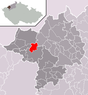
| Location of Domašín in the Chomutov district | ||||

|
||||
Domašín ( German Tomitschan ) is a municipality in Ústecký kraj in the Czech Republic .
geography
location
Domašín is about six kilometers north of Klášterec nad Ohří on the southern slope of the Ore Mountains .
Local division
The municipality of Domašín consists of the districts Domašín ( Tomitschan ), Louchov ( Laucha ), Nová Víska ( Neudörfel b. Reischdorf ) and Petlery ( beggars ). Basic settlement units are Domašín, Louchov, Nová Víska, Petlery and Podmilesy ( Pöllma ). The Krčma ( Kretscham ) desert also belongs to Domašín .
The municipality is divided into the cadastral districts of Domašín u Klášterce nad Ohří, Louchov, Nová Víska u Domašína, Petlery and Podmilesy.
Neighboring places
| Kryštofovy Hamry (Christophhammer) | ||
| Měděnec (Copper Mountain) |

|
Výsluní (Sun Mountain) |
| Klášterec nad Ohří (Klösterle on the Eger) |
history
The origin of the village name comes from the proper name Domaslav (Domaš) and referred to Domašův Hof. The village was also called Thomaczin, Tometschen, Domaczino, Tamiczow and with the German official name Tomitschan .
The first written message comes from 1431. At that time the property was shared between Alesch and Wilhelm von Schönburg on the basis of a contract. Half of the village went to each of him. In 1449 it was bought by Wilhelm von Ileburg as part of the Neu Schönburg estate, but in 1453 he ceded it to his creditors to the von Vitzthum brothers, Andreas von Kauffungen and Nikolaus Pflugk . In 1552 Bohuslav Felix von Lobkowicz received the royal permit to buy Vernéřov and the hereditary villages of the Schönburg family. From this point on, the village belonged to the rule of Wernsdorf. The Lobkowicz lost the village in 1594 when Georg Popel von Lobkowicz fell out of favor with Emperor Rudolf II and his property was confiscated. In 1606 the royal treasury sold the village to Elias Schmidtgräbner von Lustenegg, who became the hereditary owner. Because of his participation in the Battle of the White Mountain in 1622 his goods were confiscated and passed on to Jaroslav Borsita Count von Martinic . A year later the daughter of the original owner Schmidtgräbner got the village back, whose family kept it until 1700. The next owner was Wenzel Ernst, Margrave of Bayreuth . After his death in 1740 Wenzel Chotek von Chotkow took over the rule. There were still a few changes of ownership until 1857, when Hugo Korb von Weidenheim settled in the village, whose family owned the estate until 1945.
Tomitschan was part of the Luditz district from the middle of the 19th century .
Development of the population
|
|
|
economy
As early as the 14th century, Italian prospectors had been collecting agates in the village , which were used for mosaics . In 1623 viticulture began in the village . However, most of the population was engaged in agriculture and livestock. From the beginning of the 18th century, Wenzel Ernst Markgraf von Bayreuth set up a weapons factory. This was headed by the armorer Johann Wenzel Nitsch from 1766 .
Web links
Individual evidence
- ↑ http://www.uir.cz/obec/563048/Domasin
- ↑ Český statistický úřad - The population of the Czech municipalities as of January 1, 2019 (PDF; 7.4 MiB)
- ↑ http://www.uir.cz/casti-obce-obec/563048/Obec-Domasin
- ↑ http://www.uir.cz/zsj-obec/563048/Obec-Domasin
- ↑ http://www.uir.cz/katastralni-uzemi-obec/563048/Obec-Domasin
- ↑ Historický lexikon obcí České republiky - 1869-2015. Český statistický úřad, December 18, 2015, accessed on February 17, 2016 (Czech).

