Měděnec
| Měděnec | ||||
|---|---|---|---|---|
|
||||
| Basic data | ||||
| State : |
|
|||
| Region : | Ústecký kraj | |||
| District : | Chomutov | |||
| Area : | 1280 ha | |||
| Geographic location : | 50 ° 25 ' N , 13 ° 7' E | |||
| Height: | 845 m nm | |||
| Residents : | 139 (Jan. 1, 2019) | |||
| Postal code : | 431 84 | |||
| License plate : | U | |||
| traffic | ||||
| Street: | Výsluní - Loučná pod Klínovcem | |||
| Railway connection: | Chomutov – Vejprty | |||
| structure | ||||
| Status: | local community | |||
| Districts: | 6th | |||
| administration | ||||
| Mayor : | Valerie Marková (as of 2007) | |||
| Address: | Nádražní 212 43184 Měděnec |
|||
| Municipality number: | 563226 | |||
| Website : | www.medenec.cz | |||
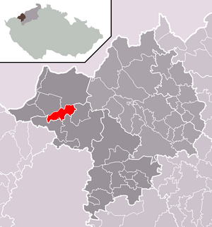
| Location of Měděnec in the Chomutov district | ||||

|
||||
Měděnec (German Kupferberg ) is a municipality in Ústecký kraj in the Czech Republic .
geography
location
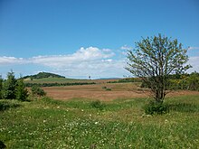
The village is located in western Bohemia , six kilometers northwest of Klášterec nad Ohří ( Klösterle an der Eger ), on the Bohemian side of the central Ore Mountains on a saddle at the southern foot of the 910 m high Mědník ( Kupferhübel ). The Chomutov – Vejprty railway line , on which the Měděnec and Měděnec zastávka stations are located, runs north of this mountain with a chapel and a wide view .
Neighboring towns are Mezilesí in the north, Kotlina in the northeast, Louchov and Domašín in the east, Petlery in the southeast, Kamenné in the south, Rájov and Mýtinka in the southwest, Horní Halže in the west and Kovářská in the northwest.
Community structure
The municipality consists of the districts Měděnec Dolní Halže ( lower neck ), Horní Halže ( upper neck ), Kamenné ( Stone Green ), Kotlina ( Köstelwald ) Měděnec ( Kupferberg ) and Mýtinka ( Rödling ). Basic settlement units are Horní Halže, Kamenné, Kotlina, Měděnec and Mýtinka.
The municipality is divided into the cadastral districts Horní Halže, Kamenné, Kotlina, Měděnec and Mýtinka.
Neighboring places
| Kovářská (Forge Hill ) | Kryštofovy Hamry (Christophhammer) | |

|
Domašín (Tomichan) | |
| Perštejn (Pürstein) | Klášterec nad Ohří (Klösterle on the Eger) |
history
The history of Kupferberg is closely linked to the mining industry, which here at the foot of the Kupferhübel (Mědník) has probably been in operation since the 10th century and which primarily dealt with silver-containing copper ores. Kupferberg was first mentioned as a settlement in 1449. In 1520 she was granted the privilege of free silver trading. A prosperous development began.
The 16th century is considered to be the first heyday of mining. At that time copper pyrites and pyrite , which were processed into sulfuric acid and copper and iron vitriol , were primarily promoted. A corresponding vitriol hut is available for Ober Hals (Horní Halže) during this time. In 1543 Hans von Vitzthum became the owner of Kupferberg, which had previously belonged to the Schoenburg dominions. Four years later (1547) the local mines were placed under the mining jurisdiction of Sankt Joachimsthal (Jáchymov) . The first wooden church was built in 1581.
In 1588, Kupferberg was raised to the status of a mining town , was able to buy out in 1616 and henceforth be called a royal free mining town. The next owner after Kaspar von Vitzthum was Christoph von Taubenreuther, who founded the city brewery at the beginning of the 17th century. In 1628 the Schlicken acquired Kupferberg and incorporated it into the rule of Hauenstein .
In the years 1803 to 1814 the church was completely rebuilt, but received the five harmonious sounding bells of the old, dilapidated wooden church that was demolished.
The decline of the former free mining town began in 1640 when Kupferberg was burned down during the Thirty Years War . In the course of the re-Catholicization, Kupferberg remained Protestant, but numerous residents moved to Saxony. Ferdinand III. granted the city the right to mint in 1646 . On November 20, 1665, Julius Franz von Sachsen-Lauenburg bought Kupferberg, who assigned the town to his rule as slag value.
In 1807 mining was temporarily stopped and in 1811 the small town went to the imperial chamber, which it sold to Graf Graf Buquoy in 1836 . Twenty years later, on July 3, 1856, 19 houses, the church, the brewery and the town hall fell victim to a city fire. In 1872, Kupferberg received a station on the railway connection between Chemnitz and Komotau (Chomutov) ( Buschtěhrad Railway ). This was the basis for the boom in tourism, for which the Kupferhübel in particular was the main attraction. Wilhelm von Humboldt called it "... one of the most beautiful viewpoints in Central Europe ...". With the Mariahilfstolln , one of the mines at Kupferhübel was opened to tourists in 1910 (reopening in 2007) as access to the malachite caves .
After the First World War , Kupferberg was added to the newly created Czechoslovakia in 1919 . Due to the Munich Agreement of 1938 place came to the German Reich and was until 1945 the district Preßnitz , Region of Eger , in the Reich District of Sudetenland . After the end of the Second World War , the German-Bohemian population was largely expropriated and expelled .
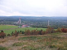
In the mid-1950s, geological explorations provided evidence of minable, previously unknown magnetite deposits. The mine, which was then rebuilt, began mining on May 17, 1968, which was discontinued on July 31, 1992 after the deposit had been largely exhausted. During this time the mine produced almost 2.7 million tons of iron ore with an average iron content of 35%. The iron was u. a. used for the heavy concrete shielding of the Temelín nuclear power plant . In addition, 323 tons of copper and 807 kg of silver were extracted. Another private mining attempt by GARMICA, started in 1994, failed after two years. In 1996 the company GARMICA, which had tried to market Muscovite mica slate , was closed because no sales markets were found.
Demographics
| year | Residents | Remarks |
|---|---|---|
| 1783 | k. A. | 92 houses |
| 1830 | 710 | in 115 houses |
| 1845 | 935 | in 125 houses |
| 1869 | 955 | |
| 1880 | 1201 | |
| 1890 | 1101 | |
| 1900 | 1157 | German residents |
| 1910 | 1159 | |
| 1921 | 1011 | 1002 German residents |
| 1930 | 1113 | |
| 1939 | 1137 |
| year | 1947 | 1950 1 | 1961 1 | 1970 2 | 1980 3 | 1991 3 | 2001 3 | 2011 3 |
| Residents | 202 | 291 | 214 | 225 | 282 | 170 | 155 | 137 |
Attractions
- Baroque chapel for the Immaculate Conception on Mědník
- Mariahilfstolln ( Marie Pomocná ) visitor mine on the Kupferhübel (Mědník) mountain
- Visitor mine Promised Land Stolln (štola Země zaslíbená-Os Historické rudné doly Mědník měděnec) on the mountain Kupferhübel (Mědník)
- Church of the Holy Mary's Birth: built 1803–1814 on the site of the wooden church from 1581
- Sfingy rock formation well worth seeing
literature
- Euroregion Erzgebirge (Hrsg.): Historical mining in the Euroregion Erzgebirge. Freiberg 2000, pp. 57-59.
- Ulrich Möckel : Kupferberg and Kupferhübel. Historical pictures and texts from Kupferberg, from Kupferhübel and about the Erzgebirge poet and composer Reinhold Illing. Self-published, Schönheide 2009.
- different authors (including Stanislav Ded): Přísečnice-zatopena, ale nezapomenuta / Preßnitz-sunken but not forgotten; Sbornik / anthology, Czech / German, Chomutov Regional Museum, 2004, Czech Republic, without ISBN. (On the history of the city, its demolition, preserved and relocated monuments and cultural assets. An illustrated book. With the history of the ore mining district of Preßnitz with the mines in Kupferberg and Christofhammer)
Web links
- St. Kupferberg in Bohemia. Retrieved March 12, 2014 .
- Information on mining history. Retrieved March 12, 2014 .
- The mining area of Kupferberg (Meděněc) in the Bohemian Ore Mountains (Krusne Hory). Retrieved March 12, 2014 .
Individual evidence
- ↑ Český statistický úřad - The population of the Czech municipalities as of January 1, 2019 (PDF; 7.4 MiB)
- ↑ uir.cz
- ↑ uir.cz
- ↑ uir.cz
- ^ A b Johann Gottfried Sommer : The Kingdom of Bohemia. Volume 15: Elbogen Circle. Prague 1847, pp. 137-138, paragraph 10 ( books.google.de ).
- ↑ cited in Euroregion Erzgebirge 2000, p. 57.
- ↑ various authors (including Stanislav Ded): Přísečnice-zatopena, ale nezapomenuta / Preßnitz-sunken but not forgotten; Sbornik / anthology, Czech / German, Chomutov Regional Museum, 2004, Czech Republic, without ISBN. History of the ore mining area Preßnitz (with the mines in Kupferberg and Christofhammer), p.91
- ↑ Jaroslaus Schaller : Topography of the Kingdom of Bohemia. Volume 2: Ellbogner Kreis. Prague 1785, pp. 79-80, paragraph 66 ( books.google.de ).
- ↑ Yearbooks of the Bohemian Museum of Natural and Regional Studies, History, Art and Literature. Volume 2, Prague 1831, p. 200, paragraph 27 ( books.google.de ).
- ^ Meyer's Large Conversational Lexicon. 6th edition, Volume 11, Leipzig and Vienna 1907, pp. 834–835, point 3 ( zeno.org ).
- ↑ a b c d Genealogy network Sudetenland
- ↑ Historický lexikon obcí České republiky - 1869–2015. (PDF) Český statistický úřad, December 18, 2015, accessed on January 23, 2016 (Czech).


