Perry County, Pennsylvania
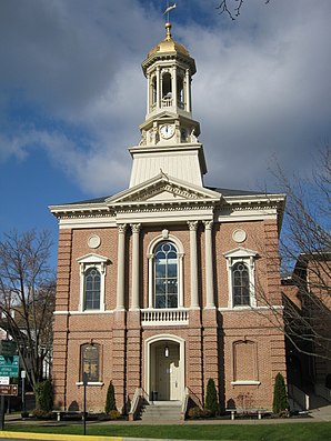
 Perry County Courthouse , one of 19 entries for the county in the NRHP |
|
| administration | |
|---|---|
| US state : | Pennsylvania |
| Administrative headquarters : | New Bloomfield |
| Address of the administrative headquarters: |
Perry County Courthouse P.O. Box 37 25 West Main Street New Bloomfield, PA 17068 |
| Foundation : | March 22, 1820 |
| Made up from: | Cumberland County |
| Area code : | 001 717 |
| Demographics | |
| Residents : | 43,602 (2000) |
| Population density : | 30.4 inhabitants / km 2 |
| geography | |
| Total area : | 1439 km² |
| Water surface : | 6 km² |
| map | |
| Website : www.perryco.org | |
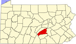
Perry County is a county in the state of Pennsylvania in the United States . At the 2000 census , the county had 43,602 people and a population density of 30 people per square kilometer. The county seat is New Bloomfield .
history
Perry County was formed from Cumberland County on March 22, 1820 and named after Oliver Hazard Perry , brother of Matthew Perry .
19 buildings and sites in the county are listed on the National Register of Historic Places (NRHP) (as of July 24, 2018).
geography
The county has an area of 1,439 square kilometers, of which 6 square kilometers are water. Most of the hilly area is still sparsely populated forest landscape. The cost of the land is comparatively low, but the prices are Pennsylvania's fastest rising.
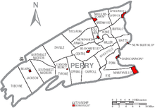
Cities and towns
| Population development | |||
|---|---|---|---|
| Census | Residents | ± in% | |
| 1900 | 26,263 | - | |
| 1910 | 24,136 | -8.1% | |
| 1920 | 22,875 | -5.2% | |
| 1930 | 21,744 | -4.9% | |
| 1940 | 23,213 | 6.8% | |
| 1950 | 24,782 | 6.8% | |
| 1960 | 26,582 | 7.3% | |
| 1970 | 28,615 | 7.6% | |
| 1980 | 35,718 | 24.8% | |
| 1990 | 41,172 | 15.3% | |
| 2000 | 43,609 | 5.9% | |
| 1900-1990
2000 |
|||
Web links
Individual evidence
- ^ Perry County in the United States Geological Survey's Geographic Names Information System . Retrieved February 22, 2011
- ↑ Search mask database in the National Register Information System. National Park Service , accessed July 24, 2018.
- ↑ Extract from Census.gov . Retrieved February 28, 2011
- ↑ Excerpt from factfinder.census.gov.Retrieved February 28, 2011
Coordinates: 40 ° 24 ′ N , 77 ° 16 ′ W

