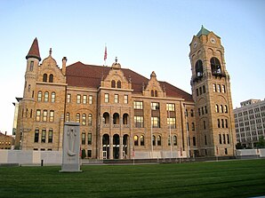
Lackawanna County
 Lackawanna County Courthouse |
|
| administration | |
|---|---|
| US state : | Pennsylvania |
| Administrative headquarters : | Scranton |
| Foundation : | August 13, 1878 |
| Made up from: | Lucerne County |
| Demographics | |
| Residents : | 209,330 (2007) |
| Population density : | 176.2 inhabitants / km 2 |
| geography | |
| Total area : | 1203 km² |
| Water surface : | 15 km² |
| map | |
| Website : www.lackawannacounty.org | |
Lackawanna County is a county in the state of Pennsylvania in the United States . In 2007 the county had 209,330 residents and a population density of 176 people per square kilometer. The county seat is Scranton .
history
The county was formed on August 21, 1878. The background of the naming is not fully clarified, it probably comes from the Delawarian term lechauhanne , which means "bifurcating river".
There is a National Historic Site in the county , the Steamtown National Historic Site . One place has the status of a National Historic Landmark , the Terence V. Powderly House . 32 buildings and sites in the county are listed on the National Register of Historic Places (NRHP) (as of July 18, 2018).
geography
The county covers an area of 1,203 square kilometers, of which 15 square kilometers are water.
Cities and towns
| Population development | |||
|---|---|---|---|
| Census | Residents | ± in% | |
| 1900 | 193.831 | - | |
| 1910 | 259,570 | 33.9% | |
| 1920 | 286.311 | 10.3% | |
| 1930 | 310.397 | 8.4% | |
| 1940 | 301,243 | -2.9% | |
| 1950 | 257.396 | -14.6% | |
| 1960 | 234,531 | -8.9% | |
| 1970 | 234.107 | -0.2% | |
| 1980 | 227.908 | -2.6% | |
| 1990 | 219.039 | -3.9% | |
| 2000 | 213.296 | -2.6% | |
| 1900-1990
2000 |
|||
Web links
Individual evidence
- ^ Lackawanna County in the United States Geological Survey's Geographic Names Information System . Retrieved February 22, 2011
- ↑ http://www.census.gov/ The population numbers are only estimated according to the United States Census Bureau . They are not based on a count.
- ↑ Charles Curry Aiken, Joseph Nathan Kane: The American Counties: Origins of County Names, Dates of Creation, Area, and Population Data, 1950-2010 . 6th edition. Scarecrow Press, Lanham 2013, ISBN 978-0-8108-8762-6 , p. 167 .
- ↑ Listing of National Historic Landmarks by State: Pennsylvania . National Park Service , accessed July 18, 2018.
- ↑ Search mask database in the National Register Information System. National Park Service , accessed July 18, 2018.
- ↑ Extract from Census.gov . Retrieved February 28, 2011
- ↑ Excerpt from factfinder.census.gov.Retrieved February 28, 2011
Coordinates: 41 ° 26 ′ N , 75 ° 37 ′ W


