Plougras
|
Plougras Plougraz |
||
|---|---|---|

|
|
|
| region | Brittany | |
| Department | Cotes-d'Armor | |
| Arrondissement | Lannion | |
| Canton | Plestin-les-Grèves | |
| Community association | Lannion-Trégor Communauté | |
| Coordinates | 48 ° 31 ′ N , 3 ° 34 ′ W | |
| height | 164-314 m | |
| surface | 26.48 km 2 | |
| Residents | 413 (January 1, 2017) | |
| Population density | 16 inhabitants / km 2 | |
| Post Code | 22780 | |
| INSEE code | 22217 | |
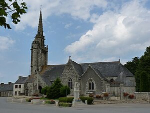
 Saint-Pierre village church |
||
Plougras ( Breton : Plougraz ) is a French commune with 413 inhabitants (as of January 1, 2017) in the Côtes-d'Armor department in the Brittany region . It belongs to the Arrondissement of Lannion , the canton of Plestin-les-Grèves and is a member of the Lannion-Trégor Communauté community association founded in 2015 . The residents call themselves Plougrasien / Plougrasiennes .
geography
Plougras is located around 26 km (as the crow flies) south-southwest of the small town of Lannion in northern Brittany on the border with the Finistère department .
Population development
| year | 1793 | 1800 | 1846 | 1856 | 1866 | 1872 | 1926 | 1962 | 1968 | 1975 | 1982 | 1990 | 1999 | 2006 | 2012 |
| Residents | 1,030 | 673 | 1,216 | 1,167 | 1,510 | 1,402 | 1,200 | 725 | 670 | 592 | 530 | 498 | 495 | 465 | 427 |
| Sources: Cassini and INSEE | |||||||||||||||
The increasing mechanization of agriculture led to a decrease in the number of inhabitants to the lowest levels in the present.
Architectural monuments
See: List of Monuments historiques in Plougras
literature
- Le Patrimoine des Communes des Côtes-d'Armor. Flohic Editions, Volume 2, Paris 1998, ISBN 2-84234-017-5 , pp. 981-983.
Web links
Commons : Plougras - collection of images, videos and audio files
