Priobje
| Urban-type settlement
Priobje
Приобье
|
||||||||||||||||||||||||||||||||||||||
|
||||||||||||||||||||||||||||||||||||||
|
||||||||||||||||||||||||||||||||||||||
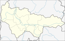
Priobje ( Russian Прио́бье ) is an urban-type settlement in the West Siberian Autonomous Okrug of the Khanty and Mansi / Ugra ( Russia ) with 7215 inhabitants (as of October 14, 2010).
geography
The settlement is located in the West Siberian lowlands about 250 kilometers northwest of the administrative center of the Khanty-Mansiysk Autonomous Okrug , on the left bank of the Aljoschkinskaya , a left arm of the Ob . The main arm of the Ob runs about five kilometers west of Priobje, which lies on an elevation in the middle of the floodplain of the river that was flooded during the spring floods .
Priobje belongs to Oktyabrskoye district (Oktyabrsky); its administrative center, the Oktjabrskoje settlement, is a good 20 kilometers southwest on the far right bank of the Ob.
history
The place was created from 1967 in connection with the construction of a railway line from Iwdel in the Northern Urals , which had a railway connection from Serow since 1943 . The left bank of the Ob, a few kilometers north of the Sergino settlement, was chosen as the end point of the route, where a river port was to be built.
In 1969 the railway line was opened. The station was named Priobje (from Russian pri Obi for on the Ob or this side of the Ob ). The settlement near the train station and river port was initially officially named Serginski after the original village , where a village soviet (local government) existed from 1972 ; but the name of the Priobje train station was also used.
The importance of the place grew in particular with the emergence of the city of Njagan , located almost 50 kilometers to the south, and the start of oil production in this area in the 1980s, so that on May 10, 1988, the status of an urban-type settlement was awarded under its current name.
Population development
| year | Residents |
|---|---|
| 1989 | 8,570 |
| 2002 | 7.140 |
| 2010 | 7,215 |
Note: census data
Economy and Infrastructure
Priobje is mainly the logistic center for the supply of oil and gas production areas in the western part of the Khanty-Mansi and Yamalo-Nenets Autonomous Okrug . With its river port, as the end point of the 379 kilometer long railway line from Iwdel and, in winter, the starting point of an ice road on the Ob, it is an important transfer point.
There are also companies involved in the construction industry and for maintaining the pipelines running through the area, as well as smaller forestry and agricultural operations.
UTair operates a helicopter airport in Priobje .
Individual evidence
- ↑ a b Itogi Vserossijskoj perepisi naselenija 2010 goda. Tom 1. Čislennostʹ i razmeščenie naselenija (Results of the All-Russian Census 2010. Volume 1. Number and distribution of the population). Tables 5 , pp. 12-209; 11 , pp. 312–979 (download from the website of the Federal Service for State Statistics of the Russian Federation)
Web links
- Website of the settlement Priobje (Russian)


