Rijksweg 8
| Autosnelweg A8 / Autoweg N8 in the Netherlands | |||||||||||||||||||||||||||||||||||||
 
|
|||||||||||||||||||||||||||||||||||||
| |
|||||||||||||||||||||||||||||||||||||
| map | |||||||||||||||||||||||||||||||||||||
| Basic data | |||||||||||||||||||||||||||||||||||||
| Operator: |
|
||||||||||||||||||||||||||||||||||||
| Overall length: | 10.8 km | ||||||||||||||||||||||||||||||||||||
| Development condition: | 2 × 2 lanes + emergency lanes | ||||||||||||||||||||||||||||||||||||
|
Course of the road
|
|||||||||||||||||||||||||||||||||||||
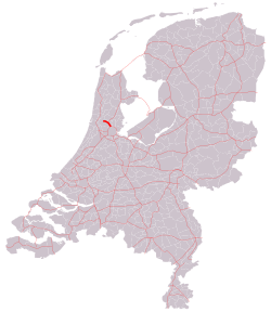
The Rijksweg 8 is a highway in the province of North Holland in the Netherlands , which km in east-west direction runs and with a length of 10 is one of the shortest highways in the Netherlands. It starts at the Knooppunt Coenplein in the north of Amsterdam and continues northwards past the eastern outskirts of Zaandam . Shortly afterwards the motorway ends at the Assendelft exit . At the moment it serves more as a bypass of the municipality of Zaanstad .
There are plans to extend the A8 further west. The plans were initially not pursued further due to the oil crisis in 1974. Possibilities are currently being examined again, but the planning dragged on because the financing was not secured.
The A8 is currently being diverted via the N246 and N203 .
Web links
- Information on Autosnelwegen.nl (Dutch)


