
Rijksweg 20
| Autosnelweg A20 in the Netherlands | ||||||||||||||||||||||||||||||||||||||||||||||||||||||||||||||||||||||||||||||||||||||||||||||||||||

|
||||||||||||||||||||||||||||||||||||||||||||||||||||||||||||||||||||||||||||||||||||||||||||||||||||
| |
||||||||||||||||||||||||||||||||||||||||||||||||||||||||||||||||||||||||||||||||||||||||||||||||||||
| map | ||||||||||||||||||||||||||||||||||||||||||||||||||||||||||||||||||||||||||||||||||||||||||||||||||||
 |
||||||||||||||||||||||||||||||||||||||||||||||||||||||||||||||||||||||||||||||||||||||||||||||||||||
| Basic data | ||||||||||||||||||||||||||||||||||||||||||||||||||||||||||||||||||||||||||||||||||||||||||||||||||||
| Operator: |
|
|||||||||||||||||||||||||||||||||||||||||||||||||||||||||||||||||||||||||||||||||||||||||||||||||||
| Overall length: | 39 km | |||||||||||||||||||||||||||||||||||||||||||||||||||||||||||||||||||||||||||||||||||||||||||||||||||
|
Course of the road
|
||||||||||||||||||||||||||||||||||||||||||||||||||||||||||||||||||||||||||||||||||||||||||||||||||||
The Rijksweg 20 is a Dutch motorway from Westland , the largest horticulture area in the Netherlands until after Gouda . The Rijksweg begins as the N213 in the Westerlee district and then passes the Maasdijk district as a motor vehicle for a few hundred meters. The actual motorway begins from Maassluis . Among other things, it forms the northern part of the Rotterdam motorway ring . At Nieuwerkerk , the motorway crosses the lowest point in the Netherlands. This is 6.75 m below the Amsterdam level .
photos

The A20 near Vlaardingen
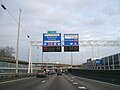
The A20 at Knooppunt Kleinpolderplein

The A20 at Knooppunt Terbregseplein


Web links
- Traffic reports - Rijkswaterstaat (Dutch)
- Opening history of the A20 (Dutch)
| Current routes |
A1 | A2 / N2 | N3 | A4 | A5 | A6 | A7 / N7 | A8 / N8 | A9 / N9 | A10 | N11 | A12 | A13 | N14 | A15 / N15 | A16 | A17 | A18 / N18 | A20 | A22 | A27 | A28 | A29 | A30 | A31 / N31 | A32 / N32 | N33 | A35 / N35 | N36 | A37 | A38 | A44 / N44 | N46 | N48 | A50 / N50 | N57 | A58 / N58 | A59 / N59 | N61 | A65 / N65 | A67 | A73 | A74 | A76 | A77 | A79 | N99 | A200 / N200 |
 |
| Former routes |
N34 | N41 | N46 | A48 / N48 | A52 / N52 | N60 | A68 / N68 | N69 | N265 | N271 | N289 |