
Rijksweg 76
| Autosnelweg A76 in the Netherlands | ||||||||||||||||||||||||||||||||||||||||||||||||||||||||||||||||

|
||||||||||||||||||||||||||||||||||||||||||||||||||||||||||||||||
| |
||||||||||||||||||||||||||||||||||||||||||||||||||||||||||||||||
| map | ||||||||||||||||||||||||||||||||||||||||||||||||||||||||||||||||
 |
||||||||||||||||||||||||||||||||||||||||||||||||||||||||||||||||
| Basic data | ||||||||||||||||||||||||||||||||||||||||||||||||||||||||||||||||
| Operator: |
|
|||||||||||||||||||||||||||||||||||||||||||||||||||||||||||||||
| Overall length: | 27 km | |||||||||||||||||||||||||||||||||||||||||||||||||||||||||||||||
| Development condition: | 2 × 2 lanes and 3 + 2 lanes | |||||||||||||||||||||||||||||||||||||||||||||||||||||||||||||||
|
Course of the road
|
||||||||||||||||||||||||||||||||||||||||||||||||||||||||||||||||
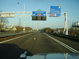
The Rijksweg 76 (abbreviation: RW 76 ) - short form: Autosnelweg 76 (abbreviation: A76 ) - is a Dutch motorway . It runs through the province of Limburg and connects the Belgian A2 , the German A4 and the most important north-south connection in the Netherlands, Rijksweg 2 . Rijksweg 76 is part of European route 314 along its entire length .
Picture gallery

Scharbergbrug over the Meuse

Knooppunt Kerensheide , before 2005
The A76 at knooppunt Kerensheide , 2008

Knooppunt Ten Esschen , before 2005

Knooppunt Kunderberg , before 2005


Web links
| Current routes |
A1 | A2 / N2 | N3 | A4 | A5 | A6 | A7 / N7 | A8 / N8 | A9 / N9 | A10 | N11 | A12 | A13 | N14 | A15 / N15 | A16 | A17 | A18 / N18 | A20 | A22 | A27 | A28 | A29 | A30 | A31 / N31 | A32 / N32 | N33 | A35 / N35 | N36 | A37 | A38 | A44 / N44 | N46 | N48 | A50 / N50 | N57 | A58 / N58 | A59 / N59 | N61 | A65 / N65 | A67 | A73 | A74 | A76 | A77 | A79 | N99 | A200 / N200 |
 |
| Former routes |
N34 | N41 | N46 | A48 / N48 | A52 / N52 | N60 | A68 / N68 | N69 | N265 | N271 | N289 |