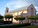
Saint-François (Guadeloupe)
|
Saint-François Senfwanswà |
|
|---|---|

|
|
| region | Guadeloupe |
| Department | Guadeloupe |
| Arrondissement | Pointe-à-Pitre |
| Canton | Saint-François |
| Community association | La Riviéra du Levant |
| Coordinates | 16 ° 15 ′ N , 61 ° 16 ′ W |
| height | 0-67 m |
| surface | 61.00 km 2 |
| Residents | 12,816 (January 1, 2017) |
| Population density | 210 inhabitants / km 2 |
| Post Code | 97118 |
| INSEE code | 97125 |
Saint-François ( Guadeloupe-Creole : Senfwanswà ) is a municipality with 12,816 inhabitants (as of January 1, 2017) in the French overseas department of Guadeloupe . It belongs to the Arrondissement Pointe-à-Pitre .
The community has made a name for itself as a tourist destination and is located on the south-eastern tip of the island of Grande-Terre in the Caribbean . From Saint-François there are boat connections to the island of La Désirade .
In addition to the tourist infrastructure, which includes a large hotel complex, a golf course and a casino , Saint-François contains large agricultural areas that have existed at least since the 18th century and were and are mainly used for the cultivation of cotton and sugar cane .
| year | 1961 | 1967 | 1974 | 1982 | 1990 | 1999 | 2006 | 2012 |
|---|---|---|---|---|---|---|---|---|
| Residents | 6.254 | 5,789 | 5,593 | 6,972 | 7,987 | 10,659 | 13,424 | 14,797 |
Personalities
- Vincent Campenon (1772–1843), member of the Académie française
Web links
Commons : Saint-François - Collection of images, videos and audio files


