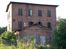
Sarbia (Kołobrzeg)
| Sarbia | ||
|---|---|---|

|
|
|
| Basic data | ||
| State : | Poland | |
| Voivodeship : | West Pomerania | |
| Powiat : | Kołobrzeski | |
| Gmina : | Kołobrzeg | |
| Geographic location : | 54 ° 6 ' N , 15 ° 25' E | |
| Height : | 3 m npm | |
| Residents : | ||
| Telephone code : | (+48) 94 | |
| License plate : | ZKL | |
| Economy and Transport | ||
| Next international airport : | Szczecin-Goleniów | |
Sarbia (German Zarben ) is a village in the West Pomeranian Voivodeship in Poland . It belongs to the rural community Kołobrzeg ( Kolberg ) in the powiat Kołobrzeski .
Geographical location
The village is located in Western Pomerania at an altitude of about three meters above sea level. The neighboring town of Drzonowo ( Drenow ) is about one kilometer to the east, the municipal seat in the city of Kołobrzeg about 13 kilometers to the northeast and the beach of the Baltic Sea about 6.5 kilometers to the north.
history
Sarbia was an old church village that was founded in the Middle Ages. It was named in 1254 under the name Zirbe in a deed of gift with which the Pomeranian Duke Wartislaw III, who resided in Demmin . bequeathed the village to Belbuck Monastery . Around 1784 in Zabern there was a preacher, a sexton, a schoolboy, twelve farmers, three kossaten - including the miller, who ran a kossaten farm and a water mill, a blacksmith, five bidders , a preacher's widow's house and a total of 25 fireplaces (households) . Agriculture has always been the main source of income for the village. The Zabernsche watermill, a leasehold mill, had the farmers of the villages Glansee, Hagenow, Zamow and Zarben as guests. Around the middle of the 19th century, the municipality of Zabern acquired a joint sprinkler system for the agricultural operations.
Until 1945 the place belonged to the district of Greifenberg i. Pom. in the province of Pomerania .
Towards the end of the Second World War , the region was occupied by the Red Army in the spring of 1945 and then placed under Polish administration together with all of Western Pomerania. The German village was now given the Polish name Sarbia .
There is a brick village church from the beginning of the 13th century, which is dedicated to John the Baptist . According to the church chronicle, the main building with the presbytery was completed in 1325. In the following centuries, expansion, renovation and renovation work was carried out. In 1885 the church received a wooden bell tower on a field stone foundation as well as two side aisles and a transept. This gave it its current appearance. Inside, a gothic baptismal font made of opaque shell limestone (14th century) and a carved crucifixion group (15th century) are worth seeing.
Parish
Zarben had a Protestant mother church that belonged to the Synod of Treptow, with a branch in the neighboring village of Hagenow .
literature
- Johannes Hinz : Pomerania. Signpost through an unforgettable country. Flechsig-Buchvertrieb, Würzburg 2002, ISBN 3-88189-439-X , pp. 427-428.
Web links
Individual evidence
- ↑ Ludwig Wilhelm Brüggemann : Detailed description of the current state of the Royal Prussian Duchy of Western and Western Pomerania . Stettin 1784, p. 406, No. 17 ( online )
- ^ Metzel: Information about the common sprinkler system of the community of Zarben in Pomerania . In: Annals of Agriculture in the Royal Prussian States . 9th year, Volume 17, Berlin 1851, pp. 12–23 ( online )
- ↑ Flyer: Open Churches. Around Kolobrzeg (Kolberg) . Published by the regional planning office Uckermark-Barnim, Eberswalde 2005
- ^ Brüggemann (1784), loc. cit. , S. LXVI-LXVII ( online )


