Weinbiet
| Weinbiet | ||
|---|---|---|
|
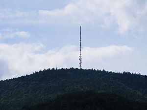
Weinbiet from Mußbach, panorama tower (left, with small antenna) due to the relative proximity (air line distance 3 km, photo 2008) almost completely covered by trees |
||
| height | 554 m above sea level NHN | |
| location | Germany | |
| Mountains | Haardt | |
| Coordinates | 49 ° 22 '33 " N , 8 ° 7' 17" E | |
|
|
||
| rock | Rocks of the lower and middle red sandstone | |
| Age of the rock | 251 to 243 million years | |
| Normal way | so-called donkey path | |
| particularities | 2003 night temperature record: 27.6 ° C | |
|
The wine region from the north by plane; the top of the transmission mast randomly points to Hambach Castle 6 km to the south (small in the background). |
||
The 554 m high Weinbiet on the forest district of Neustadt on the wine route ( Rheinland-Pfalz ) is a free-standing, striking back mountain in the Haardt , the eastern edge of Palantine Forest to Oberrheinischen Plain out.
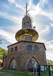
On the top of the hill there is a radio transmission mast , which is locally called Weinbietsender , a brick-built panorama tower with a weather station called the Weinbiethaus , and the excursion restaurant Weinbiethaus . The two distinctive towers make the mountain from the plain 400 m below a regional landmark, after which the winegrowers' cooperative Weinbiet Manufaktur in the Neustadt districts of Mußbach (Sitz), Gimmeldingen and Haardt chose their name.
geography
Location and structure

1: Weinbiet summit
2: Wolfsburg ruins
3: East edge of the city of Lambrecht
4: Local community Lindenberg
On the right, from top to bottom, are the districts of Gimmeldingen and Haardt as well as the core town of Neustadt an der Weinstrasse, and down in the Speyerbachtal is the Schöntal district.
The Weinbiet is located in the Palatinate northwest above the core town of Neustadt an der Weinstraße on the western shoulder of the Upper Rhine Graben . This collapsed about 50 million years ago and was later replenished by deposited sediments to the level of today's Upper Rhine Plain. The Weinbiet massif with its foothills measures around 4 km at its foot in a west-east direction, from north-north-west to south-south-east the diameter is around 6 km.
The east runner of the Weinbiet massif, the 319 m high Nebelberg , occasionally appears in literature as the Nöpelberg . It is quite pronounced and extends almost 2 km to the edge of the rift valley. Right above the valley of Mußbachs lies in 316 m height on the top of the mountain fog the Heidenburg , one as Fliehburg scale ring wall from the 9th century. It was named because they falsely for a building of a pagan applicable Celts was held. While the Gimmeldingen quarry on the east side was abandoned in the middle of the 20th century, the Haardter quarry on the southern slope continues to operate.
To the southeast of the 409 includes 220 m sloping Schlossberg at that on his spur the castle Winzingen and Haardter Castle bears. On its west and south-west side it falls into the Meisental , which is traversed by the Sulzwiesengraben . This brook flows further downwards in the urban area of Neustadt from the left into the Floßbach , an approx. 1.5 km long left branch of the Speyerbach . The Haardtrand - Schloßberg nature reserve takes up the southwest slope of the Schlossberg down to the Meisental .
Beyond the Meisental, the 490.7 m high Wolfsberg with the three hectare nature reserve on the Wolfsberg stretches from the Weinbiet to the south. Towards the south-east it flattens out towards the Bergstein natural monument ( 380 m ); Somewhat higher at around 427 m is the Steinerner Hirsch relief , from where a wide view over the Rhine plain is possible. The ruins of Wolfsburg ( 270 m ) and Hohfels ( 320 m ) are also in the lower south-west . The Nonnental runs roughly in a south-north direction west of the Wolfsberg .
The west runner , the 428.2 m high Schwalbeneck , goes north over to the elongated Hinterer Langenberg . Its highest elevation - 501.9 m , in the very south-east, towards the Weinbiet summit - carries the rock Weinbiet-Stein , which is often also called Weinbiet-Loog or Hohes Loog . The strongest tributary of the Mußbach rises 500 m to the south-east at a height of 460 m on the northern flank of the Weinbiet, contained in the Loosenbrunnen . The Gimmeldinger Valley , deepened by the Mußbach, closes off the Weinbiet massif to the northeast. The stream then passes Gimmeldingen and Mußbach and then flows from the left into the Rehbach , the northern branch of the Speyerbach.
In the north, the forest area of the city of Deidesheim borders the Weinbiet massif, in the east the districts of Königsbach , Gimmeldingen and Haardt as well as the core town of Neustadt an der Weinstrasse follow, in the south the Schöntal district , in the west the local community Lindenberg .
Natural allocation
The Weinbiet belongs to the Palatinate Forest natural area, which is classified as a 3rd order Greater Region in the systematics of the handbook on the natural structure of Germany published by Emil Meynen and Josef Schmithüsen and its subsequent publications . According to the internal structure of the natural area , it belongs to the Middle Palatinate Forest and the Haardt mountain range, which separates the Palatinate Forest from the Upper Rhine Plain.
In the hierarchy of natural areas, the wine area is thus in the following nesting:
- Greater region 1st order: Layer level land on both sides of the Upper Rhine Rift
- Greater region 2nd order: Palatinate-Saarland layer level land
- Greater region 3rd order: Palatinate Forest
- 4th order region (main unit): Middle Palatinate Forest
- 5th order region: Haardt
climate
The Weinbietmassiv brought the east in his Lee situated wine villages Haardt, Gimmeldingen, Mußbach and King Bach, all of which belong to the independent city Neustadt on the wine route since 1969, a mild and little rainfall, climate, the cultivation of quality wines favored.
The average annual precipitation on the Weinbiet itself is 585 mm over the long term. This is a low value, in the lower fifth of the values recorded in Germany; only 18% of the German Weather Service's measuring stations register lower values. The driest month is January, with the most rainfall in May, 1.7 times more than in January. Nevertheless, the precipitation is distributed fairly evenly over the year; the seasonal fluctuations are lower at only 12% of the measuring stations . The climate diagram shown shows similar values for the selected period 1987-2016, for example for the annual precipitation 605 mm.
Extraordinary weather phenomena occasionally occur in the Weinbiet . On August 13, 2003, in the so-called summer of the century, the highest nocturnal low temperature ever recorded in Germany was recorded at 27.6 ° C, or to put it simply: This was the warmest night in Germany since records began. On February 28, 2010, hurricane Xynthia reached a wind speed of 166 km / h in the Weinbiet.
Surname
The name of the mountain is said to have originated from the name of the Weinbiet stone 800 m north of the summit, which is also called Weinbiet Loog in literature . This rock on the Weinbiet foothills Hinterer Langenberg already had his name in 1670 and was explicitly mentioned as a boundary stone in 1534, 1714 and 1755 ; Loog is an old German word for border . At that time the rock marked the border between the Deidesheimer Wald in the north, the Gimmeldinger Wald in the east and the Haardter Wald in the south. That on the rock surface u. a. "G" for Gimmeldingen carved into the stone is said to have resembled the trough of the wine press , which caught the must and was called Biet , ie a wine area . The inscription on the rock extended the explanation: Wine was poured into the shallow depression of the "G" when young men first crossed the border; then the faces of the newcomers were dipped in the wine to imprint the borderline.
A Palatinate dialect poet associated the origin of the name with the temptation of Jesus by the devil ( Mt 4.1-10 EU ) described in the Bible and dressed it in a story that is written in the Palatinate dialect .
Attractions
Weinbiethaus
The Gimmeldingen local group of the Palatinate Forest Association (PWV), founded in 1906, built a wooden hut in 1910 on the Weinbiet as a weatherproof bar. The stone Weinbiethaus was planned from 1925 and built from red sandstone from 1927 for 15,000 Reichsmarks . It was inaugurated on June 3, 1928. It is run by the Palatinate Forest Association and is managed every day except Fridays.
In 1960 and 1966 the house was expanded to include a new kitchen, toilet facilities and an additional guest room. The Loosenbrunnen supplied fresh and service water until 1988, when the water supply and disposal was started up via pipes from Neustadt. The renovation and expansion between July 2014 and summer 2015 for around € 500,000 includes the construction of an additional guest room, the expansion of the kitchen and warehouse, the renovation of the terrace and new toilet facilities. Since July 2015, 270 seats have been available inside instead of 200, to which there are more than 150 under the trees in the outside area.
Weinbietturm
The panorama tower, which was also built from red sandstone between 1870 and 1874, belongs to the city of Neustadt and is open at the same time as the Weinbiethaus. It was named Weinbietturm as early as the 19th century . It is 21.5 m high. Visitors can only reach the masonry gallery via a stone spiral staircase in the lower part of the interior and metal further above . A round platform retrofitted near the top of the tower is reserved exclusively for business purposes.
Since April 1952 there has been a station of the German Weather Service in the tower. It also serves as a transmission tower , but its performance is limited due to its low height.
In June 2010 the Naturschutzbund Deutschland (NABU) installed the first panorama camera Palatinate Forest on the tower in cooperation with the German Weather Service and the city of Neustadt . It faces south and, on permanent loan from the camera manufacturer Mobotix, transmits live images and temperature information to the Internet, which are updated every ten minutes.
Weinbietsender
About 50 m north-north-west of the panorama tower, a 136 m high guyed steel truss mast was erected in 1952 for the Weinbiet transmitter , which today supplies the region with VHF radio and DVB-T . To distinguish it from the old Weinbietturm , the lattice mast is usually called a wine bidder on site .
Transport links
The Weinbiet is a lookout point that is often visited by hikers . Hiking trails lead up from Neustadt, Gimmeldingen, Haardt and Lindenberg, which are marked with a red dot , for example .
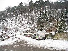
In the second half of the 20th century, roads to the Weinbiet summit were also laid. The right above the valley of Mußbachs of Gimmeldingen leading to the summit former main access contributes to the former transport animals the name donkey path . It was widened and fortified in the 1960s so that supply vehicles can also run there; it is not approved for general motor vehicle traffic. On the outskirts of Haardt, in the Meisental valley, a 4 km long road begins at about 240 m , which overcomes the difference in altitude to the summit via serpentines and wide loops.
literature
Reinhard Kermann, Alfred Sitzmann: Weinbiet - Entdeckertouren , Pfälzerwald-Verein Ortsgruppe Gimmeldingen 2017, ISBN 978-3-00-056836-7 .
Web links
- Weather station Weinbiet , current forecast
- Weinbiet webcam
Individual evidence
- ↑ a b c d e f g h i j k l m n LANIS: Weinbiet on a topographical map from the map service of the landscape information system of the Rhineland-Palatinate nature conservation administration. Retrieved May 16, 2017 .
- ↑ Albert H. Keil: Bavarian "Language Heritage". Verlag PfalzMundArt, accessed on January 19, 2015 .
- ↑ Walter Eitelmann, Ernst Kimmel: Knight Stones in the Palatinate Forest - with 59 hiking suggestions . Ed .: Palatinate Forest Association. 5th edition. Neustadt (Weinstr.) 2005, ISBN 3-00-003544-3 .
- ↑ Adalbert Pemöller: Geographical land survey: The natural spatial units on sheet 160 Landau i. d. Palatinate. Federal Institute for Regional Studies, Bad Godesberg 1969. → Online map (PDF; 4.2 MB).
- ↑ Helmut Beeger u. a .: The landscapes of Rheinhessen-Pfalz - naming and spatial delimitation. In: Reports on German regional studies , Volume 63, Issue 2, Trier 1989, pp. 327–359.
- ↑ Weather records in Germany. (PDF) (No longer available online.) German Weather Service, archived from the original on September 23, 2015 ; Retrieved August 12, 2014 .
- ↑ Hurricane low over Western Europe: "Xynthia" claims more than 50 deaths. Spiegel online, March 1, 2010, accessed August 12, 2014 .
- ↑ Neustadt local mountains. The Weinbiet. (PDF; 6.2 kB) (No longer available online.) Stadt Neustadt, archived from the original ; Retrieved January 20, 2015 .
- ^ Otto Gödel: A border crossing in the Deidesheimer forest with pictures . In: Heimatfreunde Deidesheim und Umgebung (Hrsg.): Heimatblätter Deidesheim und Umgebung . No. 3 , 1972, p. 15 .
- ^ Albert H. Keil: 's Woibiet un die Palz. (High German: The Weinbiet and the Palatinate) . Verlag PfalzMundArt, accessed on January 20, 2015 .
- ^ A b Palatinate Forest Association, Gimmeldingen local group: Association history. Retrieved January 21, 2015 .
- ^ Palatinate Forest Association, Gimmeldingen local group: Weinbiethaus. Retrieved May 27, 2015 .
- ↑ → List of cultural monuments in Gimmeldingen .
- ↑ Weinbiethaus. Stadt Neustadt, accessed on January 21, 2015 .
- ↑ Current measured values from the weather station. Wetteronline, accessed on May 3, 2013 (current readings of the weather).
- ↑ The Rhine Palatinate . Ludwigshafen June 15, 2010.
- ↑ Martin Grund and Ursel Mosebach: Webcam Weinbiet. NABU , July 2017, accessed July 30, 2017 .
- ^ Georg Dürrschmidt : Laudation. Palatinate Forest Association, Gimmeldingen local group, April 30, 2006, accessed on January 20, 2015 .
- ↑ Wolfsburg ruins and Weinbiet. wandern-in-der-pfalz.kruemelhuepfer.de, accessed on January 20, 2015 (circular hike in the southern and eastern Weinbiet massif with overview map and photos).


