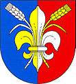
Únehle
| Únehle | ||||
|---|---|---|---|---|
|
||||
| Basic data | ||||
| State : |
|
|||
| Region : | Plzeňský kraj | |||
| District : | Tachov | |||
| Area : | 606.1766 ha | |||
| Geographic location : | 49 ° 47 ' N , 13 ° 1' E | |||
| Height: | 499 m nm | |||
| Residents : | 136 (Jan. 1, 2019) | |||
| Postal code : | 349 01 | |||
| License plate : | P | |||
| structure | ||||
| Status: | local community | |||
| Districts: | 1 | |||
| administration | ||||
| Mayor : | Jana Křelinová (as of 2006) | |||
| Address: | Únehle 6 349 01 Stříbro |
|||
| Municipality number: | 541435 | |||
| Website : | www.unehle.cz | |||
Únehle (German Unola , also Unolla ) is a municipality with 136 inhabitants (as of January 1, 2019) in the Czech Republic . It is located 5 km northeast of Stříbro at an altitude of 449 m above sea level. M.
history
The first mention of the place comes from the year 1115, at that time the village belonged to the Kladrau monastery . In 1232 it became the property of the Teplá Monastery . Since 1390 Unola has been one of the villages of the royal town of Mies and later passed to the Trpísty - Třebel rule , who owned it until the patrimonial rule was abolished . Unola was parish in Welperschitz .
After the Munich Agreement , the place was added to the German Reich and until 1945 belonged to the district of Mies . In 1939, 280 people lived in Unola.
Between 1960 and 1980 it was incorporated into Kšice and from July 1, 1980 to November 24, 1990, Únehle was part of Erpužice .
Únehle was created around a village square and pond. The place has a chapel, which is located near the pond in the rear village.


