
Rozvadov
| Rozvadov | |||||
|---|---|---|---|---|---|
|
|||||
| Basic data | |||||
| State : |
|
||||
| Region : | Plzeňský kraj | ||||
| District : | Tachov | ||||
| Area : | 5493.3855 ha | ||||
| Geographic location : | 49 ° 40 ' N , 12 ° 33' E | ||||
| Height: | 570 m nm | ||||
| Residents : | 735 (Jan. 1, 2019) | ||||
| Postal code : | 348 06 | ||||
| License plate : | P | ||||
| structure | |||||
| Status: | local community | ||||
| Districts: | 6th | ||||
| administration | |||||
| Mayor : | Pavel Pajer (as of 2019) | ||||
| Address: | Rozvadov 10 348 06 Přimda |
||||
| Municipality number: | 561169 | ||||
| Website : | www.rozvadov.cz | ||||


Rozvadov (German Roßhaupt ) is a municipality with 735 inhabitants (as of January 1, 2019) in the Czech Republic . It is 570 m above sea level. M. in the Upper Palatinate Forest (Český les) on the border with Bavaria and belongs to the Okres Tachov . The municipality has an area of 54.9 km².
There is a border crossing for motor vehicle traffic to the neighboring German municipality of Waidhaus , located 5 km to the south-west .
The D5 motorway runs south of the town , and continues on the German side at Waidhaus as BAB 6 , and on this section it is also the European route 50. Until the Czech Republic joined the Schengen Agreement on December 21, 2007, the largest German-Czech border crossing was located here.
history
The place, which was sometimes called Sichdichfür , was mentioned for the first time in 1581, and a Bohemian customs office had existed since 1613 . The current customs office building was built in 1934.
After the Munich Agreement , the place was added to the German Empire and until 1945 belonged to the Tachau district .
The most striking building was the baroque St. Wenceslas Church , built between 1816 and 1825 . After 1945 the church was briefly used as a cinema, then as a warehouse and was renovated in 2015 by the diocese of Pilsen.
In 1938 there were 784 inhabitants in Roßhaupt, which consisted of 137 houses. Including the associated six layers , the place had 1,191 inhabitants.
Community structure
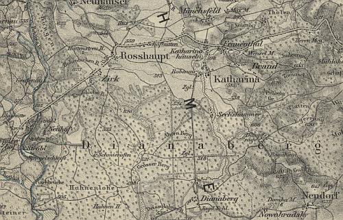
The municipality Rozvadov consists of the districts Diana ( Dianaberg ) , Milíře ( Brand ), Nové Domky ( Neuhäusl ), Rozcestí ( sheep huts ), Rozvadov and Svatá Kateřina ( Sankt Katharina , also Katharinen ). Basic settlement units are Diana, Kateřinské Chalupy ( Katharinahäuseln ), Milíře, Nové Domky, Rozcestí, Rozvadov, Střeble ( Ströbl ) and Svatá Kateřina.
The municipality is divided into the cadastral districts Nové Domky, Rozvadov, Střeble and Svatá Kateřina u Rozvadova. The Frauentál ( Frauenthal ), Hraničky ( Reichenthal ), Mnichovství ( Münchsdorf ), Polesí ( Zirk ), Robenava ( Robenau ) and Venclův Mlýn ( Wenzelmühle ) deserts are located in the municipality .
Culture and sights
The King's Resort is located in Rozvadov and currently has the largest poker room in Europe. From 2017 to 2021, this will host circuit tournaments as well as the World Series of Poker Europe 2017 , 2018 and 2019 .
Web links
Individual evidence
- ↑ http://www.uir.cz/obec/561169/Rozvadov
- ↑ Český statistický úřad - The population of the Czech municipalities as of January 1, 2019 (PDF; 7.4 MiB)
- ↑ http://www.uir.cz/casti-obce-obec/561169/Obec-Rozvadov
- ↑ http://www.uir.cz/zsj-obec/561169/Obec-Rozvadov
- ↑ http://www.uir.cz/katastralni-uzemi-obec/561169/Obec-Rozvadov