
Lestkov
| Lestkov | |||||
|---|---|---|---|---|---|
|
|||||
| Basic data | |||||
| State : |
|
||||
| Region : | Plzeňský kraj | ||||
| District : | Tachov | ||||
| Area : | 3880.3038 ha | ||||
| Geographic location : | 49 ° 53 ' N , 12 ° 52' E | ||||
| Height: | 617 m nm | ||||
| Residents : | 392 (Jan. 1, 2019) | ||||
| Postal code : | 349 53 - 349 54 | ||||
| License plate : | P | ||||
| structure | |||||
| Status: | local community | ||||
| Districts: | 6th | ||||
| administration | |||||
| Mayor : | František Bezpalec (as of 2007) | ||||
| Address: | Lestkov 210 349 53 Bezdružice |
||||
| Municipality number: | 561011 | ||||
| Website : | www.obeclestkov.cz | ||||


Lestkov (German Leskau ) is a municipality in the Okres Tachov in the Czech Republic .
Geographical location
The village is located in western Bohemia , ten kilometers east of Planá ( Plan ) on the road to Konstantinovy Lázně ( Konstantinsbad ), at an altitude of 617 m above sea level. M.
history


The first mention of Lezchow comes from the year 1257. Since 1262 the place can be traced as the parish seat. The Church of St. Prokop was acquired in 1740 and 1780.
Until the death of Count Johann Friedrich von Schwanberg in 1659, the town was owned by the Schwanbergers , whose coat of arms - the swan - is still the municipal coat of arms today. The next owners were the Counts of Heisenstein, in 1712 Maximilian Karl acquired Prince zu Löwenstein on Weseritz Leskau.
Leskau had a weekly market since 1506. In 1508 the place was granted freedom of trade and privileges for self-administration and jurisdiction. In 1524 the right to boil and in 1527 the permission for two annual markets were added. In the course of the 18th and 19th centuries, Leskau lost more and more importance, the cause was on the one hand in the proximity to the up-and-coming town of Plan . The establishment of the Konstantinsbad spa in 1874 also led to further stagnation and Leskau, halfway between the two towns, was not connected to the new important means of transport, the railroad.
After the abolition of patrimonial Leskau came to the district of Plan. In the following period the affiliation changed several times between the political districts Weseritz, Tepl and finally Marienbad.
After the First World War , Leskau was added to the newly created Czechoslovakia in 1919 . Due to the Munich Agreement , Leskau belonged from 1938 to 1945 to the district of Tepl , administrative district of Eger , in the Reichsgau Sudetenland .

St. Prokop Church, from the south-east (photo 2014)

Church of St. Prokop, from the southwest (photo 2014)

St. Prokop Church (photo 2012)
Rectory (photo 2016)


In 1838 there were 907 people living in the small town of Leskau, in 1939 there were 820.
After the end of the Second World War , the property of the princes of Löwenstein was expropriated in 1945. The German-Bohemian residents of Leskau were expropriated and driven out .
In 1991 the place had 250 inhabitants.
Demographics
| year | Residents | Remarks |
|---|---|---|
| 1785 | k. A. | 29 houses |
| 1830 | 803 | in 113 houses |
| 1832 | 800 | in 113 houses |
| 1837 | 907 | in 118 houses, including seven Israelite families |
| 1869 | 1077 | |
| 1880 | 1090 | |
| 1890 | 1078 | |
| 1900 | 1058 | |
| 1910 | 1044 | |
| 1921 | 868 | including 860 German residents |
| 1930 | 873 | |
| 1939 | 820 |
| year | 1950 | 1961 | 1970 | 1980 | 1991 | 2001 | 2011 |
|---|---|---|---|---|---|---|---|
| Residents | 310 | 382 | 559 | 418 | 346 | 361 | 357 |
Attractions
St. Prokop Church
The Church of St. Prokop, which shapes the image of the place, was in ruins for decades and has recently been repaired. It already existed in 1375. At that time it was under the patronage of the Schwanberger and Johann von Schwanberg exercised the office of pastor. During the Thirty Years' War the building was in serious disrepair and in 1647 the pastor Kaspar Haas had parts of the church demolished. In the period from 1739 to 1740 the church was rebuilt and in 1780 construction work was carried out again. The church received its baroque appearance.
During the communist rule, the church fell into disrepair. In a storm in 1972, the tower cross fell from the church tower. In October 1993 the roof of the nave collapsed and fell into the interior of the church. Security measures are currently being carried out on the ruins to prevent further deterioration.
The furnishings from the period from 1720 to 1730 are now partly in the church in Domaslav, other pieces are stored in Pilsen in the bishopric.
The church was previously surrounded by a cemetery, which was closed in 1683 with the creation of the new cemetery at the now demolished chapel of John the Baptist. During the construction work carried out on the church in 1780, it was lifted and some of the graves were reburied in the New Cemetery.
Other structures
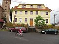
In addition to the church ruins, the former schoolhouse on the market square also shapes the townscape. It was built in 1876 instead of a previous building from 1679 for 16,400 guilders and served as the local school until 1999. After the school was closed, the building was converted into a municipal office.
There is a statue of St. Anthony of Padua in front of the town hall. Another statue that shows the patron saint, St. Prokop, represents, stands in the rows of trees in the market. There is also an old granary in Lestkov.
Community structure
The Lestkov municipality consists of the following districts:
- Domaslav ( Bohemian Domaschlag ), 26 inhabitants, first mentioned in 1227
- Hanov ( Honau ), 16 inhabitants, first mentioned in 1367,
- Lestkov
- Stan ( Gstom ), 28 residents, first mentioned in 1357, with
- Dolní Víska ( Unterdörflas ), no permanent residents, only 2 secondary residences, first mentioned in 1654
- Vrbice u Bezdružic ( Fürwitz ), 1 inhabitant, first mentioned in 1367, and
- Vysoké Jamné ( Hohenjamny ), 26 inhabitants, first mentioned in 1208.
Basic settlement units are Dolní Víska, Domaslav, Hanov, Lestkov, Stan, Vrbice u Bezdružic and Vysoké Jamné.
The municipality is divided into the cadastral districts of Dolní Víska, Domaslav, Hanov u Lestkova, Lestkov, Stan u Lestkova, Vrbice u Bezdružic and Vysoké Jamné. In the municipality are the places and residential areas Český Mlýn ( Bohemian Mill ), Horní Víska ( Oberdörflas ) and Milkov ( Millikau ) , which were abandoned in the 1950s and 1960s . The deserted areas of Kopáčov, Křivoústy and Tisvice have been deserted since the 16th century, their inhabitants fell victim to the plague and the places were never repopulated.
Individual evidence
- ↑ Obec Lestkov: Územně identifikační registr ČR. Retrieved March 17, 2018 .
- ↑ Český statistický úřad - The population of the Czech municipalities as of January 1, 2019 (PDF; 7.4 MiB)
- ↑ a b Jaroslaus Schaller : Topography of the Kingdom of Bohemia . Volume 9: Pilsner Kreis , Prague and Vienna 1788, pp. 146–147, item 37) .
- ^ A b Johann Gottfried Sommer : The Kingdom of Bohemia . Volume 6: Pilsen Circle. Prague 1838, p. 285, paragraph 16) .
- ↑ Yearbooks of the Bohemian Museum of Natural and Regional Studies, History, Art and Literature . Volume 2, Prague 1831, p. 203, item 12) below.
- ^ Carl E. Rainold: Taschen-Reise-Lexikon für Böhmen . Prague 1833, p. 310 .
- ↑ a b c d e f Historical Lexicon of the Republic of the Czech Republic 1869–2011 ( page no longer available , search in web archives ) Info: The link was automatically marked as defective. Please check the link according to the instructions and then remove this notice.
- ^ Sudetenland Genealogy Network
- ^ A b Michael Rademacher: German administrative history from the unification of the empire in 1871 to reunification in 1990. Teplá district (Czech Teplá). (Online material for the dissertation, Osnabrück 2006).
- ↑ Části obcí: Územně identifikační registr ČR. Retrieved March 17, 2018 .
- ↑ Základní sídelní jednotky: Územně identifikační registr ČR. Retrieved March 17, 2018 .
- ↑ Katastrální území: Územně identifikační registr ČR Retrieved March 17, 2018 .