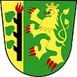
Lesná u Tachova
| Lesná | ||||
|---|---|---|---|---|
|
||||
| Basic data | ||||
| State : |
|
|||
| Historical part of the country : | Bohemia | |||
| Region : | Plzeňský kraj | |||
| District : | Tachov | |||
| Area : | 8425.9829 ha | |||
| Geographic location : | 49 ° 45 ' N , 12 ° 33' E | |||
| Height: | 643 m nm | |||
| Residents : | 465 (Jan 1, 2019) | |||
| Postal code : | 347 01 | |||
| License plate : | P | |||
| structure | ||||
| Status: | local community | |||
| Districts: | 4th | |||
| administration | ||||
| Mayor : | Zdeněk Uhlík (as of 2006) | |||
| Address: | Lesná 1 347 01 Tachov 1 |
|||
| Municipality number: | 561002 | |||
| Website : | www.obeclesna.cz | |||
Lesná (German Schönwald ) is a municipality in western Bohemia ( Czech Republic ).
geography
Lesná lies nine km southwest of Tachov at 643 m above sea level. M. in the Upper Palatinate Forest (Český les) and belongs to the Okres Tachov . The Kateřinský potok ( Katharinabach ), which bears the name Pfreimd in German territory, rises to the southeast of the village on Holý vrch . The extensive municipal area includes large forest areas up to the border with the neighboring Bavarian municipalities of Flossenbürg and Georgenberg .
history
Schönwald was first mentioned in 1349. Since 1720 the place had its own parish, before it was parish after Purschau . In 1939 there were 564 people living in Schönwald with the districts Inselthal, Kohlerhof and Kolm.
After the Munich Agreement , the place was added to the German Empire and until 1945 belonged to the Tachau district .
The municipality of Česká Ves (with České Nové Domky, Josefovo Údolí, Nová Knížecí Huť, Starý Pochr ) was disbanded and relocated after 1948 due to its proximity to the border in the course of the construction of the Iron Curtain ; in 1952 it was officially declared extinct. Stará Knížecí Huť (with Háje), Zahájí (with Přední Zahájí and Zadní Zahájí) and Nový Losimtál (with Nová Huť) were also dissolved in 1948 and incorporated. At the same time, in the course of the dissolution of the municipality Pavlův Studenec, the corridors of the districts Nový Windischgrätz , Ostrůvek and Zlatý Potok zu Lesná were closed. In 1961 Písařova Vesce (with Bažantov) was incorporated.
Community structure
The municipality of Lesná consists of the districts Háje ( Leierwinkel ), Lesná ( Schönwald ), Písařova Vesce ( Albersdorf ) and Stará Knížecí Huť ( Altfürstenhütte ). Basic settlement units are Bažantov ( Wosant ), Česká Ves ( Böhmischdorf ) Jedlina ( Neu Losimthal also Neulosimthal ), Lesná, Ostrůvek ( Island Thal ) Písařova Vesce, Stará Knížecí Huť and Zahájí ( Waldheim ). The municipality is divided into the cadastral districts of Bažantov, Česká Ves u Lesné, Jedlina, Lesná u Tachova, Pavlův Studenec 1 ( Inselthal ), Písařova Vesce, Stará Knížecí Huť and Zahájí u Lesné.
The area of the municipality also includes the extinct localities of České Nové Domky ( Böhmisch Neuhäusl ), Josefovo Údolí ( Josefsthal ), Kolerova Huť ( Kohlerhof ), Nová Huť ( Neuhütte ), Nová Knížecí Huť ( Neufürstenhütte ), Skláře ( Neu Windischgrätz ), Stoupa ( Altpocher ) and Zlatý Potok ( Goldbach ).
Culture and sights
Individual evidence
- ↑ http://www.uir.cz/obec/561002/Lesna
- ↑ Český statistický úřad - The population of the Czech municipalities as of January 1, 2019 (PDF; 7.4 MiB)
- ↑ http://www.uir.cz/casti-obce-obec/561002/Obec-Lesna
- ↑ http://www.uir.cz/zsj-obec/561002/Obec-Lesna
- ↑ http://www.uir.cz/katastralni-uzemi-obec/561002/Obec-Lesna

