Post-mining landscape Geiseltal
Coordinates: 51 ° 18 ′ 34 ″ N , 11 ° 52 ′ 7 ″ E
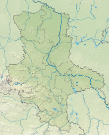
The Geiseltal post-mining landscape is a nature reserve in the cities of Müuellen (Geiseltal) , Bad Lauchstädt , Braunsbedra and Merseburg in the Saalekreis in Saxony-Anhalt .
description
The nature reserve was created as a post-mining landscape . It bears the designation NSG 0368 and is around 1156 hectares in size. The area has been under protection since 2005 (date of regulation: February 8, 2005). The responsible lower nature conservation authority is the Saalekreis.
The nature reserve is located in the Geiseltal west of Merseburg. It places part of the recultivated post-mining landscape of the former open- cast lignite mines Müelte and Neumark-Nord under protection. The nature reserve consists of three sub-areas: the approximately 467 hectare Klobikau dump south of the Bad Lauchenstadt district of Klobikau , which is approx. 113 hectare stockpile Blösien west of Blösien belonging to the Merseburg district of Geusa and the approximately 576 hectare inner dump area northeast of Müelte and northwest of Braunsbedra.
The inner dump area was partially flooded by the resulting Geiseltalsee when the remaining open- cast mining holes were flooded, forming islands and peninsulas with bays rich in shores. The two heaps are located on the north bank of the lake, which was created between 2003 and 2011, and each include areas in front of them that have become areas of the lake close to the shore due to the flooding of the site. To the south of the Blösien dump, there is also a small open pit, separated from the Geiseltalsee, part of the nature reserve.
The two heaps are partly wooded or bushy, partly characterized by open areas. The open areas are mainly occupied by dry grass . Here z. B. the straw flower . In the wooded areas settle u. a. Orchids such as brown-red stendellum and large two-leaf . A wine-growing area was created on the slope of the Klobikau dump, which is exposed to the south . The areas around the wine-growing area are grazed with Red Höhenvieh and Boer goats for maintenance . In the area of the inner dump and the bank areas in front of the dumps, large areas of reed beds can be found in some cases.
The nature reserve is the habitat of a species-rich avifauna . So live here u. a. Red kite , quail , wryneck , red- backed killer , curly pipit , sparrowhawk and gray bunting . A cormorant colony has settled in the nature reserve . The bee eater is also native here. He uses steep walls and slopes for the construction of his brood tube. The eagle owl also finds a suitable habitat in the area of steep walls. The dumps have developed into a suitable habitat for the brown hare , harvest shrew and harvest mouse . The former bunkers on the Klobikau dump, which were built in the 1980s as the command post of the air defense south of the Soviet armed forces group in Germany , are used as quarters by the brown long-eared and gray long-eared bat species . The dry open areas are the habitat of the grasshoppers, blue-winged wasteland insects , blue-winged sand insects , spotted club insects and long-feeler thorn insects, as well as various ground beetles , wild bees and butterflies .
A circular path runs through the partial areas of Halde Klobikau and Halde Blösien, which spans the entire Geiseltalsee. There are also other publicly accessible paths on the Klobikau dump. An observation tower has also been built here. Another observation station is located in the area of the inner dump, where a former signal box has been converted into a nature, guard and observation station. The area of the inner dump borders in the south on the area of the Geiseltalsee released for recreational use .
See also
Web links
- Post-mining landscape Geiseltal , State Administration Office Saxony-Anhalt
- Map of Geiseltalsee and the surrounding area , Geiseltalsee.de (PDF file, 4.1 MB)
Individual evidence
- ↑ Ordinance of the state administration office of Saxony-Anhalt on the nature reserve "Mining post-mining landscape Geiseltal" . (PDF file, 43.6 kB). Retrieved April 17, 2018.
- ↑ A vision put into practice , viticulture at Geiseltalsee. Retrieved August 18, 2015.
- ↑ From mining to viticulture , viticulture at Geiseltalsee, Geiseltalsee.de. Retrieved August 18, 2015.
- ↑ Natural green maintenance with cattle and castle goats , viticulture at Geiseltalsee, Geiseltalsee.de. Retrieved August 18, 2015.
- ^ "Relapse into old thinking" - On the announced preparation of a cormorant regulation in the state of Saxony-Anhalt , NABU Saxony-Anhalt. Retrieved August 18, 2015.
- ↑ Control bunker - Klobikau, LV Süd , Sperrgebiet.eu. Retrieved August 18, 2015.
- ↑ a b heap Kobikau , interest and development association Geiseltalsee e. V. Retrieved August 18, 2015.
- ↑ Matthias Därr: Masterplan of the post-mining landscape Geiseltal , Halle / Saale, December 1998 (PDF file, 2.2 MB). Retrieved August 18, 2015.
- ↑ Geiseltalrundwege , Geiseltalsee Association of Interest and Friends. V. Retrieved August 18, 2015.
- ↑ Nature, guard and observation station , Geiseltalsee eV interest and support association. Accessed on August 18, 2015.
- ↑ Map of the general decree regulating public use on the southern Geiseltalsee , district of Saalekreis, March 2014 (PDF file, 2.5 MB). Retrieved August 18, 2015.


