Porphyry landscape near Brachwitz
Coordinates: 51 ° 32 ′ 35 ″ N , 11 ° 52 ′ 17 ″ E
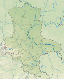
The porphyry landscape near Brachwitz is a nature reserve in the town of Wettin-Löbejün in the Saale district in Saxony-Anhalt .
The nature reserve with the registration number NSG 0265 is around 152 hectares . It is partially a component of the FFH area "porphyry hill country northwest Hall" and almost completely from the conservation area surrounded "Saale". The area has been under protection since 2002 (date of regulation: August 7, 2002). The responsible lower nature conservation authority is the Saalekreis.
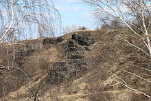
The nature reserve is located northwest of Halle (Saale) in the Lower Saale Valley Nature Park . It is a characteristic section of the nationwide unique porphyry hill landscape on the edge of the Saale valley under protection. The areas in the nature reserve were often used for agriculture, mainly as fields . Most of the fields are temporarily closed or have fallen completely fallow . Some of the former arable land that fell fallow has been converted into species-rich grassland . The porphyry peaks rise between the agricultural areas, on the shallow soils of which dry and semi-arid lawns with meadow harbor communities and dwarf shrub heaths predominate. Occasionally, feathery twine lawns can also be found on the lower slopes and blue fescue pioneer corridors on very shallow soils. In the arid and semi-arid grasslands partially settle endangered plant species including winged Orchid , Rock gold star and pulsatilla vulgaris . On the Lucienberg there is a small, abandoned quarry that is heavily bushed.
In the south of the nature reserve, the Brachwitzer Bach runs in a depression between Lucienberg, Klapperberg and Schulberge, which flows into the Saale a little south of Brachwitz . The stream is surrounded by a black alder lined -Eschenwald and poplar trees and Staudenfluren accompanied. In the stream grows frogbit , on an adjacent carbon Distelwiese located Inula Britannica .
The nature reserve is the habitat of a species-rich insect flora . Various grasshoppers live here , including field crickets , field grasshoppers , spotted club hoppers , red-bodied grasshoppers , small heather grasshoppers , butterflies , including the great mother-of-pearl butterfly , mountain witch , silver-green blue , sarsette rams and white-spot rams as well as wild bees such as the trouser beetle and ground beetle . B. the short-domed ground beetle . Spiders, various birds , including partridge and gray bunting , and the brown hare are also native. The nature reserve is also a feeding habitat for various birds of prey .
In the south, the nature reserve borders in places on Bachwitz and on public roads. In the northwest it is crossed by the state road 162 and the road to Friedrichsschwerz. Furthermore, pass through the area several rural roads , also called the trails are used. The federal motorway 143 (Halle western bypass), the further construction of which is planned between the federal highway 80 near Bennstedt and the federal highway 14 near Görbitz, would run directly north of Friedrichsschwerz and thus in the immediate vicinity of the nature reserve and here the FFH area "Porphyry hill landscape northwest of Halle", that connects the nature reserve "Porphyry landscape near Brachwitz" and the nature reserve " Porphyry landscape near Gimritz ", a little to the north . The connection between the two nature reserves is to be restored by a green bridge . The NABU Sachsen-Anhalt had sued against the planning approval decision 2005. In January 2007, the Federal Administrative Court classified the planning approval decision as illegal and therefore not enforceable.
See also
Web links
Individual evidence
- ↑ Excursion guide to the workshop donation register and near-natural greening measures , information system near-natural greening measures, Anhalt University of Applied Sciences , Bernburg department (PDF, 3.9 MB). Retrieved August 18, 2015.
- ↑ Hikes in the "Lower Saale Valley" nature park , leaflet from the "Lower Saale valley" association. V. (PDF, 168 kB). Retrieved August 18, 2015.
- ↑ Sebastian Voigt, Astrid Grüttner, Maud von Lampe, Götz Meister and Matthias Stöck (eds.): Landscapes of European Importance in the Lower Saale Valley - Endangered Natural Areas between Halle and Wettin , Calendula, Hallesche Umweltblätter, 4th special issue, Halle (Saale) 2001 ISSN 0949-8573 (PDF, 1.8 MB). Retrieved August 18, 2015.
- ^ A b Sebastian Voigt: Nature conservation and road planning: practical experience using the example of the Saale valley motorway A 143 - "Halle western bypass" ( memento from August 24, 2015 in the Internet Archive ), NABU Halle / Saalekreis.
- ↑ Jens Schmidt: A 143: Why a motorway is covered , Volksstimme , February 25, 2014. Retrieved on August 18, 2015.
- ↑ A 143 - NABU achieves success in stages for the preservation of the Lower Saale Valley near Halle , press release by NABU Saxony-Anhalt, January 17, 2007 (PDF, 51.5 kB). Retrieved August 18, 2015.


