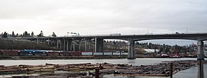
British Columbia Highway 91A
| Highway 91A in British Columbia, Canada | |||||||||||||||||||
| Queensborough Connector | |||||||||||||||||||

|
|||||||||||||||||||
| map | |||||||||||||||||||
| Basic data | |||||||||||||||||||
| Operator: | British Columbia Ministry of Transportation |
||||||||||||||||||
| Start of the street: |
Richmond ( 49 ° 10 ′ N , 122 ° 58 ′ W ) |
||||||||||||||||||
| End of street: |
New Westminster ( 49 ° 12 ′ N , 122 ° 57 ′ W ) |
||||||||||||||||||
| Overall length: | 7 km | ||||||||||||||||||
| Queensborough Bridge | |||||||||||||||||||
|
Course of the road
|
|||||||||||||||||||
The Highway 91A in British Columbia , Canada , is only 7 km. It runs as a feeder from New Westminster to Highway 91 to Richmond . Until the construction of the western part of Highway 91 this led over the route from Highway 91 to New Westminster. The route crosses the northern arm of the Fraser River over the Queensborough Bridge .
Individual evidence
- ^ Official Numbered Routes in British Columbia. British Columbia Ministry of Transportation, May 28, 2008, accessed March 9, 2013 .
- ↑ BC Landmark Kilometer Inventory (LKI). British Columbia Ministry of Transportation, December 19, 2013, accessed June 2, 2014 .

