
Bystry Istok
| Village
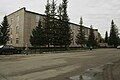
Bystry Istok
Быстрый Исток
|
||||||||||||||||||||||||||||||
|
||||||||||||||||||||||||||||||
|
||||||||||||||||||||||||||||||


Bystry Istok ( Russian Бы́стрый Исто́к ) is a village (selo) in the Altai region ( Russia ) with 3852 inhabitants (as of October 14, 2010).
geography
The place is about 120 km as the crow flies south-southeast of the regional administrative center of Barnaul and 60 km west-southwest of Biysk on the left bank of the Ob .
Bystry Istok is the administrative center of the Rajons Bystroistokski and seat and only town in the rural community Bystroistokski selsowet .

Lenin Street
District administration

school


history
The village was founded in 1763. In 1925 Bystry Istok became the center of a Rajon. From 1959 to 1991 the place had the status of an urban-type settlement .
Population development
| year | Residents |
|---|---|
| 1939 | 8280 |
| 1959 | 6967 |
| 1970 | 6664 |
| 1979 | 6165 |
| 1989 | 6211 |
| 2002 | 4490 |
| 2010 | 3852 |
Note: census data
traffic
Road connection exists to the regional road coming from Biysk, which follows the Ob tributary Anui about 20 km south of Bystry Istok to the neighboring district center of Petropavlovskoye to the southwest .
Sons and daughters of the place
- Valery Solotuchin (1941–2013), actor
Individual evidence
- ↑ a b Itogi Vserossijskoj perepisi naselenija 2010 goda. Tom 1. Čislennostʹ i razmeščenie naselenija (Results of the All-Russian Census 2010. Volume 1. Number and distribution of the population). Tables 5 , pp. 12-209; 11 , pp. 312–979 (download from the website of the Federal Service for State Statistics of the Russian Federation)
| Cities |
Aleisk S / R | Barnaul S | Belokuricha S | Biysk S / R | Gornjak R | Jarowoje S | Arrived on Ob R | Novoaltaisk S / R | Rubtsovsk S / R | Sarinsk S / R | Slavgorod S | Smeinogorsk R |
|
| Urban-type settlements |
Blagoveshchenka R | Yuzhny | Malinovoye Osero | Sibirski S / G | Stepnoje Osero | Talmenka R |
|
| Other Rajon centers |
Altayskoye | Bayewo | Burla | Bystry Istok | Chabary | Halbstadt | Yeltsovka | Kalmanka | Klyuchi | Kosicha | Krasnogorskoye | Krasnoschtschokovo | Kruticha | Kulunda | Kurja | Kytmanowo | Mamontowo | Mikhailovskoye | Novichikha | Novoyegoryevskoye | Pancrushikha | Pavlovsk | Petropavlovskoye | Pospelicha | Rebricha | Rodino | Romanowo | Zalessovo | Zavyalovo | Schelabolicha | Shipunovo | Smolenskoye | Solonezhnye | Solton | Sonalnoye | Sovetskoye | Staroaleiskoje | Tabuny | Tyumensevo | Togul | Topchikha | Troitskoye | Charyschskoye | Uglovskoye | Ust-Kalmanka | Ust-Charyschskaja Pristan | Werch-Sujetka | Volchikha | Tin buoy |