
Crimla
| coat of arms | Germany map | |
|---|---|---|

|
Coordinates: 50 ° 48 ' N , 12 ° 3' E |
|
| Basic data | ||
| State : | Thuringia | |
| County : | Greiz | |
| Fulfilling municipality : | Weida | |
| Height : | 280 m above sea level NHN | |
| Area : | 1.44 km 2 | |
| Residents: | 263 (Dec. 31, 2019) | |
| Population density : | 183 inhabitants per km 2 | |
| Postal code : | 07557 | |
| Area code : | 036603 | |
| License plate : | GRZ, ZR | |
| Community key : | 16 0 76 014 | |
| LOCODE : | DE CMJ | |
| Address of the municipal administration: |
Markt 1 07570 Weida |
|
| Website : | ||
| Mayoress : | Martina Voigtmann | |
| Location of the municipality of Crimla in the district of Greiz | ||
  |
||

Crimla is a municipality in the Greiz district in Thuringia . The fulfilling municipality is the city of Weida .
geography
Crimla lies on a slightly undulating plateau between Gera and Weida.
Directly adjacent communities are Weida , Wünschendorf / Elster , Harth-Pöllnitz and Zedlitz .
history
Crimla was first mentioned in a document on October 18, 1287.
For the Wartenberg desert , which was a preliminary work to the Crimla manor even before the Reformation, four bushels of oats had to be paid annually to the Weida office and three bushels of grain to the Mildenfurth monastery for looking after the chapel.
During the Peasants' War in 1525, Crimla was spared the atonement because it had not participated in the uprising. In 1546, six house owners were found in documents. In 1551 Crimla came to the parish of Sirbis . It had previously been subordinate to the Veitsberg Church.
In 1576 the Weida office granted the manor Crimla lower jurisdiction . On June 25, 1605, jurisdiction was returned from the Weida office as a higher inheritance court.
In 1797, a dysentery epidemic left many people dead. From July 26 to October 15, 1797 a total of 14 residents of Crimla died of the disease. On October 11, 1806, French military marched through Crimla.
On February 1, 1826, the community service in Crimla was lifted. On March 17, 1849, the ordinance repealing patrimonial jurisdiction in the country came into force, whereupon the court in Crimla was repealed. On March 23, 1849, the forced labor in Crimla was lifted.
In 1866 Prussian troops were quartered in Crimla and were marching through on their way to the war against Austria.
In 1912 a public water network was built in Crimla. In 1921 Crimla was connected to the electrical network.
Until 1995, Crimla was a member of the Harth administrative association and has since been met by the city of Weida.

Funkens Gasthaus and partial view (1903)

Alcohol-free restaurant "Zum Goldenen Stern" 1915
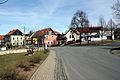
Partial view of the town center


Population development
Development of the population (as of December 31st) :
|
|
|
|
|
- Data source: Thuringian State Office for Statistics
Individual evidence
- ^ Population of the municipalities from the Thuringian State Office for Statistics ( help on this ).
Web links
Auma-Weidatal | Bad Köstritz | Berga / Elster | Bethenhausen | Bocka | Brahmenau | Braunichswalde | Caaschwitz | Crimla | End contactor | Gurgling | Greiz | Grossenstein | Harth-Pöllnitz | Hartmannsdorf | Hilbersdorf | Hirschfeld | Hohenleuben | Dog heads | Crouch | Basket feet | Power Village | Kühdorf | Langenwetzendorf | Langenwolschendorf | Lederhose | Linda b. Weida | Linden Cross | Mohlsdorf-Teichwolframsdorf | Münchenbernsdorf | Paitzdorf | Pölzig | Reichstädt | Ronneburg | Rückersdorf | Saara | Schwaara | Schwarzbach | Seelingstädt | Teichwitz | Weida | Weißendorf | Wish village / Elster | Zedlitz | Zeulenroda shoot