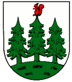
Auma-Weidatal
| coat of arms | Germany map | |
|---|---|---|

|
Coordinates: 50 ° 42 ' N , 11 ° 54' E |
|
| Basic data | ||
| State : | Thuringia | |
| County : | Greiz | |
| Height : | 394 m above sea level NHN | |
| Area : | 55.91 km 2 | |
| Residents: | 3441 (Dec. 31, 2019) | |
| Population density : | 62 inhabitants per km 2 | |
| Postal code : | 07955 | |
| Primaries : | 036626, 036622 | |
| License plate : | GRZ, ZR | |
| Community key : | 16 0 76 092 | |
| Community structure: | 10 districts , 5 localities | |
| Address of the municipal administration: |
Marktberg 9 07955 Auma-Weidatal |
|
| Website : | ||
| Mayor : | Frank Schmidt ( CDU ) | |
| Location of the municipality of Auma-Weidatal in the district of Greiz | ||
The city of Auma-Weidatal is a rural municipality in the Greiz district in Thuringia . The seat of the administration is the former city of Auma .
geography
Auma-Weidatal is located in the southwest of the district of Greiz. The municipality of Harth-Pöllnitz borders in the north, the city of Weida and the municipality of Hohenleuben in the northeast and the city of Zeulenroda-Triebes in the east and south . In the west, the communities of Tegau , Dittersdorf , Tömmelsdorf , Triptis and Mittelpöllnitz in the Saale-Orla district border on Auma-Weidatal.
| Triptis |
Mittelpöllnitz Harth-Pöllnitz |
Weida , Hohenleuben |
| Tommelsdorf |

|
Zeulenroda shoot |
| Dittersdorf | Tegau | Zeulenroda shoot |
Urban or rural municipality structure
Auma-Weidatal is divided into five localities, which correspond to the municipalities of origin of the city with their districts:
- Auma with the districts of Gütterlitz , Krölpa , Muntscha , Untendorf , Wenigenauma and Zickra
- Braunsdorf with the district of Tischendorf
- Göhren-Döhlen with the districts Döhlen and Göhren
- Staitz
- Wiebelsdorf with the districts Pfersdorf and Wöhlsdorf
history
The mayors of the city of Auma and the municipalities of Braunsdorf , Göhren-Döhlen , Staitz and Wiebelsdorf signed the contract on January 13, 2011 for the formation of a rural municipality. The five municipalities have been doing their administrative business in the administrative community of Auma-Weidatal since 1996 together with three others . The merger took place on December 1, 2011.
Population development
|
|
politics
City council
Since the city council election on May 25, 2014, the city council has been composed as follows:
- CDU : 7 seats (± 0)
- Gewerbeverein Auma / Sportverein Blau Weiß Auma (GVA / SVA): 4 seats (± 0)
- Independent citizens' association (UBV): 3 seats (+ 1)
- Bowling club / volunteer fire brigade / home club (KV / FFW / HV): 1 seat (± 0)
- FDP / Citizens for Auma-Weidatal: 1 seat (+ 1)
mayor
Since the city was founded on December 1, 2011, Iris Seidel (CDU) was the city's representative. On April 22nd, 2012, a new mayor was elected in addition to the city council. Frank Schmidt (CDU) prevailed in this election with 58.5% of the votes and a turnout of 58.1% against two competitors.
Economy and Infrastructure
Several state roads run through Auma-Weidatal to the surrounding towns. The Triptis motorway junction of the federal motorway 9 is about 11 kilometers by car from the city center. The section of the Triptis – Marxgrün railway between Triptis and Saalburg-Ebersdorf , where Auma and Krölpa had a train station, has been closed.
The city's economy is characterized by medium-sized industry (eg. As Barat Ceramics ), craft , commercial and agricultural affected farms. In the village of Staitz there is the “In der Muschke” industrial park.
Attractions
Worth seeing in Auma are the church , the old town hall (rebuilt in 1790), to the left of it on the other side of the street the new town hall (1907/08) and the Saxon post mile column.
Web links
- Official website of the city
- Information about Auma-Weidatal on the official website of the district of Greiz
Individual evidence
- ^ Population of the municipalities from the Thuringian State Office for Statistics ( help on this ).
- ↑ Information sheet from the city of Auma-Weidatal on the community merger (PDF file; 225 kB)
- ↑ StBA: Area changes from January 01 to December 31, 2010
- ^ Thuringian State Office for Statistics, municipal council election 2014 - final result, City of Auma-Weidatal , accessed on June 17, 2015.


