
Hilbersdorf (Thuringia)
| coat of arms | Germany map | |
|---|---|---|
 Help on coat of arms |
Coordinates: 50 ° 49 ' N , 12 ° 9' E |
|
| Basic data | ||
| State : | Thuringia | |
| County : | Greiz | |
| Management Community : | Wish village / Elster | |
| Height : | 300 m above sea level NHN | |
| Area : | 4.06 km 2 | |
| Residents: | 203 (Dec. 31, 2019) | |
| Population density : | 50 inhabitants per km 2 | |
| Postal code : | 07580 | |
| Area code : | 036602 | |
| License plate : | GRZ, ZR | |
| Community key : | 16 0 76 027 | |
| Community structure: | 2 districts | |
| Address of the municipal administration: |
Russdorf 7 07580 Hilbersdorf |
|
| Mayor : | Erhard Dörfer | |
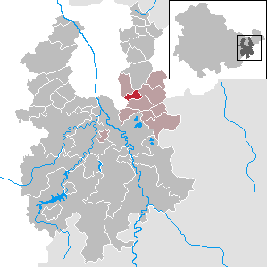
| Location of the community Hilbersdorf in the district of Greiz | ||
  |
||

The Thuringian community Hilbersdorf is located in the district of Greiz and belongs to the administrative community Wünschendorf / Elster . It is located in the upper Wipsetal .
geography
Geographical location
Hilbersdorf is located in the Ronneburg arable and mining area ; The redeveloped mining areas of SDAG Wismut border the municipality to the north . The Wipse rises east of the community in Erlicht, flows through the community to the west and flows into the White Elster at Gera-Liebschwitz . The regional watershed between the Weißen Elster and the Pleiße runs east of the municipality . From Hilbersdorf you can reach Gera , Weida or Ronneburg in a few minutes . None of the nearest cities are further than 10 km away.
Neighboring communities
Neighboring communities are Kauern , Linda b. Weida , Rückersdorf and the city of Ronneburg in the district of Greiz and the independent city of Gera . Gera is only indirectly adjacent to the district of Falka .
Community structure
Hilbersdorf consists of the districts Hilbersdorf and Rußdorf .
history
It is believed that the Mildenfurth monastery near Wünschendorf was founded and settled in the 12th century. For a long time, Hilbersdorf was divided into four different states. In the middle of the 19th century, 13 houses with 85 inhabitants belonged to the Duchy of Saxony-Altenburg , two houses with 15 inhabitants to the Grand Duchy of Saxony-Weimar-Eisenach , three houses with 18 inhabitants to the Principality of Reuss younger line and six houses with 36 inhabitants to the Kingdom of Saxony ( Ziegenhierdsches country ). After the Thuringian states were absorbed into the state of Thuringia in 1920, the Saxon part of Hilbersdorf came to Thuringia in 1928 as part of an area exchange.
On July 1, 1950, the previously independent community of Rußdorf was incorporated.
From 1952 on, the municipality belonged to the Gera district and the Gera-Land district . In 1990 the Gera district became part of the state of Thuringia. In 1994 the districts in Thuringia were reorganized and Hilbersdorf has been part of the Greiz district ever since.
Population development
In 1933, the two later districts together had 246 and 1939 221 inhabitants.
Development of the population (from 1994: as of December 31) :
|
|
|
|
|
- Data source from 1994: Thuringian State Office for Statistics
politics
Municipal council

The municipal council was determined by a majority vote in the local elections on May 25, 2014 . The members are united in the Hilbersdorf / Rußdorf electoral list. The turnout was 59.5%, 4.7% p below that of 2009.
mayor
In the mayoral election on June 12, 1994, Erhard Dörfer received 76.8% of the valid votes in the first ballot. It was confirmed in the election of June 13, 1999 with 93.9% of the votes in the first ballot. In the June 27, 2004 election, there was no opposing candidate. The election on June 6, 2010 resulted in re-election with 90.1% of the votes.
Culture and sights

Despite the close proximity to the overburden dumps of the bismuth mining, delightful hikes are possible along the Wipse in the direction of Liebschwitz and north to the Reuster Berg. The European long-distance hiking trail E3 or the EB-Weg and the Thüringenweg lead through the district of Rußdorf. The current exterior and interior appearance of the church is determined by the last renovation in 1742.
Economy and Infrastructure
traffic
The community is connected via the county road K 116 from Pohlen to Kauern . Other local roads lead from Hilbersdorf to Wüstfalke and from Rußdorf to Reust . On working days except Saturdays, the bus route 219 Gera – Wünschendorf – Linda – Wolfersdorf – Seelingstädt operated by RVG Regionalverkehr Gera / Land . Since 1956, the Seelingstädt – Schmirchau line of the Wismut-Werkbahn has run through the municipality, which until 1983 had an operational crossing station near Rußdorf. The closest access to local rail transport is in Wünschendorf / Elster .
Established businesses
The main source of income in earlier years was agriculture . In the meantime, 12 smaller businesses or companies have established themselves in the village.
Web links
Individual evidence
- ^ Population of the municipalities from the Thuringian State Office for Statistics ( help on this ).
- ^ Johann Friedrich Kratzsch: Lexicon of all localities of the German federal states. Naumburg, 1843. p. 305.
- ↑ Local election results 2014
Auma-Weidatal | Bad Köstritz | Berga / Elster | Bethenhausen | Bocka | Brahmenau | Braunichswalde | Caaschwitz | Crimla | End contactor | Gurgling | Greiz | Grossenstein | Harth-Pöllnitz | Hartmannsdorf | Hilbersdorf | Hirschfeld | Hohenleuben | Dog heads | Crouch | Basket feet | Power Village | Kühdorf | Langenwetzendorf | Langenwolschendorf | Lederhose | Linda b. Weida | Linden Cross | Mohlsdorf-Teichwolframsdorf | Münchenbernsdorf | Paitzdorf | Pölzig | Reichstädt | Ronneburg | Rückersdorf | Saara | Schwaara | Schwarzbach | Seelingstädt | Teichwitz | Weida | Weißendorf | Wish village / Elster | Zedlitz | Zeulenroda shoot