Damoh (District)
| Damoh Hindi District दमोह ज़िला |
|
|---|---|

|
|
| State | Madhya Pradesh |
| Division : | Sagar |
| Administrative headquarters : | Damoh |
| Area : | 7306 km² |
| Residents : | 1,264,219 (2011) |
| Website : | Damoh district |
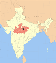
The district of Damoh ( Hindi : दमोह ज़िला) is a district of the central Indian state of Madhya Pradesh in the historical region of Bundelkhand . The administrative and economic center is the city of Damoh , which has around 145,000 inhabitants .
geography
The district of Damoh borders on the Sagar district to the west and the Chhatarpur to the northwest and north . To the east the district is bounded by the Panna district ; the Katni district borders in the southeast and the Narsinghpur district in the south .
The climate is warm; Rain (approx. 1260 mm / year) falls almost exclusively in the monsoon months from June to September. The Ken and Sonar Rivers cross the district from southwest to northeast and join near the northern district boundary. In the south of the district rises the Vindhya Mountains , between 350 and 595 m high , where both rivers have their source.
Administrative division
The Damoh district is divided into seven administrative districts ( Tehsils or Subdivisions ): Batiyagarh, Damoh, Hatta, Jabera, Patera, Patharia and Tendukheda with a total of almost 1200 villages and - in addition to the city of Damoh - only four medium-sized or smaller cities: Hatta (approx 35,000), Hindoria (approx. 18,000), Patharia (approx. 25,000) and Tendukheda (approx. 17,000).
population
As a result of the sustained population growth in large parts of northern India and due to immigration, the population of the district has increased enormously in recent decades:
| year | 1991 | 2001 | 2011 |
|---|---|---|---|
| Residents | 898.125 | 1,083,949 | 1,264,219 |
Hindus dominate the rural villages (about 98%); about 15 to 20% of the urban population are Muslims . In the decade between 2001 and 2011, the population grew by almost 20% to around 1.26 million, with the male population exceeding the female population by around 10%. About 85% of the population lives in rural villages; more than a third of people (mostly women) are illiterate. One speaks Hindi and Bundeli .
economy
According to official statistics, the Damoh district is one of the 250 most backward of a total of 640 districts in India. It is characterized by agriculture to a very high degree, with migrant workers also playing a not unimportant role to this day. Only in the few cities are there a few larger shops and craft businesses as well as banks, hospitals and secondary schools. There is a large cement plant owned by the HeidelbergCement Group near the city of Narsinghgarh . The district has a total of ten train stations on the Sagar - Katni line .
history
In the early Middle Ages (approx. 400–600) the region belonged to the Gupta empire ; In the High Middle Ages (approx. 900–1200) it was ruled by the Kalachuris of Tripuri , but the Chandella dynasty was also present at times. In the 15th century, the Malwa Sultanate of Mandu temporarily ruled the region. In the early 16th century it belonged to the Empire of the Gond , which was conquered by the Mughal General Asaf Khan in 1564 against the fierce resistance of the last ruling princess, Rani Durgavati . The area had been under British control since 1818 . After India's independence (1947) and after the territorial reform of 1956, the area that had belonged to the Sagar district since 1932 came to the newly created state of Madhya Pradesh as an independent district .
Attractions
The most important sights in the area of the hardly developed tourist district Damoh are the mostly modern Jain temples of Kundalpur . There are other Jain sanctuaries spread across the district. A ruined Hindu temple from the Kalachuri or early Chandella period is located around 25 km to the south-east of Nohta . In Bandakpur, about 14 km east of Damoh, there is a regionally significant Shiva pilgrimage site with temples from the 17th to 19th centuries.
literature
- RK Thukral, Shafeeq Rahman (Eds.): Madhya Pradesh District Factbook: Damoh District. Datanet India, New Delhi January 2018, ISBN 978-93-86683-39-7 [?] (English; extract: PDF: 4.3 MB, 32 pages on datanetindia-ebooks.com).
Web links
Individual evidence
- ↑ Damoh district - climate tables
- ↑ Damoh District - Map etc.
- ↑ Damoh District - Cities
- Jump up ↑ Damoh District - counties, towns and villages
- ↑ citypopulation.de: Damoh District - Population 1991–2011.
- Jump up ↑ Damoh District Population
- ↑ Damoh District - Economy
- ↑ Damoh District - Train Stations
- Jump up ↑ Damoh District History
Small text


