Singrauli (district)
| Singrauli District ( Hindi सिंगरौली ज़िला ) |
|
|---|---|
| State | Madhya Pradesh |
| Division : | Rewa |
| Administrative headquarters : | Waidhan |
| Area : | 5672 km² |
| Residents : | 1,178,132 (2011) |
| Website : | Singrauli district |
The Singrauli district ( Hindi सिंगरौली ज़िला ) is a district in the historical region Baghelkhand in the northeast of the central Indian state of Madhya Pradesh . The administrative center is the city of Waidhan , which has a population of around 350,000 .
geography
The Singrauli district is located in the northeastern foothills of the Vindhya Mountains . The average height is between 200 (on the Son River) and 400 m in the hinterland. The average annual rainfall is about 1015 mm, of which about 90% falls during the summer monsoon season . The Son River is the only major river in the north of the district, in the west and south the Gopad River and the Mahan River are important.
Administrative division
Singrauli District is divided into five administrative districts ( Tehsils or Subdivisions ): Singrauli, Deosar, Chitrangi, Mada and Sarai. It consists of the large cities Singrauli (approx. 250,000) and Waidhan, several small towns and approx. 720 smaller and larger villages.
The only neighboring district of Madhya Pradesh is the Sidhi district in the west; otherwise the district is enclosed by the state of Uttar Pradesh .
population
Official population statistics have only been kept and published since 1991.
| year | 1991 | 2001 | 2011 |
| Residents | 663.998 | 920.169 | 1,178,273 |
Hindu and tribal population ( scheduled tribes ) dominate in the villages in rural areas (about 95%); A not inconsiderable number of Muslims also live in the cities (around 20%). In the decade between 2001 and 2011, the population grew by around 10% to around 1.18 million, with the male population exceeding that of the female population by around 10%. A good 80% of the population lives in rural villages; on average around 40% of people (and more in rural regions) are considered illiterate. They speak Hindi and the local dialect Bagheli .
economy

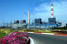
Most of the Singrauli district is still largely agricultural; In the vicinity of the city of Singrauli, however, there are large coal deposits that have been exploited in open-cast mines since the 1960s and converted into electricity in thermal power plants. Further companies (e.g. aluminum works ) are planned. A small part of the Rihand dam is in the Singrauli district. There are 5 train stations throughout the district; three more are located in the border area of Uttar Pradesh.
history
The remote and formerly wooded region around Singrauli belonged to the 3rd and 2nd centuries BC. To the Maurya Empire and in the 4th / 5th centuries BC . Century AD to the Gupta Empire , which was later replaced by the kings of the Kalachuri dynasty. In the High Middle Ages, the Gond rulers took power; in the 14th century the Bagheli- Rajputs from Gujarat immigrated . From 1577 the area used for hunting purposes was under the nominal sovereignty of the Mughal Empire . In the 17th and 18th centuries, the region came under the influence of the Marathas ; since the middle of the 19th century the area belonging to the princely state of Rewa was under British control. After India's independence (1947), the region belonged to the princely states of the Central Provinces , from which the state of Madhya Pradesh emerged from 1950 to 1956. The Singrauli District was created in 2008 when it was separated from the Sidhi District; In 2012, two more administrative districts (tehsils) were created.
Attractions
There are only a few places of cultural and historical importance in the entire Singrauli district - these include some rock overhangs with paintings at Chitrangi and the rock caves at Mada. Most of the Hindu temples are more recent. Only the Sanjay Dubri National Park , which extends in parts to the south of the district, is of tourist interest .
literature
- DEU Baker: Baghelkhand, or, the tigers' lair: region and nation in Indian history. Oxford University Press, New Delhi 2007, OCLC 607768237.
Web links
- District Singrauli - various information (PDF; English)
- District Singrauli - various information (English)
Individual evidence
- ↑ District Singrauli - climate tables
- ^ Singrauli district - administrative districts and villages
- ^ Singrauli district map
- ↑ Singrauli District - Census 1991 to 2011
- ↑ Singrauli District - Census 2011
- ↑ Madhya Pradesh - Languages
- ^ Singrauli district - train stations
- ↑ Sidhi District - Sanjay Dubri National Park
Small text

