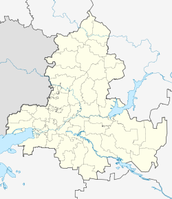
Gluboki (Rostov, Kamensky)
| Urban-type settlement
Gluboki
Глубокий
|
||||||||||||||||||||||||||||||||
|
||||||||||||||||||||||||||||||||
|
||||||||||||||||||||||||||||||||
Gluboki ( Russian Глубо́кий ) is an urban-type settlement in Rostov Oblast in Russia with 9,880 inhabitants (as of October 14, 2010).
geography
The place is about 150 km as the crow flies north-northeast of the Rostov-on-Don Oblast Administrative Center , about 30 km from the state border with Ukraine . It is located on the left bank of the Glubokaya , a left tributary of the Seversky Donets .
Gluboki is the administrative center of Kamensky Rajons and the seat of the municipality Glubokinskoje gorodskoje posselenije, which also includes the settlements of Kamennogorje (4 km east), Krutaya Gorka (7 km west) and Talowataja Balka (6 km northeast).
history
The place arose in 1871 around a train station, which was built on the railway line Moscow - Rostov-on-Don, which was opened continuously that year, not far from an old post office. As a result, as Stanitsa, it was named Glubokaya after the river, like the train station .
In the 1930s, the place received the status of an urban-type settlement under the current name. From 1934 the settlement was the administrative seat of the newly created Rajons (Glubokinski rajon) named after her .
During the Second World War , Gluboki was occupied by the German Wehrmacht from July 14, 1942 to January 14, 1943 .
On February 1, 1963, the Rajon was dissolved and connected to the Kamenski rajon, which is based in the eponymous city of Kamensk-Shakhtinski , a good 20 km south . With the separation of Kamensk-Schachtinski into an independent urban district in the 1990s, Gluboki became the administrative seat of the Rajon again.
Population development
| year | Residents |
|---|---|
| 1939 | 14,613 |
| 1959 | 15,528 |
| 1970 | 13,991 |
| 1979 | 13.163 |
| 1989 | 12.198 |
| 2002 | 11,242 |
| 2010 | 9,880 |
Note: census data
traffic
The Glubokaya station in Gluboki is located at kilometer 1014 of the Moscow - Voronezh - Rostov-on-Don railway, which opened on this section in 1871 and has been electrified since 1963 .
The federal highway M4 Don Moscow - Rostov - Novorossiysk passes east of the town .
Sons and daughters of the place
- Ivan Udodow (1924–1981), weightlifter, first Soviet Olympic champion ( 1952 )
- Viktor Melnikow (* 1957), politician; Mayor of Volgodonsk
Web links
Individual evidence
- ↑ a b Itogi Vserossijskoj perepisi naselenija 2010 goda. Tom 1. Čislennostʹ i razmeščenie naselenija (Results of the All-Russian Census 2010. Volume 1. Number and distribution of the population). Tables 5 , pp. 12-209; 11 , pp. 312–979 (download from the website of the Federal Service for State Statistics of the Russian Federation)

