Gourdon (Lot)
| Gourdon | ||
|---|---|---|

|
|
|
| region | Occitania | |
| Department | Lot | |
| Arrondissement | Gourdon | |
| Canton | Gourdon | |
| Community association | Quercy-Bouriane | |
| Coordinates | 44 ° 44 ' N , 1 ° 23' E | |
| height | 130-323 m | |
| surface | 45.56 km 2 | |
| Residents | 4,094 (January 1, 2017) | |
| Population density | 90 inhabitants / km 2 | |
| Post Code | 46300 | |
| INSEE code | 46127 | |
| Website | http://www.gourdon.fr/ | |

|
||
Gourdon is a French commune with 4094 inhabitants (as of January 1, 2017) in the Lot department in the Occitanie region . It is the administrative seat of the Arrondissement of Gourdon and the capital of the Canton of Gourdon .
geography
Gourdon lies between the Causse de Gramat and the Périgord , in a sandy landscape called Bouriane . The next larger towns are Cahors (45 km), Sarlat (25 km) and Brive-la-Gaillarde (50 km).
history
The Gourdon area has been inhabited since prehistory, as well as in Gallo-Roman times. In the Middle Ages, a castrum was built here on a rock spur, a castle surrounded by circular walls. The Lords of Gourdon are first mentioned in the 11th century. In 1244 the Gourdon received a constitution, according to which it was ruled by four consuls. In 1316 Johann von Armagnac, Count von Rodez , took over the rule of the city.
The 16th century was Gourdon's most prosperous period, and around 5000 people lived in the city even then. King Louis XIII had the castle razed in 1619 after Pons de Lauzières , Marquis de Thémines, had opposed him in a dispute with Maria de Medici .
Population development
- 1962: 4157
- 1968: 4803
- 1975: 4728
- 1982: 4899
- 1990: 4851
- 1999: 4882
- 2016: 4202
Attractions
- Mairie (Town Hall)
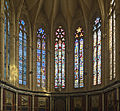
- Saint-Pierre church, built between 1304 and 1510
- Pigeon tower , built in the 14th century
Town twinning
A partnership with the German city of Ibbenbüren in North Rhine-Westphalia has existed since 2001 . The Johannes-Kepler-Gymnasium in Ibbenbüren maintains close contacts, as well as a student exchange program with the Lycée von Gourdon.


