
Hatzenbühl
| coat of arms | Germany map | |
|---|---|---|

|
Coordinates: 49 ° 7 ' N , 8 ° 15' E |
|
| Basic data | ||
| State : | Rhineland-Palatinate | |
| County : | Germersheim | |
| Association municipality : | Jockgrim | |
| Height : | 114 m above sea level NHN | |
| Area : | 7.76 km 2 | |
| Residents: | 2832 (Dec. 31, 2019) | |
| Population density : | 365 inhabitants per km 2 | |
| Postal code : | 76770 | |
| Area code : | 07275 | |
| License plate : | GER | |
| Community key : | 07 3 34 009 | |
| LOCODE : | DE HZ2 | |
| Address of the municipal administration: |
Town hall, Kirchstrasse 7 76770 Hatzenbühl |
|
| Website : | ||
| Local Mayor : | Karlheinz Henigin ( CDU ) | |
| Location of the local community Hatzenbühl in the district of Germersheim | ||
  |
||


Hatzenbühl is a municipality in the district of Germersheim in Rhineland-Palatinate . She belongs to the Jockgrim Association . Hatzenbühl is Germany's oldest tobacco growing place. There is a tobacco trail there.
geography
Geographical location
Hatzenbühl is located in the south of the Palatinate , between Haardt and the Rhine , on the left bank of the Erlenbach and on the northern edge of the Bienwald .
Neighboring communities
Neighboring communities of Hatzenbühl - starting clockwise in the east - are Rheinzabern , Jockgrim , Kandel , Erlenbach , Hayna and Herxheim .
history
On March 3, 1272, Hatzenbühl was first mentioned in a document. Gothic structures on the church tower, which was built around 1290, show that the village was built earlier. Hatzenbühl was probably settled at the same time as Jockgrim around 1180–1200. Other sources even speak of the time around 1050.
Hatzenbühl was created as a so-called development settlement on the original mark of Herxheim . Only in a document from 1366 is there talk of an independent village. Hatzenbühl used to belong to the Lauterburg Oberamt of the Speyer Monastery , today it belongs to the Germersheim district .
Around 1618 Hatzenbühl had about 270 inhabitants and was therefore a larger village for the time. But the Thirty Years War brought the village down in 1636. A conflagration destroyed all buildings with the exception of the church, town hall and two barns. As a result, the place was uninhabited for almost 30 years. Three attempts to repopulate after the end of the war failed, not least due to renewed chaos of the war. The fourth attempt was better luck - in 1680 there were again 42 families resident in Hatzenbühl.
The time of peace should not last long. The War of the Spanish Succession 1701–1714 also left its mark on Hatzenbühl. The city of Landau was besieged four times during the war. So there were camps, sometimes by German, sometimes by French soldiers with the "usual" foraging . Winter quarters also had to be provided. As if that hadn't caused enough hardship among the residents, two robberies were added. Pastor Kelle writes in his parish book that the people harassed by so much need, fear and misery could hardly grasp the time of the subsequent peace.
The Oberamt Lauterburg and thus also Hatzenbühl belonged de facto to France from 1673 to 1815. By belonging to France, the turbulence of the French Revolution also showed its effects in the Palatinate and Hatzenbühl. After a short transition period (1815-1816) under Austrian administration, the places of the upper office Lauterburg with the rest of the Palatinate came as the Rhine District and later Palatinate (Bavaria) to the Kingdom of Bavaria .
A direct consequence of the recurring wars, but also bad harvests and a sandy soil in a relatively small area forced many villagers to emigrate in the 18th and 19th centuries. The emigration destinations included America (from 1709) and Russia (from 1762). At the end of the 19th century, many also moved to Ludwigshafen ( BASF ), Germersheim and the areas on the right bank of the Rhine.
Population development
If not listed separately, the source of the data is the State Statistical Office of Rhineland-Palatinate.
|
|
|
religion
In 2012, 61.7 percent of the population were Catholic and 12.6 percent Protestant. The rest belonged to another religion or were non-denominational.
In 1871, out of a total of 1101 inhabitants, 1,097 were Catholic and 4 were Protestant.
politics
Municipal council
The municipal council in Hatzenbühl consists of 20 council members, who were elected in a personalized proportional representation in the local elections on May 26, 2019 , and the honorary local mayor as chairman.
The distribution of seats in the municipal council:
| choice | SPD | CDU | FDP | FWG | WGR | UWG | total |
|---|---|---|---|---|---|---|---|
| 2019 | 2 | 7th | 3 | 3 | 3 | 2 | 20 seats |
| 2014 | 2 | 8th | 2 | 4th | 2 | 2 | 20 seats |
| 2009 | 3 | 9 | - | 3 | 3 | 2 | 20 seats |
| 2004 | 4th | 8th | - | 3 | 3 | 2 | 20 seats |
- FWG = Free Voting Group Hatzenbühl e. V.
- UWG = Independent Voting Group Hatzenbühl e. V.
mayor
Karlheinz Henigin (CDU) became local mayor of Hatzenbühl in August 2004. In the direct election on May 26, 2019, he was confirmed in his office for a further five years with a share of the vote of 66.54%.
coat of arms
|
|
Blazon : “In silver on green ground, St. Wendelin as a shepherd, bareheaded and barefoot in a blue smock, with a silver halo and a slung golden shepherd's bag, in his right hand a golden shepherd's shovel with silver iron, at his feet a golden royal crown. The coat of arms is separated from the black capital letters S and W. "
It was approved by the Bavarian State Ministry of the Interior in 1924 and goes back to a court seal from 1721. |
Community partnerships
Saint-Martin-Belle-Roche has been the official partner municipality of Hatzenbühl since 1988. The community is located in the French wine-growing region of Burgundy and has around 1200 inhabitants. The Freundeskreis Hatzenbühl organizes regular contacts in the private and public sector.
Culture and sights

Stork nest

town hall

Tobacco scales
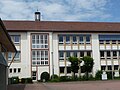
school


Landmark

Steeple

Water tower


Landmarks of Hatzenbühl are the church tower built in its foundation walls at the end of the 13th century and the water tower built from 1967 to 1969. With a height of 50 m, this is also the highest building in the village.
Economy and Infrastructure
Tobacco growing

The Hatzenbühler pastor Anselmann planted in 1573 in his garden for the first time in Germany tobacco on. He probably got the seed from Lorraine or Alsace. It is not known whether he regarded tobacco as an ornamental or medicinal plant. Tobacco cultivation gained economic importance from the 18th century. Four hundred years after the mentioned first cultivation in the parish garden, Hatzenbühl was both the oldest and the largest cultivation community in Germany in 1973 with 265 hectares of tobacco growing area. The numerous tobacco sheds in which the tobacco is dried after the harvest are a sign of tobacco cultivation that can be seen from afar . In Hatzenbühl, many sheds have survived, especially on the north side and in the center of the village.
traffic
The federal highway 65 runs west of Hatzenbühl and the federal road 9 runs east . The closest train stations are in Rheinzabern on the Germersheim-Karlsruhe line and in Kandel on the Winden-Karlsruhe line .
education
There is a primary school, a community college, a community and a parish library in the village.
Personalities
Honorary citizen
- Peter Josef Ohmer (1881–1968), 1927–1949 pastor in Hatzenbühl and 1930 builder of the third Hatzenbühl church.
- Adolf Wünstel 1. (1892–1974), long-time mayor and member of the Rhineland-Palatinate Advisory State Assembly , holder of the Federal Cross of Merit
People who worked on site

- Michael Frey (1788–1854), pastor in Hatzenbühl from 1826 to 1853. Alongside Franz Xaver Remling (1803–1873) and Johann Georg Lehmann (1797–1876), he is considered the most important Palatinate historian of his time. Among other things, he wrote the four-volume historical work attempt at a geographical-historical-statistical description of the royal Bavarian Rhine district (Speyer, 1836/37) . After the Second World War , Hindenburgstrasse was renamed Pfarrer-Frey-Strasse.
- Ingrid Persohn married. Weigel (* 1952), cyclist and three-time German champion, member of the municipal council
Web links
- Hatzenbühl
- Literature about Hatzenbühl in the Rhineland-Palatinate state bibliography
Individual evidence
- ↑ State Statistical Office of Rhineland-Palatinate - population status 2019, districts, communities, association communities ( help on this ).
- ↑ State Statistical Office Rhineland-Palatinate: Hatzenbühl
- ↑ a b c Official directory and statistics of the Royal Bavarian Government District of the Palatinate, 1863, p. XVI of the appendix
- ↑ a b Results of the census in the Kingdom of Bavaria from December 1, 1871 according to individual communities, 1873, p. 65
- ↑ Ewois, as of July 31, 2012
- ^ The Regional Returning Officer Rhineland-Palatinate: Local elections 2019, city and municipal council elections
- ↑ Barbara Eichenlaub: Henigin again Hatzenbühler mayor. Die Rheinpfalz, May 27, 2019, accessed on April 25, 2020 .
- ^ Karl Heinz Debus: The great book of arms of the Palatinate. Gräber, Neustadt an der Weinstrasse 1988, ISBN 3-9801574-2-3 .

Bellheim | Berg (Palatinate) | Erlenbach near Kandel | Freckenfeld | Freisbach | Germersheim | Hagenbach | Hatzenbühl | Heard | Jockgrim | Candelabra | Knittelsheim | Kuhardt | Leimersheim | Lingenfeld | Lustadt | Minfeld | Neuburg am Rhein | Neupotz | Ottersheim near Landau | Rheinzabern | Rülzheim | Scheibenhardt | Schwegenheim | Steinweiler | Vollmersweiler | Weingarten (Palatinate) | Westheim (Palatinate) | Winches | Wörth am Rhein | Zeiskam