
List of half-timbered houses in the Saxon Switzerland-Eastern Ore Mountains district


The list of half-timbered houses in the Saxon Switzerland-Eastern Ore Mountains district contains the listed half-timbered houses in the Saxon Switzerland-Eastern Ore Mountains district , as shown in the list of monuments for the district maintained by the State Office for the Preservation of Monuments , as well as other non-listed timbered houses.
Around 6000 listed timber frame houses are located in Upper Lusatia and are concentrated in the districts of Görlitz and Bautzen . In addition, there are also offshoots of this unique landscape of half-timbered houses in other Saxon regions, for example in Dresden (6), in the district of Meißen (2), in the Erzgebirgskreis (Aue 1), in Saxon Switzerland / Eastern Ore Mountains (approx. 250 listed) and in Transnational Vogtland with Saxony ( Mühlental and Gürth near Raun ), Thuringia ( Altenburger Land and others) and Bavaria ( Regnitzlosau ).
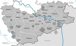
In the following, the around 270 half-timbered houses in the Saxon Switzerland / Eastern Ore Mountains district are listed in a list.
Listed half timbered houses
Altenberg
| image | designation | location | Dating | description | ID |
|---|---|---|---|---|---|
.JPG) More pictures |
Residential building | Geising, Enge Gasse 2 (map) |
Residential house (upper floor half-timbered) (formerly surrounding area) |
|
|
.JPG) More pictures |
Residential building | Geising, Enge Gasse 4 (map) |
Residential house (surrounding area) and granite stepping stone in front of the entrance |
09277439 |
|
.JPG) More pictures |
Residential stable house | Oberbärenburg, Waldidyller Weg 8; 10 (card) |
Residential stable house |
|
Bad Schandau
Cribs
| image | designation | location | Dating | description | ID |
|---|---|---|---|---|---|
.JPG) More pictures |
Residential building | Berghangweg 17 (map) |
1656/58 | Residential building |
|
 More pictures |
Residential building | Friedrich-Gottlob-Keller-Strasse 78 (map) |
Residential building |
|
Ostrau
| image | designation | location | Dating | description | ID |
|---|---|---|---|---|---|
.JPG) More pictures |
Residential building | Old way to school 1 (map) |
Residential building |
|
|
.JPG) More pictures |
Residential building | Old way to school 4 (map) |
Residential house (formerly surrounding area) and side building |
|
|
.JPG) More pictures |
farm | Old way to school 6 (map) |
Farm with stable house (surrounding area) and barn with passage |
|
|
.JPG) More pictures |
Residential building | Dorfstrasse 12 (map) |
Residential house (surrounding area) and side building |
|
|
.JPG) More pictures |
Residential building | Heidehorn 4 (map) |
Residential building |
|
Porschdorf
| image | designation | location | Dating | description | ID |
|---|---|---|---|---|---|
.JPG) More pictures |
Station building | At station 58 (map) |
Reception building with attached wooden waiting hall |
|
|
.JPG) More pictures |
Residential building | Hohnsteiner Strasse 20 (map) |
Residential building |
|
Postelwitz
| image | designation | location | Dating | description | ID |
|---|---|---|---|---|---|
 |
Residential building | Elbufer 9 (map) |
Residential house (formerly surrounding area) |
|
|
.JPG) More pictures |
Residential building | Elbufer 11 (map) |
Residential house (surrounding area) with arcade |
|
|
.JPG) More pictures |
Residential building | Elbufer 47 (map) |
Residential building |
|
|
.JPG) More pictures |
Residential building | Elbufer 49 (map) |
Residential building |
|
|
.JPG) More pictures |
Residential building | Elbufer 51 (map) |
Residential building |
|
|
.JPG) More pictures |
Seven Brothers House | Elbufer 59 (map) |
Seven Brothers House |
|
|
.JPG) More pictures |
Seven Brothers House | Elbufer 61 (map) |
Seven Brothers House |
|
|
.JPG) More pictures |
Seven Brothers House | Elbufer 65 (map) |
Seven Brothers House |
|
|
.JPG) More pictures |
Residential building | Wolfsgraben 5 (map) |
Residential building |
|
Schandau
| image | designation | location | Dating | description | ID |
|---|---|---|---|---|---|
.JPG) |
Residential building | Schloßberg 12 (map) |
Residential building |
|
Schmilka
| image | designation | location | Dating | description | ID |
|---|---|---|---|---|---|
.JPG) More pictures |
Residential building | Schmilka 29 (map) |
Residential building |
|
|
.JPG) More pictures |
Residential building | Schmilka 38 (map) |
Residential building |
|
Waltersdorf
| image | designation | location | Dating | description | ID |
|---|---|---|---|---|---|
| Residential building | Liliensteinstrasse 5 (map) |
House and barn of a farm |
|
Dohma
| image | designation | location | Dating | description | ID |
|---|---|---|---|---|---|
.JPG) More pictures |
farm | Weißenhoher Weg (Cotta B 3) (map) |
16th Century | Residential stable house, side building (surrounding area) and remains of the north-western barn of a farm, plus courtyard paving |
|
Dürrröhrsdorf-Dittersbach
| image | designation | location | Dating | description | ID |
|---|---|---|---|---|---|
.JPG) More pictures |
Dreiseithof | Dobra, Pirnaer Strasse 16 (map) |
Two outbuildings (barn to Alten Straße, former residential building with surrounding lumber to Pirnaer Straße) and four gate posts as well as an inscription plaque of a three-sided courtyard, in the courtyard of the old threshing gate |
|
|
.JPG) More pictures |
Residential building | Stürza, Hohnsteiner Strasse 39 (map) |
House and barn of a farm |
|
|
.JPG) More pictures |
Cottage property | Wilschdorf, Dresdner Strasse 55 (map) |
Cottage property (upper floor half-timbered) with surrounding area |
09277222 |
Gohrisch
Cunnersdorf
| image | designation | location | Dating | description | ID |
|---|---|---|---|---|---|
.JPG) More pictures |
Residential building | Cunnersdorfer Strasse 4 (map) |
Residential house (formerly surrounding area) |
|
|
.JPG) More pictures |
farm | Cunnersdorfer Strasse 12 (map) |
Residential stable house, house for migrants and barn of a three-sided courtyard, plus old paving in the courtyard and two gate pillars |
|
|
.JPG) More pictures |
Residential building | Cunnersdorfer Strasse 22 (map) |
Residential building |
|
|
.JPG) More pictures |
Residential building | Cunnersdorfer Strasse 37 (map) |
Residential building |
|
|
.JPG) More pictures |
Residential building | Cunnersdorfer Strasse 52 (map) |
Residential building |
|
Kleinhennersdorf
| image | designation | location | Dating | description | ID |
|---|---|---|---|---|---|
.JPG) More pictures |
Residential stable house | Hauptstrasse 35 (map) |
Residential stable house (surrounding area) of a farm |
|
|
.JPG) More pictures |
Residential building | Hauptstrasse 48 (map) |
Residential building |
|
|
| Residential building | Liethenhäuser 13, 13 a (map) |
Residential building |
|
Mockery
Cunnersdorf
| image | designation | location | Dating | description | ID |
|---|---|---|---|---|---|
 More pictures |
Residential stable house | Bockmühlenstrasse 40 (map) |
Southern stable house (surrounding area) of a four-sided courtyard |
|
|
 More pictures |
Residential stable house | Im Polenztal 4 (map) |
Stable house (surrounding area) |
|
Ehrenberg
| image | designation | location | Dating | description | ID |
|---|---|---|---|---|---|
.JPG) |
Residential building | Mühlstrasse 6 (map) |
Stable house (surrounding area) |
|
Goßdorf
| image | designation | location | Dating | description | ID |
|---|---|---|---|---|---|
.JPG) More pictures |
Residential stable house | Hohlweg 6 (map) |
Stable house (surrounding area) |
|
Lohsdorf
| image | designation | location | Dating | description | ID |
|---|---|---|---|---|---|
.JPG) More pictures |
Residential stable house | At worry 8 (card) |
Stable house (surrounding area) |
|
|
.JPG) More pictures |
Residential stable house | Oberdorfstrasse 8 (map) |
Stable house (surrounding area) of a former three-sided courtyard |
|
Ulbersdorf
| image | designation | location | Dating | description | ID |
|---|---|---|---|---|---|
.JPG) More pictures |
Residential building | Dorfstrasse 11 (map) |
Residential house (surrounding area) and rock cellar |
|
|
.JPG) More pictures |
Former Wrought | Dorfstrasse 15 (map) |
Former Blacksmith's shop |
|
|
.JPG) More pictures |
Residential stable house | Dorfstrasse 32 (map) |
Stable house (surrounding area) and barn of a farm |
|
Waitzdorf
| image | designation | location | Dating | description | ID |
|---|---|---|---|---|---|
.JPG) More pictures |
Residential building | To Dorfgrund 1 (map) |
Residential building |
|
|
 |
Residential building | To Dorfgrund 6 (map) |
Residential building |
|
|
.JPG) More pictures |
Residential building | To Dorfgrund 15 (map) |
Residential building |
|
Koenigstein
| image | designation | location | Dating | description | ID |
|---|---|---|---|---|---|
 |
Residential building | Flatness 9 (to) (card) |
Residential building |
|
|
 More pictures |
Residential building | Pfaffenberg 15 (map) |
1587 | Residential house in open development |
|
 More pictures |
Residential building | Pfaffenberg 31 (map) |
1549 | Plappermühle, rural house |
|
.jpg) More pictures |
Residential building | Pfaffendorf: Pfaffensteinweg 5 (map) |
Residential building |
|
Wages
| image | designation | location | Dating | description | ID |
|---|---|---|---|---|---|
 More pictures |
Residential stable house | Am Steigerhaus 3 (map) |
Stable house (surrounding area) |
|
|
 More pictures |
Residential building | Basteistraße 59 (map) |
Residential building |
|
|
.JPG) More pictures |
Residential stable house |
Doberzeit , Am Anger 4 (map) |
Ausgedingehaus (surrounding framework, stable house) of a three-sided courtyard |
|
Neustadt in Saxony
Krumhermsdorf
| image | designation | location | Dating | description | ID |
|---|---|---|---|---|---|
| Residential stable house | Neuhauser 38 (map) |
Residential stable house (surrounding area) with integrated barn part |
|
Langburkersdorf
| image | designation | location | Dating | description | ID |
|---|---|---|---|---|---|
.JPG) More pictures |
Ausgedingehaus | Dorfstrasse 153 (map) |
Ausgedingehaus (surrounding area) |
|
|
 More pictures |
Residential building | Laubigtweg 22 (map) |
Residential building |
|
|
.JPG) More pictures |
Residential stable house | Raupenbergstrasse 16 (map) |
Stable house (surrounding area) |
|
Neustadt
| image | designation | location | Dating | description | ID |
|---|---|---|---|---|---|
.JPG) More pictures |
Residential building | Neue Gasse 10 (map) |
Residential house (surrounding framework) with extension at right angles (with old upper arbor) |
|
Niederottendorf
| image | designation | location | Dating | description | ID |
|---|---|---|---|---|---|
.JPG) More pictures |
Residential stable house | Alter Weg 17a (map) |
Stable house (surrounding area) |
|
|
.JPG) More pictures |
Residential stable house | Old path 29 (map) |
Stable house (surrounding area) |
|
|
.JPG) More pictures |
Residential stable house | Old path 31 (map) |
Stable house (surrounding area) |
|
|
.JPG) More pictures |
Residential stable house | Bischofswerdaer Strasse 251 (map) |
Residential stable house (surrounding area) with arbor |
|
|
| Residential stable house | Bischofswerdaer Strasse 252 (map) |
Stable house (surrounding area) |
|
Polenz
| image | designation | location | Dating | description | ID |
|---|---|---|---|---|---|
 |
Residential building | Mittelweg 25 (map) |
Residential house (surrounding area) with integrated barn part |
|
|
 |
Residential stable house | Mittelweg 119 (map) |
Residential stable house (surrounding area) with integrated barn |
|
|
| Residential stable house | Mittelweg 134 (map) |
Residential stable house (surrounding area) with integrated barn |
|
||
.JPG) More pictures |
Residential stable house | Upper settlement 2 (map) |
Residential stable house (surrounding area) with integrated economic part |
|
|
.JPG) More pictures |
Residential stable house | Polenztalstraße 62 (map) |
Stable house (surrounding area) |
|
|
.JPG) More pictures |
former school building | Polenztalstrasse 81 (map) |
School building and barn |
|
|
.JPG) More pictures |
Residential stable house | Polenztalstraße 85 (map) |
Stable house (surrounding area) |
|
Pirna
| image | designation | location | Dating | description | ID |
|---|---|---|---|---|---|
 |
Residential building | Bonnewitz, Im Grund 1 (map) |
Rural house (half-timbered with surrounding framework) |
|
|
 |
Residential stable house | Jessen, Altjessen 51 (map) |
Three-sided courtyard with residential stable house (half-timbered with surrounding framework, formerly plastered), side building (half-timbered) and barn |
|
|
 |
Residential building | Mockethal, Arthur ‐ Thiermann ‐ Strasse 4 (map) |
Rural house (two parts built together at an angle, one of which is surrounding a building) and the property's retaining wall |
|
Rathen
| image | designation | location | Dating | description | ID |
|---|---|---|---|---|---|
.JPG) More pictures |
Residential building | Am Grünbach 9 (map) |
Residential building |
|
|
.jpg) More pictures |
Residential stable house | Basteiweg 1 (map) |
Stable house (surrounding area) |
|
Rathmannsdorf
| image | designation | location | Dating | description | ID |
|---|---|---|---|---|---|
 |
Residential building | Am Dörfel 9 (map) |
Residential house (formerly surrounding area) |
|
|
.JPG) More pictures |
Residential stable house | Dorfplatz 12 (map) |
Stable house (surrounding area) |
|
Reinhardtsdorf-Schöna
Reinhardtsdorf
| image | designation | location | Dating | description | ID |
|---|---|---|---|---|---|
.JPG) More pictures |
Residential stable house | Dr.-Jacobi-Weg 5 (map) |
Stable house (Umgebung, No. 5), moving house (No. 5b) and barn of a farm |
|
Nice
| image | designation | location | Dating | description | ID |
|---|---|---|---|---|---|
 More pictures |
Residential building | Grundweg 57 (map) |
Residential building |
|
|
 More pictures |
Residential building | Hauptstrasse 4 (map) |
Residential building |
|
|
 More pictures |
Moving house | Hauptstrasse 30a (map) |
Residential stable house, moving house (surrounding area), barn and shed of a four-sided courtyard |
|
Kleingießhübel
| image | designation | location | Dating | description | ID |
|---|---|---|---|---|---|
.JPG) More pictures |
Exodus house | Dorfstrasse 13 (map) |
Residential stable house (Umgebung, No. 13b) and house for migrants (Umgebung, No. 13) of a former three-sided farm |
|
|
.JPG) More pictures |
Residential stable house | Dorfstrasse 13 b (map) |
Residential stable house (Umgebung, No. 13b) and house for migrants (Umgebung, No. 13) of a former three-sided farm |
|
|
.JPG) More pictures |
Residential building | Hirschgrund 15 (map) |
Residential building |
|
|
.JPG) More pictures |
Residential stable house | Hirschgrund 18 (map) |
Residential stable house (surrounding area) and side building of a farm |
|
|
.JPG) More pictures |
Residential building | Hirschgrund 23 (map) |
Residential building |
|
|
.JPG) More pictures |
Residential stable house | Circular route 1 (map) |
Residential stable house (Umgebung, No. 1) and residential house (No. 1b) |
|
|
.JPG) More pictures |
Residential building | Loop 2 (map) |
Residential building |
|
|
.JPG) More pictures |
Residential stable house | Circular route 3 (map) |
Residential stable house (surrounding area) and side building of a farm |
|
|
.JPG) More pictures |
Residential stable house | Loop 27 (map) |
Southern stable house (surrounding area), northern side building, western field barn and south-eastern barn of a three-sided courtyard |
|
Sebnitz
Altendorf
| image | designation | location | Dating | description | ID |
|---|---|---|---|---|---|
.JPG) More pictures |
Residential building | Sebnitzer Strasse 5a (map) |
Rural house (surrounding area) |
|
|
| Residential stable house | Sebnitzer Strasse 7a (map) |
Former Vorwerk with a large stable house (surrounding area) and outbuildings (stable and stable barn) |
|
Hertigswalde
| image | designation | location | Dating | description | ID |
|---|---|---|---|---|---|
.JPG) More pictures |
Residential building | Hertigswalde 75 (map) |
Detached house (surrounding framework, upper floor half-timbered, boarded up) |
|
|
 |
Residential building | Hertigswalde 97 (map) |
Rural house |
|
|
.JPG) More pictures |
Residential building | Hertigswalde 134 (map) |
Residential house with surrounding framework and log room, upper floor half-timbered |
|
Hinterhermsdorf
| image | designation | location | Dating | description | ID |
|---|---|---|---|---|---|
| Residential stable house | Am Langk 3 (map) |
Stable house (surrounding area) |
|
||
| Residential stable house | Am Langk 4 (map) |
Stable house (surrounding area) |
|
||
 |
Residential building | An der Kirnitzsch 1 (map) |
Rural house (surrounding area) |
|
|
.JPG) More pictures |
Residential building | Stain 1 (card) |
Small residential building (Umgebung) |
|
|
.JPG) More pictures |
Residential building | Stain 4 (card) |
Small residential building (Umgebung) |
|
|
 More pictures |
Residential building | Stain 5 (card) |
Residential building |
|
|
| Residential stable house | Stain 11 (card) |
Stable house (surrounding area) |
|
||
 |
Residential stable house | Stain 12 (card) |
Stable house (surrounding area) and wooden barn of a small two-sided courtyard |
|
|
 More pictures |
Residential stable house | Birkenweg 9 (map) |
Stable house (surrounding area) |
|
|
.JPG) More pictures |
Residential building | Buchenstrasse 1 (map) |
Rural house (surrounding area) |
|
|
| Residential building | Buchenstrasse 4 (map) |
Rural house (surrounding area) |
|
||
 More pictures |
Residential stable house | Buchenstrasse 8 (map) |
Large stable house (surrounding area) |
|
|
 |
Residential building | Dorfbachweg 1 (map) |
Residential house (surrounding area) without extension |
|
|
.jpg) More pictures |
Residential building | Dorfbachweg 2 (map) |
Rural house (surrounding area) |
|
|
.JPG) More pictures |
Residential stable house | Dorfbachweg 3 (map) |
Stable house (surrounding area) |
|
|
| Residential building | Dorfbachweg 5 (map) |
Rural house (surrounding area) |
|
||
| Residential building | Dorfbachweg 6 (map) |
Residential building |
|
||
.JPG) More pictures |
Residential stable house | Dorfbachweg 11 (map) |
Stable house (surrounding area) |
|
|
| Residential building | Dorfbachweg 12 (map) |
Residential building |
|
||
.JPG) More pictures |
Residential building | Dorfbachweg 19 (map) |
Small rural house (Umgebung) |
|
|
.JPG) More pictures |
Residential building | Dorfbachweg 25 (map) |
Residential building |
|
|
 More pictures |
Residential building | Neudorfstrasse 1 (map) |
Rural house (surrounding area), of importance in terms of building history and the appearance of the streets |
|
|
.JPG) More pictures |
Residential building | Neudorfstrasse 2 (map) |
Rural house (surrounding area) |
|
|
.JPG) More pictures |
Residential building | Neudorfstrasse 8 (map) |
Rural house (surrounding area) |
|
|
.JPG) More pictures |
Residential building | Neudorfstrasse 33 (map) |
Small rural house (Umgebung) |
|
|
.JPG) More pictures |
Residential stable house | Neudorfstrasse 35 (map) |
Stable house (surrounding area) |
|
|
 |
Residential stable house | Neudorfstrasse 39 (map) |
Residential stable house (surrounding area) with integrated barn |
|
|
 |
Residential building | Neudorfstrasse 41 (map) |
Rural house (surrounding area) |
|
|
.JPG) More pictures |
Residential stable house | Neudorfstrasse 43 (map) |
Residential stable house (surrounding area), with integrated economic part |
|
|
.JPG) More pictures |
Residential stable house | Neudorfstrasse 47 (map) |
Stable house (surrounding area) |
|
|
.JPG) More pictures |
Residential building | Neudorfstrasse 49 (map) |
Residential house (surrounding area) on a solid base (hillside) |
|
|
.JPG) More pictures |
Residential building | Neudorfstrasse 51 (map) |
Residential building |
|
|
.JPG) More pictures |
Residential stable house | Neudorfstrasse 53 (map) |
Stable house (surrounding area) |
|
|
.JPG) More pictures |
Residential stable house | Neudorfstrasse 55 (map) |
Stable house (surrounding area) |
|
|
.JPG) More pictures |
Residential stable house | Neudorfstrasse 57 (map) |
Residential stable house (surrounding area) with integrated barn |
|
|
 |
Residential building | Neudorfstrasse 59 (map) |
Rural house (surrounding area) |
|
|
.JPG) More pictures |
Neudorfstrasse 61 (map) |
Rural house (surrounding area) |
|
||
.jpg) |
Residential building | Oberdorfweg 1 (map) |
Residential building |
|
|
| Residential building | Oberdorfweg 4 (map) |
Residential building |
|
||
 |
Residential building | Oberdorfweg 7 (map) |
Residential building |
|
|
 |
Residential building | Oberdorfweg 10 (map) |
Residential building |
|
|
 More pictures |
Residential building | Oberdorfweg 14 (map) |
Rural house (surrounding area) with integrated barn |
|
|
.JPG) More pictures |
Residential building | Oberdorfweg 29 (map) |
Residential house and wooden barn on a farm |
|
|
 |
Oberdorfweg 37 (map) |
Residential house (surrounding framework, original block room with corner combing) |
|
||
.JPG) More pictures |
Former school | Schandauer Strasse 7 (map) |
Former school and staircase |
|
|
.JPG) More pictures |
Residential stable house | Schandauer Strasse 9 (map) |
Residential stable house with integrated small barn part (surrounding structure) and staircase |
|
|
.JPG) More pictures |
Residential building | Schandauer Strasse 21 (map) |
Residential building |
|
|
.JPG) More pictures |
Residential building | Schandauer Strasse 22 (map) |
Rural house (surrounding area) |
|
|
.JPG) More pictures |
Residential building | Schandauer Strasse 23 (map) |
Rural house (surrounding area) |
|
|
.JPG) More pictures |
Residential building | Schandauer Strasse 24 (map) |
Residential building |
|
|
.JPG) More pictures |
Residential building | Schandauer Strasse 27 (map) |
Residential building |
|
|
.JPG) More pictures |
Residential building | Schandauer Strasse 30 (map) |
Residential building |
|
|
| Residential building | Schandauer Strasse 31 (map) |
Rural house (surrounding area, single-storey cottage property) |
|
||
.JPG) More pictures |
Residential stable house | Schandauer Strasse 33 (map) |
Stable house (surrounding area) and wooden barn of a small two-sided courtyard |
|
|
.JPG) More pictures |
Residential building | Schandauer Strasse 40 (map) |
Residential house (surrounding area) with integrated barn |
|
|
.JPG) More pictures |
Residential stable house | Schandauer Strasse 50 (map) |
Residential stable house (surrounding area) and sandstone trough and mortar |
|
|
.JPG) More pictures |
Residential building | Schandauer Strasse 54 (map) |
Residential building |
|
|
.JPG) More pictures |
Residential stable house | Schandauer Strasse 64 (map) |
Stable house (surrounding area) |
|
|
.JPG) More pictures |
Residential building | Schandauer Strasse 74 (map) |
Residential building |
|
|
.JPG) More pictures |
Residential stable house | Schandauer Strasse 76 (map) |
Residential stable house (surrounding area) with an integrated small barn |
|
|
.JPG) More pictures |
Residential building | Schandauer Strasse 78 (map) |
Rural house (surrounding area) with an integrated small barn |
|
|
 More pictures |
Residential building | Schandauer Strasse 86 (map) |
Rural house (surrounding area) without extension |
|
Lichtenhain
| image | designation | location | Dating | description | ID |
|---|---|---|---|---|---|
| Residential stable house | Follow path 3 (map) |
Residential stable house (surrounding area, upper floor half-timbered) with stable extension |
|
||
 |
Residential building | Short street 12 (map) |
Rural house (upper floor half-timbered, surrounding timber) |
|
|
| Residential building | Talstrasse 3 (map) |
Rural house (surrounding area, block room) |
|
||
.JPG) More pictures |
Residential stable house | Talstrasse 20 (map) |
Residential stable house (timber frame, upper floor) and two side buildings of a three-sided courtyard |
|
|
.JPG) More pictures |
Residential building | Talstrasse 25 (map) |
Residential house (surrounding framework, upper floor half-timbered) |
|
Mittelndorf
| image | designation | location | Dating | description | ID |
|---|---|---|---|---|---|
| Residential stable house | Dorfstrasse 12 (map) |
Stable house (surrounding framework, upper floor half-timbered) |
|
||
.JPG) More pictures |
Residential building | Niederdorfstrasse 3 (map) |
Rural house (surrounding timber, upper floor half-timbered) |
|
|
.JPG) More pictures |
Residential stable house | Obere Strasse 16 (map) |
Residential stable house (surrounding framework, upper floor half-timbered) of a farm |
|
Ottendorf
| image | designation | location | Dating | description | ID |
|---|---|---|---|---|---|
 More pictures |
Residential stable house | Endlerkuppe 7 (map) |
Stable house (surrounding framework, upper floor half-timbered) |
|
|
.JPG) More pictures |
Residential building | Hauptstrasse 2 (map) |
Surrounding part of a rural house |
|
|
 More pictures |
Residential building | Hauptstrasse 5 (map) |
Rural house (surrounding timber, upper floor half-timbered) |
|
|
.JPG) More pictures |
Residential building | Hauptstrasse 23 (map) |
Rural house (surrounding timber, upper floor half-timbered) |
|
|
.JPG) More pictures |
Bushmill | Kirnitzschtalstrasse 1 (map) |
Residential mill house (Umgebung), storage, mill and water technology system |
|
|
.JPG) More pictures |
Residential stable house | Hole clearing light 8 (card) |
Stable house (surrounding framework, upper floor half-timbered) |
|
|
.JPG) More pictures |
Residential stable house | Parkweg 13 (map) |
Stable house (surrounding framework, upper floor half-timbered) |
|
|
 |
Residential building | Sebnitzer Strasse 11 (map) |
Rural house (surrounding timber, upper floor half-timbered) |
|
|
| Hunting lodge | Zeughausstrasse 2 (map) |
Former Kgl. Hunting lodge |
|
||
| building | Zeughausstrasse 5 (map) |
Massive building |
|
Saupsdorf
| image | designation | location | Dating | description | ID |
|---|---|---|---|---|---|
.JPG) More pictures |
Residential stable house | Am Schäferberg 4 (map) |
Stable house (surrounding framework, upper floor half-timbered) |
|
|
.JPG) More pictures |
Residential stable house | Gerberweg 5 (map) |
Stable house (surrounding framework, upper floor half-timbered) |
|
|
 More pictures |
Residential stable house | Rear room 1 (map) |
Saupsdorfer Hütte, stable house (surrounding framework, upper floor half-timbered) |
|
|
 |
Residential building | Rear room 5 (map) |
Single storey rural house (surrounding area) |
|
|
 More pictures |
Residential building | Rear room 9 (map) |
Rural house (surrounding timber, upper floor half-timbered) |
|
|
| Residential building | Rear room 15 (map) |
Residential house (surrounding framework, upper floor half-timbered) |
|
||
| Residential stable house | Rear room 16 (map) |
Stable house (surrounding framework, upper floor half-timbered) |
|
||
 |
Residential building | Hinterhermsdorfer Strasse 1 (map) |
Residential house (surrounding framework, upper floor half-timbered) |
|
|
 More pictures |
Residential stable house | Hinterhermsdorfer Strasse 9 (map) |
Stable house (surrounding framework, upper floor half-timbered) |
|
|
| Moving house | High 11 (card) |
Moving house (surrounding area) of a four-sided courtyard |
|
||
 |
Residential building | High 23 (card) |
Rural house (surrounding timber, upper floor half-timbered) |
|
|
.JPG) More pictures |
Residential building | Mittelweg 5 (map) |
Residential house (surrounding area) and a side building of a hooked courtyard attached to it |
|
|
 More pictures |
Residential building | Mittelweg 7 (map) |
Residential house (surrounding area) and a side building of a hooked courtyard attached to it |
|
|
 More pictures |
Residential building | Niederdorfstrasse 13 (map) |
Rural house (surrounding area) |
|
|
.JPG) More pictures |
Residential building | Niederdorfstrasse 14 (map) |
Rural house (surrounding timber frame, upper floor half-timbered), without corner extension |
|
|
 |
Residential building | Niederdorfstrasse 15 (map) |
Residential house (surrounding area) and a side building of a hooked courtyard attached to it |
|
|
 More pictures |
Residential building | Niederdorfstrasse 18 (map) |
Rural house (surrounding timber, upper floor half-timbered) |
|
|
 More pictures |
Residential building | Niederdorfstrasse 25 (map) |
Rural house (surrounding timber, upper floor half-timbered) |
|
|
 More pictures |
Residential stable house | Niederdorfstrasse 26 (map) |
Stable house (surrounding framework, upper floor half-timbered) |
|
|
.JPG) More pictures |
Residential stable house | Oberdorf 29 (map) |
Stable house (surrounding framework, upper floor half-timbered) |
|
|
 |
Residential stable house | Oberdorf 30 (map) |
Stable house (surrounding framework, upper floor half-timbered) |
|
|
 More pictures |
Residential building | Way to school 10 (map) |
Residential house (surrounding area), side building and moving house (surrounding area) of a farm and a trough |
|
|
.JPG) More pictures |
Moving house | Way to school 12 (map) |
Residential house (surrounding area), side building and moving house (surrounding area) of a farm and a trough |
|
|
 More pictures |
Residential stable house | Schustergasse 2 (map) |
Stable house (surrounding framework, upper floor half-timbered) |
|
|
.JPG) More pictures |
Residential mill house | Front room 10 (map) |
Former Residential mill house (surrounding area, upper floor half-timbered), now an inn |
|
|
 More pictures |
Residential stable house | Wachbergstrasse 16 (map) |
Stable house (surrounding framework, upper floor half-timbered) |
|
|
.JPG) More pictures |
Residential building | Wachbergstrasse 22 (map) |
Rural house (surrounding timber, upper floor half-timbered) |
|
|
.JPG) More pictures |
Residential stable house | Wachbergstrasse 31 (map) |
Stable house (surrounding framework, upper floor half-timbered) |
|
|
 More pictures |
Residential building | Desert leg 3 (map) |
Rural house (surrounding area) |
|
Schönbach
| image | designation | location | Dating | description | ID |
|---|---|---|---|---|---|
.JPG) More pictures |
Residential building | Martin-May-Strasse 41 (map) |
Rural house (surrounding area) with a guesthouse that was added later |
|
|
.JPG) More pictures |
Residential stable house | Martin-May-Strasse 49 (map) |
Residential stable house (surrounding framework, upper floor half-timbered) with wooden shed extension |
|
|
 |
Residential building | Ungerweg 1 (map) |
Detached house (surrounding framework, upper floor timber-framed boarded up) |
|
Sebnitz
| image | designation | location | Dating | description | ID |
|---|---|---|---|---|---|
.JPG) More pictures |
Residential building | Bergstrasse 16 (map) |
Half-timbered house with surrounding framework and log room |
|
|
.JPG) More pictures |
Residential building | Bergstrasse 18 (map) |
Residential building |
|
|
 |
Residential building | Bergstrasse 23 (map) |
Surroundings dwelling house |
|
|
.JPG) More pictures |
Residential building | Bergstrasse 25 (map) |
Surroundings dwelling house |
|
|
.JPG) More pictures |
Residential building | Bergstrasse 26 (map) |
Surroundings dwelling house |
|
|
.JPG) More pictures |
Friedhofstrasse 18 (map) |
Single-storey residential building (formerly a half-timbered house) |
|
||
 More pictures |
Residential building | Hertigswalder Strasse 9 (map) |
Factory extension and house (surrounding area) with extension |
|
|
 More pictures |
Residential building | Hertigswalder Strasse 14 (map) |
Half-timbered house |
|
|
 More pictures |
Residential building | Hertigswalder Strasse 20 (map) |
Half-timbered house with block room on the left |
|
|
 More pictures |
Residential building | Hertigswalder Strasse 28 (map) |
Surroundings dwelling house |
|
|
 More pictures |
Residential building | Hertigswalder Strasse 31 (map) |
Residential building (half-timbered) |
|
|
 |
Residential building | Lange Strasse 31 (map) |
Surrounding house (left with block room) |
|
|
 |
Residential building | Lange Strasse 49 (map) |
Half-timbered house (upper floor half-timbered) |
|
|
.JPG) More pictures |
Residential building | Niederer Rosenberg 2 (map) |
Half-timbered house with log room |
|
|
.JPG) More pictures |
Niederer Rosenberg 4 (map) |
Single-storey half-timbered house with surrounding framework and block room |
|
||
.JPG) More pictures |
Residential building | Oberer Rosenberg 6 (map) |
Half-timbered house with two log rooms |
|
|
.JPG) More pictures |
Residential building | Oberer Rosenberg 12 (map) |
Half-timbered house with log room |
|
|
 More pictures |
Residential building | Obergasse 4 (map) |
Residential house with surrounding framework (plastered) |
|
|
 More pictures |
Residential building | Obergasse 6 (map) |
Residential house (upper floor half-timbered, boarded up), surrounding framework on the right |
|
|
 More pictures |
Residential building | Obergasse 12 (map) |
Residential house with surrounding framework on the left and block room |
|
|
 |
Residential building | Obergasse 13 (map) |
Residential house with surrounding framework on the right and block room |
|
|
.JPG) More pictures |
Residential building | Obergasse 18 (map) |
Residential house with surrounding framework on the left and block room |
|
|
.jpg) More pictures |
Residential building | Obergasse 23 (map) |
Surroundings and log room (upper floor half-timbered with sheet metal cladding) |
|
|
.JPG) More pictures |
Residential building | Obergasse 25 (map) |
Half-timbered house |
|
|
 More pictures |
Residential building | Weberstrasse 37 (map) |
Surrounding house (half-timbered house with arbor) |
|
|
.JPG) More pictures |
Residential building | Weberstrasse 54 (map) |
Residential building (former half-timbered house) |
|
|
 More pictures |
Residential building | Weberstrasse 60 (map) |
Residential house with surrounding framework and block room |
|
City of Wehlen
Village of Wehlen
| image | designation | location | Dating | description | ID |
|---|---|---|---|---|---|
 |
Residential stable house | Pirnaer Strasse 11 (map) |
Residential stable house (surrounding area) of a farm |
|
|
 |
Residential building | Pirnaer Strasse 42 (map) |
Residential building |
|
|
 |
Residential building | Pirnaer Strasse 53 (map) |
Residential building |
|
|
 |
Residential stable house | Pirnaer Strasse 85 (map) |
Two-sided courtyard with stable house (surrounding area) and barn |
|
|
 |
Residential stable house | Teichweg 9 (map) |
Farm with residential stable house (surrounding area), barn and stable building as well as courtyard paving |
|
City of Wehlen
| image | designation | location | Dating | description | ID |
|---|---|---|---|---|---|
 |
Residential building | Mennickestrasse 11 (map) |
Residential house (surrounding area) in half-open development |
|
Stumble
| image | designation | location | Dating | description | ID |
|---|---|---|---|---|---|
.JPG) More pictures |
Residential stable house | Talstrasse 14 (map) |
Stable house (upper floor half-timbered, at the rear partly surrounding wood) |
|
Non-listed half timbered houses
| image | Name / designation | Construction year | description |
|---|---|---|---|
.JPG)
|
Residential building | Helmsdorf (Stolpen), Wilschdorfer Straße 30 (location) |
|
| Residential building | Hinterhermsdorf (Sebnitz), Beize 13 (Lage) |
||

|
Residential building | Hinterhermsdorf (Sebnitz), Birkenweg 1 (location) |
|
| Residential building | Hinterhermsdorf (Sebnitz), Neudorfstrasse 10 (location) |
||
| Residential building | Hinterhermsdorf (Sebnitz), Neudorfstrasse 65 (location) |
||
.JPG)
|
Residential building | Hinterhermsdorf (Sebnitz), Schandauer Straße 13 (location) |
|
| Residential building | Hinterhermsdorf (Sebnitz), Schandauer Straße 19 (location) |
||
.JPG)
|
Residential building | Lichtenhain (Sebnitz), Mittelweg 4 (location) |
|
| Residential building | Mittelndorf (Sebnitz), Obere Straße 4a (location) |
||
| Residential building | Ottendorf (Sebnitz), Sebnitzer Straße 7a (location) |
||
.JPG)
|
Residential building | Polenz (Neustadt), Teichweg 2 (location) |
|
.JPG)
|
Residential building | Rathen, Mühlenweg 4 (location) |
|
| Residential building | Saupsdorf (Sebnitz), Schustergasse 9 (location) |
||
.JPG)
|
Residential building | Saupsdorf (Sebnitz), Wachbergstraße 7 (location) |
|

|
Residential building | Saupsdorf (Sebnitz), Wachbergstraße 21 (location) |
|

|
Residential building | Sebnitz, Obergasse 11 (location) |
|
.JPG)
|
Residential building | Waitzdorf (Hohnstein), Zum Dorfgrund (location) |
Half-timbered houses in regions bordering northwest
Dresden
Niederpoyritz
| image | designation | location | Dating | description | ID |
|---|---|---|---|---|---|
 |
Residential building | Pillnitzer Landstrasse 224 (map) |
Residential house with outbuildings, half-timbered house |
|
|
 |
Residential building | Pillnitzer Landstrasse 226 (map) |
Half-timbered house with half-timbering and Andrew's cross |
|
Pillnitz
| image | designation | location | Dating | description | ID |
|---|---|---|---|---|---|
 |
Residential building | At the sheep farm 2 (map) |
Half-timbered house |
|
Rockau
| image | designation | location | Dating | description | ID |
|---|---|---|---|---|---|
 More pictures |
Residential building | Am Dorfplatz 5 (map) |
rural house |
|
Wachwitz
| image | designation | location | Dating | description | ID |
|---|---|---|---|---|---|
 |
Residential building | Altwachwitz 5 (map) |
around 1700 | Half-timbered house |
|
 |
Residential building | Wachwitzgrund 13 | 1623 | One of the oldest residential buildings in Wachwitz, a half-timbered house, dated to 1623 by an inscription in the lintel |
|
Meißen district
| image | designation | location | Dating | description | ID |
|---|---|---|---|---|---|
 |
Rectory | Naustadt, Pfarrweg 3a; 3b (card) |
Rectory with residential house and stable house (built side by side at an angle) (former surrounding framework) and well with manual pump (monument protection area Dorf Naustadt) |
|
|
 More pictures |
farm | Röhrsdorf, Kirchberg 2 (map) |
Residential stable house (half-timbered house) and stable barn of a farm |
|
literature
- Horst Pinkau, Joachim Oswald: Half-timbered houses in Saxon Switzerland (drawings and texts), self-published brochure 2014
- Horst Pinkau: Half-timbered houses in Saxon Switzerland portrayed with a pen, calendar 2016
- State Office for the Preservation of Monuments of Saxony : Monument lists of the district of Saxon Switzerland-Eastern Ore Mountains. (No longer available online.) Formerly in the original ; Retrieved June 20, 2013 . ( Page no longer available , search in web archives )